Cultural-Heritage-Evaluation-Form-TSK
advertisement
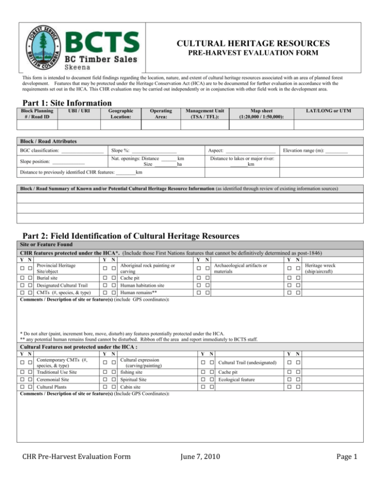
CULTURAL HERITAGE RESOURCES PRE-HARVEST EVALUATION FORM This form is intended to document field findings regarding the location, nature, and extent of cultural heritage resources associated with an area of planned forest development. Features that may be protected under the Heritage Conservation Act (HCA) are to be documented for further evaluation in accordance with the requirements set out in the HCA. This CHR evaluation may be carried out independently or in conjunction with other field work in the development area. Part 1: Site Information Block Planning # / Road ID UBI / URI Geographic Location: Operating Area: Management Unit (TSA / TFL): Map sheet (1:20,000 / 1:50,000): LAT/LONG or UTM Block / Road Attributes BGC classification: _________________ Slope %: __________________ Slope position: _____________ Nat. openings: Distance ______ km Size _________ha Aspect: ____________________ Elevation range (m): _________ Distance to lakes or major river: _______km Distance to previously identified CHR features: ________km Block / Road Summary of Known and/or Potential Cultural Heritage Resource Information (as identified through review of existing information sources) Part 2: Field Identification of Cultural Heritage Resources Site or Feature Found CHR features protected under the HCA*. (Include those First Nations features that cannot be definitively determined as post-1846) Y N Y Y N Provincial Heritage Aboriginal rock painting or Site/object carving Burial site Cache pit Designated Cultural Trail Human habitation site CMTs (#, species, & type) Human remains** Comments / Description of site or feature(s) (include GPS coordinates): N Y Archaeological artifacts or materials N Heritage wreck (ship/aircraft) * Do not alter (paint, increment bore, move, disturb) any features potentially protected under the HCA. ** any potential human remains found cannot be disturbed. Ribbon off the area and report immediately to BCTS staff. Cultural Features not protected under the HCA : Y N Y Y N Contemporary CMTs (#, Cultural expression species, & type) (carving/painting) Traditional Use Site fishing site Ceremonial Site Spiritual Site Cultural Plants Cabin site Comments / Description of site or feature(s) (Include GPS Coordinates): Cultural Trail (undesignated) Cache pit Ecological feature CHR Pre-Harvest Evaluation Form N June 7, 2010 Y N Page 1 Part 3: Management Strategies Recommended for Identified CHR Features Potential Management Strategy (Check all that may be applied) Details / Comments Conduct an Archaeological Impact Assessment (applicable for HCA-protected features that will be impacted by forest development) Confirm age of the feature Modify the harvest area or road location to avoid the feature Conserve feature in a reserve (specify reserve type and min. distance around site or feature) Conserve by leaving tree feature standing where safe to do so Assess and manage for wind throw hazard Crown or stand modification Stump (some / all) contemporary CMT(s) at a specified height Re-establish or limit access following completion of development activity Limit silviculture activity (e.g. no soil prep. treatments if sub-surface features are present) Specify silviculture requirements to promote cultural trees/plants (e.g. plant Cw) Monitor for additional archaeological site information during forestry activities Landscape level management strategies apply No CHR management strategies required other:__________________________ Comments / Discussion regarding recommended management strategies: Attachments to this form (maps, photos, etc.) Item (photo #) Description Site Form Completed By: (print full name) CHR Pre-Harvest Evaluation Form Date Signature: Additional Comments (location and direction of photo) Date: June 7, 2010 Page 2


