Climate in Somalia
advertisement
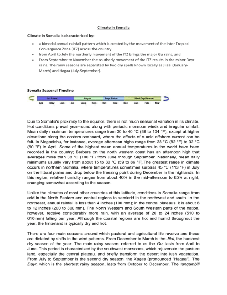
Climate in Somalia Climate in Somalia is characterized by: a bimodal annual rainfall pattern which is created by the movement of the Inter Tropical Convergence Zone (ITZ) across the country from April to July the northerly movement of the ITZ brings the major Gu rains, and From September to November the southerly movement of the ITZ results in the minor Deyr rains. The rainy seasons are separated by two dry spells known locally as Jilaal (JanuaryMarch) and Hagaa (July-September). Somalia Seasonal Timeline Due to Somalia's proximity to the equator, there is not much seasonal variation in its climate. Hot conditions prevail year-round along with periodic monsoon winds and irregular rainfall. Mean daily maximum temperatures range from 30 to 40 °C (86 to 104 °F), except at higher elevations along the eastern seaboard, where the effects of a cold offshore current can be felt. In Mogadishu, for instance, average afternoon highs range from 28 °C (82 °F) to 32 °C (90 °F) in April. Some of the highest mean annual temperatures in the world have been recorded in the country; Berbera on the north western coast has an afternoon high that averages more than 38 °C (100 °F) from June through September. Nationally, mean daily minimums usually vary from about 15 to 30 °C (59 to 86 °F).The greatest range in climate occurs in northern Somalia, where temperatures sometimes surpass 45 °C (113 °F) in July on the littoral plains and drop below the freezing point during December in the highlands. In this region, relative humidity ranges from about 40% in the mid-afternoon to 85% at night, changing somewhat according to the season. Unlike the climates of most other countries at this latitude, conditions in Somalia range from arid in the North Eastern and central regions to semiarid in the northwest and south. In the northeast, annual rainfall is less than 4 inches (100 mm); in the central plateaus, it is about 8 to 12 inches (200 to 300 mm). The North Western and South Western parts of the nation, however, receive considerably more rain, with an average of 20 to 24 inches (510 to 610 mm) falling per year. Although the coastal regions are hot and humid throughout the year, the hinterland is typically dry and hot. There are four main seasons around which pastoral and agricultural life revolve and these are dictated by shifts in the wind patterns. From December to March is the Jilal, the harshest dry season of the year. The main rainy season, referred to as the Gu, lasts from April to June. This period is characterized by the southwest monsoons, which rejuvenate the pasture land, especially the central plateau, and briefly transform the desert into lush vegetation. From July to September is the second dry season, the Xagaa (pronounced "Hagaa"). The Dayr, which is the shortest rainy season, lasts from October to December. The tangambili periods that intervene between the two monsoons (October–November and March–May) are hot and humid. Somalia was the worst hit country on the African Continent by the tsunami in December 2004. Other natural disasters are recurring droughts, frequent dust storms over the eastern planes in the summer, and flooding’s during the rainy seasons as well as riverbanks breeching during extreme rainfalls in Ethiopia from the Jubba and Shabelle rivers. 2005 has in some areas seen good rains although for the agricultural sector it has not been productive as the rains were either late or not in the main agricultural areas. This in the long term creates famine due to crop failure. Frequent use of contaminated water contributes to human health problems; deforestation (charcoal exported to Arab states); overgrazing; soil erosion and further desertification. The main long-term effect on Somalia is civil unrest, which has been ongoing for the last 25 years of civil war. There is a very obvious direct link between man-made calamities as in Somalia and peoples livelihood and food shortages.
