Mitigated Negative Declaration - Resource Conservation District of
advertisement
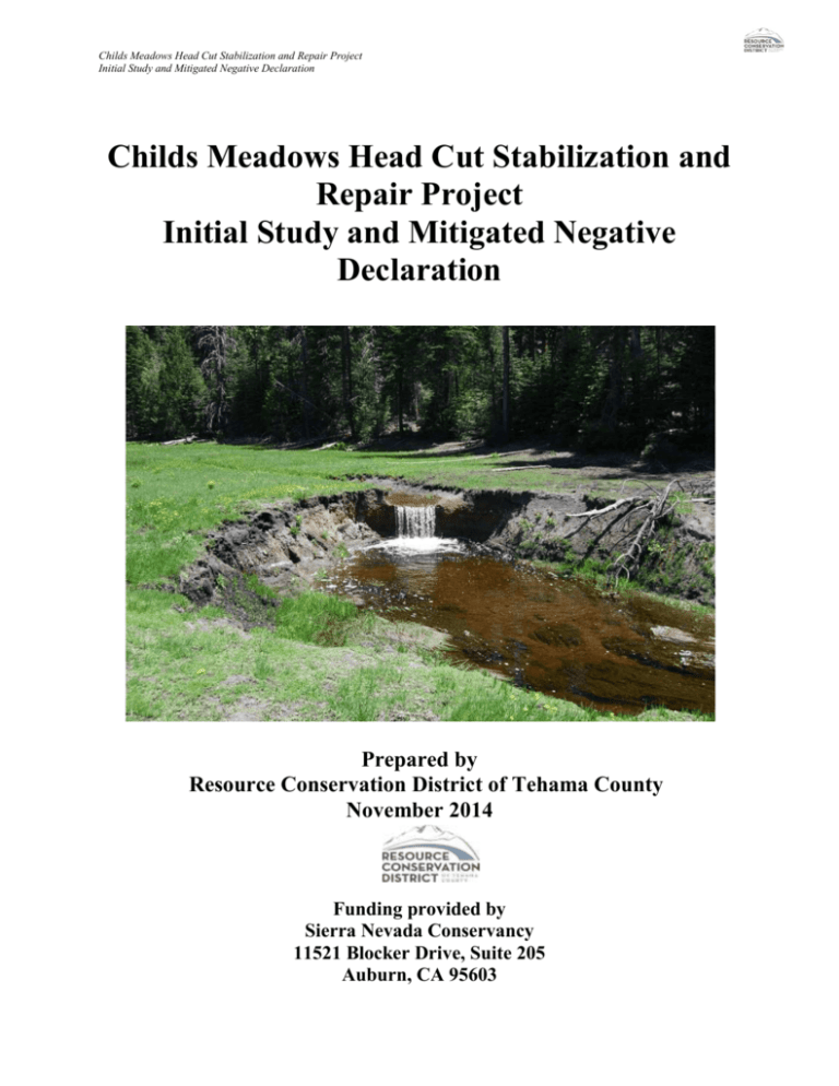
Childs Meadows Head Cut Stabilization and Repair Project Initial Study and Mitigated Negative Declaration Childs Meadows Head Cut Stabilization and Repair Project Initial Study and Mitigated Negative Declaration Prepared by Resource Conservation District of Tehama County November 2014 Funding provided by Sierra Nevada Conservancy 11521 Blocker Drive, Suite 205 Auburn, CA 95603 Childs Meadows Head Cut Stabilization and Repair Project Initial Study and Mitigated Negative Declaration Table of Contents I. Mitigated Negative Declaration ..............................................................................................1 Project Description and Environmental Setting ......................................................................... 1 Project Location ............................................................................................................................ 1 Legal Description ........................................................................................................................... 1 General Plan Designation ............................................................................................................. 1 Zoning ........................................................................................................................................... 1 Introduction and Project History ................................................................................................... 2 Project Description......................................................................................................................... 2 Project Monitoring ....................................................................................................................... 10 Surrounding Land Uses and Environmental Setting .................................................................... 10 Environmental Factors Potentially Affected ................................................................................ 13 II. Maps, Figures and Graphics, Photographs Map A- Aerial Photograph of Project Site and Surrounding Area Childs Meadows Head Cut Stabilization and Repair Project ............................................................................................... 14 Map B- Topographic Map of Childs Meadows Head Cut Stabilization and Repair Project Site And Surrounding Area ................................................................................................................... 15 Map C- Detailed Topographic Map of Childs Meadows Head Cut Stabilization and Repair Project Site ..................................................................................................................................... 16 Map D- Parcel Map of Project Site and Surrounding Area Childs Meadows Head Cut Stabilization and Repair Project Site ............................................................................................. 17 Map E- Photomap of Childs Meadows Head Cut Stabilization and Repair Project Site .............. 18 Map F- Aerial Photo Plan View of Existing Conditions Within the Childs Meadows Head Cut Stabilization and Repair Project Site and Surrounding Area ......................................................... 19 Map G- Area of Expected Disturbance Childs Meadows Head Cut Stabilization and Repair Project ................................................................................................................................ 20 Map H- Detailed Air Photo Map of Stream Alignments Other Hydrologic Features and Roads . 21 Childs Meadows Head Cut Stabilization and Repair Project Initial Study and Mitigated Negative Declaration Map I-Air Photo Analysis of Historic Channel Conditions Within Childs Meadows Between 1941 and 2012 ................................................................................................................................ 22 Figure 1 – Overview Map of Major Erosion Control Infrastructure ............................................. 23 Figure 2 – Project Site Topographic Survey and Location of Major Erosion Control Infrastructure .................................................................................................................................. 24 Figure 3 – Longitudinal Profile of Project Site ............................................................................. 25 Figure 4 – Vegetated Rip-Rap Schematic ..................................................................................... 26 Figure 5 – Sectional View of Vegetated Rock Armor Structure................................................... 27 Figure 6 – Schematic of Rootwad Revetment and Live Fascines ................................................. 28 Figure 7 – Detailed Location Map of Rootwad Revetment and Live Fascines ............................ 29 Figure 8 – Detailed Schematic of Log Cored Willow Baffle Infrastructure ................................. 30 Figure 9 – Location of Proposed Log Cored Willow Baffle Infrastructures................................. 31 Photo 1 – Overview Photograph of Childs Meadows Complex North of the Project Area. ......... 32 Photo 2- View of Childs Meadows Complex Showing a Wet Area That Drains into Gurnsey Creek Near the Head Cut Site ........................................................................................................ 33 Photo 3- View of One Small Channel Feeding into Gurnsey Creek Near the Headcut site. ........ 34 Photo 4- Overview of the Head Cut and Surrounding Impacted Area. ......................................... 35 Photo 5- Close Up of Head Cut ..................................................................................................... 36 Photo 6- Close up of Downstream Channel Immediately Adjacent to the Head Cut. .................. 37 Childs Meadows Head Cut Stabilization and Repair Project Initial Study and Mitigated Negative Declaration Photo 7- Stream Flood Plain Downstream of Head Cut Site. ....................................................... 38 Photo 8- Close Up of Stream Bank and Road Cut Shown in Photo 7 ........................................... 39 Photo 9- Close Up of Widened Channel Downstream From Head Cut Site. ................................ 40 Photo 10- Example of Side Cutting into Forested Area Immediately Downstream From Head Cut Site. ................................................................................................................................................ 41 Photo 11- Close-Up View of Side Cutting into Forested Area and Impacts to Adjacent Vegetation. ..................................................................................................................................... 42 Photo 12- Narrow Incised Channel Within Forested Area. .......................................................... 43 Photo 13- Reduced Amount of Side Cutting and Channel Incising Within a Portion of Forested Area Having Moderate Slopes. ...................................................................................................... 44 Conclusion of Mitigated Negative Declaration .......................................................................... 45 Other Public Agencies Whose Approval Is Required ................................................................... 45 Mitigation Measures ..................................................................................................................... 45 Summary of Findings .................................................................................................................... 54 III. Initial Study/Environmental Checklist ............................................................................................ 55 Environmental Factors Potentially Affected ................................................................................. 56 Determination ................................................................................................................................ 57 Analysis of Potential Environmental Impacts ............................................................................... 58 Aesthetics ......................................................................................................................... 58 Agriculture and Forest Resources .................................................................................... 60 Air Quality ....................................................................................................................... 62 Biological Resources ....................................................................................................... 65 Cultural Resources ........................................................................................................... 76 Geology and Soils ............................................................................................................ 80 Greenhouse Gas Emissions .............................................................................................. 85 Hazards and Hazardous Materials ................................................................................... 86 Hydrology and Water Quality .......................................................................................... 89 Land Use and Planning .................................................................................................... 94 Mineral Resources ........................................................................................................... 95 Noise ................................................................................................................................ 96 Population and Housing ................................................................................................... 99 Public Services ............................................................................................................... 100 Childs Meadows Head Cut Stabilization and Repair Project Initial Study and Mitigated Negative Declaration Recreation ...................................................................................................................... 101 Transportation/Traffic .................................................................................................... 102 Utilities and Service Systems ......................................................................................... 104 Mandatory Findings of Significance .............................................................................. 106 IV. Appendices ..........................................................................................................................108 Appendix A Mitigation Monitoring and Reporting Plan (MMRP) ................................................................. 109 Appendix B Best Management Practices Developed and Selected for the Childs Meadows Head Cut Stabilization and Repair Project .................................................................................................. 120 Appendix C Results of Biological Resources Database Inquires and Species Review of Listed Species Found Within and Around the Childs Meadows Head Cut Stabilization and Repair Project Area ........ 165 Appendix D CNDDB Map Printouts Childs Meadows Head Cut Stabilization and Repair Project ............... 172 Appendix E Protocols for Surveying and Evaluating Impacts to Special Status Native Plant Populations and Natural Communities ........................................................................................ 173 List of Preparers of this Document .........................................................................................174 List of Experts Consulted .........................................................................................................174 References Cited ........................................................................................................................177
