to (.doc) - Mosby Heritage Area
advertisement
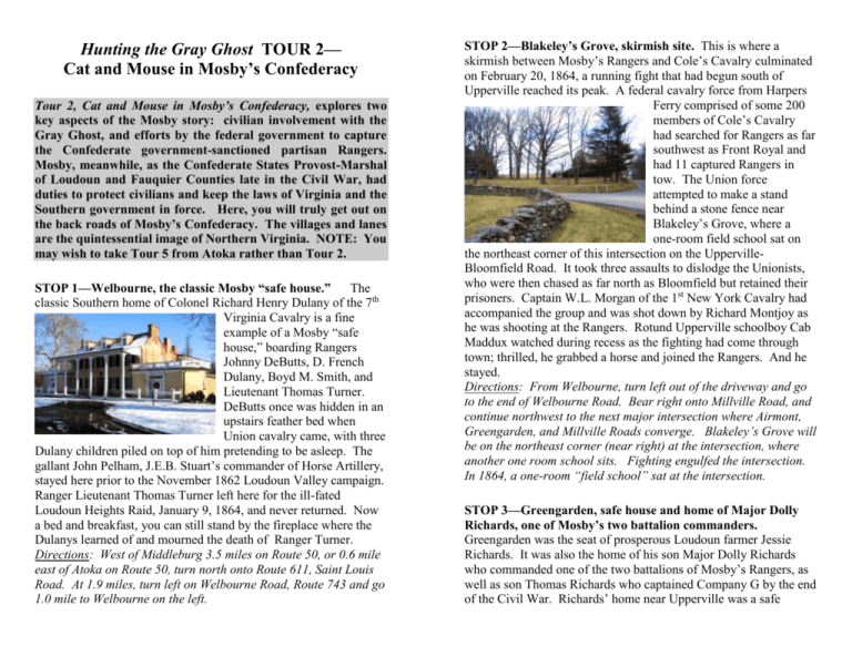
Hunting the Gray Ghost TOUR 2— Cat and Mouse in Mosby’s Confederacy Tour 2, Cat and Mouse in Mosby’s Confederacy, explores two key aspects of the Mosby story: civilian involvement with the Gray Ghost, and efforts by the federal government to capture the Confederate government-sanctioned partisan Rangers. Mosby, meanwhile, as the Confederate States Provost-Marshal of Loudoun and Fauquier Counties late in the Civil War, had duties to protect civilians and keep the laws of Virginia and the Southern government in force. Here, you will truly get out on the back roads of Mosby’s Confederacy. The villages and lanes are the quintessential image of Northern Virginia. NOTE: You may wish to take Tour 5 from Atoka rather than Tour 2. STOP 1—Welbourne, the classic Mosby “safe house.” The classic Southern home of Colonel Richard Henry Dulany of the 7th Virginia Cavalry is a fine example of a Mosby “safe house,” boarding Rangers Johnny DeButts, D. French Dulany, Boyd M. Smith, and Lieutenant Thomas Turner. DeButts once was hidden in an upstairs feather bed when Union cavalry came, with three Dulany children piled on top of him pretending to be asleep. The gallant John Pelham, J.E.B. Stuart’s commander of Horse Artillery, stayed here prior to the November 1862 Loudoun Valley campaign. Ranger Lieutenant Thomas Turner left here for the ill-fated Loudoun Heights Raid, January 9, 1864, and never returned. Now a bed and breakfast, you can still stand by the fireplace where the Dulanys learned of and mourned the death of Ranger Turner. Directions: West of Middleburg 3.5 miles on Route 50, or 0.6 mile east of Atoka on Route 50, turn north onto Route 611, Saint Louis Road. At 1.9 miles, turn left on Welbourne Road, Route 743 and go 1.0 mile to Welbourne on the left. STOP 2—Blakeley’s Grove, skirmish site. This is where a skirmish between Mosby’s Rangers and Cole’s Cavalry culminated on February 20, 1864, a running fight that had begun south of Upperville reached its peak. A federal cavalry force from Harpers Ferry comprised of some 200 members of Cole’s Cavalry had searched for Rangers as far southwest as Front Royal and had 11 captured Rangers in tow. The Union force attempted to make a stand behind a stone fence near Blakeley’s Grove, where a one-room field school sat on the northeast corner of this intersection on the UppervilleBloomfield Road. It took three assaults to dislodge the Unionists, who were then chased as far north as Bloomfield but retained their prisoners. Captain W.L. Morgan of the 1st New York Cavalry had accompanied the group and was shot down by Richard Montjoy as he was shooting at the Rangers. Rotund Upperville schoolboy Cab Maddux watched during recess as the fighting had come through town; thrilled, he grabbed a horse and joined the Rangers. And he stayed. Directions: From Welbourne, turn left out of the driveway and go to the end of Welbourne Road. Bear right onto Millville Road, and continue northwest to the next major intersection where Airmont, Greengarden, and Millville Roads converge. Blakeley’s Grove will be on the northeast corner (near right) at the intersection, where another one room school sits. Fighting engulfed the intersection. In 1864, a one-room “field school” sat at the intersection. STOP 3—Greengarden, safe house and home of Major Dolly Richards, one of Mosby’s two battalion commanders. Greengarden was the seat of prosperous Loudoun farmer Jessie Richards. It was also the home of his son Major Dolly Richards who commanded one of the two battalions of Mosby’s Rangers, as well as son Thomas Richards who captained Company G by the end of the Civil War. Richards’ home near Upperville was a safe house, boarding his two Ranger sons, John Hipkins, and Robert S. Walker, later founder of Woodbury Forest School. Here, on the frigid night of Saturday-Sunday, February 18-19, 1865, federal cavalry surrounded the house and forced Richards and several other Rangers to dive down a “hidey hole” in a first floor closet. Richards lost a new uniform, but led a mauling counter-attack against the Union force at Mount Carmel Church in Clarke County, west of Ashby’s Gap (See Tour 3, STOP 6). Directions: Turn south on Greengarden Road (Route 719) and go 1.8 miles to Greengarden on the right at # 22439. A private home, it can be nicely viewed up its lovely farm lane from the road. STOP 4—Upperville, pristine village of “Mosby’s Confederacy.” While many associate Middleburg with Mosby, the town the Rangers would best recognize today would be Upperville, an antebellum community in which Mosby’s men shopped, socialized, and went to church. Here they rendezvoused and shared federal booty. You can still walk through Upperville and see its fine antebellum architecture. There are cemeteries with Civil War dead along Route 50 on the east end of the village, and immediately south of the highway at the Methodist Church on Delaplane Grade Road. You can seek libation and sustenance at the English pub, Hunter’s Head. When in the Mosby Heritage Area, take time to slow down and see the past. The village has Virginia Civil War Trails signs, two at the east end in a small park at Vineyard Hill, and two at the west end along Route 50. This tiny hunt country town has been called “Virginia in miniature.” Directions: Continue south 0.7 mile on Greengarden Road to Route 50. Turn right and head west; the village is just ahead. STOP 5—Paris, at the base of Ashby’s Gap, the other village most recognizable to Mosby’s Rangers. Paris sits at the base of Ashby’s Gap (right) in the Blue Ridge, and is the gateway to the Crooked Run Valley National Historic District. A stroll through the quiet streets of this village is rewarding not only for its architecture but for its views. Walk down the main street—Federal Street—and the first house beyond Madison Street belonged to Dr. Albin Payne. Here boarded Mosby Ranger Lewis Thornton Powell, who, when he disappeared in the winter of 1865, became Lewis Payne, Lincoln conspirator, and attempted to assassinate U.S. Secretary of State William Seward the same night Lincoln was killed. The village has amazing views along Gap Run Road, the southern entryway to Paris, and begs walking with a camera. You can photograph both Ashby’s Gap in the Blue Ridge and the lovely Crooked Run Valley to the south. The Ashby Inn at the main intersection in the village offers lodging, food, and fine drink in an historic atmosphere. Directions: Head 3 miles west of Upperville on Route 50 to the stoplight at Route 17. Turn left (south) and go to the next right, Gap Run Road, Route 701. This lane leads into the village with lovely Crooked Run Valley and Ashby’s Gap views. STOP 6—Mount Bleak, Mosby Ranger safe house at Sky Meadows State Park. ” Like so many houses in the Crooked Run Valley, young Dr. Thomas Settle’s “Mount Bleak” was a Mosby “safe house,” boarding Rangers Abner, Isaac, and Thomas Settle in the attic. In 1859, Dr. Settle had been the Virginia Medical Examiner who declared John Brown dead. After the War, the house was sold to Ranger George Slater. Slater had been in the room with Mosby kidnapping General Edwin H. Stoughton during the Fairfax Courthouse Raid in March 1863. Mosby’s son John was brought here in 1915 to hopefully recover from throat cancer. Despite the loving care, fine vistas, and clean air at Mount Bleak, the younger Mosby died the year before his father. Colonel Mosby visited the house on a number of occasions. During park hours, the house and outbuildings can usually be visited. There is a small state park parking fee to enter but the park’s glorious views, rewarding hiking, history, and restrooms make it worth it even for a short visit. You will need your camera! Directions: At the end of Edmonds Lane (Route 710) off Route 17 a mile below Paris, this stone home is a key building beside the state park’s main parking lot. STOP 7—Belle Grove, Mosby safe house and home of the famous diarist of Mosby’s Confederacy, Amanda Virginia Edmonds. Living here with her mother and brothers, Belle Grove was the home of noted young Southern diarist Amanda Virginia “Tee” Edmonds. Belle Grove was a busy Mosby safe house for Rangers Samuel C. Alexander, Benjamin S. Edmonds, Clement W. Edmonds, Edward G. Edmonds, George W. Hunt, Matthew F. Magner (who Miss Edmonds fell in love with), George W. Triplett, and Richard C. Triplett. Edmonds’ diary is the best civilian account of life in Mosby’s Confederacy. Early on February 18, 1864, Belle Grove was surrounded by federal cavalry acting on a tip from a disgruntled former member of Mosby’s Command, John Cornwell. Rangers Edward G. “Bud” Edmonds, Sam Alexander, and George Triplett were able to get to Belle Grove’s emergency “hidey hole,” but Richard Triplett and George Hunt were captured and sent to the Old Capitol Prison and ultimately to Fort Delaware. Here Amanda Virginia Edmonds is buried in the small family cemetery, but it is private property. You will see an account of that morning elsewhere in this booklet. Directions: Return to Route 17 on Edmonds Lane (the park road) and turn right (south) on Route 17. Belle Grove is the next house on the right, set back from the highway. While private property, it can easily be viewed from the side of Route 17. STOP 8—Highfield, Mosby safe house and a site of a fine piece of federal revenge. Also known as “Hill and Dale” Farm, this was a Mosby safe house owned by Benjamin Triplett, boarding Rangers Benjamin A. Triplett, Reuben Triplett, Lieutenant Albert Wrenn, and James Wrenn. Here on Friday March 25, 1864, a memorable example of successful Union resistance to Mosby took place. After a raid into the northern Shenandoah Valley, Mosby stopped at Highfield, leaving James Wrenn to guard the horses as the others went into the house. Wrenn had the prisoners tie their horses, but Corporal Simpson of Company H, 21st New York Cavalry, tied his horse at the same time as he untied Mosby’s horse. He mounted Mosby’s horse—still with its pistols on the saddle—and with one other prisoner, galloped successfully away. The two were “vigorously pursed for some distance” claim historians Tom Evans and Jim Moyer, but unsuccessfully so, evading capture. Mosby lost a good horse, pistols, and key documents, including his original commission as Captain of Mosby’s Rangers. A month earlier, on February 18, 1864, using betrayer John Cornwell’s intelligence, Highfield was surrounded by federal cavalry, as was next-door Belle Grove. The Wrenn brothers escaped that incident barefoot in their nightclothes over the frozen landscape. Highfield is in a grove of trees set back from the road but the entrance lane is marked. Directions: Continue south on Route 17 from Belle Grove. On the west (right) side of Route 17, Highfield is the first house south of Leeds Manor Road (Route 688). STOP 9—Fleetwood, Mosby safe house and mill. Next to the old stone Fleetwood Rolling Mills (right), Fleetwood (below) was a Mosby safe house for Rangers John W. Corbin, John E. Gibson, Joseph A. Gibson, E. Prioleau Henderson, William A. Mickler, and William B. Walston. On February 18, 1864, five Rangers surrendered here rather than let the house be burned by the federals. The next door mill was important in the Crooked Run Valley’s grain economy. Directions: Continue south on Route 17 from Highfield. On the west (right) side of Route 17, Fleetwood is the first house south of Highfield, sitting with the stone mill to its left. It is private property but both the house and the photogenic mill can be viewed easily from the road. STOP 10—Oakwood, the home of Jamieson Ashby. This safe house a mile west of the Winchester Road was the home of Jamieson Ashby. Rangers Henry S. Ashby, Walter Frankland (Captain, Company F), and John A. Hammer were boarded here. It was here that Ranger/raconteur Johnny Munson first met Mosby, providing his oft-quoted description of the Guerilla Chieftain. Sitting next to Mosby, Munson noted, “the secret of his power over his men was disclosed. It was in his eyes, which were deep blue, luminous, clear, piercing; when he spoke they flashed the punctuations of his sentence.” Jamieson Ashby was later used as a hostage by Union forces, strapped to a federal military train using the Manassas Gap Railroad tracks as insurance against guerilla attack. In said position, Ashby was killed during an attack in October 1864. Directions: Continue 2.6 miles south on Rt. 17 to Pleasant Vale Road (Route 724) on the right. Oakwood Farm is signposted at 0.8 mile west on Pleasant Vale Road on the north (right) side. This private property can be viewed from the roadside. Note: Be very careful of foxhunters galloping across this stretch of road. STOP 11--Pleasant Vale Church, rural Ranger rendezvous point. Near the tiny Fauquier hamlet of Scuffleburg, this simple 1845 Baptist Church was a popular Ranger assembly point between Piedmont Station and Markham. Access to both Ashby’s Gap to the north and Manassas Gap to the south was easy from here. The church exudes the sense of “a hiding place” perfect for a pre-raid rendezvous. It is also a fine example of rural Virginia Baptist churches of the antebellum period, and local efforts are committed to its restoration. Directions: Take Pleasant Vale Road (Route 724) anther 0.2 mile west of Oakwood to Scuffleburg Road (Route 826); the unsteepled brick Pleasant Vale Church will almost immediately be on your left as you begin down the ancient unpaved Scuffleburg Road. STOP 12—The hamlet of Scuffleburg, where Company B of Mosby’s Rangers was formed. This flyspeck village, now 3 houses, was a wonderful back-roads meeting place for the Rangers due to its out-ofthe-way location and easily defensible terrain. It was here that Company B of the Ranger’s 43rd Virginia Battalion of Cavalry was formed on October 1, 1863, with William R. “Billy” Smith as Captain. Scuffleburg consisted then of a home plus blacksmith and wheelwright’s shops. Directions: From Pleasant Vale Church, continue north on Scuffleburg Road (Route 826). Watch for deer. At the dead end, in less than a mile, you’ll see three period structures that currently comprise Scuffleburg. The village’s isolation will be palpable. STOP 13--Yew Hill, where Mosby and J.E.B. Stuart conferred. Miss Kitty Shacklett lived here during the War, and Mosby knew her well, often stopping by. Here on June 16, 1863, J.E.B. Stuart established his headquarters tent, and the next morning, Mosby conferred with him—just before the opening of the massive AldieMiddleburg-Upperville cavalry battles. Mosby would meet again with Stuart at Beveridge’s Hotel in Middleburg (today’s Red Fox Inn) later that June 17 with updated intelligence. As the commander of the 43rd Virginia Cavalry, Colonel Mosby worked in concert with his commander, General J.E.B. Stuart, as well as with General Robert E. Lee and Confederate President Jefferson Davis to regularly provide crucial intelligence. Directions: From Scuffleburg, retrace your steps out Scuffleburg Road and east on Pleasant Vale Road back to Route 17. Turning right (south) on 17, go just over 2 miles to Route 55 west on the right. The first house on the right on Route 55 is Yew Hill, with its distinctive “cat slide” roof. While private property, Yew Hill can be viewed by pulling off to the right side of Route 55 west. STOP 14—Ashland, where “Big Yankee” Ames died. Ashland was the home of Benjamin Shacklett, whose son “Bub” (Edward) was a Ranger. On October 9, 1864, fighting broke out just north of Piedmont Station between Mosby’s men and the 5th New York Cavalry, as part of a campaign by Mosby to stop the railroad from being repaired by General Sheridan’s Union forces. Sheridan wanted the damaged Manassas Gap Railroad available as a supply line from Manassas to his army in the Shenandoah Valley. The fighting spread from Delaplane Grade Road onto the grounds of Ashland. The body of the popular James “Big Yankee” Ames was found by Rangers lying in the entry lane, pictured here. A member of the 8th Illinois Cavalry was going through Ames’ pockets, and was assisted to “the beyond” on the spot. Ames, a native of Maine, had defected to Mosby’s Rangers from the 5th New York Cavalry in early 1863, and had been a key player in the famed Fairfax Courthouse Raid. It was Ames who escorted Mosby’s command through a gap in Union lines. Ames’ death was intensely lamented in Mosby’s command. NOTE: It is often mistakenly claimed that Ames fell at Yew Hill, Stop 13. Further research shows otherwise. This is the place. Directions: Reverse direction and go 0.1 mile north on Route 17 to Delaplane. Two roads head away from Route 17 at Delaplane; take the left one, Delaplane Grade Road (Route 712). Go 0.4 mile north up the hill towards Upperville. Ashland is the first house on the left (west) side fully beyond the village. Its name is on a stone entry gate. You can see the driveway where Ames fell. The house is but partly visible in a grove of trees. This is private property. THIS ENDS TOUR 2. Directions if you choose to end your tour here OR to go on to Tour 5—“The Brothers’ War: Continue on Delaplane Road six miles to Upperville, where you will come to a stop sign at Route 50, the John S. Mosby Highway. Turn right and head east on Route 50..Atoka is just off Route 50 (right hand side) four miles to the east. Directions if you choose to continue with either Tour 3 or Tour 4: Reverse direction and head down the hill to Delaplane to continue. MOSBY AND THE BOYS. A nonchalant pose by Mosby (center) and some of his men, ca. 1865, most likely taken just after the end of the War. Photo from the National Archives collection. ACKNOWLEDGEMENTS: The Mosby Heritage Area Association would like to recognize the work of Mosby historians John Divine, Jim Moyer, Tom Evans, Horace Mewborn, Dave Roth, Don Hakenson, Greg Dudding, Jeff Wert, James Ramage, Eric Buckland, and Dave Goetz and sincerely thank them. Without their research efforts, Hunting the Gray Ghost would not have been possible. Horace Mewborn and Tom Evans have made information available that has been crucial in locating Mosby sites. Tour design, text, photos, and cover are by Richard T. Gillespie, Mosby Heritage Area Association Director of Education. Maps are by Watsun Randolph of the Piedmont Environmental Council.
