to (.doc) - Mosby Heritage Area
advertisement
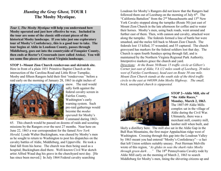
Hunting the Gray Ghost, TOUR 1 The Mosby Mystique. Tour 1, The Mosby Mystique will help you understand how Mosby operated and just how effective he was. Included in the tour are some of the classic still-extant pieces of the historical Mosby landscape. If you take just one exploratory tour of Mosby’s Confederacy, this is a good tour to take. The tour begins at Aldie in Loudoun County, passes through Middleburg, goes out into the countryside of Fauquier County, then ends at Rector’s Crossroads (now called Atoka). You will see some fine pieces of the rural Virginia landscape. STOP 1--Mount Zion Church rendezvous and skirmish site. Here in front of a plain 1851 Primitive Baptist Church at the intersection of the Carolina Road and Little River Turnpike, Mosby and fifteen Rangers held their first “rendezvous” before a raid early on the morning of January 28, 1863 in eight inches of snow. The raid would sally forth against the federal cavalry screen in Fairfax County, Washington’s early warning system. Such pre-raid gatherings would become the modus operandi for Mosby’s Command during 186365. This church would be passed on dozens of raids and scouting missions by the Rangers over the next 27 months. Near here on June 22, 1863 a war correspondent for the famed New York Herald, Lynde Walter Buckingham, was chased by Mosby’s men as he sought to return to Washington to post his dispatches on the cavalry battles of Aldie, Middleburg, and Upperville. He took a fatal fall from his horse. The church was then being used as a hospital; Buckingham died there. Well-known Civil War sketch artist Alfred Waud dug his grave in the churchyard next day. [He has since been moved.] In July 1864 Federal cavalry searching Loudoun for Mosby’s Rangers did not know that the Rangers had followed them out of Leesburg on the morning of July 6th. The “California Battalion” from the 2nd Massachusetts and 13th New York Cavalry stopped along the turnpike (Route 50) just east of Mount Zion Church in the late afternoon for coffee and to water their horses. Mosby’s men, using back roads, went around and further east of them. Then, with cannon and cavalry, attacked west along the turnpike. The federals formed a line of battle but were smashed, and the melee fell back to Mount Zion Church. The federals lost 13 killed, 37 wounded, and 55 captured. The church graveyard has markers for the federal soldiers lost that day. The Church is open fourth Sundays spring through fall, and is maintained by the Northern Virginia Regional Park Authority. Interpretive markers grace the church and yard. Directions: At the Route 50/Route 15 traffic circle at Gilbert’s Corner just east of Aldie, VA (12 miles south of Leesburg, 20 miles west of Fairfax Courthouse), head east on Route 50 one mile. Mount Zion Church stands at the south side of the third traffic circle to the east at #40309 John Mosby Highway. The small, brick, unsteepled church is signposted. STOP 2--Aldie Mill, site of “the Aldie Races,” Monday, March 2, 1863. The 1807-09 Aldie Mills complex sat in the village of Aldie during the Civil War. Ultimately, there was a merchant mill, country mill, lumber mill when built, and likely a distillery here. The mill also sat in the Aldie Gap in the Bull Run Mountains, the first major Appalachian ridge west of Washington. Crossing through this gap into the Loudoun Valley by 1863 meant you had entered “Mosby’s Confederacy”—a fact that left Union soldiers suitably uneasy. Poet Herman Melville wrote of this region, “As glides in seas the shark rides Mosby through green dark . . .” The 18th Pennsylvania Cavalry rode by Aldie Mill early on the morning of March 2, 1863 to search Middleburg for Mosby’s men, lining the shivering citizens up and taking several boys and old men captive when they found no Rangers. They returned past Aldie Mill, heading east, and raced off the turnpike when they encountered cavalry—unknown to them, not Mosby’s men but the 1st Vermont. Watching amused, the 1st Vermont continued west and soon stopped for a coffee break at Aldie Mill, just in time for an infuriated Mosby with sixteen Rangers following to smash into them. His morning rendezvous had led him through Middleburg to hear the citizens’ tale of woe. The Yankees, not knowing how many Rangers were involved, fled or jumped into the flour bins of the mill even though only initially seeing Mosby. Mosby was riding a recently captured Union horse and at the bridge just east of the mill, saw a wall of Yankees beyond. Unable to control his mount, with his famed squirrel’s grace, he decamped into Little River--a sight to see! The fight was short and sharp. Soon, a mud- covered Mosby, the captured flour-coated federals, and the freed Middleburg captives all proceeded to Middleburg, much to the satisfaction of local citizens. [Included in the group were several Middleburg slaves just liberated by the Pennsylvanians but abandoned in their panic upon seeing the Vermonters . . .] This famed incident has come to be known as “the Aldie Races” in deference to its nature. The mill is open on Saturdays and Sundays April to November and still grinds when water flow is sufficient. It is operated by the Northern Virginia Regional Park Authority. Directions: Aldie Mill sits along Route 50 in Aldie at 39401 John S. Mosby Highway, Aldie VA 20105—you will see it on the south side of the highway (on your left heading west) after crossing the narrow stone bridge over Little River. STOP 3—Mosby’s Hill, a psychological tool used by the Gray Ghost against federal soldiers. A little less than half a mile west of the village of Aldie rises a long, low, barren hill paralleling the John S. Mosby Highway (Route 50)—the old turnpike. Mosby often watched federal turnpike traffic from this hillside perch, which usually left him perfectly silhouetted against the sun, and thus mysterious and foreboding. Some Union forays simply turned back upon seeing him as it was unclear how many others accompanied him. Mosby, who often scouted alone, was wonderfully adept at his use of psychological warfare and the power of suggestion. Directions: Look for Champe Ford Road on your left as you head west from the village limits of Aldie; it is approximately 0.5 mile. You can get up close to Mosby’s Hill by heading down this dirt lane and looking right just past a narrow bridge, or you can pull off on the left-hand (south) side of Route 50 by the four silver and black Virginia historical signs to look through the trees lining the road for a glimpse of the hill—barren in winter, tree-lined in summer. The photo was taken from Champe Ford Road. STOP 4—Dover, a crossroads often used as a Ranger Rendezvous. This tiny crossroads village and mill site east of Middleburg served as Mosby’s Rendezvous before the most famous of all his raids, the Fairfax Courthouse Raid of March 8 & 9, 1863, that “gobbled up” the youthful Union General Edwin H. Stoughton from his bed and delivered him to Confederate General Fitzhugh Lee. The main house, the original roads, and the small mill building on the right are still here from 1863. Few of the Rangers leaving Dover knew that their snow-bound target was ten hours away--through the Union’s outer defenses of Washington. Directions: Dover sits just under two miles west of Aldie Mill and a third of a mile beyond Mosby’s Hill; it is signposted and lies at the Intersection of Route 50 and Cobb House Road. You can pull over easily here. DRIVE-BY MOSBY SITE TO NOTE. Oakham Farm, where Mosby’s Rangers were born. At this whitewashed stone farm owned by Hamilton Rogers, Confederate General J.E.B. Stuart stopped on December 29, 1862 after his successful Christmas Dumfries Raid, many miles from their starting point at Fredericksburg. Rogers had several lovely daughters, a plus for that evening’s sparkling entertainment. Next morning, Stuart’s scout John S. Mosby proposed that he be allowed to conduct special operations and intelligence gathering behind Union lines from the Loudoun Valley. Stuart gave his approval. Mosby returned with a small but talented core of his future command from the 1st Virginia Cavalry in January. Directions: Oakham lies in a grove of trees on the north (right) side of Route 50 at the top of the hill that ascends out of Dover; it’s 0.7 miles west of Dover. STOP 5—Lorman Chancellor House, home of Mosby’s compatriot and Civil War Middleburg mayor. Mosby worked to retain excellent relations with his military superiors and members of the Confederate civilian government, keeping in regular touch with General J.E.B. Stuart, General Robert E. Lee, and Confederate President Jefferson Davis. Similarly, as Provost Marshal of Loudoun and Fauquier counties, he met with local government officials to keep the wheels of his mission grinding smoothly. Here at Middleburg Mayor Lorman Chancellor’s fine stone home, Mosby ate dinner before the vaunted Fairfax Courthouse Raid, Sunday March 8, 1863. He told the mayor before leaving on the raid, “I shall mount the stars tonight or sink lower than the plummet ever sounded.” On January 29-30, 1863, the first federal hunt for Mosby took place after his raid from the initial Mount Zion Church rendezvous. Mosby and Ranger Font Beattie were staying at the Chancellor House. Awakened by a servant, Mosby and Beattie rapidly departed, gathered a squad of seven Rangers, and boldly attacked Colonel Percy Wyndham’s column as they departed Middleburg after a fruitless search. Directions: The stone Lorman Chancellor House sits on the south (left) side of Highway 50 at the top of the hill entering Middleburg at the near (southeast) corner of South Jay Street. The house is privately owned. STOP 6--The Red Fox Inn, Middleburg, meeting place of J.E.B. Stuart and Mosby, June 17, 1863. Known as Beveridge’s Hotel in 1863, Mosby met with the arriving General J.E.B. Stuart here with crucial intelligence concerning the arrival of federal cavalry to the south and east. Keep in mind that Mosby’s primary function was the collection of valuable military intelligence. Drinking much coffee, Mosby could ride for almost two days, and had the ability to retain amazing details for his superiors. Stuart used this inn as his headquarters as the series of cavalry actions developed at Aldie on that steamy Wednesday, June 17, 1863, and subsequently, at Middleburg and Upperville during June 18-21. Mosby would provide crucial intelligence for Stuart’s shift north into Pennsylvania, and would doggedly support his former commander after the War when Stuart was criticized for his late arrival at the Battle of Gettysburg. Directions: The Red Fox Inn sits on the northeast corner of Route 50 and North Madison street at the lone stoplight in downtown Middleburg. It serves breakfast, lunch, and dinner in a hunt country atmosphere and offers lodging. The still-used bar top is said to have been used as an operating table in June of 1863. STOP 7—The Hathaway House, site of Mosby’s ultimate “squirrely” feat. Known in 1863 as “Denton” or “Western View,” Mosby stayed here on several occasions, sometimes with his wife Pauline. Most notably, they were here on the night of June 8-9, 1863 when this home of James Hathaway’s was surrounded by troopers of the 1st New York Lincoln Cavalry. After a fruitless eight-hour search in which only Mosby’s wife, spurs, and horse were found, Mosby climbed in his bedroom window from the large branch of the adjacent black walnut tree in which he had been hiding. Mosby, the very definition of “squirrely,” was just 5’6” tall and 125 pounds. Earlier in the War, Mr. Hathaway had given famed Confederate cavalry leader Turner Ashby his favorite white horse, “Tom Telegraph.” Directions: Head west through Middleburg to where Route 50 becomes a divided highway. Take the first crossover in the median to Zulla Road (Route 709) on the south side of the highway. Follow Zulla for 3.0 miles to Young Road (Route 708) on the right; the Hathaway House is the first house on the right (north) side of Young Road at 0.5 mile west of Zulla Road. The Hathaway House is private property, but it can be viewed from this quiet dirt road by pulling off to the right side. Mosby and his wife were staying in the rear wing, second floor, near the black walnut tree that still stands at the east (near) side of this lovely brick house. DRIVE-BY MOSBY COUNTRY TO NOTE: The Fauquier back roads near Hathaway House. Fauquier is classic Northern Virginia hunt country today—horse country—and the still-dirt roads and lovely farms that dot the countryside are little changed from the warren of lanes that Mosby’s Rangers knew well and used to their advantage to elude the ever-hunting federal cavalry. Keep to 25 miles per hour, but do not fear our dirt roads. The state maintains them. Do slow down when approaching another vehicle. Directions: From the Hathaway House, continue west on Young Road past Carter’s Mill Road to Five Points Road on the right, about a mile. Turn right onto Five Points Road and continue several lovely winding miles to the intersection at Five Points where the dirt lane comes to the paved Atoka Road, Route 713. STOP 8—Five Points, rendezvous and skirmish site. At this intersection of several roads creating five “points,” Mosby’s Rangers often met in rendezvous. It allowed them to head in a myriad of directions. At the time of the Civil War, many of these lanes were lined with stone fences, literally, a stone wall with a low worm fence constructed on top for the purpose of keeping horses, cattle, sheep, and goats in their proper fields. One might wonder as well if their purpose was for Mosby’s equestrian Rangers to use as mere “show off” points, as they often leapt them in escape during running battles when their frustrated Union opponents could not. This intersection was also a skirmish site. On Friday, January 1, 1864, it dawned fair and cold, but soon clouded up and began to snow. Eighty Union soldiers of Cole’s Maryland Cavalry based at Harpers Ferry arrived at eight in the morning to search nearby Upperville for Mosby’s guerillas, then headed on to Rectortown— two miles south of this intersection--to search further. A Ranger rendezvous for a New Year’s Day raid was coincidentally planned at Rectortown for about noon. With the Union cavalrymen there in the village, the Rangers eerily formed on hillsides around the village in plain view of those hunting for them. Cole’s cavalry began their return to Harpers Ferry by pretending to go south towards Salem (now Marshall) and Warrenton to fool the Rangers. But then they cut overland across the fields to get to the road north to Rector’s Crossroads (now Atoka). The Rangers immediately saw their trick. Knowing the local landscape better, Mosby’s men headed here to Five Points by a better route to cut them off. While Mosby’s men had only about 30 men against 80, the power of their focused charge at Five Points and the immediate loss of the Union commander, Captain Albert M. Hunter led to a frantic flight by the Union force in all directions in search of cover. Many were chased into a frigid stream; 35 of the 80 Union cavalrymen were captured. By the end of the day, the captured “Yankees” were suffering from frostbite. Two-thirds of these Union cavalry captured at Five Points would die in Southern prisoner-of-war camps, some at the much-feared Andersonville. Fighting Mosby was a brutal business. Directions: This historic intersection comes where Five Points Road hits Atoka Road, Route 713. Here Atoka Road (going two ways), Carter’s Mill Road, and Five Points Road (going two ways) intersect, creating 5 points. let go! Note--This story continues at Tour 3, Stop 5. Photo of STOP 9—Lakeland, site of Mosby’s near death and magnificent deception, December 21, 1864. This Virginia farm and its many slaves belonged to Ludwell Lake. The stone home served as a Mosby safe house for Rangers Ludwell Lake Jr., William H. Lake, and Henry H. Smith. Here Mosby dined during a sleety reconnaissance with Ranger Tom Love on ribs, biscuits, gravy, and coffee on the night of December 21, 1864. They had earlier been to the wedding of Ranger Jake Lavinder and a local safe house girl at Rosenvix, southwest of Rectortown, when federal cavalry had appeared at Rectortown. Mosby and Love took a patrol to watch and warn their Rangers should it be necessary. Mosby was not much of a party animal, by all accounts! With the nasty night, Mosby let down his guard, and allowed both himself and Love to eat with Lake, his wife, and two daughters, Landonia Lake Skinner and Sarah Lake, without any watch. The house was surrounded by Company E of the 13th New York Cavalry. A shot through the window hit Mosby, and Love was captured. Mosby put blood from his wound into his mouth, convincing the Union surgeon that he was a badly wounded Lieutenant Johnson of the 6th Virginia Cavalry. The surgeon decided the wound was fatal and left Mosby behind. Imagine the federals’ dismay when they learned who they’d cornered and then STOP 10--Lake Field School, used to form Mosby’s Rangers. Field schools were common in antebellum Virginia—several farmers would pool together to build a small primary school and hire a teacher. At this stone version just south of Rector’s Crossroads, Mosby’s Rangers waited on Wednesday June 10, 1863 as Mosby formed Company A of the 43rd Virginia Battalion of Cavalry (“Mosby’s Rangers”) on orders from the Confederate government. The first “election” of officers for Company A was held here. Mosby had appointed those who would be elected at the Rector House at the crossroads earlier in the day. The tiny school is still private property. Directions: The school sits in a wood on the east/right side of Atoka Road, Route 713, 0.6 mile beyond Lakeland. Mosby from Library of Congress collection. Directions: Turn right onto Atoka Road, Route 713. Lakeland is a stone home on a diagonal lane veering left off Atoka Road in a southwesterly direction approximately 1.8 miles south of Five Points. It is private property; please respect the owner’s privacy. STOP 11—Rector’s Crossroads (Atoka), ground zero of the Mosby operation. Rector’s Crossroads was the intersection of the road to Rectortown that went south to Warrenton and beyond, the road to Union (or Unison) that went north to Snickers Gap in the Blue Ridge, and the Ashby’s Gap Turnpike (today’s Route 50) that went west over Ashby’s Gap in the Blue Ridge to Winchester, or east to Aldie, continuing on to Alexandria as the Little River Turnpike. At this tiny crossroads village sat Denton’s Store where the current Atoka store sits, a blacksmith’s shop and home, the stone Caleb Rector House, and a stone springhouse. Thus the needs of man and horse could be met before a raid. The Atoka Store serves pizza, sandwiches, and beverages still for those of you off on a raid or tour. Today Route 50 bypasses the small village that saw more Mosby rendezvous than any other site. By 1864, as many as three separate raids or reconnaissance missions might leave Rector’s Crossroads on a single day headed in a variety of directions. Directions: Rector’s Crossroads (Atoka) sits 1.1 mile north of Lakeland where Atoka Road reaches a stop sign. Turn right. Passing the stone Rector House on the right, look for the hole in the stone wall for parking or just pull off to the side of the road. A. Caleb Rector House, where the 43rd Virginia Cavalry was formed; current headquarters of the Mosby Heritage Area-The Caleb Rector House at Rector’s Crossroads is renowned for Major Mosby using it to establish the 43rd Virginia Battalion of Cavalry on June 10, 1863. The home belonged to Caleb Rector and his wife MaryAnn; they shared the farm with eight slaves. Here in the parlor (front left of the house) Mosby appointed Captain James William Foster, 1st Lieutenant Thomas Turner, 2nd Lieutenant rd William L. Hunter, and 3 Lieutenant George H. Whitescarver as the first officers of Company A of the newly formed 43rd Battalion Virginia Cavalry. They were subsequently elected by the men of Mosby’s command as required by Confederate Law. Mosby would use Rector’s Crossroads many times for rendezvous between 1863-65. General J.E.B. Stuart had his tent pitched here the night of June 22-23 following the cavalry battles at Upperville on the 21st, and here received his orders from General Lee to proceed north across the Potomac, which ultimately would be to Gettysburg. A very aged Mosby revisited this house in 1915 or 1916 and was seen by a Rector descendent to be lost in tears with his memories as he sat in a corner chair of the parlor. He had indicated that “he had a little history with the house” when he made this unannounced visit just months before his death. Directions: The signposted Rector House, stone with light blue trim, sits diagonally opposite the Atoka Store on Route 713, the second house on the right (#1461) as you turn right at the stop sign in the village. The Mosby Heritage Area Association offices are here with brochures, a small exhibit, and helpful information during business hours, most weekdays from 9:00 to 5:00. Walking and driving tour pamphlets are always available on the back porch. B-Rector springhouse—This stone springhouse sat next to a blacksmith shop opposite the Rector House at Rector’s Crossroads, right along the Ashby Gap Turnpike. It was one of the reasons Mosby often used the location for rendezvous. Rangers stopped here to water their horses and fill their canteens on the way east to the rendezvous at Dover on Sunday March 8, 1863 just before the famed Fairfax Courthouse Raid. Directions: The stone Rector Springhouse sits in a gully between Route 50 and the beginning of Atoka Road, Route 713, across from the Caleb Rector House. C-Rector’s Crossroads blacksmith’s house—While the blacksmith shop that sat between the store and springhouse at Rector’s Crossroads in 1863-65 is now gone (replaced by a still-standing white 1926 filling station), the blacksmith’s house remains standing behind the store. It is a classic simple two-room-down, two-room-up Virginia house, ca. 1830. Blacksmith Hamilton Davis was very helpful servicing horses before a raid. Directions: The blacksmith’s house sits behind the Atoka Store at Rector’s Crossroads down a short alley. The store is the third building on the right on Atoka Road, Route 713, off Route 50. Please be respectful; this is private property. STOP 12—Goose Creek Bridge, a piece of highway history used by the Rangers daily. The 1803 Goose Creek Bridge just west of Rector’s Crossroads once carried the Ashby’s Gap Turnpike, and later, until 1957, Route 50. The bridge was the site of a significant cavalry battle on June 21, 1863 between J.E.B. Stuart’s cavalry and the federal cavalry of Alfred Pleasonton. Mosby’s Rangers and pursuing federal cavalry used this turnpike bridge regularly during 1863-65. The bridge is an excellent place to touch history. Walk across this ancient stone causeway and feel where Mosby’s Rangers were. One of the things that most affects visitors to the Mosby Heritage Area is the totality of the physical Mosby story still in existence at every turn of our winding roads. Directions: From the Rector House parking lot, turn left and go one-half mile through Atoka out to Route 50. Turn left (west) on Route 50, and go to the bottom of the hill, where you will find Lemmons Bottom Road on the right. It is marked by a Virginia Civil War Trails sign. Go to the end of this short lane and park on either side. Follow the Virginia Civil War Trails way-finding sign down to the bridge overlook. You can walk over to and on to the ancient stone bridge, one of Virginia’s oldest. ACKNOWLEDGEMENTS: The Mosby Heritage Area Association would like to recognize the work of Mosby historians John Divine, Jim Moyer, Tom Evans, Horace Mewborn, Dave Roth, Don Hakenson, Greg Dudding, Jeff Wert, James Ramage, Eric Buckland, and Dave Goetz and sincerely thank them. Without their research efforts, Hunting the Gray Ghost would not have been possible. Horace Mewborn and Tom Evans have made information available that has been crucial in locating Mosby sites. Tour design, text, photos, and cover are by Richard T. Gillespie, Mosby Heritage Area Association Director of Education. Maps are by Watsun Randolph of the Piedmont Environmental Council.
