History - Kilkenny
2
.1
Historical Background of Kilkenny
2.1.1 History of Kilkenny
2.1.2 Timeline for Kilkenny
2.1.3 Townscape and Urban Structure
2.1.4 The City and the River
I
Urban Design Framework for Abbey Creative Quarter, Kilkenny
2.1 Historical Background of Kilkenny
2.1.1 History of Kilkenny
Kilkenny began with an early sixth century ecclesiastical foundation and was a stronghold of the kings of Ossory, the Mac
Giolla Phádraig family. This early settlement centred on St.
Canice’s Cathedral, was known as the Irishtown of Kilkenny, and formed a separate town from the Hightown, with its own
Corporation existing until the 1830’s. In 1207, William Marshall,
Lord of Leinster, gave Kilkenny a charter as a town setting out the rights of its burgesses and freemen. Its first Council was elected in 1231 and from then Kilkenny has had a continuous record of municipal government.
Following the Norman invasion of Ireland, Kilkenny Castle and a series of walls were built to protect the burghers of what became a Norman controlled merchant town. The Statutes of Kilkenny, passed in 1367, aimed to curb the decline of the Hiberno-
Norman Lordship of Ireland. In 1609, James I, King of England granted Kilkenny a Royal Charter conferring on it the status of a city, with the title of Mayor for its chief citizen. From the 13 th century to the end of the 16th the chief magistrate was known as the Sovereign, and subsequently as the Mayor. Following the
Rebellion of 1641, the Irish Catholic Confederation, also known as the “Confederation of Kilkenny”, was based in Kilkenny and lasted until the Cromwellian conquest of Ireland in 1649.
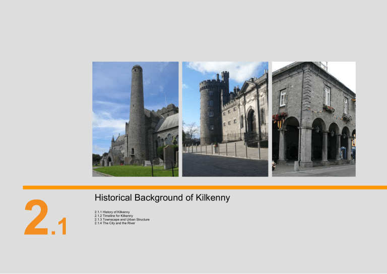
Kilkenny retains many buildings from the early centuries of its existence. The Round Tower at St. Canice’s is at least 900 years old; the Talbot Tower was built around 1260; there are five medieval churches dating from the 13th century; Rothe house is the best known of a series of merchants’ houses from the late
16th and early 17th centuries; and a number of fine Georgian houses are to be seen on its streets. The two most prominent and historically important buildings in the city are Kilkenny
Castle, and St. Canice’s Cathedral.
As well as its built heritage, Kilkenny has an outstanding written record. The Tholsel on High Street houses an important collection of documents from the 13th century to the present day.
As well as the charters mentioned already, there are deeds, grants, leases and record books giving a unique insight into the governance of Kilkenny over the centuries. The most important document of the c ollection is the “Liber Primus Kilkenniensis”, a manuscript record of urban records containing a copy of William
Marshall’s charter, and continuing to the 16th century.
Kilkenny, 1758, by John Roque (Trinity College Dublin),
Historic Towns Atlas
I
Urban Design Framework for Abbey Creative Quarter, Kilkenny
2.1.2 Timeline for Kilkenny
o 1100 St. Canice’s Round Tower was built. Beside it stood a church which was taken down in the 13th century to make way for the present St. Canice’s
Cathedral o 1111 Old church of St. Canice adopted as Cathedral of
Diocese of Ossory o 1172 Strongbow builds a wooden motte and bailey castle at Kilkenny o 1205 Start of work on Cathedral of St. Canice o 1205 (approximately) St. Mary’s Church built o 1207 William Marshall, Earl of Pembroke, gives Kilkenny its first charter as a town o 1211 St. John’s Priory built by William Marshall o 1225 Black Abbey founded by William Marshall the younger o 1231 St. Francis Abbey founded by Richard Marshall o 1231 Kilkenny elects its first Sovereign (the equivalent of
Mayor) o 1250 First Murage Grant (the right to collect taxes to build a wall around Kilkenny) o 1260 (approximately Building of the Talbot Tower at south-west corner of wall o 1366 Lionel, Duke of Clarence holds a parliament at
Kilkenny. A series of laws called the Statutes of Kilkenny are passed. o 1383 King Richard II of England confirms the charters of
William Marshall and his son and confirms other rights to the citizens of Kilkenny. o 1466 Act of Parliament restoring the rights of Sovereign,
William Archer, and to the Burgesses of Kilkenny. o 1540 St. Franci s Abbey and St. John’s Priory suppressed o 1543 Black Abbey suppressed
Map of Kilkenny, c. 1655
I
Urban Design Framework for Abbey Creative Quarter, Kilkenny
Map of Kilkenny, c. 1760
o 1564 A great flood in which St. John’s Bridge and Castle fell down o 1582 The Shee Almshouse in Rose Inn Street is founded by Sir Richard Shee o 1594 – 1610 Rothe House built o 1597 The defences of Kilkenny strengthened during the
Nine Years War o 1603 Churches in Kilkenny seized by citizens for
Catholic Worship o 1642 – 1949 Confederation of Kilkenny. Confederate
Catholics set up a legislative assembly, and a Supreme
Council to govern the parts of Ireland in rebel hands o 1759 – 1761 The Tholsel (city Hall) in High Street is built o 1763 A great flood sweeps away both bridges in the city o 1771 The Market Cross, built in 1335 is removed o 1782 Burrel’s Hall in James’s Street is opened as a
Catholic school by the Diocese of Ossory o 1782 County Hall, formerly Kilkenny College built o 1831 St. Canice’s Catholic Church consecrated o 1843 – 1857 St. Mary’s Cathedral is built. o Waterford becomes the dominant industrial location o 1842 Kilkenny Workhouse built to house 1,200 paupers.
Within 5 years, Kilkenny Workhouse held 2,228 people at the height of the famine o 1935 Kilkenny Castle is closed up and the Ormonde family leaves Ireland o 1965 Kilkenny Design Workshops open o 1967 The Marquess of Ormonde presents Kilkenny
Castle to the people of Kilkenny o 2012 Smithwick’s Brewery site is purchased from Diageo by Kilkenny County Council
Map of Kilkenny 1829 1841 OSI Historic 6” Map
I
Urban Design Framework for Abbey Creative Quarter, Kilkenny
Map of Kilkenny 1841
2.1.3 Townscape and Urban Structure
The city of Kilkenny is readily identifiable by its distinctive urban grain, with the main thoroughfare of High Street and Parliament
Street intersected with parallel slipways in a herringbone pattern.
On the former Smithwick’s Brewery and Bateman Quay sites, historical maps reveal that the site was subdivided into long plots of ground with one end on the main street known as burgage plots. These burgage plots were first established by William
Marshall in 1207. A ‘burgess’ rented a burgage plot for a shilling a year and built a house on the street. Behind the house stretched a long narrow garden for growing fruit and vegetables.
The burgesses built sheds in these gardens and in some instances, a dovecote, which ensured a supply of fresh meat for the family all year around.
If the city offers a model that might inform an approach to the redevelopment of the masterplan site then the subdivision of the site into “burgage” type plots recommends itself. This urban form is integral to the urban structure of Kilkenny City.
Its usefulness as a model is invoked not to suggest an historicist approach to site planning but rather to demonstrate that a wide range of functions can coexist in the context of well ordered and legible public spaces.
2.1.4 The City and the River
Historically, Kilkenny like all Irish cities and towns, turned its back on the river. The redevelopment of the masterplan site represents the first large scale opportunity to redefine the relationship of the river to the city. The Councils have identified the potential of the river and its banks to be developed as a recreational, amenity and transportation asset for the city, the county and the region as a whole.
It is the policy of Kilkenny County Council to promote the natural amenity potential of the River Nore in order to facilitate the development of amenity, recreational, ecological and tourism benefits for the city and region generally.
Map of Kilkenny c 1850
I
Urban Design Framework for Abbey Creative Quarter, Kilkenny
Map of Kilkenny c 1910
