Turkey-Photo Album (1943633)
advertisement
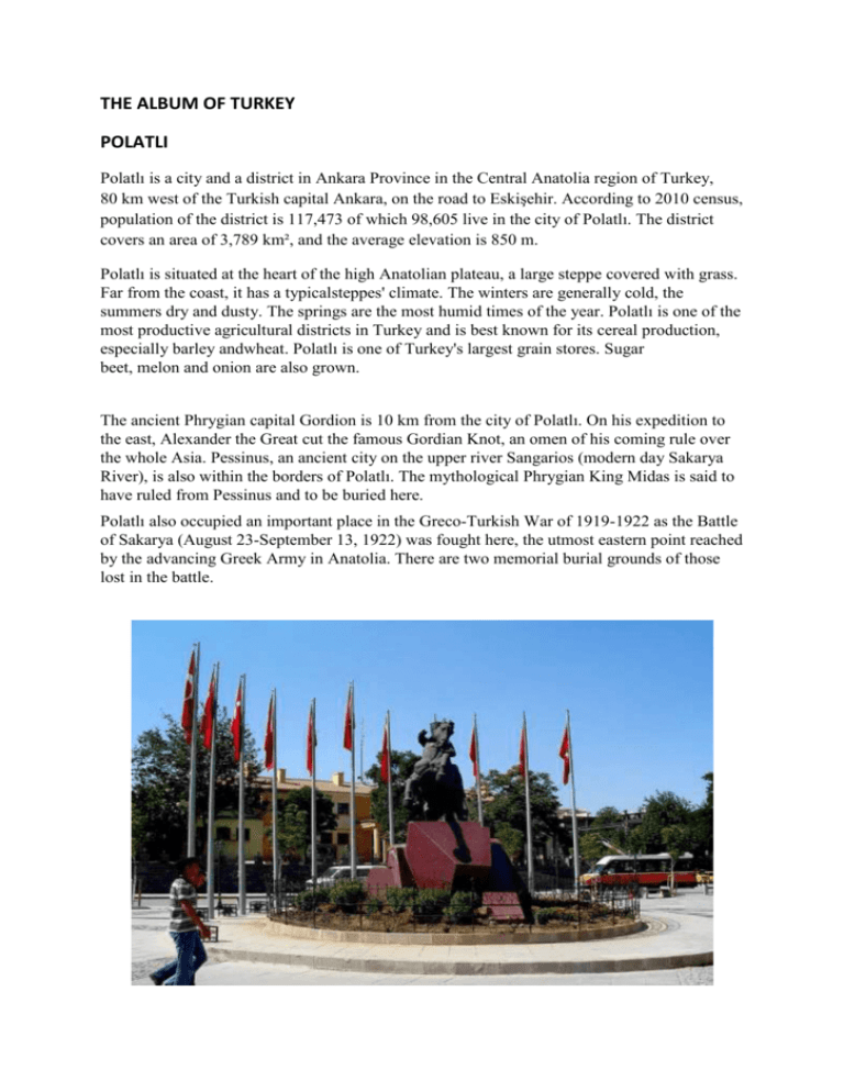
THE ALBUM OF TURKEY POLATLI Polatlı is a city and a district in Ankara Province in the Central Anatolia region of Turkey, 80 km west of the Turkish capital Ankara, on the road to Eskişehir. According to 2010 census, population of the district is 117,473 of which 98,605 live in the city of Polatlı. The district covers an area of 3,789 km², and the average elevation is 850 m. Polatlı is situated at the heart of the high Anatolian plateau, a large steppe covered with grass. Far from the coast, it has a typicalsteppes' climate. The winters are generally cold, the summers dry and dusty. The springs are the most humid times of the year. Polatlı is one of the most productive agricultural districts in Turkey and is best known for its cereal production, especially barley andwheat. Polatlı is one of Turkey's largest grain stores. Sugar beet, melon and onion are also grown. The ancient Phrygian capital Gordion is 10 km from the city of Polatlı. On his expedition to the east, Alexander the Great cut the famous Gordian Knot, an omen of his coming rule over the whole Asia. Pessinus, an ancient city on the upper river Sangarios (modern day Sakarya River), is also within the borders of Polatlı. The mythological Phrygian King Midas is said to have ruled from Pessinus and to be buried here. Polatlı also occupied an important place in the Greco-Turkish War of 1919-1922 as the Battle of Sakarya (August 23-September 13, 1922) was fought here, the utmost eastern point reached by the advancing Greek Army in Anatolia. There are two memorial burial grounds of those lost in the battle. Gordium Gordium is the capital city of ancient Phrygia. It was located at the site of modern Yassıhüyük, about 70–80 km southwest of Ankara (capital of Turkey), in the immediate vicinity of Polatlı district. The site was excavated by Gustav and Alfred Körte in 1900 and then by the University of Pennsylvania Museum of Archaeology and Anthropology, under the direction of Rodney S. Young, between 1950 and 1973. Excavations have continued at the site under the auspices of the University of Pennsylvania Museum with an international team. Gordium lies where the ancient road between Lydia and Assyria/Babylonia crossed the Sangarius river. In the 12th century BCE, Gordium was settled by Thracians who had migrated from southeastern Europe. During the 9th and 8th centuries BCE, the city grew into the capital of a kingdom that controlled much of Asia Minor west of the river Halys. The kings of Phrygia built large tombs near Gordium called tumuli, which consist of artificial mounds constructed over burial chambers. There are about one hundred of them, covering both cremations and inhumations. In the 8th century, the lower city and the area to the north of the citadel was surrounded by a circuit wall with regularly spaced towers. The most famous king of Phrygia was the quasi-legendary Midas. Contemporary Assyrian sources dating between c. 718 and 709 BCE call him Mit-ta-a. According to the Greek historian Herodotus, King Midas was the first foreigner to make an offering at the sanctuary of Apollo at Delphi, dedicating the throne from which he gave judgment. During his reign, according to Strabo, the nomadic Cimmerians invaded Asia Minor, and in 710/709, Midas was forced to ask for help from the Assyrian King Sargon II. In Strabo's account, King Midas committed suicide by drinking bull's blood when the Cimmerians overran the city. Tumulus MM (for "Midas Mound"), the Great Tumulus, is the largest burial mound at Gordium, standing over 50 meters high today, with a diameter of about 300 meters. The tumulus was excavated in 1957 by Young's team, revealing the remains of the royal occupant, resting on purple and golden textiles in an open log coffin, surrounded by a vast array of magnificent objects. The burial goods included pottery and bronze vessels containing organic residues, bronze fibulae (ancient safety pins), leather belts with bronze attachments, and an extraordinary collection of carved and inlaid wooden furniture, exceptional for its state of preservation. The Tumulus MM funeral ceremony has been reconstructed, and scientists have determined that the guests at the banquet ate lamb or goat stew and drank a mixed fermented beverage. While it is possible that this is the tomb of King Midas himself, it is now generally assumed to be that of his father Gordias. The Monument of The Sakarya Martyrs The Sakarya Victory which has been accepted as a turning point of the Independence War, was made real by the thousands of Turks who had given their lives for their motherland and had reached the martydom degree in Sakarya, between 23 rd August 13 rd September, 1921. The works for constructing a monument for the Sakarya martyrs was started long time ago. The Şehitlerkaşı Hill, in the north of the municipalty boundary of the Polatlı county, was found appropriate for the monument and an area of 343.410 m², 42.240 m² of it for the cemetrey, was assigned for this purpose. The foundation of the monument was laid on 13 th September, 1971 which is the date of the 50 th anniversary of the Sakarya Victory and it was opened on 28 th October, 1973 which is the 50th anniversary of the Republic. The monument symbolizing the memories of the Sakarya martyrs, stands above the old, modest Sakarya Martyrdom which is on the Şehitlerkaşı Hill. It is possible from this hill to see the most part of the land where the war was led The monument of the Sakarya martyrs is composed of three parts, namely the body itself, statues and a museum. Starting from an altitude of 915 m above the sea level, a stairway of 420 steps goes up to an altitude of 970 m where the body stands. The columns on both sides of this way, express the victory in spite of the superior enemy forces. Those forty-two pairs of concrete columns mark the days and nights passed from breasting the enemy till the defeat. At the end of the stepped way, the museum and reliefs expressing the story of the Turkish army's victory are exist. Photographs, documents and various arms documenting the Sakarya War are being exhibited in the museum.
