312/1 Geography Paper 1 July 2013 SUBUKIA DISTRICT JOINT
advertisement
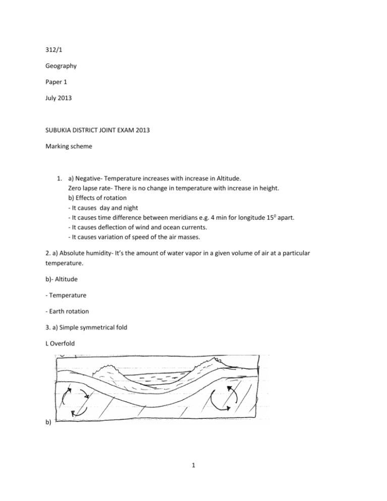
312/1 Geography Paper 1 July 2013 SUBUKIA DISTRICT JOINT EXAM 2013 Marking scheme 1. a) Negative- Temperature increases with increase in Altitude. Zero lapse rate- There is no change in temperature with increase in height. b) Effects of rotation - It causes day and night - It causes time difference between meridians e.g. 4 min for longitude 150 apart. - It causes deflection of wind and ocean currents. - It causes variation of speed of the air masses. 2. a) Absolute humidity- It’s the amount of water vapor in a given volume of air at a particular temperature. b)- Altitude - Temperature - Earth rotation 3. a) Simple symmetrical fold L Overfold b) 1 4. a) Plutonic are formed when magma cools and solidifies within the earth crust. Rock are coarse since cooling is gradual. Volcanic rocks are formed when magma cools and solidifies on the surface. The rocks are fine grained with fine texture. b) i) Quartzite ii) Marble iii)Slate 5. a) X- A clint Y- A joint Z- A grike b) Warm or hot climate - Moderate or high rainfall - Deep water table - Hard jointed rocks - The rock should be thick limestone, dolomite or chalk. 6. a) i) 395327 or 395328 ii) 8.8km + 0.1 b) i) Sheet no g the map to the south of Kitale is 89/1 ii) Huts Loose surface road Culvert iii) South west c) i) 1800m above sea level ii) No of complete squares=1 29 No of incomplete squares= 29 = = 14.5 2 Total no of complete squares = 14.5 + 1 = 15.5km2 d) There are numerous swamps in the area e.g the swamp surrounding Keelah farm The area has many permanent rivers e.g Koilobos river, River Noigameget and many others. The area is characterized by numerousdams e.g in grid square 3630. Most of the rivers have their sources in Kapolet and kiptaberr forest e.g. River Kapolet. 4x1=4mks e) i) To identify the type of crop grown in the farm. 2 To identify the source of water for the farm. To identify the crop management practices in the farm. iii) Tape recorder Taking ones Photographing or filming Filling in the questionnaire Field sketching Tabulation and tallying 7. a) Magma- Rock in a semi- solid state below the crust Lave- Magma that has lost its gases on the earth surface after ejection. b) Volcano Basic lava/shield domes Acid/avacones Complex cones (stratified and parasitic) Ash and cider cones Plug dome volcano/spine volcano/plug volcano Volcanic plug Composite/ stratocones Volcano depressions c) i) Hotsprings/ steam jets/ Geysers ii) Three sisters- Cape province - Kinkon falls- Guinea *- Still cappings in parts of Morrocco d) Volcanic soils- Increased agricultural productivity- Exports generate income. - Contributed to the scenic beauty influencing domestic and foreign tourists whom have provided foreign exchange that has improved other industries e.g. infrastructure. - It has resulted to formation of rich metallic minerals e.g Gold in Kakamega, Diamonds in Tanzania that have been sold to provide revenue for development vof the country. - Geothermal steam and power from hot springs and Geysers. - Pda of CO2 – Cooling agent/ dry ice- raw materials in industries - Water catchment areas- for agricultural pdn, fishing etc. e i) The magma movements below or on the earth’s crust cause tremors. - Volcanic emission of gases shakes and shatters rocks thus resulting to earthquarkes e.g ring of fire in Japan, The great Rift valley - Violent displacement of rocks during an eruption sets off vibrations that cause earthquakes. ii)Major - Tetonic movement - Isostatic adjustment - Human activities Others - Radioactivity - Gravitational pressure 8. a) – X- Mediterranean Y- Equitorial rain forest Z- Tropical desert vegetation ii) Wetter areas near forests have vegetation consisting of tall trees 3 - Wetter area have tall thick grass. Gradually away from the forest, the trees become fewer shorter. Grass is shorter in drier areas In drier area the trees are short and more scattered. Some trees are deciduous Most trees includes acacia and other rhorny trees Where rainfall is lowest grass is tuffed and course There are scattered baobab tree- there is a presence of riverine vegetation and thick bush along rivers. b) i) Areas with heavy and reliable rainfall have luxuriant vegetation growth while areas with little unreliable rainfall have poor and scanty vegetation. Rainfall enhances photosynthesis, growth and flowering. It also maintains leaf lurgidity. ii) Temperature determines the rate of germination, growth, photosynthesis, transpiration, flowering and fruiting. Each plant requires specific temp. Plants in tropical lands grow faster than those temperate lands. Fewer species survive in colder climates. iii) Gentle slopes haves table development of vegetation than steep and rough slopes. Steep rugged slopes are exposed to erosion and mass wasting, run off is rapid and water does not remain available to plants. On gentle slopes, water penetrates the soil and becomes available to the plants for for longer periods hence luxuriant vegetation. iv) Soil texture- determines the ease at which roots penetrate into the soil for anchorage and obtain nutrients and water. - Most plants grow at a PH of about 6.5 to as all minerals are sufficiently available. - Organic matter and in-organic matter determine fertility of soils for plant growth. v) Clearing vegetation for agriculture and settlemet - Cutting of trees for timber products - Forest fires by hunters and honey harvests destroy vegetation - Public campaign on value of forest through mass media - Encouraging recycling of waste products to produce useful products. - Introduction of Agroforestry to supplement natural vegetation. - Extension afforestation programme to provide alternative source of timber other than from natural forest. - Employement of forest gurds and forest officer. 9. a) i) A desert is an arid area characterized by sparse vegetation as it receives low and unreliable rainfall. ii) - High temperature and excessive evaporation rates - Low and unreliable rainfall - Existences of cold ocean currents on the parts of rain bearing winds - Rain shadow effect - Continentality. b) i) K ii) L iii) M c) i) Deflation - A brasion - Attrition ii)- Absence of vegetation cover - Presence of loose unconsolidated material such as sand and gravel - Occurrence of strong wind storms in the desert. 4 - High temperatures which enhances physical weathering thus exposing the wethered rocks to attack by wind erosion - Low rainfall amounts experienced in the desert d) i) A depression is formed on the surface of the earth. - The depression is exposed to the wind current. - The wind currents/ eddies depen and enlarge the depression through deflation which removes unconsolidated materials. - The surface of the depression is lowered until it reaches the water bearing rocks/ acquits - Water oozes out of the ground and collects in the depression to form an oasis. ii) Strong deflation winds scoop and remove very fine dust from sandy desert. - The particles are transformed to great distances. When the speed of the wind reduces, the dust particles are deposited in uniform layer to form Loess E) i) Playas - Alluvial fans - Bajadas/ pediments/ pediplains - Salinas ii) To avoid getting lost in the desert - To estimate the distance to be covered To estimate the time required to travel To estimate the transport cost. 10. a) i) Ice sheet - It’s a large continuous mass of ice which covers vast areas of lowland. ii) Iceberg - A mass of floating ice that broke from an ice sheet. iii)Snowline - It is the line beyond which there is a permanent snow cover. b) Ice erosion process i) Abrasion ii) Plucking iii) Sapping c) Factors influencing glacial erosion i) Nature of the underlying rock 5 - Well jointed/faulted rocks are eroded by plucking process since the joints allow water to enter in the rock. ii) Availability of debris which act as erosive tools. - The more the debris embedded in the ice the more effective is abrasion process. iii) Speed of the glacier. - The faster the speed the greater the erosive energy. iv) the thickness and weight of the ice. - A thick glacier exerts greater pressure on the underlying rock causing weathering. The rock debris embedded in the glacier is pressed down by the thick glacier to erode by abrasion. d) Types of Moraines. - Terminal Moraines - Recessional - Lateral Moraines - Medial Moraines - Englacial - Ground Moraines e) Lake Naivasha - The lake has underground outlet into the Indian Ocean that drains out salt. - The late eruption of volcanic lava covered the alkaline layers within the lake bed. - It has a regular inflow of finish water from rivers that dilutes the salts. e.g. river Malewa - it is situated in an area of high convectional rainfall which keeps the water fresh. - It is situated in an area of low temperatures hence low evaporation rate. 6
