Landfill 1 rev`d sat. photo-map-drwg. for EASR Notice
advertisement
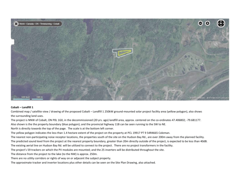
Cobalt – Landfill 1 Combined map / satellite view / drawing of the proposed Cobalt – Landfill 1 250kW ground-mounted solar project facility area (yellow polygon), also shows the surrounding land uses. The project is NNW of Cobalt, ON P0L 1G0, in the decommissioned (20 yrs. ago) landfill area, approx. centered on the co-ordinates 47.406802; -79.681177. Also shown is the the property boundary (blue polygon); and the provincial highway 11B can be seen running to the SW to NE. North is directly towards the top of the page. The scale is at the bottom left corner. The yellow polygon indicates the less than 1.4 hectare extent of the project on the property at PCL 19917 PT 9 54R4665 Coleman. The nearest non-participating noise receptor locations, the properties south of the site on the Hudson Bay Rd., are over 200m away from the planned facility. The predicted sound level from the project at the nearest property boundary, greater than 20m directly outside of the project, is expected to be less than 40dB. The existing aerial line on Hudson Bay Rd. will be utilized to connect to the project. There are no project transformers in the facility. The project’s 59 trackers on which the PV modules are mounted; and the 25 inverters will be distributed throughout the site. The distance from the project to the lake (to the NW) is approx. 250m. There are no utility corridors or rights of way on or adjacent the subject property. The approximate tracker and inverter locations plus other details can be seen on the Site Plan Drawing, also attached.
