The Physical Geography of India
advertisement
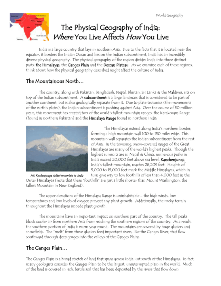
World Geography The Physical Geography of India: Where You Live Affects How You Live India is a large country that lays in southern Asia. Due to the facts that it is located near the equator, it borders the Indian Ocean and lies on the Indian subcontinent, India has an incredibly diverse physical geography. The physical geography of the region divides India into three distinct parts: the Himalayas, the Ganges Plain and the Deccan Plateau. As we examine each of these regions, think about how the physical geography described might affect the culture of India. The Mountainous North… The country, along with Pakistan, Bangladesh, Nepal, Bhutan, Sri Lanka & the Maldives, sits on top of the Indian subcontinent. A subcontinent is a large landmass that is considered to be part of another continent, but is also geologically separate from it. Due to plate tectonics (the movements of the earth’s plates), the Indian subcontinent is pushing against Asia. Over the course of 50 million years, this movement has created two of the world’s tallest mountain ranges: the Karakoram Range (found in northern Pakistan) and the Himalaya Range found in northern India The Himalayas extend along India’s northern border, forming a high mountain wall 100 to 150 miles wide. This mountain wall separates the Indian subcontinent from the rest of Asia. In the towering, snow-covered ranges of the Great Himalayas are many of the world’s highest peaks. Though the highest summits are in Nepal & China, numerous peaks in India exceed 20,000 feet above sea level. Kanchenjunga, India’s tallest mountain, reaches 28,209 feet. Heights of 5,000 to 15,000 feet mark the Middle Himalayas, which in Mt. Knchenjunga, tallest mountain in India turn give way to low foothills of less than 4,000 feet in the Outer Himalayas (note that these “foothills” are just a little shorter than Mount Washington, the tallest Mountain in New England). The upper elevations of the Himalaya Range is uninhabitable – the high winds, low temperatures and low levels of oxygen prevent any plant growth. Additionally, the rocky terrain throughout the Himalayas impede plant growth. The mountains have an important impact on southern part of the country. The tall peaks block cooler air from northern Asia from reaching the southern regions of the country. As a result, the southern portion of India is warm year round. The mountains are covered by huge glaciers and snowfields. The “melt” from these glaciers feed important rivers, like the Ganges River, that flow southward through deep gorges into the valleys of the Ganges Plains. The Ganges Plain… The Ganges Plain is a broad stretch of land that spans across India just south of the Himalayas. In fact, many geologists consider the Ganges Plain to be the largest, uninterrupted plain in the world. Much of the land is covered in rich, fertile soil that has been deposited by the rivers that flow down into the region from the Himalayas. The Ganges River, India’s principle (most important) river, is located in this region. The Ganges River has many tributaries that reach out across the plains. The river and its tributaries serve as important sources of fresh water in the region. The Ganges Plains also contains large deposits of ground water underneath the earth’s surface. This groundwater is yet another important sources of freshwater for the region. The Himalayas prevent the colder winds from the north from reaching the plains. As a result, the temperature in this part of India is warm year round. Monsoon winds bring rainfall to the region in the summer months and dry weather to the region in the winter months. While most of the Ganges Plain is rich in freshwater and fertile soil, there is one portion of this region that is unique: the Thar Desert. The Thar Desert is located in the western part of the Ganges Plains. It is the seventh largest desert in the world and it is covered in dry, rocky soil. Rain falls erratically during the wet monsoons of the summer, but fresh water is hard to find in the hot Thar Desert. The Deccan Plateau… The Deccan Plateau (also known as the Highlands of India) is a large, triangular plateau located in the southern part of India. The region makes up a majority of the southern part of the country. The Deccan Plateau is at a slightly higher elevation than the rest of the Ganges Plains. The region is rich in a variety of different minerals. Large deposits of iron ore (used to produce iron/steel) are found in the Deccan Plateau. Additionally there are deposits of precious metals like gold and diamonds in some parts of the region. The Krishna River and its tributaries serve as the primary river system in the Deccan Plateau. Name: Date: Core: World Geography Where You Live Affects How You Live: Focus on India Directions: Use the Physical Geography of India: Where You Live Affects How You Live handout to help you answer the following questions. Reading Comprehension… 1. After describing the heights of the various sections of the Himalayas (20,000 feet at the top, 10,00 feet in the middle, 4,000 feet in the foothills), the author writes, “n note that these ‘foothills’ are just a little shorter than Mount Washington, the tallest Mountain in New England”. What was the main reason that the author had for including that last sentence? a. To show that Mount Washington is a very tall mountain b. To show that the Himalayas, even at their lowest elevation, are very tall c. To show that the Himalayas are actually much smaller than Mount Washington d. To remind the reader that Mount Washington is the tallest mountain in New England. 2. What is a subcontinent? _________________________________________________________ ______________________________________________________________________________ 3. Read the sentence below: The upper elevations of the Himalaya Range is uninhabitable – the high winds, low temperatures and low levels of oxygen prevent any plant growth. Additionally, the rocky terrain throughout the Himalayas also impede plant growth. Which of the following means about the same as the word “impede”? a. b. c. d. helps supports prevents accelerates I chose answer choice _____ because: _______________________________________________ ______________________________________________________________________________ ______________________________________________________________________________ Critical Thinking… (Answer using ATIC) 4. In which region of India do you think that the population density is the lowest (meaning which part of India is the least crowded)? a. The Himalayas b. The Ganges Plain c. The Deccan Plateau Explain your answer using support from the text. _____________________________________ ______________________________________________________________________________ ______________________________________________________________________________ ______________________________________________________________________________ ______________________________________________________________________________ ______________________________________________________________________________ ______________________________________________________________________________ ______________________________________________________________________________ ______________________________________________________________________________ ______________________________________________________________________________ 5. In which region of India do you think most of the country’s farming takes place? a. The Himalayas b. The Ganges Plain c. The Deccan Plateau Explain your answer using support from the text. _____________________________________ ______________________________________________________________________________ ______________________________________________________________________________ ______________________________________________________________________________ ______________________________________________________________________________ ______________________________________________________________________________ ______________________________________________________________________________ ______________________________________________________________________________ ______________________________________________________________________________ ______________________________________________________________________________
