papers_and_reviewers_2015_amj
advertisement
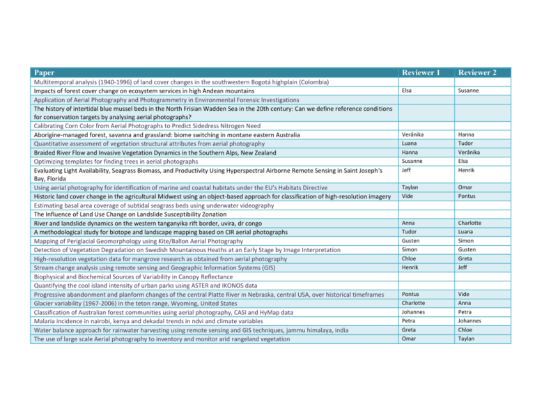
Paper Multitemporal analysis (1940-1996) of land cover changes in the southwestern Bogotá highplain (Colombia) Impacts of forest cover change on ecosystem services in high Andean mountains Application of Aerial Photography and Photogrammetry in Environmental Forensic Investigations The history of intertidal blue mussel beds in the North Frisian Wadden Sea in the 20th century: Can we define reference conditions for conservation targets by analysing aerial photographs? Calibrating Corn Color from Aerial Photographs to Predict Sidedress Nitrogen Need Aborigine-managed forest, savanna and grassland: biome switching in montane eastern Australia Quantitative assessment of vegetation structural attributes from aerial photography Braided River Flow and Invasive Vegetation Dynamics in the Southern Alps, New Zealand Optimizing templates for finding trees in aerial photographs Evaluating Light Availability, Seagrass Biomass, and Productivity Using Hyperspectral Airborne Remote Sensing in Saint Joseph's Bay, Florida Using aerial photography for identification of marine and coastal habitats under the EU’s Habitats Directive Historic land cover change in the agricultural Midwest using an object-based approach for classification of high-resolution imagery Estimating basal area coverage of subtidal seagrass beds using underwater videography The Influence of Land Use Change on Landslide Susceptibility Zonation River and landslide dynamics on the western tanganyika rift border, uvira, dr congo A methodological study for biotope and landscape mapping based on CIR aerial photographs Mapping of Periglacial Geomorphology using Kite/Ballon Aerial Photography Detection of Vegetation Degradation on Swedish Mountainous Heaths at an Early Stage by Image Interpretation High-resolution vegetation data for mangrove research as obtained from aerial photography Stream change analysis using remote sensing and Geographic Information Systems (GIS) Biophysical and Biochemical Sources of Variability in Canopy Reflectance Quantifying the cool island intensity of urban parks using ASTER and IKONOS data Progressive abandonment and planform changes of the central Platte River in Nebraska, central USA, over historical timeframes Glacier variability (1967-2006) in the teton range, Wyoming, United States Classification of Australian forest communities using aerial photography, CASI and HyMap data Malaria incidence in nairobi, kenya and dekadal trends in ndvi and climate variables Water balance approach for rainwater harvesting using remote sensing and GIS techniques, jammu himalaya, india The use of large scale Aerial photography to inventory and monitor arid rangeland vegetation Reviewer 1 Reviewer 2 Elsa Susanne Verånika Luana Hanna Susanne Jeff Hanna Tudor Verånika Elsa Henrik Taylan Vide Omar Pontus Anna Tudor Gusten Simon Chloe Henrik Charlotte Luana Simon Gusten Greta Jeff Pontus Charlotte Johannes Petra Greta Omar Vide Anna Petra Johannes Chloe Taylan
