World Climates
advertisement
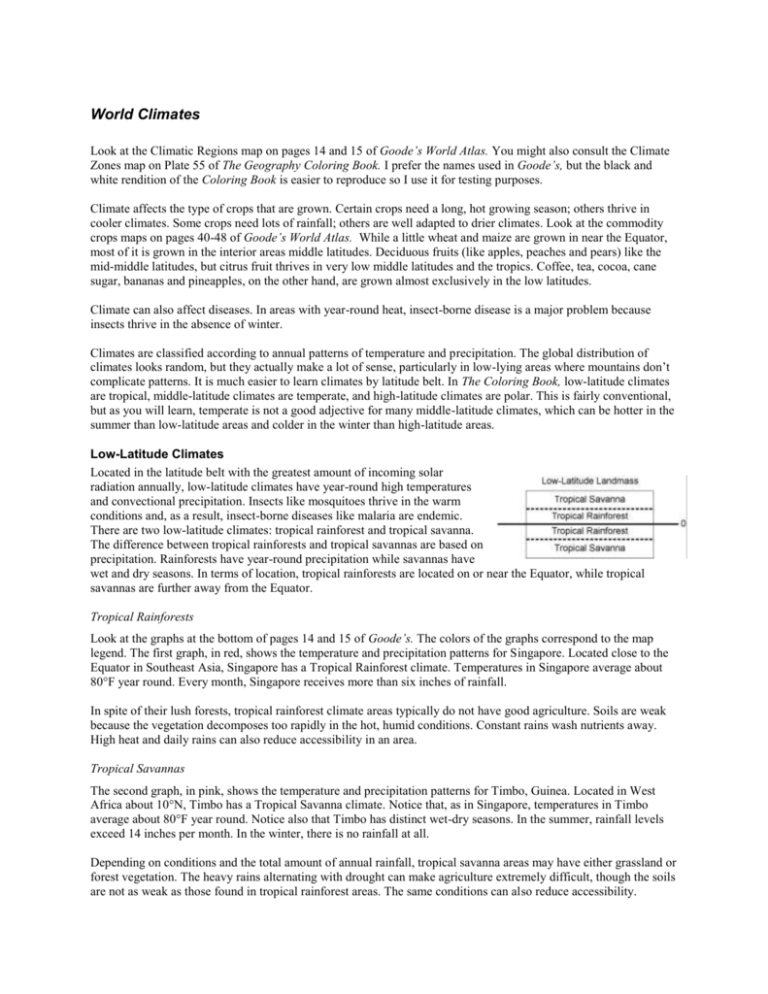
World Climates Look at the Climatic Regions map on pages 14 and 15 of Goode’s World Atlas. You might also consult the Climate Zones map on Plate 55 of The Geography Coloring Book. I prefer the names used in Goode’s, but the black and white rendition of the Coloring Book is easier to reproduce so I use it for testing purposes. Climate affects the type of crops that are grown. Certain crops need a long, hot growing season; others thrive in cooler climates. Some crops need lots of rainfall; others are well adapted to drier climates. Look at the commodity crops maps on pages 40-48 of Goode’s World Atlas. While a little wheat and maize are grown in near the Equator, most of it is grown in the interior areas middle latitudes. Deciduous fruits (like apples, peaches and pears) like the mid-middle latitudes, but citrus fruit thrives in very low middle latitudes and the tropics. Coffee, tea, cocoa, cane sugar, bananas and pineapples, on the other hand, are grown almost exclusively in the low latitudes. Climate can also affect diseases. In areas with year-round heat, insect-borne disease is a major problem because insects thrive in the absence of winter. Climates are classified according to annual patterns of temperature and precipitation. The global distribution of climates looks random, but they actually make a lot of sense, particularly in low-lying areas where mountains don’t complicate patterns. It is much easier to learn climates by latitude belt. In The Coloring Book, low-latitude climates are tropical, middle-latitude climates are temperate, and high-latitude climates are polar. This is fairly conventional, but as you will learn, temperate is not a good adjective for many middle-latitude climates, which can be hotter in the summer than low-latitude areas and colder in the winter than high-latitude areas. Low-Latitude Climates Located in the latitude belt with the greatest amount of incoming solar radiation annually, low-latitude climates have year-round high temperatures and convectional precipitation. Insects like mosquitoes thrive in the warm conditions and, as a result, insect-borne diseases like malaria are endemic. There are two low-latitude climates: tropical rainforest and tropical savanna. The difference between tropical rainforests and tropical savannas are based on precipitation. Rainforests have year-round precipitation while savannas have wet and dry seasons. In terms of location, tropical rainforests are located on or near the Equator, while tropical savannas are further away from the Equator. Tropical Rainforests Look at the graphs at the bottom of pages 14 and 15 of Goode’s. The colors of the graphs correspond to the map legend. The first graph, in red, shows the temperature and precipitation patterns for Singapore. Located close to the Equator in Southeast Asia, Singapore has a Tropical Rainforest climate. Temperatures in Singapore average about 80°F year round. Every month, Singapore receives more than six inches of rainfall. In spite of their lush forests, tropical rainforest climate areas typically do not have good agriculture. Soils are weak because the vegetation decomposes too rapidly in the hot, humid conditions. Constant rains wash nutrients away. High heat and daily rains can also reduce accessibility in an area. Tropical Savannas The second graph, in pink, shows the temperature and precipitation patterns for Timbo, Guinea. Located in West Africa about 10°N, Timbo has a Tropical Savanna climate. Notice that, as in Singapore, temperatures in Timbo average about 80°F year round. Notice also that Timbo has distinct wet-dry seasons. In the summer, rainfall levels exceed 14 inches per month. In the winter, there is no rainfall at all. Depending on conditions and the total amount of annual rainfall, tropical savanna areas may have either grassland or forest vegetation. The heavy rains alternating with drought can make agriculture extremely difficult, though the soils are not as weak as those found in tropical rainforest areas. The same conditions can also reduce accessibility. High-Latitude Climates Located in the latitude belt with the least incoming solar radiation, high-latitude climates are cold year round. There are two high-latitude climates, Ice Cap and Tundra. Ice Caps are located on or near the poles, while tundra climates are further away. In spite of the persistent cold temperatures, there is quite a bit of variation in temperature. This is because of the tremendous variation in incoming solar radiation. Remember that at the Poles, the sun doesn’t rise for six months and for the next six months it doesn’t set. Ice Cap Climates The last graph, in pale violet, shows the temperature and precipitation patterns for Eismitte, Greenland. Temperatures there average less than 14°F year round, with winter temperatures plunging to -40°F. Look closely at the graph. The symbol there does not show precipitation patterns but indicates that the data are incomplete. In general, Ice Cap climates receive very low levels of precipitation because there is very little evaporation and the frigid air cannot retain moisture. Ice Cap climates have no vegetation; they are covered with snow. If there is so little precipitation, why are Ice Cap areas covered with snow? In many areas, snow has been accumulating for hundreds of years. Even with low levels of precipitation, such lengthy accumulation can result in thick ice sheets. The extreme cold makes accessibility difficult in Ice Cap areas. Tundra Climates The second-to-last graph, in medium violet, shows the temperature and precipitation patterns for Barrow, Alaska. Located on the north coast of Alaska, Barrow has a tundra climate. Tundra climates have brief summers, when temperatures reach above freezing. Winters are cold, with temperatures averaging about -15°F. Notice that in spite of its coastal location, Barrow receives very little precipitation. This is due to its very cold temperatures. Precipitation is most likely to fall in summer months, when temperatures are above freezing. Even in the summer, the ground is permanently frozen just inches below the surface. This is an inhospitable place for vegetation except for the hardiest mosses, lichens, and dwarf shrubs and trees. Arability is very low as is accessibility. Middle-Latitude Climates Middle-latitude climates are the most complex. Their average annual temperature varies by latitude. All middle latitude climates exhibit seasonal temperature and precipitation patterns, but they do so to varying extents. Climates on the west coast are different than those on the east. There are two reasons for the distinctly different climates on the west and east coasts. First, west coast currents, circulating down from the high latitudes, are colder than east coast currents, which circulate up from the low latitudes. Second, the prevailing wind in the middle latitudes is from west to east. Moderating winds, therefore, have more impact on the west coast than the east. Far from the moderating effects of water, areas in the interior of larger landmasses are colder in the winter and hotter in the summer than their coastal counterparts. These areas are also drier. For simplicity, we will use the climate system (Plate 55) in The Geography Coloring Book for the middle-latitude areas. West Coast Middle-Latitude Climates The figure at right shows two middle-latitude landmasses – the top in the Northern Hemisphere and the bottom in the Southern hemisphere. Shown are the two westcoast middle-latitude climates: Mediterranean and Marine West Coast. Mediterranean climates lie in the lower middle latitudes while Marine West Coast climates lie in the higher middle latitudes. Because of their location close to coldwater currents and because of the westerly winds, they exhibit less seasonal temperature variation than other middle-latitude climates. With west-coast climates, temperatures are higher in the lower middle latitudes, but precipitation is lower. Mediterranean Climates The dark green graph left of the centerfold shows the temperature and precipitation patterns for Athens, Greece. This climate is found in the countries on the north coast of the Mediterranean Sea and in southern California. Athens has hot summers and mild winters. Notice that rainfall levels tend to be low. Summers in Mediterranean areas are very dry. The main reason is that the high pressure cell shifts north and sits over Mediterranean areas in the summer. In some areas, like California, the land is hot in the summer and the ocean currents are cold, which contributes to arid conditions. The summer droughts stunt natural vegetation. Trees and shrubs are typically stunted, with thick leaves. Wild fires are frequent summer hazards. In terms of agriculture, the hot summers and mild winters of Mediterranean climates produce long growing seasons, but the summer droughts mean that crops must either be drought tolerant, like olives and figs, or irrigated. Where irrigation water is readily available, Mediterranean areas can have highly profitable agriculture. Marine West Coast Climates The medium-green graph, just right of the centerfold displays the temperature and precipitation patterns for Dublin, Ireland. Dublin is located in the higher middle latitudes. Look at the map and you’ll see that it is at the same latitude as central Canada. In spite of that, its west-coast location moderates temperatures. Summers are warm and winters are mild. Each month, there is a bit more than two inches of rainfall. Extensive forests are the natural vegetation of Marine West Coast climate areas. These can still be found in the Pacific Northwest of the United States and adjacent areas of Canada, but in Europe, they were long ago cleared. Agricultural conditions can be quite good for crops adapted to cooler temperatures, damper conditions and shorter growing season. Eastern Middle-Latitude Climates The figures at right show the three eastern middle-latitude climates: Humid Subtropical, Humid Continental, and Subarctic. On the east side, both average temperature and precipitation are higher in the lower middle latitudes. Less affected by moderating influence of the westerly winds, eastern climates have more seasonal temperature variation than their west-coast counterparts. Humid Subtropical Climates Look at the pale green graph for Charleston, South Carolina. Located in the lower middle latitudes of the United States, Charleston has hot summers and mild winters. Each month, more than two inches of rain falls and accumulations of over six inches are common in the summer due to convectional precipitation. Humid subtropical climates have excellent agriculture because of their long growing seasons and ample precipitation. Even long-season crops like sugar and rice can be grown in the warmest humid subtropical areas. Humid Continental Climates As in The Geography Coloring Book, we will combine the Humid Continental Warm Summer and Humid Continental Cool Summer areas into a single Humid Continental climate. Look at the pale blue graph for Peoria, Illinois, and the medium blue graph for Moscow, Russia. You will see both have very warm summers and cold winters. Both areas receive ample year-round precipitation. Humid Continental climate areas have very good agricultural potential. While the growing season is not as long as in Humid Subtropical areas, it is long enough in many areas to support wheat, corn, soybeans and other important crops. Subarctic Climates As in The Geography Coloring Book, we will combine the Humid Continental Dry Winter and Subarctic into a single Subarctic Climate. Look at the purple graph for Verkhoyansk, Russia, and the bright blue graph for Moose Factory, Canada. Both areas have warm summers and frigid winters. Both areas have low rainfall, though Moose Factory has a bit more because of its proximity to Hudson’s Lake. In both areas, rainfall is highest in the summer. Subarctic climates are characterized by extensive evergreen forests, called taiga. The short growing seasons, the extreme cold, and the permafrost that lies under the colder areas, severely restrict agriculture and make transportation quite difficult. Low or Middle Latitude Climates Arid climates and mountain climates can occur in either the low or middle latitudes. They are not found in the high latitudes where the extremely cold winters dominate all areas. Arid Climates: Deserts and Steppes Arid climates are those climates that receive less than 20 inches of rainfall annually but that are not characterized by frigid weather. Not all deserts are very hot, however. Those located in the middle latitudes may have strong seasonal temperature variation. Twenty inches of rainfall is significant because it is considered the minimum amount of rainfall needed for unirrigated agriculture. There are two types of arid climates: steppes, which receive less than 20 inches of rainfall, and deserts, which receive less than 10 inches of rainfall. Of course, the lack of rainfall inhibits agriculture – unless there is water for irrigation. The dry conditions can also decrease internal accessibility. Undifferentiated Highland / Mountain Climates Undifferentiated Highland / Mountain Climates are found in the world’s highest mountains where altitude and orientation change a lot in relatively small areas. Windward sides of mountains may be very wet while lee sides are dry. As you move up in altitude, it is similar to moving up in latitude. At the highest altitudes are snow caps. Between the snow cap and the tree line is tundra climate, followed by Subarctic climates and then local climates will begin. Although limitations on agriculture vary quite a bit with altitude, farming and transportation can be quite challenging in rugged terrain and high altitudes.
