Draft Yea Wetlands Fire Management Plan
advertisement
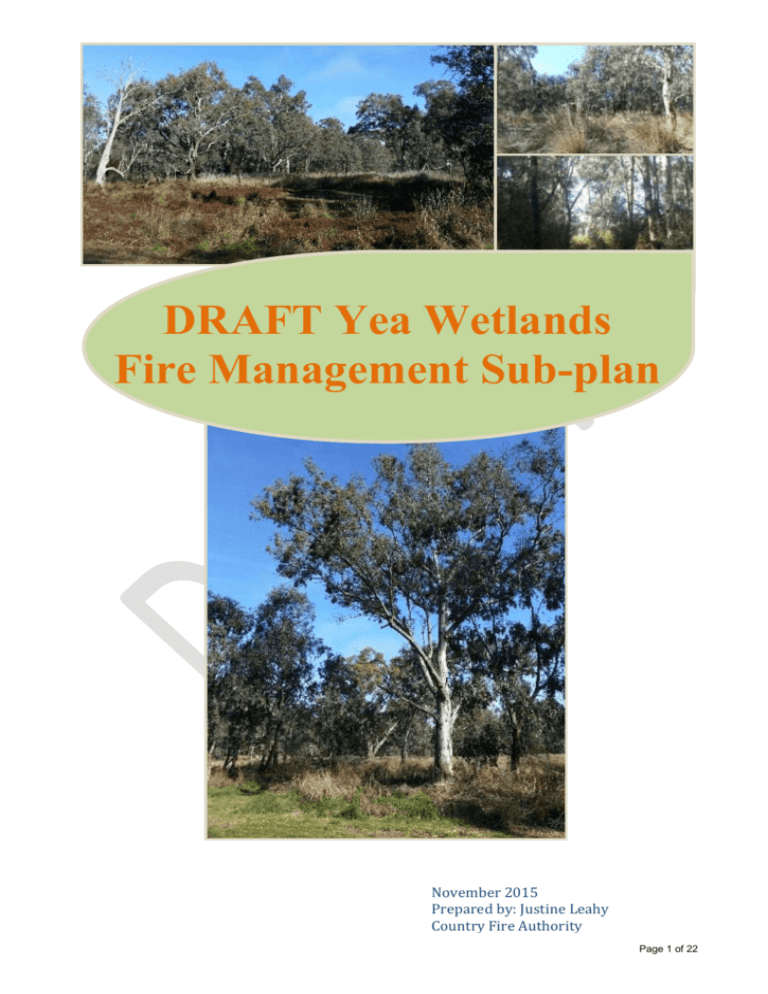
DRAFT Yea Wetlands Fire Management Sub-plan November 2015 Prepared by: Justine Leahy Country Fire Authority Page 1 of 22 Contents Yea Wetlands Fire Management Plan ............................................................. 3 1. Introduction ............................................................................................ 3 1.1 Plan development and basis............................................................ 3 1.2 Legislation ....................................................................................... 3 1.3 Fire history ....................................................................................... 4 2. Risk-based fire management planning ................................................... 4 2.2 Objectives and strategies ................................................................ 9 2.3 Options analysis .............................................................................. 9 2.4 Engagement and communication .................................................. 12 2.5 Ecological planned burning and post-fire actions .......................... 16 3. Monitoring, evaluation and reporting .................................................... 16 4. Summary .............................................................................................. 17 References..................................................................................................... 18 Appendices .................................................................................................... 19 Appendix 1. Example of an Assessment of Actions and Their Success ..... 20 Appendix 2: Map of Wetland Treatment Zones .......................................... 21 Page 2 of 22 Yea Wetlands Fire Management Plan 1. Introduction 1.1 Plan development and basis The purpose of this fire management plan is to deliver a strategic, long term approach to fire and fuel load management in the Yea Wetlands. This plan outlines the strategies and actions for fire risk management over the next 10 years for the wetlands, whilst being mindful of applying an adaptive management approach to suit emerging research and evaluation of the plan. This plan has been developed as a sub-plan to the Murrindindi Shire Council and Lake Mountain Alpine Resort Municipal Fire Management Plan and has been considered and adopted by the Municipal Fire Management Planning Committee (MFMPC). This plan examines fire risk, fuel reduction and mitigation both within and surrounding the wetlands area whilst aiming to preserve the unique ecological environment. Yea Wetlands is a reserve area of 32 hectares immediately north/north-east of the town of Yea, Victoria. The wetlands occur both north and south of the Goulburn Valley Highway. The wetlands are dominated by Floodplain Riparian Woodland Ecological Vegetation Class (EVC 56) which has a status of Endangered in the Central Victorian Uplands Bioregion. Since September 2000, the wetlands have been managed by the Yea Wetlands Committee of Management. This Committee is a ‘Section 86 committee’ under the Local Government Act 1989. Funding has been sought and improvements have been implemented by the Yea Wetlands Committee of Management since 2000, with the focus in recent years being on weed management and infrastructure development1. Other than associated fuel reduction by actively managing weeds and mowing works undertaken by the Council of the main visitor parking areas within the wetlands, fire management and the reduction of fire fuel loads has not yet been actively addressed by the Committee of Management. However the Committee is eager to incorporate fire management and fuel load management into their core objectives. The Yea Wetlands Fire Management Plan (FMP) will be incorporated as a subset of the overall management plan for the Yea Wetlands and its development and implementation over time will be assisted by the MFMPC. The Committee have worked with the Country Fire Authority and the MFMPC to develop this FMP and aim to consult with the local community, Goulburn Broken Catchment Management Authority, Department of Environment and Land, Water and Planning, and Murrindindi Shire Council to ensure the priorities and methods are widely supported. 1.2 Legislation As the land manager, Council has a legislative obligation to ‘take all practicable steps (including burning) to prevent the occurrence of fire on, and minimise the danger of the spread of fires on and from any land in it or under its control and management’ pursuant to S.43 of the Country Fire Authority Act 1958. The Committee of Management is committed to assisting Council in fulfilling this obligation in a manner that is appropriate to such responsibilities. Page 3 of 22 Community support and involvement is vital to the successful development and running of council managed land and facilities. To achieve this, under Section 86 of the Victorian Local Government Act 1989, Council may establish a Committee of Management to ‘act for and on behalf of Council’ for a range of purposes. ‘Acting for and on Behalf of Council’ means the committee is seen as an extension of Council and is therefore governed by the same requirements and legislation as Council, including Council’s obligations under the Local Government Act 1989, the Occupational Health & Safety Act 2004, and various other legislative requirements as defined within the deed of delegation. All fire management works undertaken require adherence to relevant State (Flora and Fauna Guarantee Act 1988; Environment Protection Act 1970) and Commonwealth (Environment Protection and Biodiversity Conservation Act 1999) environmental legislation. Although the primary focus of the FMP is to reduce risk from fire, where possible all environmental impacts are assessed against a risk matrix to ensure only the most appropriate options are considered and applied. Cultural heritage is prominent in the Yea Wetlands and the Committee of Management is mindful that cultural assets need to be protected through any fire management actions in line with the Aboriginal Heritage Act 2006 and the Heritage Act 1995. 1.3 Fire history The FMP focuses on Yea Wetlands and surrounds, and although areas adjoining Yea and significant areas of Murrindindi Shire have been subject to bushfire, particularly in recent years, the wetlands themselves have a history of being long un-burnt. It is unknown if Taungurung traditional owners applied fire to the wetlands as a means of caring for country. 2. Risk-based fire management planning 2.1.1 Assets and values The Yea interface area (the settlement area immediately adjacent to the wetlands) has been assessed in the state-wide Victorian Fire Risk Register (VFRR) as having a risk rating of Medium (VFRR 2015). This area of risk is largely residential development on the outskirts of Yea, excluding the Yea Caravan Park tourism development in the southern area of the wetlands and the new ‘Y Water’ Discovery Centre on the corner of Hood and High Streets. The Goulburn Valley Highway dissects the wetlands into north and south sections. The highway is a major inland transport corridor. There is a strong need to consider the highway in the wetlands fire management planning to ensure that the risk of bushfire impacting on the operating ability of the highway be managed within a risk assessment framework. Equally important are the proximity of the highway to the wetlands, and the risk of fire starting in the road reserve and impacting on the wetlands and adjacent residential and tourist development. The biodiversity quality of the wetlands varies across the reserve, as described in the Yea Wetlands Vegetation Management Plan1. The Committee of Management is progressing weed control works in line with the recommendations of the vegetation Page 4 of 22 Figure 1. Goulburn Valley Highway adjacent to Yea Wetlands management plan. As a priority activity, the application of herbicide and manual works near the Y Water Discovery Centre resulted in elevated dead biomass. Though the works are of great benefit and improvement to biodiversity values, they resulted in a short term increase in available fuel load. This area has since had mulching of the dead biomass which has reduced the risk considerably by removing elevated fuels. 2.1.2 Threatened Species Yea Wetlands supports several threatened fauna species of significance. Species that have a State or Commonwealth threatened status and are known to inhabit the Yea Wetlands been are listed in Table 1. Table 1. Threatened fauna and conservation status Species Hemiphlebia Damselfly (Hemiphlebia mirabilis) Azure Kingfisher (Alcedo azurea) Eastern Great Egret (Ardea modesta) Flat-headed Galaxias (Galaxias rostratus) EPBC Act ** Status in Victoria Flora & Fauna Guarantee Act Endangered Listed Near Threatened Vulnerable Listed Ineligible ** Listed as a Migratory Species (2009) under EPBC Act 1999 Of the above listed threatened species that utilise the Yea Wetlands, the Hemiphlebia Damselfly would be considered at greatest threat by any potential management techniques. The Damselfly is a threatened invertebrate that is highly restricted in its extent and number. Only three long-known populations occur in Victoria at Wilsons Promontory, Goulburn River floodplain and Yea Wetlands. A recent fourth population has been identified in Victoria’s Western District. Goulburn Valley populations were first recorded circa 1900. Significant population decline resulted in a single population being recorded at the Yea Wetlands in 1992. Threatening actions that contribute to the decrease in population size have been identified in the Action Statement and are linked to land use changes of agriculture whereby the effects of livestock and changes in water course drainage patterns have occurred2. Key habitat for the Damselfly is grasses, rushes and sedges on the periphery of wetlands. Distances of the extent of habitat used by the Damselfly are difficult to determine, are site specific, and will vary depending on the life cycle or seral stage of the species. For instance, juveniles use water bodies and ephemeral water bodies as well as the immediately surrounding grasses, sedges and rushes, whereas adults are more likely to use grasses, rushes and sedges close to water bodies. Adults are present from late November to late February, breeding only occurs once a year with eggs inserted into aquatic vegetation. This management plan and the suggested actions factor in the life cycle and habitat needs of the Damselfly. Other threatened species present in or nearby the Yea Wetlands are the Azure Kingfisher and the migratory Eastern Great Egret. The Eastern Great Egret (EPBC List of Migratory Species) utilise a wide range of wetland habitats. Breeding in southern Australia is generally Spring and Summer, particularly November and December. The main threat to this species is the loss and degradation of foraging and breeding habitat through altered water flows, drainage or clearing of wetlands. Frequent burning of wetland vegetation nest sites has also Page 5 of 22 been identified as a threat. Threat abatement and recovery actions are focused on retention of wetland habitat and appropriate water allocation to maintain suitable wetland conditions3. The fuel management actions outlined in Table 2 consider the breeding, habitat and foraging needs of the Eastern Great Egret by temporally and spatially applying varying management actions to achieve a reduced fire risk. The Azure Kingfisher is classified as Near Threatened in Victoria. Breeding occurs from Spring through to Summer, nesting in burrows in stream banks or at the edge of wetlands. Similar to other threatened species that utilise the wetlands, altered drainage, clearing of vegetation and agricultural land use are the greatest threats to this species. Displacement and a decline in naturally occurring native fish species in the wetlands has also contributed to reduced food sources for the Azure Kingfisher4. Flat-headed Galaxias has been declined for FFG listing. However in New South Wales it is Critically Endangered, and many other Galaxias species are listed as threatened under FFG and EPBC. Altered drainage, flow regimes, and competition from other native and nonnative species are identified as threats to the species5. It is important to factor in the potential for other fauna species, threatened or not, that may utilise the Yea Wetlands in an itinerant manner, but may not have been recorded in formal surveys. Species records often reflect the amount of survey effort that has been put into an area, and these can often be influenced by seasonal, weather and climatic factors. Migratory species are sometimes neglected in reserve management due to their itinerant manner, however the requirements stated in the international agreements of Japan Australia Migratory Bird Agreement (JAMBA) and China-Australia Migratory Bird Agreement (CAMBA) cannot be neglected. Department of Environment, Land, Water and Planning (DELWP) Biodiversity staff provided information on species that are listed as threatened (EPBC, FFG, Victorian advisory list) that have been recorded in the Goulburn River floodplain between Alexandra and Seymour (Table 2). This may appear an extensive area, however birds can travel great distances for suitable, or particular, food source or habitat preference. The Goulburn River floodplain exhibits Floodplain Riparian Woodland Ecological Vegetation Class between these two locations, therefore a strong estimation can be made that similar vegetation (therefore habitat and food source) provides the ecological basis for species to move amongst these areas. It is acknowledged that varying vegetation quality occurs within floodplain. Figure 2 is an example of vegetation mapping in the landscape from Yea to Kerrisdale. The extent of Floodplain Riparian Woodland (purple dots) along the Goulburn River and tributaries gives a visual explanation from an aerial viewpoint why birds could utilise extensive lengths of the Goulburn River floodplain. It is acknowledged that local, regular observers of the Yea Wetlands have not observed some of these species during the past 10 years. However, long term records recorded in the Victorian Biodiversity Atlas still need to be considered due to the sometimes opportunistic manner of faunal movements. These movements can be attributed, but not restricted, to weather, drought, flooding, fire, temporary land use changes, or food source availability or limitations. Page 6 of 22 Figure 2. Ecological Vegetation Class mapping from Yea to Kerrisdale (Goulburn River floodplain in purple dots). Table 2. Threatened fauna within the extended Goulburn River floodplains from Alexandra to Seymour. Species Lewins Rail (Rallus pectoralis pectoralis) Latham’s Snipe (Gallinago hardwickii) Australian Painted Snipe (Rostratula australis) Little Bittern (Ixobrychus minutus) Australasian Bittern (Botaurus poiciloptilus) Habitat / Food Source / Breeding Season Wetland areas with dense vegetation Forages around water’s edge in shallow water and close to cover, for aquatic plants and invertebrates Nests created amongst dense vegetation of tussock grasses and reeds; tunnels created for quick retreat into dense vegetation Wetlands with low, dense vegetation for shelter of grasses, reeds & shrubs Forages for vegetation, seeds worms, spiders & invertebrates in areas of mud with low dense vegetative cover Does not breed in Australia – breeds in Japan & Russia Nests on small islands in wetlands on the ground in dense grasses, sedges, rushes or reeds Occasional use of trees or fallen timber adjacent to wetlands Feeds on vegetation, seeds & invertebrates near the water’s edge under clumps of tall, dense shrubs August – February breeding, however breeding is also opportunistic based on wetland hydrological condition 2 – 3 week incubation period Habitat of dense reed beds Nests are flimsy platform of reed stems and sedges usually in reed beds Forages on wide range of wetland invertebrates and some vertebrates such as frogs October – December breeding in Southern Australia Wetlands with tall, dense vegetation, particularly sedges, rushes, Gahnia Forages from vegetation at the edges of water for leaves, fruit, frogs, fish & snakes Page 7 of 22 Brown Toadlet (Pseudophryne bibronii) Growling Grass Frog (Litoria raniformis) October – February breeding Damp areas with cover provided by logs, leaf litter, grass debris and grassy areas next to water Breeds in Autumn Eggs laid above water level on moist soil under leaf litter, logs & partially decomposed leaf litter Vegetation within or at the edge of water bodies Spring/Summer breeding 2 – 12 mth larval phase A common theme flows through habitat, feed source and nesting requirements of each of the above species which is the requirement for dense grasses, sedges and reeds at the water’s edge with dense shrubs in close proximity. Of all the listed species the greatest threats to population decline have been identified as loss, modification, degradation and fragmentation of vegetation and ground debris in aquatic and adjacent terrestrial habitats. 2.1.3 Cultural heritage The majority of Murrindindi Shire, including Yea, lies in the traditional territory of the Daung wurrung (also spelt Taungarung) language group, which is spread across much of the central region of Victoria. It is suggested that areas in the south of the Shire, including areas of the Kinglake National Park, are located in the Traditional lands of the Wurundjeri or Woi wurrung people. The ethnographic sources suggest that the Daung wurrung group was composed of nine clans, occupying the Broken, Delatite, Goulburn, Coliban and Campaspe watersheds.6,7 According to Clark7 the majority of lands in the Murrindindi Shire area appear to have been occupied by the Yowung-illam balug clan of the Daung wurrung. This clan was known to have occupied land near the Howqua River quarry (Youang-illum stone quarry), Mount Battery, Alexandra, the Upper Goulburn River at Mansfield, sources of the Goulburn River and Hunter and Watson’s ‘Wappan’ Run6,7. Interpretation signage at the Yea Wetlands provides an outline of the importance of the area, particularly the wetlands, to the Waring Illum Balluk part of the Taungurung clan. 8 Physical or spiritually sensitive areas to be excluded from planned burning or mechanical works and will, where appropriate and permitted, be identified in the map of the Yea Wetlands for exclusion. Detail of individual site assets will not be included unless approved by the Committee of Management in consultation with the Aboriginal contacts. 2.1.4 Built infrastructure There are a number of constructed recreational assets within the fire management plan boundaries including interpretive signage and timber boardwalks. Where planned burning is considered appropriate and may occur, these areas should be noted in each individual burn plan as constructed assets to be excluded from the burn area or protected through methods of asset protection such as the use of foam. There are areas within the wetlands that have recently been revegetated with native grasses, shrubs and trees. These areas will need to be excluded from fire for at a minimum of 5 years for the shrubs and trees to establish, to enable them to survive a low intensity burn of the ground layer. Page 8 of 22 2.2 Objectives and strategies The fire management objectives of this plan are in line with the state fire management objectives. The Department of Sustainability and Environment7 identified five key themes, with the strategies and actions being the measurable and deliverable components. It is considered appropriate that these be factored into the planning and delivery of this plan. 1. Planning together: Develop fire management plans and planning with a clear purpose and a consistent assessment of risk 2. Collaborative implementation: Develop and implement fire management programs and activities in a collaborative manner 3. Building knowledge: Build and share knowledge in the fire management sector across the community 4. Building capacity: Improve the capability of communities, the fire management sector and the government to deal with fires 5. Using fire: using fire to manage fuels and support the health of environmental, social and economic environments. Though these objectives are broad statements, the strategies of this plan are the means to applying the best options (options analysis) where all stakeholders are involved and contribute to the decision making. 2.3 Options analysis A risk-based approach has been used to develop the fuel and fire risk management options for the Yea Wetlands which has been broken done into ten (10) zones which are highlighted in Appendix 2. Table 3 provides an option analysis for management options within each of the identified zones including the ‘no management ‘option. Each of the actions has risks and responsibilities applied to settlement, economic, environmental and cultural assets. The stakeholders involved in the preparation, development and implementation have considered each of these, and have agreed upon and support the methods of management (or no management) to be applied to the wetlands. Four main methods were identified as suitable management options: 1. Mechanical / hand removal 2. Mulching 3. Grass slashing 4. Grazing Planned burning for ecological improvement is an option that will be further investigated and possibly implemented with the approval of all stakeholders; however it is not the preferred fire risk treatment option at the present time due to the lack of scientific evidence of the efficacy of burning in riparian areas2. Ecological burning in Riparian Zones also has to be closely managed as it can lead to changes in the structure of an EVC and potentially increase fire risk and fuel loads3. Burning in riparian zones can increase fuel loads and subsequently fire risk by allowing canopy gaps and drier conditions, the build-up of dead timber and the establishment of fire adapted species. Page 9 of 22 The main four management options are explained briefly: 1. Mechanical / hand removal is an ongoing action for weed management, either as the method of weed control (cut and paint woody weeds) and removal of weed debris or spot spraying herbicide for targeted weed control 2. Mulching is being used as a once-off treatment to reduce elevated dead matter being mostly herbicide-killed Honeysuckle and small fallen branches into a thick mulch 3. Grass slashing is already undertaken by Council in grassed areas immediately backing onto residences and in picnic areas 4. An area in the north-western extent of the wetlands adjoins freehold grazing property. It is possible to utilise crash grazing during specific timing of year to act as a management option to reduce Phalaris-dominated fuels by placing temporary fencing to identified areas. The area immediately adjacent to the Y Water Discovery Centre has been targeted for woody weed removal through the application of herbicide (Figure 3). There has been a successful kill rate of woody weeds resulting in elevated dead material on the ground and attached to tree trunks. The Committee of Management engaged a contractor to mulch the elevated fuel as a once-off treatment. The site is now free of unwanted elevated fuel and enables ready access for spot herbicide application as weeds germinate. The area immediately north of the Goulburn Valley Highway exhibits tall, dense native shrubs with a River Red Gum overstorey (Figure 4). The edges of tracks have been trimmed using the mulching machinery to enable maintain access throughout the wetlands for management or emergencies. This area will be maintained by hand tools by the Committee of Management into the future. Figure 3. Dead biomass from weed control works Figure 4. Established vegetation adjacent to the 'Y Water Discovery Centre' Slashing is already undertaken by Murrindindi Shire Council where residential properties adjoin the wetlands and creates a limited fuel break during the fire season. However, the land immediately adjoining the wetlands is leased Crown Land and freehold land, therefore responsibility for slashing is that of the landowner or leasee. Slashing reduces the fuel load in the event a fire should either run from the wetlands to residences, or vice versa. It is anticipated that variable height slashing adjacent to the currently slashed areas combined Page 10 of 22 with current slashing regimes could be utilised as a management technique. Slashing near residences where seed and dead grass is removed from the fuel layer by manual means, combined with current slashing regimes, could significantly reduce the fire risk to adjacent properties. This may have the added effect of maintaining and protecting habitat for the Damselfly and the broad range of wetland frogs that utilise the wetlands. Zones 8 and 9 are critically located in relation to fuel reduction treatments. In Zone 8 a mulching trial by DELWP in August 2015 demonstrated the ease of creating a 30m wide mulched break along the north-western boundary. This area has a Phalaris dominated ground layer with small patches of native grasses, and mature scattered River Red Gums. The mulcher excluded the patches of native grasses and has now made it possible for the 30m wide area to be maintained with a slasher. As an alternative, or in addition to this method, it is possible to construct temporary fencing and allow crash grazing immediately prior to and during the Fire Danger Period to reduce grass fuel loads. It may be possible to utilise grazing as a grassy fuel reduction treatment in Zone 9 immediately prior to and during the Fire Danger Period. This area is also Phalaris dominated with some patches of native grasses. Temporary fencing can be located to exclude areas of higher quality ground layer, or areas where juvenile Eucalypts may occur. It should be noted that this area has lower depressions which may be subject to pugging from cattle, therefore timing in relation to rainfall and season would need to be monitored to ensure minimal negative impact on the area. Figure 5. Zone 8 and 9 opportunity for grazing as fuel management The Yea caravan park and the grassland area north of the river in the southern area of the wetlands are not under the control of the Yea Wetlands Committee of Management, and therefore any fire prevention works are the responsibility of park management on the south, and the lessee of the land to the north. The Murrindindi Shire Council Municipal Fire Prevention Officer (MFPO) currently liaises with park management to ensure fire prevention works are undertaken within land under their management. The MFPO will also liaise with the lessee who currently grazes cattle on the grassland (Zone 6 and 7 on Map). An arrangement has been agreed, with the leasee, that during the Fire Danger Period grazing Page 11 of 22 will be intensive to reduce grassy fuel loads. In the event that this does not occur, Council, through the MFPO, will ensure that Zones 2 and 3 will be slashed 30m wide immediately prior to and maintained during the Fire Danger Period. Council MFPO has agreed to ensure Zone 5 located between the river and residential dwellings in the south, will be slashed immediately prior to and during the Fire Danger Period as required. Particular note should be given to areas which contain Chilean Needle Grass. This Weed of National Significance can be spread in slashing operations. Machinery hygiene includes: 1. 2. 3. 4. 2.4 Machinery must be clean when arriving onsite Clean down area onsite where Chilean Needle Grass is known to occur No clean down near drains or waterways Follow-up monitoring of the clean down site to spot spray germinants Engagement and communication The draft of this fire management plan was developed by the CFA Vegetation Management Program in close consultation with the Yea Wetlands Committee of Management, local CFA brigades, Department of Environment, Land, Water and Planning (DELWP), Goulburn Broken Catchment Management Authority (GBCMA), the Council’s Murrindindi Environment Advisory Committee and adjacent landholders. Prior to finalising the draft plan it is intended that the plan be made available for public comment to the Yea community and that the plan be reviewed by the Municipal Fire Management Planning Committee (MFMPC) and the Municipal Emergency Management Planning Committee (MEMPC) prior to final endorsement of the Murrindindi Shire Council. Page 12 of 22 Table 3. Options analysis for management Zone 1 – 10 Action No management Impacts / Options Unplanned fire Asset Type Settlement Economic Environment Cultural 1 2 3 Management Management Management Slashing Slashing Slashing Settlement Economic Environmental Cultural Settlement Economic Environmental Cultural Settlement Economic Environmental Cultural Risks & Responsibilities Potential damage to residential assets and vulnerable persons Potential damage to Y Water Discovery Centre Impact on caravan park assets Damage to combustible infrastructure within wetlands Potential road closure and interruption to traffic movement of Goulburn Valley Hwy Negative impact on Damselfly population either from fire or suppression efforts Removal of water’s edge grasses, rushes & shrubs for amphibians & birds reliant on vegetation Intolerance of River Red Gums to fire Loss of habitat structure across the wetlands Combustible artefacts damaged or destroyed, damage to physical/spiritually sensitive areas either from fire or suppression efforts Nil Cost to LGA to slash grasses Slashed twice per year: Prior to commencement of Fire Danger Period Follow-up mid-fire season depending on growing season ** ** Nil Cost to LGA to slash grasses Slashed twice per year: Prior to commencement of Fire Danger Period Follow-up mid-fire season depending on growing season ** ** Nil Cost to LGA to slash grasses Slashed twice per year: Prior to commencement of Fire Danger Period Follow-up mid-fire season depending on growing season ** ** Page 13 of 22 Zone 4 5 Action Management Management Impacts / Options Slashing Slashing Asset Type Settlement Economic Environmental Cultural Settlement Economic Environmental 6 Management Mechanical hand removal dead matter Mulching Cultural Settlement Economic Environmental Cultural Settlement Economic Environmental Cultural Risks & Responsibilities Nil Back-up slash break where grazing in Zone 8 has not occurred prior to and during-Fire Danger Period Cost to LGA to slash grasses Slashed twice per year: Prior to commencement of Fire Danger Period Follow-up mid-fire season depending on growing season ** Minimal risk to artefacts damage or physical/spiritually sensitive areas disturbed Nil Cost to LGA &/or CoM to slash grasses Slashed twice per year: Prior to commencement of Fire Danger Period Follow-up mid-fire season depending on growing season Negligible: Scattered mature River Red Gum with Phalaris dominance Small patches of native grasses to be excluded from slashing Minimal risk to artefacts damage or physical/spiritually sensitive areas disturbed Nil Once-off Honeysuckle removal conducted by CoM ** ** Nil Cost to CoM or LGA Some mulching undertaken end 2014 after mechanical hand removal Minimal risk – mulching focus is dead biomass from previous weed control works No soil disturbance other than machinery tracks Some mulching of shrubs to clear access trails ** Page 14 of 22 Zone 7 8 9 Action Management Management Management Impacts / Options Grazing or slashing by licensee Grazing, slashing, mechanical removal Grazing Asset Type Settlement Economic Environmental Cultural Settlement Economic Environmental Cultural Settlement Economic Environmental 10 Management Ecological Burn (small scale) Cultural Settlement Economic Environmental Cultural Risks & Responsibilities Nil Cattle grazing (or slashing in the absence of grazing) by licensee prior to and during Fire Danger Period – MFPO to make arrangements with licensee prior to Fire Danger Period ** Minimal risk to artefacts damage or physical/spiritually sensitive areas disturbed Nil Fuel management by licensee prior to and during Fire Danger Period – MFPO to make arrangements with licensee prior to Fire Danger Period ** Minimal risk to artefacts damage or physical/spiritually sensitive areas disturbed Nil Cattle grazing by Committee of Management prior to and during Fire Danger Period Cost to LGA &/or CoM for temporary fencing/permanent fencing with gate: Crash grazing prior to commencement of Fire Danger Period Intermittent grazing mid-fire season depending on growing season Native grasses will be grazed if not excluded Potential pugging during wetter periods – timing and intensity of grazing in relation to rain events will need to be monitored Minimal risk to artefacts damage or physical/spiritually sensitive areas disturbed Minimal risk or impact based on small scale burning Possible site preparation (depending on burn type) and CFA contribution Small percentage of native grasses will not be negatively impacted by planned burn Good method for biomass reduction of Phalaris for ongoing spot weed spraying Depending on burn method and extent, revegetation works may be killed by fire, but some may resprout and benefit from reduced competition Disturbance will not be beyond existing management/treatments of slashing, revegetation ** No risks identified outside of normal risks with treatment action Page 15 of 22 2.5 Ecological planned burning and post-fire actions The primary methods of fire risk reduction has been identified as mechanical (hand tool and machinery), slashing and grazing. The Committee of Management has discussed options of using planned burning for ecological purposes. Some stakeholders were not supportive of such treatment options to be included in the plan, however further discussions will be pursued with all stakeholders to consider small-scale planned burning. An area of dominated by Phalaris (Zone 10) in the northern extent of the wetlands provides a good location to trial ecological planned burning for Phalaris management, combined with follow-up weed spraying. In the event that all stakeholders are supportive of using small-scale planned burning for ecological improvement where specific aims and objectives are outlined, a post-fire weed management plan will need to be developed. This plan should outline what weeds are present, or likely to emerge post-fire, what the weed responses are to fire (ie. rapid or opportunistic germination or resprouting), the timing and method of weed control (ie. spot spraying herbicide post-burn), and the costings associated with weed control. 3. Monitoring, evaluation and reporting The main aim of the monitoring, evaluation and reporting phase is to determine whether the management actions are achieving their objectives for both fuel management and ecological improvement. Evaluation and reporting will be the feedback mechanism to: a) evaluate the outcomes from management actions; b) develop future planned actions; and c) modify management options where objectives have not achieved, outcomes are undesirable, or have not been achieved for various reasons. An adaptive management approach enables flexibility in addressing the fire risk reduction of the wetlands, with the precursor that clear objectives are established and maintained. When looking at management across landscape, criteria and indicators form the basis of measuring the effectiveness of actions against desired outcomes. Though the full version management system utilised by Department of Environment, Land, Water and Planning is complex and most likely out of the scope of the works proposed for Yea Wetlands, each of these criteria and indicators can be transferred into smaller scale measures of success appropriate to works applied in the wetlands. When combined with the priority of fuel management for the subject land, outcomes can be measured and actions adapted to ensure achievement of the base level of success that has been outlined in the objectives. Appendix 1 provides an example methodology for writing objectives and recording whether they have been achieved based on the criteria and indicators in Table 4. This can be used to measure success of an action, objectively analyse what worked or identify short-falls, and lead to determining whether the action taken was suitable for the objective or whether a different/amended treatment or methodology should be used for future actions. Page 16 of 22 Table 4. Criteria and Indicators for evaluation of outcome success Criteria and Indicators (DSE 2007) Adapted for Yea Wetlands 1 Conservation of Biological Diversity Species monitoring pre- and post-treatment 2 Maintenance of Productive Capacity of Forest Ecosystems Maintenance of Ecosystem Health and Vitality Species flowering/seeding/germinating posttreatment Maintaining the quality of the site through weed management Ensuring water quality does not decline after treatment Retention of mature trees and course woody debris Inclusion of community input and acknowledging the values of individuals 3 4 5 6 7 4. Conservation and Maintenance of Soil and Water Resources Maintenance of Forest Contribution to Global Carbon Cycles Maintenance and Enhancement of Long Term Multiple Socio-Economic Benefits to Meet the Needs of Societies Legal, Institutional and Economic Framework for Forest Conservation and Sustainable Management Ensuring relevant Acts and Regulations are complied with for any action that occurs Summary In summary this plan will be a guiding document that will be adaptive in its approach throughout its implementation, based on options that are acceptable to all stakeholders. To date, many changes have been made throughout the writing of this plan. A review of the success of actions and treatments is a priority throughout the implementation of risk reduction activities. As new findings or evidence arises to suggest that other more appropriate actions be implemented, these will be discussed among the key stakeholders involved in the development of this plan. Page 17 of 22 References 1. Indigenous Design Land Management (2012) Report for Yea Wetlands Trust: Yea Wetlands (5 Year) Vegetation Management Plan. 2. Department of Sustainability and Environment. 2003. Flora & Fauna Guarantee Action Statement: Hemiphlebia Damselfly (Hemiphlebia mirabilis). Depart of Sustainability and Environment, East Melbourne, Victoria. 3. Australian Government: Department of the Environment. 2013. [online]. Canberra, ACT. Available from: http://www.environment.gov.au/cgibin/sprat/public/publicspecies.pl?taxon_id=82410 4. BirdLife International (2014) Species factsheet: Alcedo azurea. Downloaded from http://www.birdlife.org on 03/01/2014. 5. Murray-Darling Basin Commission. 2007. Fact Sheet: Flat-headed Galaxias. [online]. Canberra, ACT. Available from: http://www.mdba.gov.au/sites/default/files/archived/mdbc-NFSreports/2202_factsheet_native_flat-headed_galaxias.pdf 6. Barwick, D. 'Mapping the Past: An Atlas of Victorian Clans 1835-1904', Part 1, Aboriginal History 1984, 8(2):100-31 7. Clark, I. 1990. Aboriginal Languages and Clans: An Historical Atlas of Western and Central Victoria, Monash Publications in Geography No. 7. 8. Business and Tourism Association (n.d.) Yea Heritage Walk brochure. Downloaded from http://www.yea.com.au on 08/02/14. 9. Southern Metropolitan Regional Strategic Fire Management Planning Committee (2011). Southern Metropolitan Fire Management Plan September 2011. Victoria, Australia. Page 18 of 22 Appendices Page 19 of 22 Appendix 1. Example of an Assessment of Actions and Success Objective Achieved (Yes/No) Comments (Good points, lessons learnt, what contributed to the action being successful or unsuccessful) Achieve a slash break 30 metres wide backing onto residences on Marshbank Street during Fire Danger Period Achieve a slash break 30 metres wide backing onto caravan park Have post-treatment weed management techniques been successful in maintaining or reducing weed cover after 12 months Have post-treatment weed management techniques been successful in maintaining or reducing weed cover after 2 years? Are all pre-treatment native species present 12 months post-treatment, compared with pre-treatment monitoring? Has priority Damselfly habitat (native grass tussocks and rushes) been maintained 12 months post-treatment? Has priority Damselfly habitat (native grass tussocks and rushes) increased by 5% 2 years post-treatment? Has course woody debris been retained during post-treatment? Were the community suitably engaged and informed of the fire management plan and fire risk reduction activities? Adaptive Management Approaches Responsible Agency/ Committee Licensee LGA CoM CMA CoM CMA CoM CMA CoM DELWP CoM DELWP CoM CoM, CFA, LGA, CMA, DELWP Page 20 of 22 Appendix 2: Map of Wetland Treatment Zones Page 21 of 22 Page 22 of 22

