Unit 1 Study Guide KEY
advertisement
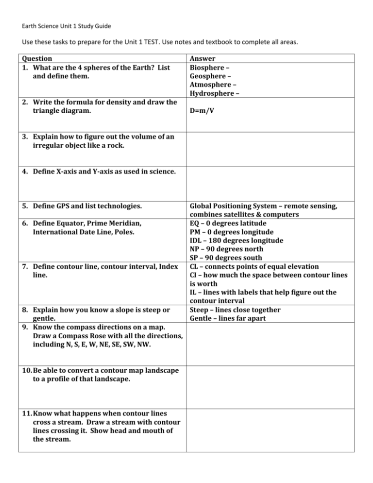
Earth Science Unit 1 Study Guide Use these tasks to prepare for the Unit 1 TEST. Use notes and textbook to complete all areas. Question 1. What are the 4 spheres of the Earth? List and define them. 2. Write the formula for density and draw the triangle diagram. Answer Biosphere – Geosphere – Atmosphere – Hydrosphere – D=m/V 3. Explain how to figure out the volume of an irregular object like a rock. 4. Define X-axis and Y-axis as used in science. 5. Define GPS and list technologies. 6. Define Equator, Prime Meridian, International Date Line, Poles. 7. Define contour line, contour interval, Index line. 8. Explain how you know a slope is steep or gentle. 9. Know the compass directions on a map. Draw a Compass Rose with all the directions, including N, S, E, W, NE, SE, SW, NW. 10. Be able to convert a contour map landscape to a profile of that landscape. 11. Know what happens when contour lines cross a stream. Draw a stream with contour lines crossing it. Show head and mouth of the stream. Global Positioning System – remote sensing, combines satellites & computers EQ – 0 degrees latitude PM – 0 degrees longitude IDL – 180 degrees longitude NP – 90 degrees north SP – 90 degrees south CL – connects points of equal elevation CI – how much the space between contour lines is worth IL – lines with labels that help figure out the contour interval Steep – lines close together Gentle – lines far apart 12. Know how to find coordinates of points on a map. 13. Know the 4 map projections studied in Earth Science. List each map projection and give a short definition. 14. How many time zones are there? How many degrees is each time zone? 15. Define control, independent variable, dependent variable, hypothesis, constant. 16. Know the three main parts of the geosphere. Draw the geosphere and accurately label with crust, mantle, core. 17. Define longitude and latitude. Latitude (N or S) listed first, longitude (E or W) listed second. Highest latitude is 90 degrees, highest longitude is 180 degrees. Pg 13 Mercator Gnomonic Robinson Conic 24 time zones 15 degrees (360 degrees/24 time zones = 15 degrees for each time zone) Control – standard that the experiment is compared to Independent Variable – the variable the scientist changes Dependent Variable – changes in response to or because of the IV Hypothesis – explanation of something observed Constant – stays the same throughout the experiment Crust, mantle, core Longitude – runs north to south, dividing the earth into east and west. Latitude – runs east and west, dividing the earth into north and south. 18. Draw a picture of a mountain with contour lines, index lines, and contour intervals. Mark an X. Give the elevation of the point in meters. 19. Define hachure and draw a picture show Hachure – tick marks on a contour line that how it works. shows depression in elevation 20. Define map scale. If you see 1:18,000 -- what 1 unit is equal to 18,000 actual. does it mean? Ex 1 cm is equal to 18,000 meters 21. Know what trial means when it comes to experiments. Explain why they are important to good experiments. 22. Define scientific theory. 23. Define meridian and parallel. The more trials an experiment has (times that you have done the experiment) the more data is available to verify results. Tested extensively with competing hypotheses eliminated Parallels – circles parallel to equator aka latitude Meridians – lines converging (coming together) at the poles
