Content Rubric - Cloudfront.net
advertisement
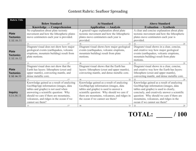
Content Rubric: Seafloor Spreading Rubric Title Plate Tectonics E.SE.06.51 Plate Tectonics E.SE.06.52 Plate Tectonics E.SE.06.53 Inquiry S.IA.06.11 Below Standard Knowledge → Comprehension No explanation about plate tectonic movement and how the lithospheric plates move centimeters each year is provided. At Standard Application → Analysis A general/vague explanation about plate tectonic movement and how the lithospheric plates move centimeters each year is provided. Above Standard Evaluation → Synthesis A clear and concise explanation about plate tectonic movement and how the lithospheric plates move centimeters each year is provided. 13…………………………………………………..17 18………………………………………………………………21 22………………………………………………………………25 Diagram/visual does not show how major geological events (earthquakes, volcanic eruptions, mountain building) result from plate motions. Diagram/visual shows how major geological events (earthquakes, volcanic eruptions, mountain building) result from plate motions. Diagram/visual shows in a clear, concise, and creative way how major geological events (earthquakes, volcanic eruptions, mountain building) result from plate motions. 13…………………………………………………..17 18…………………………………………………………….. 21 22………………………………………………………………25 Diagram/visual does not show that the Earth has layers: lithosphere (crust and upper mantle), convecting mantle, and dense metallic core. Diagram/visual shows that the Earth has layers: lithosphere (crust and upper mantle), convecting mantle, and dense metallic core. Diagram/visual shows in a clear, concise, and creative way how the Earth has layers: lithosphere (crust and upper mantle), convecting mantle, and dense metallic core. 13…………………………………………………..17 18…………………………………………………………….. 21 22………………………………………………………………25 Knowledge gained as a result of analyzing GeoMapApp information (images, data tables and graphs) is not used when answering a scientific question: Why should we care if there are mountains, volcanoes, and ridges in the ocean if we cannot see them? Knowledge gained as a result of analyzing GeoMapApp information (images, data tables and graphs) is used to answer a scientific question: Why should we care if there are mountains, volcanoes, and ridges in the ocean if we cannot see them? Knowledge gained as a result of analyzing GeoMapApp information (images, data tables and graphs) is used to clearly, concisely, and creatively answer a scientific question: Why should we care if there are mountains, volcanoes, and ridges in the ocean if we cannot see them? 13…………………………………………………..17 18…………………………………………………………….. 21 22………………………………………………………………25 TOTAL: _____ / 100
