practice quiz questions
advertisement
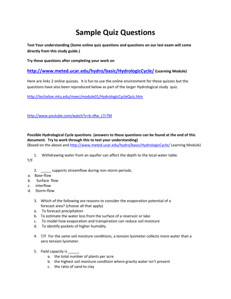
Sample Quiz Questions Test Your understanding (Some online quiz questions and questions on our last exam will come directly from this study guide.) Try these questions after completing your work on http://www.meted.ucar.edu/hydro/basic/HydrologicCycle/ (Learning Module) Here are links 2 online quizzes. It is fun to use the online environment for these quizzes but the questions have also been reproduced below as part of the larger Hydrological study quiz. http://techalive.mtu.edu/meec/module01/HydrologicCycleQuiz.htm http://www.youtube.com/watch?v=b-zRw_LTr7M Possible Hydrological Cycle questions (answers to these questions can be found at the end of this document. Try to work through this to test your understanding) (Based on the above and http://www.meted.ucar.edu/hydro/basic/HydrologicCycle/ Learning Module) 1. Withdrawing water from an aquifer can affect the depth to the local water table. T/F a. b. c. d. 2. _____ supports streamflow during non-storm periods. Base-flow Surface flow interflow Storm-flow 3. Which of the following are reasons to consider the evaporation potential of a forecast area? (choose all that apply) a. To forecast precipitation b. To estimate the water loss from the surface of a reservoir or lake c. To model how evaporation and transpiration can reduce soil moisture d. To identify pockets of higher humidity 4. T/F For the same soil moisture conditions, a tension lysimeter collects more water than a zero tension lysimeter. 5. Field capacity is _____. a. the total number of plants per acre b. the highest soil moisture condition where gravity water isn’t present c. the ratio of sand to clay d. the carrying capacity for cattle grazing 6. Springs are fed from _____. a. baseflow b. impervious surface runoff c. groundwater d. transpiration 7. The albedo is a measure of snowpack _____. a. density b. reflectivity c. melting rate d. age 8. The percent of available freshwater is _____ of the total water on the Earth. a. 97 % b. 2 % c. 10 % d. less than 1% 9. Following a snowfall, snowpack density typically _____ over time. a. increases b. decreases 10. In addition to weather conditions, which of the following has a direct influence on a. plant transpiration? b. Plant type c. Plant canopy density d. plant coverage e. all of these 11. The snow water equivalent is the ratio of the amount of liquid water to the _____. a. precipitation rate b. the isopleths of snow depth c. snowpack depth d. snow density 12. (T/F) Sublimation can never be a factor in snowpack reduction. 13. (T/F) The annual evaporation in arid regions can never exceed the annual precipitation amount. 14. An aquifer is _____. Choose all that apply. a. an underground volume of rock and sand that contains water b. a reservoir of water occurring in underground caves and caverns c. not a significant source of drinking water d. composed of water, soil, the void space within the soil, and subsurface material 15. Transpiration rates are greatest for _____. a. forest b. grassland c. desert cacti d. coastal shrubs 16. ________type soils have larger pore spaces and allow for greater infiltration and percolation than ____________ -type soils, which have more pore space and can hold more water. a. clay, sandy b. sandy, clay c. sandy, sandy d. clay , clay 17. (T/F) Less energy is required for snowpack sublimation than for snowpack melting. 18. Isohyetal contours using rain gauges are useful for _____. a. area-wide ground truth measurements b. area-wide estimates based on point measurements c. situations with heavy snow or high wind d. detailed temporal history of convective rainfall intensity 19. Components of the hydrologic cycle include precipitation, condensation, surface runoff, and _____. a. solar insolation b. evaporation c. aquifer yield d. irrigation water 20. T/F Wilting point depends on the soil texture. 21. Surface runoff occurs when the precipitation rate is _____ the infiltration rate a. greater than b. less than c. equal to 22. T/F Infiltration is when water goes into the soil. 23. The water which falls to Earth after condensing into either rain or snow. a. Condensation b. Sleet c. Deposition d. Precipitation 24. T/F Condensation happens because the temperature increases with altitude in the troposphere. 25. The process by which plants lose water through small openings in leaves. a. Transpiration b. Evaporation c. Sublimation d. Drying 26. Surface run-off is: a. The excess water after evaporation b. The excess water from snow melt c. The excess water from precipitation after evaporation and infiltration d. Precipitation plus infiltration 27. T/F The Hydrological Cycle is the same as the water cycle. 28. Water filtering down through bedrock is a. Infiltration b. Runoff c. Flow d. Percolation 29. T/F Lakes and oceans are transfers of water not stores of water 30. The process in which water vapor turns into liquid water and releases latent heat energy into the environment is called. a. Melting b. condensation c. evaporation d. sublimation e. freezing f. deposition 31. The process in which water vapor turns into ice and releases latent heat energy into the environment is called. a. Melting b. condensation c. evaporation d. sublimation e. freezing f. deposition 32. The process in which liquid water turns into ice and releases latent heat energy into the environment is called. a. Melting b. condensation c. evaporation d. sublimation e. freezing f. deposition 33. The process in which liquid water turns into water vapor and cools the environment is called. a. Melting b. condensation c. evaporation d. sublimation e. freezing f. deposition 34. The process in which ice turns into water vapor and cools the environment is called. a. Melting b. condensation c. evaporation d. sublimation e. freezing f. deposition 35. The process in which ice turns into liquid water and cools the environment is called. a. Melting b. condensation c. evaporation d. sublimation e. freezing f. deposition 36. Underground water; the water which supplies wells is a. Flow through b. Ground water c. Underground lakes d. Underground streams 37. In the figure above letter (a) most closely corresponds to a. Evaporation b. transpiration c. Ground water flow d. Infiltration e. precipitation f. runoff g. stream flow 38. In the figure above letter (b) most closely corresponds to a. Evaporation b. transpiration c. Ground water flow d. Infiltration e. precipitation f. runoff g. stream flow 39. In the figure above letter (c) most closely corresponds to a. Evaporation b. transpiration c. Ground water flow d. Infiltration e. precipitation f. runoff g. stream flow 40. In the figure above letter (d) most closely corresponds to a. Evaporation b. transpiration c. Ground water flow d. Infiltration e. precipitation f. runoff g. stream flow 41. In the figure above letter (e) most closely corresponds to a. Evaporation b. transpiration c. Ground water flow d. Infiltration e. precipitation f. runoff g. stream flow 42. In the figure above letter (f) most closely corresponds to a. Evaporation b.transpiration c. Ground water flow d. Infiltration e. precipitation f. runoff g. stream flow 43. In the figure above letter (g) most closely corresponds to a. Evaporation b. transpiration c. Ground water flow d. Infiltration e. precipitation f. runoff g. stream flow Answers to above questions Possible Hydrological Cycle quiz questions (Based on http://www.meted.ucar.edu/hydro/basic/HydrologicCycle/ Learning Module) 1. (T/F) Withdrawing water from an aquifer can affect the depth to the local water table. 2. _____ supports streamflow during non-storm periods. a. **Base-flow b. Surface flow c. interflow d. Storm-flow 3. Which of the following are reasons to consider the evaporation potential of a forecast area? (choose all that apply) a. To forecast precipitation b. **To estimate the water loss from the surface of a reservoir or lake c. **To model how evaporation and transpiration can reduce soil moisture d. To identify pockets of higher humidity 4. (T/F) For the same soil moisture conditions, a tension lysimeter collects more water than a zero tension lysimeter. 5. Field capacity is _____. a. the total number of plants per acre b. **the highest soil moisture condition where gravity water isn’t present c. the ratio of sand to clay d. the carrying capacity for cattle grazing 6. Springs are fed from _____. a. baseflow b. impervious surface runoff c. **groundwater d. transpiration 7. The albedo is a measure of snowpack _____. a. density b. **reflectivity c. melting rate d. age 8. The percent of available freshwater is _____ of the total water on the Earth. a. 97 % b. 2 % c. 10 % d. **less than 1% 9. Following a snowfall, snowpack density typically _____ over time. a. **increases b. decreases 10. In addition to weather conditions, which of the following has a direct influence on a. plant transpiration? b. Plant type c. Plant canopy density d. plant coverage e. **all of these 11. The snow water equivalent is the ratio of the amount of liquid water to the _____. a. precipitation rate b. the isopleths of snow depth c. **snowpack depth d. snow density 12. (T/F) sublimation can never be a factor in snowpack reduction. 13. (T/F) The annual evaporation in arid regions can never exceed the annual precipitation amount. 14. An aquifer is _____. Choose all that apply. a. **an underground volume of rock and sand that contains water b. a reservoir of water occurring in underground caves and caverns c. not a significant source of drinking water d. **composed of water, soil, the void space within the soil, and subsurface material 15. Transpiration rates are greatest for _____. a. ** forest b. grassland c. desert cacti d. coastal shrubs 16. __________ type soils have larger pore spaces and allow for greater infiltration and percolation than __________ -type soils, which have more pore space and can hold more water. a. clay, sandy b. **** sandy, clay c. sandy, sandy d. clay , clay 17. (T/F) Less energy is required for snowpack sublimation than for snowpack melting. 18. Isohyetal contours (lines drawn through geographical points estimated to have equal amounts of precipitation) using rain gauges are useful for _____. a. area-wide ground truth measurements b. **area-wide estimates based on point measurements c. situations with heavy snow or high wind d. detailed temporal history of convective rainfall intensity 19. Components of the hydrologic cycle include precipitation, condensation, surface runoff, and _____. a. solar insolation b. **evaporation c. aquifer yield d. irrigation water 20. T/F (T) Wilting point depends on the soil texture. 21. Surface runoff occurs when the precipitation rate is _____ the infiltration rate a. **greater than b. less than c. equal to 22. T/F (T) Infiltration is when water goes into the soil. 23. The water which falls to Earth after condensing into either rain or snow. a. Condensation b. Sleet c. Deposition d. **Precipitation 24. T/F (F temperature usually drop with altitude)Condensation happens because the temperature increases with altitude in the troposphere. 25. The process by which plants lose water through small openings in leaves. a. **Transpiration b. Evaporation c. Sublimation d. Drying 26. Surface run-off is: a. The excess water after evaporation b. The excess water from snow melt c. **The excess water from precipitation after evaporation and infiltration d. Precipitation plus infiltration 27. T/F (T) The Hydrological Cycle is the same as the water cycle. 28. Water filtering down through bedrock is a. Infiltration b. Runoff c. Flow d. **Percolation 29. T/F (F) Lakes and oceans are transfers of water not stores of water 30. The process in which water vapor turns into liquid water and releases latent heat energy into the environment is called. a. Melting b. ** condensation c. evaporation d. sublimation e. freezing f. deposition 31. The process in which water vapor turns into ice and releases latent heat energy into the environment is called. a. Melting b. condensation c. evaporation d. sublimation e. freezing f.** deposition 32. The process in which liquid water turns into ice and releases latent heat energy into the environment is called. a. Melting b. condensation c. evaporation d. sublimation e. **freezing f. deposition 33. The process in which liquid water turns into water vapor and cools the environment is called. a. Melting b. condensation c. ** evaporation d. sublimation e. freezing f. deposition 34. The process in which ice turns into water vapor and cools the environment is called. a. Melting b. condensation c. evaporation d. **sublimation e. freezing f. deposition 35. The process in which ice turns into liquid water and cools the environment is called. a. **Melting b. condensation c. evaporation d. sublimation e. freezing f. deposition 36. Underground water; the water which supplies wells is a. Flow through b. **Ground water c. Underground lakes d. Underground streams 37. In the figure above letter (a) most closely corresponds to a. Evaporation b. transpiration c. ** Ground water flow d. Infiltration e. precipitation f. runoff g. stream flow 38. In the figure above letter (b) most closely corresponds to a. Evaporation b. transpiration c. Ground water flow d. Infiltration e. precipitation f. **runoff g. ** stream flow 39. In the figure above letter (c) most closely corresponds to a. Evaporation b. transpiration c. Ground water flow d. Infiltration e. precipitation f. runoff g. stream flow 40. In the figure above letter (d) most closely corresponds to a. ** Evaporation b. transpiration c. Ground water flow d. Infiltration e. precipitation f. runoff g. stream flow 41. In the figure above letter (e) most closely corresponds to a. Evaporation b. transpiration c. Ground water flow d. Infiltration e. **precipitation f. runoff g. stream flow 42. In the figure above letter (f) most closely corresponds to a. Evaporation b.** transpiration c. Ground water flow d. Infiltration e. precipitation f. runoff g. stream flow 43. In the figure above letter (g) most closely corresponds to a. Evaporation b. transpiration c. Ground water flow d. **Infiltration e. precipitation f. runoff g. stream flow

