Furrows in the Desert Slideshow Nov. 2013
advertisement
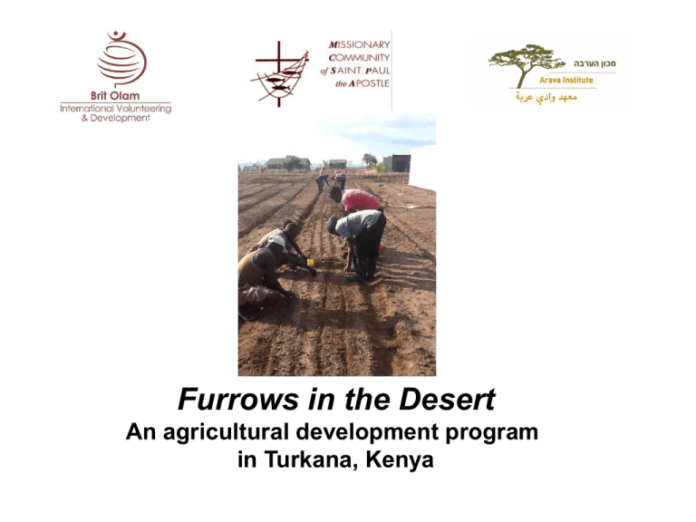
Furrows in the Desert An agricultural development program in Turkana, Kenya Turkana is a semi arid region in northwestern Kenya, on the border with Ethiopia, South Sudan and Uganda. It is the largest yet least developed district in the country. Area of Turkana: 77,000 km2 Population: Estimation of 850,000 Temperature: 20-400 c Precipitation: 100-400 mm/year Evaporation: 7-12 mm/day Population in Turkana The inhabitants of Turkana are largely pastoralists practicing a nomadic lifestyle. Traditionally the Turkana way of life Evolves around their livestock for nutritional and cultural needs. Occasionally they would gather wild fruits, hunt wild animals and gather honey. Often they would trade with neighboring tribes for maize, beans and very limited verity of vegetables and grains. The main problems facing agricultural development in Turkana: • Harsh environmental conditions. • The lack of know-how in developing agriculture in arid land. • Difficulty to bring expert agronomists and skilled manpower to the area on a long term basis. • The deep cultural gap between the herders way of life and farming way of life • The lack of transportation infrastructure and markets Program Goals: To introduce agriculture in Turkana North, as a means for: • Food production towards food security in the area. • Income generating activities for the local population through the marketing of agricultural production Model Innovation: A comprehensive, long term sustainable approach Long term commitment of partner org. permanent presence of MCSPA Developing agricultural methods appropriate for the area. Establishing a central farm for training research & demonstration Model Innovation: Comprehensive Sustainability measures On a long term basis 6 months hand on training Training the trainers lessons in mother & child centres family scale & community scale Support for marketing agricultural produce Provision of agricultural Inputs for graduates Ongoing guidance in new farmers’ family plots Program Water Infrastructure MCSPA water infrastructure In Turkana North: • rock water dams (107 units) • earth pans (89 units) • boreholes (over 165 units) • wind pumps (28 units). Planning Strategy: Following UN recommendations, we first harvest rain water by rockdams in the mountain side, or earth dams and pans. This is especially geared towards meeting the needs of the pastoralists’ herds. The dams are designed according to the geo-physical conditions. Further downstream we drill Wells fitted with handpumps, windumps or solar systems to meet the domestic needs of the population and to start agricultural developments. Water infrastructure: Hand pumps, wind pumps, tanks Water infrastructure: Dams Community participation and management The builders of rock dams are local people who have been trained in the art. In each location with a water facility, water committees are trained and enabled to run the facilities. Agricultural Models for arid conditions: 4 types based on available water sources Boreholes based family plots Earth Pan plots Liman (runoff water diverted to canals) Lake Plantations Family Plots Family Drip System (FDS): low cost, Gravity based, Water and labor efficient A typical FDS family plot: (500 m2 FDS, Additional 500 m2 traditionally irrigated) Supports the family nutrition. produces 10 times more produce than needed for family consumption (calculated for 6 people). The surplus is used for marketing to generate income. provides all year round produce (4 crop cycles). Typically each cycle will include 2 crop types. Average produce per FDS plot: Crop type Production (Kg) Tomato 1800 Melon 1500 Onion 1700 Okra 900 Watermelon 2500 Sorghum (grains) 120 Sorghum (fodder) 3000 Maize(grains) 200 Maize(fodder) 1000 Crop selection Criteria: • Nutritional value • Resistance to arid conditions • Good market price • Resilience to transportation hazards Examples: Tomatoes, okra, onion, garlic, Melon, watermelon Sorghum, Maize (for human consumption and as fodder) Dates, Pomegranates (community plantations) Appropriate practices in all stages of crop cycle Training Curriculum Compost preparation Land preparation Crop planning Nursery Irrigation Plant protection monitoring system Weed control Crop management Post harvest Record keeping FID Central training Farm in Lobur Design: Vegetable plots (500 m2 each , Family Drip Irrigation system) 3 net houses 1 Liman plot 1 Earth Pan System (1 Family Drip Irrigation system) 3 date plantations Central training Farm: Location • Close to Lobur MCSPA mission for infrastructure and logistical support. • Land is secured under a letter of allotment from Turkana County Council and from the elders of the local communities. • Water availability from 2 windmill-operated bore holes. • Security measurements are in place. • Local community in the vicinity. • Accessible to visits by locals, government officials and representatives of commercial enterprises Central farm: infrastructure Vegetable plots with elevated tanks and windpump Vegetable plots and wind breakers Nethouse and Vegetable plots 2nd course trainees and staff sharing knowledge in the shade The newly made Liman Preparation for a date plantation Central farm: Vegetable plots First Yields Central Farm: Nursery Development Outreach Points: graduates family plots Lokitaung: near the dam Narikotome Narikotome Kaikor Kokuro Kokoselei Using treadle pump in Lokitaung Liman plot in Lobur Project Beneficiaries 2014-2016 360 local families of project graduates (direct and indirect) owning family plots who will enjoy improved nutrition, additional fodder and income. Graduates' circles of relatives and neighbors who will enjoy improved nutrition. 300 families of local workers to be employed in 3 community plantations on the banks of Lake Turkana. Other members of the local communities who will generate income for their families through secondary jobs based on agriculture and marketing, e.g. food processing, food preservation, transportation of produce to markets, etc. Planning Process and Key Participants Field survey by Brit Olam and ACSD expert delegation, December 2011 MCSPA missionaries and Turkana Elders • Joint planning and ongoing revision by the 3 project partner organizations each contributing its own expertise • Selection process of local trainees in collaboration with the local community Expert visits and record keeping by Israeli professional field team & trainees FID is run in coordination with the local government and with the full approval of the Kenyan Ministry of Agriculture. Delegates of Kenyan government and World Bank visiting FID new training farm, summer 2012 The Diocese of Lodwar (DOL) functions as a central development agency in Turkana. FID is supported by DOL through MCSPA as a pilot agricultural program. Once its success will be proved, the program model may be applied in other parts of the county as well as other semi arid regions. DOL Master Plan of Food Security Main Survey Findings (2012): • Crop production is the 2nd ranked livelihood source in Turkana after livestock production. • Crop production is mainly at subsistence level. • There is high latent potential of water and arable land • There is much motivation of locals to be self-sufficient. Main Recommendations: • Capacity building of local people in agriculture • Promoting irrigated agriculture using rain and underground water harvesting • Using dry land high value crops, especially vegetables and fruits • Expanding fruit and vegetable market in Lodwar and neighboring towns • Linkage of local farmers to the available markets in the growing towns. For further reference: Missionary Community of Saint Paul the Apostle (MCSPA) www.mcspa.org Brit Olam – International Volunteering and Development www.britolam.org Arava Center for Sustainable Development (ACSD) http://arava.org Contact persons: Albert Salvans (MCSPA, Turkana): albert.salvans@mcspa.org Maque Falgas (MCSPA, Turkana): mfalgas@hotmail.com Milett Biberman (Brit Olam, Israel): milett@britolam.org Cel. +972-546-347-437
