Physical Geography of East Asia
advertisement
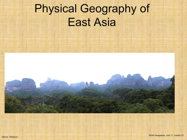
Physical Geography of East Asia ©2012, TESCCC World Geography, Unit 11, Lesson 01 Major Geographic Characteristics of East Asia • World’s MOST POPULOUS REALM • One of the world’s earliest culture hearths • Population concentrations in the East, situated in river basins and special economic zones ©2012, TESCCC World Geography, Unit 11, Lesson 01 Sub-regions of East Asia • CHINA PROPER- Eastern half; the core of China • XIZANG (TIBET)- Tall mountains and high plateaus; sparsely populated • XINJIANG- Vast desert basin and mountain rims; gateway to the Islam world • MONGOLIA- Mostly desert • The JAKOTA TRIANGLE – Japan, South Korea, Taiwan ©2012, TESCCC World Geography, Unit 11, Lesson 01 PHYSICAL GEOGRAPHY • LONGITUDINAL EXTENT (East to West) Comparable to the U.S. • LATITUDINAL RANGE (North to South): Comparable to Northern Quebec to Central Caribbean • Bordered by oceans, high mountains, steppe country, and desert ©2012, TESCCC World Geography, Unit 11, Lesson 01 Karst Landscape ©2012, TESCCC World Geography, Unit 11, Lesson 01 Eastern China ©2012, TESCCC World Geography, Unit 11, Lesson 01 Northern China: The Great Wall ©2012, TESCCC World Geography, Unit 11, Lesson 01 Tibet ©2012, TESCCC World Geography, Unit 11, Lesson 01 CLIMATE • CLIMATE TYPES INCLUDE: B (Dry); C (Humid temperate); D (Humid cold); and H (Unclassified Highlands) • Includes the largest area of highland climate in the world • Desert conditions prevail in the Northern and Western interior • Coastal, peninsular, and insular East Asia have more moderate climates than the interior regions ©2012, TESCCC World Geography, Unit 11, Lesson 01 Step terraces are designed to allow water to flow by gravity through all the fields, generally reentering a stream at a lower level. ©2012, TESCCC World Geography, Unit 11, Lesson 01 Rice Fields ©2012, TESCCC World Geography, Unit 11, Lesson 01 XIZANG (TIBET) • A harsh physical environment • Sparsely populated • Came under Chinese control during the Manchu Dynasty in 1720 • Gained separate status in the late 19th Century • China’s Communist regime took control in the 1950s • Cornerstone of Buddhism, the Dalai Lama, and monasteries • Now an autonomous region ©2012, TESCCC World Geography, Unit 11, Lesson 01 The Potala Palace in Lhasa, Tibet, is the ceremonial home of the 14th Dalai Lama, now in exile in India. ©2012, TESCCC World Geography, Unit 11, Lesson 01 Highland Pasture in Tibet – nomadic herders ©2012, TESCCC World Geography, Unit 11, Lesson 01 XINJIANG • Comprises one-sixth of China’s total land area • A region of high mountains and basins • Chinese only account for 40% of the population • Half of the population is Islamic • Has extensive reserves of oil and natural gas ©2012, TESCCC World Geography, Unit 11, Lesson 01 MONGOLIA • Steppe and desert physical environment • Sparsely populated with an estimated 2.5 million inhabitants • Part of the Chinese empire from late1600s until 1911 • Functions as a buffer state between Russia and China • Economy is focused on herding and animal products ©2012, TESCCC World Geography, Unit 11, Lesson 01 THE JAKOTA TRIANGLE • CHARACTERISTICS – Small, confined land area (Japan and Taiwan are islands and the Koreas are on a Peninsula) – Hazardous region- earthquakes, tsunamis and typhoons – Great cities and high-tech industry – Enormous consumption of raw materials, but few raw materials produced locally – Global links and rapid development ©2012, TESCCC World Geography, Unit 11, Lesson 01 Known Hazards for this Region • • • • • • ©2012, TESCCC Earthquakes Tsunamis Volcanic Activity (Japan) Typhoons Floods Drought World Geography, Unit 11, Lesson 01
