Chapter 9: Tides
advertisement
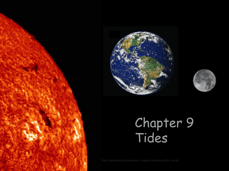
Chapter 9 Tides http://www.bbso.njit.edu/espr/sci_images/composite_earth1_red.gif Overview Rhythmic rise and fall of sea level Very long and regular shallow-water waves Caused by gravitational attraction of Sun, Moon, and Earth Tide-generating forces Barycenter between Moon and Earth – center of gravity of “Earth-Moon System” Mutual orbit due to gravity and motion Fig. 9.1 Gravitational forces Every particle attracts every other particle Gravitational force proportional to product of masses, toward center of gravity of Moon Inversely proportional to square of separation distance – decrease the farther away from Moon (look at red circles) Fig. 9.2 Centripetal force Center-seeking force – force equal at all points Tethers Earth and Moon to each other Fig. 9.3 Tide-producing forces Resultant forces = differences between centripetal and gravitational forces (blue arrows) ○ Near moon, gravitational forces are greater ○ Away from moon, centripetal forces are greater Tide-generating forces are horizontal components resulting in “bulges” Fig. 9.4 Tidal bulges (lunar) Small horizontal forces push seawater into two bulges on opposite sides of Earth One bulge faces Moon Other bulge opposite side Earth Tidal bulges (lunar) Moon closer to Earth so lunar tide-producing force greater than that of Sun Ideal Earth covered by ocean ○ If the entire earth was covered by ocean and the ocean depth and bottom was uniform ○ This is not the case (continents, etc) Two tidal bulges Two high tides, 12 hours apart High tide, flood tide, seawater moves on shore Low tide, ebb tide, seawater moves offshore Lunar Day Moon orbits Earth 24 hours 50 minutes for observer to see subsequent Moons directly overhead High tides are 12 hours and 25 minutes apart ○ Tides are based on lunar cycle Tidal bulges (solar) Sun effects tides, also Similar to lunar bulges but much smaller because sun is farther from earth Understand this figure Other complicating factors: declination • • Angular distance Moon or Sun above or below Earth’s equator • Sun to Earth: 23.5o N or S of equator • Moon to Earth: 28.5o N or S of equator Fig. 9.11 Shifts lunar and solar bulges from equator unequal tides at given latitude http://www.nos.noaa.gov/education/kits/tides/media/ Declination and tides Unequal tides (unequal tidal ranges at given latitude) Fig. 9.13 Other complicating factors: elliptical orbits Tidal range greatest at perihelion (January) and perigee Perihelion – Earth closest to sun Perigee – Earth is closest to moon Tidal range least at aphelion (July) and apogee Aphelion – Earth farthest from sun Apogee – Earth farthest from moon Moon’s perigee and apogee cycle 27.5 days Fig. 9.12 Idealized tide prediction Two high tides/two low tides per lunar day Six lunar hours between high and low tides http://www.aztecsailing.co.uk/theory/Ch2-Fig-2-tidal-cycle.gif Real tides affected by many factors Tides extreme example of shallow-water waves Earth not covered completely by ocean Continents and friction with seafloor modify tidal bulges Tides are shallow water waves with speed determined by depth of water Tidal bulges cannot form (too slow) Ocean is not deep enough Speed of tides (which are shallow water waves) cannot keep up with rotation of Earth Therefore: Tidal cells “slosh” around amphidromic point in ocean basins ○ Crests and troughs of tides rotate around this point ○ Tidal range is zero at this point Tidal cells in world ocean Cotidal lines Connects all points experiencing the same phase of the tide Radiates from amphidromic point Tidal patterns Semidiurnal Two high tides/two low tides per day Tidal range about same Diurnal One high tide/one low tide per day Rarest Mixed Two high tides/two low tides per day Tidal range different Most common http://www.fhwa.dot.gov/engineering/hydraulics/images/h25_b6.jpg Global distribution of tides www.nos.noaa.gov/.../ tides/media/ Tidal Pattern for Fort Pierce Tidal Phenomena Standing waves Tide waves reflected by coast Amplification of tidal range Example, Bay of Fundy maximum tidal range 17 m (56 ft) http://academics.sru.edu/GGE/pictures/Newfoundland/Images Tides in coastal waters Tidal bore in low-gradient rivers ○ Come in to shallow rivers ○ Example is Amazon River Can rise 5ft Fig. 9A Tides and coastal areas like the Indian River Lagoon Reversing current Flood current or tide – water rushes into harbor with incoming tide Ebb current or tide – water drains out of harbor or bay with out-going tide Slack tide – current stops at peak of high and low tides High velocity flow in restricted channels Fig. 9.18 Tidal range is not a good predictor of tidal currents; altered by: ○ Shape and volume of basin ○ Restriction of flow at basin mouth ○ Winds ○ Currents stronger at channel center than at edges Coastal tidal currents Whirlpool Rapidly spinning seawater Restricted channel connecting two basins with different tidal cycles Not as deadly as legend suggests Fig. 9.19 Tides and marine life Tide pools and life Organisms living in intertidal have to be adapted to spending long periods underwater and long periods exposed to sun and drying out Fig. 9C http://www.stripersonline.com/surftalk/attachment.php?attachmentid=30481&stc=1&d=1169261518 Tide-generated power Renewable resource – mostly hypothetical at this point Does not produce power on demand Possible harmful environmental effects – alternating water flow http://www.bluenergy.com/technology.html Misconceptions Distance from the sun causes the seasons. All tides happen in bodies of water that are very large. Outer space doesn’t really affect Earth. The sun revolves around the Earth. Ocean Literacy Principles 1.c - Throughout the ocean there is one interconnected circulation system powered by wind, tides, the force of the Earth’s rotation (Coriolis effect), the Sun, and water density differences. The shape of ocean basins and adjacent land masses influence the path of circulation. 1.d - Sea level is the average height of the ocean relative to the land, taking into account the differences caused by tides. Sea level changes as plate tectonics cause the volume of ocean basins and the height of the land to change. It changes as ice caps on land melt or grow. It also changes as sea water expands and contracts when ocean water warms and cools. 5.h - Tides, waves and predation cause vertical zonation patterns along the shore, influencing the distribution and diversity of organisms. Florida Sunshine State Standards SC.6.P.13.2 - Explore the Law of Gravity by recognizing that every object exerts gravitational force on every other object and that the force depends on how much mass the objects have and how far apart they are. SC.8.E.5.9 - Explain the impact of objects in space on each other including: 1. the Sun on the Earth including seasons and gravitational attraction 2. the Moon on the Earth, including phases, tides, and eclipses, and the relative position of each body. SC.912.L.17.3 - Discuss how various oceanic and freshwater processes, such as currents, tides, and waves, affect the abundance of aquatic organisms.
