What is Orienteering - Orienteering Cincinnati
advertisement
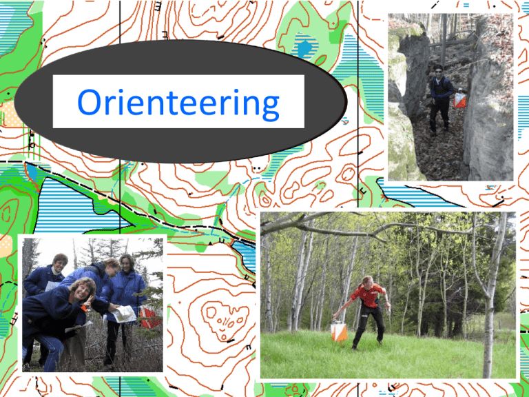
Orienteering What is Orienteering? What is Orienteering? • Orienteering is a cross country race in which participants use a highly detailed map and a compass to navigate their way between checkpoints along an unfamiliar course. • From the Boy Scout merit badge manual, 2003 What is Orienteering? • Orienteering is a cross country race in which participants use a highly detailed map and a compass to navigate their way between checkpoints along an unfamiliar course. • Over hill and dale, through the woods… What is Orienteering? • Orienteering is a cross country race in which participants use a highly detailed map and a compass to navigate their way between checkpoints along an unfamiliar course. • This is a timed event • But how fast you go is a personal choice. What is Orienteering? • Orienteering is a cross country race in which participants use a highly detailed map and a compass to navigate their way between checkpoints along an unfamiliar course. • Folks of all ages, both genders, every walk of life. • Alone or in groups. • Of all fitness levels and abilities. Suitable for all Ages As Competitive as You Want Alone or in a Group What is Orienteering? • Orienteering is a cross country race in which participants use a highly detailed map and a compass to navigate their way between checkpoints along an unfamiliar course. • A specially prepared map • In accordance with IOF mapping standards • With selected features enhancing foot navigation What is Orienteering? • Orienteering is a cross country race in which participants use a highly detailed map and a compass to navigate their way between checkpoints along an unfamiliar course. • You must have a amp to Orienteer • You do not have to have a compass; although it is a valuable aid. • Special compasses are made for Orienteering. What is Orienteering? • Orienteering is a cross country race in which participants use a highly detailed map and a compass to navigate their way between checkpoints along an unfamiliar course. • Selecting a route suitable to your abilities (Physical and mental) • Following that route, and making improvements and corrections along the way, in order to optimize your overall speed. What is Orienteering? • Orienteering is a cross country race in which participants use a highly detailed map and a compass to navigate their way between checkpoints along an unfamiliar course. • The area between two checkpoints is evaluated for alternative routes. • One is selected. • Orienteering techniques are implemented along the way. What is Orienteering? • Orienteering is a cross country race in which participants use a highly detailed map and a compass to navigate their way between checkpoints along an unfamiliar course. • The Orienteering Controls are marked with a distinct red & white kite like flag. • A unique punch or electronic recording device proves you arrived at each location. What is Orienteering? • Orienteering is a cross country race in which participants use a highly detailed map and a compass to navigate their way between checkpoints along an unfamiliar course. • A course is a series of checkpoints with controls, visited in order. • No prior knowledge of the course layout, and frequently the map is permitted in competitive orienteering. Types of Orienteering • Cross Country • Done in order – Route Choice • USOF – sub classes – Short – Middle - classic – Long Types of Orienteering • Score • • • • • • Many Controls Values Time Limit Penalty Individual/Team ROGAINEs – Grueling – 6, 8, 12, 24 hour events Types of Orienteering • Sprint Orienteering • Relays • FASTO Series Types of Orienteering • Line Orienteering • Follow Line drawn on map • Timed • Penalty for missed controls Types of Orienteering • Route Orienteering • Follow route marked on ground • Mark location of found controls on map • Timed • Penalty for inaccuracy Types of Orienteering • • • • • • • • Window/Corridor-O Memory-O Trail-O Bike-O Street-O Night-O Ski-O Command-O • • • • • • • History-O Canoe-O Radio-O Goats Other games Poker Declining score Levels of Orienteering • 4 levels of difficulty • • • • Beginner Advanced Beginner Intermediate Advanced Levels of Orienteering • 4 lengths of advanced • Age graduated • To suite the needs of all Levels of Orienteering • Color Coded • • • • • • • White Yellow Orange Brown Green Red Blue • • • • • • • Novice 1-2 km Beginner 2-3 km Intermediate 3-5 km Advanced 3-4 km Advanced 4-5 km Advanced 6-8 km Advanced 7-12 km Levels of Orienteering • Course Design • • • • • • • White Yellow Orange Brown Green Red Blue – on trails – off trails – catching features, attack points BGRB – No Holds Barred Levels of Orienteering • Map Hiking – Versus • Competitive Orienteering An Adventure Orienteering can be enjoyed as a leisurely walk in the woods or as a competitive race. An Orienteering Course… Consists of a start, a series of control sites to be visited in order, and a finish. Controls • The circles are centered on the feature to be found. • A control marks the location. • The description sheet describes the control placements and codes. Punching To verify a visit, the orienteer uses a punch hanging next to the flag to mark his or her control card. Techniques • • • • • Attack Points Handrails Catching features Aiming Off Collecting features – Checking off – Map to terrain – Terrain to map • Connecting features – making a virtual pathway • Contouring • Map simplification Attack Points • It is a feature… – near by the control • That is easier to find… – than the control itself • It is typically 50 to 100 meters away… – and seldom more than 150 meters. • Whenever possible… – attack from above. Handrails • Grasp it by the hand. – Let it guide you safely to your destination. • A linear feature • You may follow it directly… – as on a path. • You may travel along side … – it such as a fence. • You can travel near it… – knowing that it will stop you from crossing over, like a guardrail. Hand Rail • White Course. Orienteering Cincinnati, © 2005 Hand Rail • Yellow course. Orienteering Cincinnati, © 2005 Hand Rail • Orange course. Orienteering Cincinnati, © 2005 Catching Feature • Is usually a linear feature… – that is easy to notice, that resides just before or just beyond the control • Use catching features to… – alert yourself that the control is coming up very soon or that you have just passed it. • May also use catching features in… – aiming off. Orienteering Cincinnati, © 2005 Catching Feature • Traveling from 2 to 3 (cliff on the top) the orienteer has drifted to the left (north). • The fence is as a catching feature. • The alert orienteer is ‘caught’ by the catching feature. • In this example the fence is followed to the hill top and a new attack is taken to the cliff top. Orienteering Cincinnati, © 2005 Aiming Off • Deliberately aiming to one side of a linear feature; to avoid guessing which way to turn Orienteering Cincinnati, © 2005 Collecting features • – Checking off – Map to terrain – Terrain to map • Observing the features that you pass by… – Noting them on your map. • Noting features on the map that you should see… – Looking for them in your run Connecting features Making a virtual pathway Contouring – Advantage • Maintain height, energy • Use contour as a “handrail” – Disadvantage • Rarely a straight line • Easy to gain, lose height if not skilled • Steep slopes are very slow to traverse (steepness and vegetation grows at odd angles) • Tops of hills often open, easy running – General Rule: 10m climb = 100m flat Map Simplification • • • Ignore the less useful abundance of detail. Look for the major features; handrails and catching features. Identify the attack point and minimum detail to get there. • • An orienteer takes a detailed map and visualizes a simplified version in the mind. Only the details relevant to moving between controls 4 and 5 are focused upon in the simplified metal map. Orienteering Cincinnati, © 2005 Reading Ahead • When the navigating on the current leg is simple; • use the time to prevue the next leg. • Know what you will do before you need to know. Relocation Invest a few minutes to save a lot 5 minutes now could save 20 or 30. • Lose contact with map – STOP • Orient the map with the compass. • Match the terrain around you to the features on the map. • Find a plausible route from last known location to here • Otherwise, identify nearest definite guaranteed location • Return to the last place of known location or bail out to a linear feature. Systematic Orienteering • Orienting the Map • Align Orienting arrow with needle • Find your current location • Orienting the map/person together • Check and know the scale and contour interval • Study the next control • Identify potential – Attack Points – Handrails – Catching & Collecting features • Select your best route • Be extra careful with the first several legs – Build confidence and familiarity with • Map • Terrain • Self • Read ahead – plan – Exit from control – Next route • Check of features along the way Route Choice changes with experience • Judging Physical versus Mental aspects of choice – Navigational skills – Physical ability • Safe versus Risky • Negative Considerations – – – – – – Climb Obstacles Distance Difficulties Vegetation Out of bounds • Positive considerations – – – – Landmarks Handrails Features – catching, collecting Attack points Description Sheets Description Sheets Rough vs Fine Orienteering Rough • General knowledge of loaction • Usually a high rate of speed. • Gurenteed Catching features • Planning and reading ahead Fine • Precise Knowledge of location • A little to a lot slower • Avoiding risk • Focused Distance Judgment • Measuring on a map – Using compass and map scales • Dead reckoning – Subjective and limited use • Pace Counting - A learned skill Pace Counting Establishing ones pace Using Pace Counting Rough Orienteering Fine Orienteering Aiming Off Negative effects on Pace Count Climb 15m climb ~ 100m level ~ @30seconds Fatigue Obstacles – vegetation/features Slope – contouring Personal growth Injury Speed Walk/Run Pace Counting • Using pace count – – – – – – Count in the background Make a perpetual habit Always will have a rough distance traveled Reset at all known locations Accuracy dwindles with distance Use to • Gage when short or long • Know where you have hit a crossing catching feature Orienteering Cincinnati, © 2005 Strategies • • • • • • Avoiding unnecessary climb Keeping the high ground Attacking from the high ground Aiming off Using a trail to read ahead Investing a bit of unnecessary time with safer routes to guarantee no lost time Mistakes • • • • Parallel errors Directional errors Distance errors Losing contact with the map – Ignoring & misinterpreting features Orienteering Rules • • • • • • • • • No prior Knowledge of the course No mechanical or electronic aid (GPS) No assistance – navigate alone No following (mass start exceptions) Be quiet Help the injured Do not damage No trespassing Report to the finish Orienteering Preparedness • • • • • • • • • • Clothes Shoes Nutrition Hydration Temperature Precipitation Wind Terrain Duration Eye protection Post Orienteering • • • • • • Tick check Scratch and wound cleaning Clean dry warm clothes Draw route Evaluate and compare route choices Identify mistakes and better choices Orienteering Opportunities • Events – schedule – TROL – Saturdays (&Sundays) now through March • Website http://ocin.org • Contact info • Pat Meehan – 513-728-5688 – pat@ocin.org
