power point - Mr. Forsdike
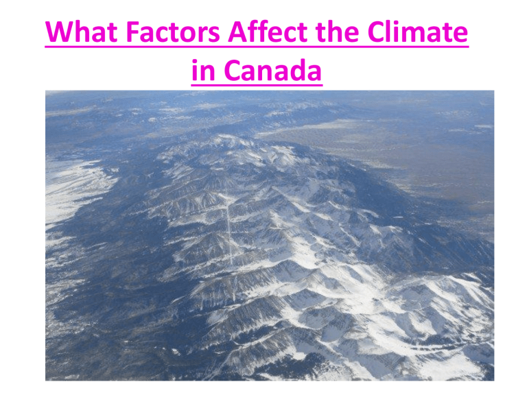
What Factors Affect the Climate in Canada
Ms. K. Fawcett
There are 6 Factors that affect
Climate:
• They are:
– Latitude
– Ocean Currents
– Winds and Air masses
– Elevation
– Relief
– Near to Water
– A useful acronym to help remember these factors is: LOWER NEAR WATER
Latitude and Climate
• Latitude: gives the location of a place on earth, north or south of the border
• Lines of Longitude: horizontal lines running east to west on a map
• As you move away from the equator (either N or S) the average temperature decreases, but the temperature range increase
• Why?
– The amount of energy hitting any spot on the earth is equal
• But, because the earth is curved, at certain points this energy is spread out over larger distances
low angle of incoming sunlight hits the north and south poles – less direct sunlight
– Sunlight directly hits the equator overhead
– the rays are spread out in the poles and more concentrated at the equator
Therefore,
Temperature decreases as you move north or south of the equator because due to the curvature of the earth, less light from the sun is hitting per square meter.
Ocean Currents and Climate
• An Ocean Current is Continuous, directed movement of ocean water.
• The temperature of Ocean Currents can increase or reduce the temperature of nearby land areas.
• Ocean winds blowing towards the shore will increase or decrease in temperature depending on the temperature of the ocean water.
• EXAMPLE : North Atlantic Gulf Stream
• Temperature of the current + surrounding water = overall current temperature
Current temperature affects
Air Temperature passing over it.
West Coast:
North Pacific Current = warm
- warmer air
- warmer BC climate
Labrador current meets Gulf
Stream and NFLD = FOG
Therefore,
• Ocean currents affect climate because they influence the temperature of the air coming off the water.
Winds and Climate
•
Air Mass – large volume of air that takes on climate conditions
• Wind – movement of air from high pressure to low pressure areas
• Prevailing Wind – well established patterns of wind
• Polar Front – boundary between dry, polar air, and warm, wet tropical air
• Jet Stream –west to east movement of air high above polar front
• Because air masses takes on their climatic conditions,
• Ocean air masses = lots of moisture and warm/cool
• Land Air masses = very dry and warm/cool
Winds Affect Climate
• Air moves,
– High Pressure Low pressure
• creates patterns called PREVAILING (Dominant)
WINDS
» In Canada, blow west to East
» (Westerlies)
» Warm winds blow from hot areas and will raise temperatures
» Cold winds come from cold areas and decrease the temperature
• = Move air masses affects and changes weather
Jet Stream
• The east to west movement of the jet stream controls the location of the polar front.
• N of jet
Stream = COLD
S of the Jet stream =
WARM
• This can have a MAJOR implications on weather.
• If the jet stream shifts, there can be large shifts in temperature.
Active Weather for Canada - Today
Therefore,
• Winds affects climate by moving air masses that mimic climatic conditions and alter the position of the jet stream.
Elevation and Climate
• Temperatures decrease with Height.
• Increase in elevation = decrease in temperature
• Mountain ranges affect climate on both sides
The air is less dense and cannot hold heat as easily. This is how we have snow and ice at the tops of mountains
- As air rises up, it expands and cools ,it will continue till the forming of clouds, then it becomes saturated
• Results in precipitation
– Rain, snow, freezing rain, hail
Mount Kilimanjaro in Kenya
Therefore,
• Increased elevation causes temperature decreases and precipitation increases
Elevation and Climate
• The windward coastal side of the mountain range will receive lots of precipitation as it rises up over the mountain, the air cools and causes it to release the moisture.
• This is called Orographic Precipitation
• The other side of the mountain range will be in an air called the rain shadow , meaning that this area will not receive any moisture from prevailing winds.
• No precipitation since it was lost on the other side of the mountain
Relief and Climate
• Mountain barriers create relief precipitation
Therefore,
• The presence of mountains will cause cooler and wetter climates on windward sides and drier and warmer climates on leeward sides
Near Water and Climate
• Land heats and cools faster than water
• Therefore, coastal areas have a lower temperature range than those that are inland.
Near Water and Climate
Continental Climate
(not close to body of water – Interior locations)
• large temp. range
• hot = summer,
• cold = winter
• Low amounts of precipitation
Maritime Climate
(close to large water bodies – coastal location)
• Relatively small temperature range
• A lot of precipitation
• Mild winters and cool summers
Therefore,
• The temperature range and amount of precipitation can be influenced by the proximity of the body of water.
What Climate Factor(s) Affect the following regions in Canada?
Cold Temperatures in the Arctic
Dry Areas in the B.C Interior
Fog in Newfoundland
Snow in British Columbia Mountains

![Weather_Review_HW[1]](http://s3.studylib.net/store/data/006649734_1-838a8b8e383ea61d359b3efce7382f09-300x300.png)
