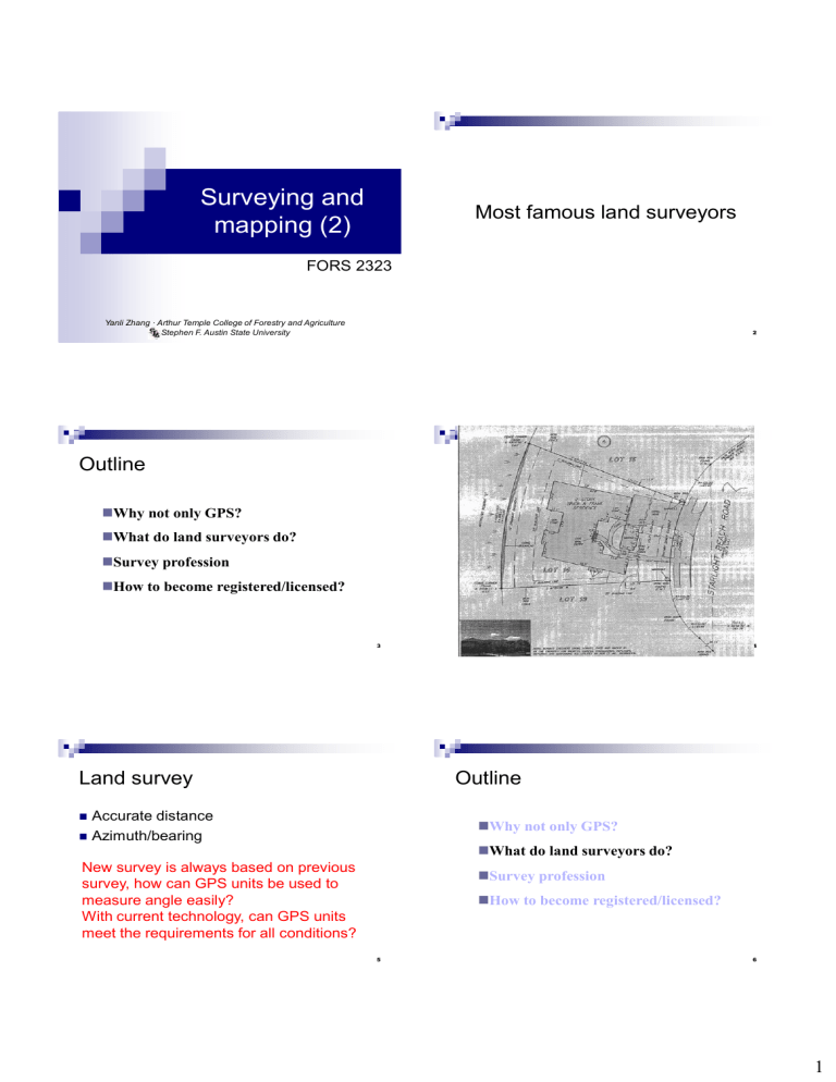
Surveying and mapping (2) Most famous land surveyors FORS 2323 Yanli Zhang · Arthur Temple College of Forestry and Agriculture Stephen F. Austin State University 2 Outline ◼Why not only GPS? ◼What do land surveyors do? ◼Survey profession ◼How to become registered/licensed? 3 Land survey 4 Outline Accurate distance ◼ Azimuth/bearing ◼ ◼Why not only GPS? ◼What do land surveyors do? New survey is always based on previous survey, how can GPS units be used to measure angle easily? With current technology, can GPS units meet the requirements for all conditions? ◼Survey profession ◼How to become registered/licensed? 5 6 1 7 TSPS Youtube channel ◼ 8 Outline ◼Why not only GPS? https://www.youtube.com/user/TSPSTX ◼What do land surveyors do? ◼Survey ◼ What is Survey ◼ Survey history ◼ Survey classification ◼ Types of survey ◼How to become registered/licensed? 9 What is surveying 1? ◼ 10 What is surveying 2? Surveying, which is also interchangeably called geomatics, has traditionally been defined as the science, art, and technology of determining the relative positions of points above, on, or beneath the Earth's surface, or of establishing such points. 11 ◼ Surveying (geomatics) is a discipline that encompasses all methods for measuring and collecting information about the physical earth and our environment, processing that information, and disseminating a variety of resulting products to a wide range of clients. (Elementary Surveying, Charles D. Ghilani and Paul R. Wolf) 12 2 13 History of surveying 1 ◼ 14 History of surveying 2 The Egyptian land register (3000 BC). ◼ ◼ ◼ ◼ A recent reassessment of Stonehenge (c. 2500 BC) suggests that the monument was set out by prehistoric surveyors using peg and rope geometry. The Groma surveying instrument originated in Mesopotamia (early 1st millennium BC). Under the Romans, land surveyors were established as a profession, and they established the basic measurements under which the Roman Empire was divided, such as a tax register of conquered lands (300 AD). The rise of the Caliphate led to extensive surveying throughout the Arab Empire. Egyptian rope stretchers. (From “Discovering Geometry: An Inductive Approach,” M. Serra, 1997) 15 History of surveying 3 ◼ ◼ ◼ 16 Survey classification 1 In England, The Domesday Book by William the Conqueror (1086) Continental Europe's cadastre was created in 1808 Founded by Napoleon I (Bonaparte) Contained numbers of the parcels of land (or just land), land usage, names etc., and value of the land 100 million parcels of land. ◼ Survey classification is based on the assumption on which the computations are based. Geodetic ◼ TX survey is derived from the Spaniard. Plane ◼ Source: http://en.wikipedia.org/wiki/Surveying 17 Surveying "In geodetic surveying, the curved surface of the Earth is considered by performing the computations on an ellipsoid (curved surface approximating the size and shape of the Earth)" Surveying "In plane surveying, except for leveling, the reference base for fieldwork and computations is assumed to be a flat horizontal surface. The direction of a plumb line (and thus gravity) is considered parallel throughout the survey region, and all observed angles are presumed to be plane angles.” 18 3 Federal Geodetic Control Subcommittee Survey classification 2 ◼ Geodetic surveying ◼ National boundaries and control networks Higher accuracy required than plane surveying ◼ ◼ Plane surveying Measurements and computations are assumed to be on a flat horizontal surface. Simplifies computation ◼ On a line 5 miles long, the ellipsoidal arc and chord lengths differ by only about 0.02 ft Under Federal Geographic Data Committee. The Federal Geodetic Control Subcommittee (FGCS) exercises government wide leadership in coordinating the planning and execution of geodetic surveys, in developing standards and specifications for these surveys, and in the exchange of geodetic survey data and technical information. FGCS coordinates agency responsibilities which include standards setting, testing new geodetic instrumentation and operational systems, coordination of user agency requirements, and dissemination of government data to user agencies. 19 NGS 20 Plane surveying ◼ 5 measurements Horizontal distances distances Slope distances Vertical ◼ Mission: The Mission of NOAA's National Geodetic Survey (NGS) is "to define, maintain and provide access to the National Spatial Reference System to meet our nation's economic, social, and environmental needs.". Horizontal Vertical angles (zenith) angles 21 22 Surveyor ◼ A surveyor is a professional person with the academic qualifications and technical expertise to conduct one, or more, of the following activities: to determine, measure and represent land, three-dimensional objects, point-fields and trajectories; to assemble and interpret land and geographically related information, to use that information for the planning and efficient administration of the land, the sea and any structures thereon; and, to conduct research into the above practices and to develop them. 23 http://www.nsps.us.com/page/TaskForce 24 4 Specialized types of surveys 1 ◼ Specialized types of surveys 2 Control survey ◼ Establish a network of horizontal and vertical monuments that serve as a reference framework for initiating other survey. Geodetic survey ◼ Land, boundary and cadastral survey Establish property lines and property corner markers Hydrographic survey ◼ Construction survey ◼ Topographic survey Provides line, grade, control elevations, horizontal positions, dimensions, and configurations for construction operations. They also secure essential data for computing construction pay quantities. 26 Determine locations of natural and artificial features and elevations used in map making. 25 Specialized types of surveys 3 Outline Alignment survey ◼ As-build survey ◼ ◼Why not only GPS? Documents the precise final locations and layouts of engineering works and record any design changes that may have incorporated into the construction. These are particularly important when underground facilities are constructed. Mine survey ◼ Solar survey ◼What do land surveyors do? ◼Survey profession ◼How to become registered/licensed? ◼In general ◼ ◼In TX 27 28 In general FS exam Field experience ◼ PS exam ◼ ◼ https://pels.texas.gov/downloads/ExamAnnouncement1222.pdf 29 30 5 In TX ◼ FS and PS exam ◼ FS exam Meaning Fundamentals https://pels.texas.gov/sit.htm Principles Field experience ◼ PS exam ◼ Texas Specific Surveying Exam (TSSE) ◼ ◼ Organized by NCEES The National Council of Examiners for Engineering and Surveying A national nonprofit organization dedicated to advancing professional licensure for engineers and surveyors. It develops, administers, and scores the examinations used for engineering and surveying licensure in the United States. https://pels.texas.gov/lsexams.htm 31 TX PELS of Surveying exam and Practice of Surveying exam 32 Become a professional surveyor ◼ Merge of Texas Board of Professional Engineers and the Texas Board of Professional Land Surveying in 6.2019 ◼ Texas Board of Professional Engineers and Land Surveyors ◼ While each state licensing board has its own laws regarding surveying licensure, here is the general process for licensure candidates: 1. 2. 3. 4. 5. 33 Complete the appropriate level of education. Check your state’s requirements: some require only a high school diploma, while many others require a degree from an accredited fouryear surveying program. Pass the FS exam (also known as SIT exam). Gain acceptable work experience (typically four years). In most cases, this must be completed under the supervision of a licensed surveyor. Pass the PS exam Pass the TSSE (TX specific). http://ncees.org/licensure/ 34 SIT ◼ Surveyor in Training certification If you are interested in land surveying, the Surveyor in Training (SIT) certification is the beginning point which allows you time to obtain additional education and/or experience as you move towards licensure as a Registered Professional Land Surveyor (RPLS). You must qualify, and be approved by the Board, to take the exam. SIT certification is valid for 8 years and can be renewed annually after this period. Cannot prepare survey reports or sign and seal surveys 35 ◼ https://pels.texas.gov/sit.htm 36 6 SIT qualification options 1. 2. 3. 4. 5. hold a Bachelor of Science in surveying; hold a Bachelor’s degree with 32 hours in civil engineering, land surveying, math, photogrammetry, forestry, land law or the physical sciences and one year of experience working under a RPLS; hold an Associate’s degree in surveying and have two years of experience working under a RPLS have 32 hours in land surveying courses and two years of experience working under a RPLS; or graduated from high school, have four years of experience working under an RPLS, and can prove you are self-educated in land surveying. https://pels.texas.gov/sit.htm 37 Application 38 Course list ◼ 32 hour course work 39 https://pels.texas.gov/downloads/surveying/sit/SITApplication.pdf Civil Engineering Math Photogrammetry Forestry Land Law Business Physical Science Computer Science Cartography Technical writing Ethics Surveying 40 FS exam ◼ https://pels.texas.gov/downloads/surveying/sit/Approved-Courses-Check-List.pdf 41 Link https://ncees.org/surveying/fs/ 42 7 FS exam 43 44 PS ◼ PS is organized by NCEES ◼ Registration and authorization https://ncees.org/exams/ps-exam/#texas Hold a current Texas Surveyor-in-Training (SIT) certification and have passed the NCEES FS exam. Be approved to sit for the PS exam through an approved RPLS application. Hold a current Texas RPLS registration (taking PS exam for records purposes). 45 https://ncees.org/wp-content/uploads/2022/09/PS-Jan2019_CBT_final.pdf 47 https://pels.texas.gov/lsexams.htm 46 48 8 49 50 TSSE ◼ TSSE TSSE exams will be offered 3 times per year (Spring, Summer, and Fall). All applications submitted before the application deadline will be considered for approval to sit for the exam. Once you have been notified that your application has been approved for exams, you can register. You will need to submit the TSSE Payment Submission Form with your $75 exam fee to TBPELS. https://pels.texas.gov/lsexams.htm 51 52 In general FS exam ◼ Field experience ◼ PS exam ◼ 53 54 9 Next level: LSLS ◼ ◼ Texas General Land Office Licensed State Land Surveyor Study guide ◼ www.glo.texas.bov Acts, Rules and boards Laws, Statues and codes ◼ Gammel’s Laws of Texas ◼ Texas constitution Spanish and Mexican Land Titles ◼ Vernon’s Annotated Texas Statutes ◼ Texas Natural Resources Codes ◼ ... Land Surveying practice 55 56 CST program (national level) ◼ Certified Survey Technician Provides a career ladder for technicians credentials to technicians Provides a standard way for employers to evaluate capabilities of prospective applicants Can be used as an assessment tool in conjunction with survey education programs Other tracks Provides http://www.nsps.us.com/index.cfm?fuseaction=Page.viewPage&pageId=527&st opRedirect=1 57 58 59 60 10 TSPS 61 62 63 64 65 66 TSPS Useful links: ◼ https://beasurveyor.com/ 11 Scholarship https://www.tsps.org/page/scholarships 67 68 Summary ◼Why not only GPS? ◼What do land surveyors do? ◼Survey profession ◼How to become registered/licensed? 69 12


