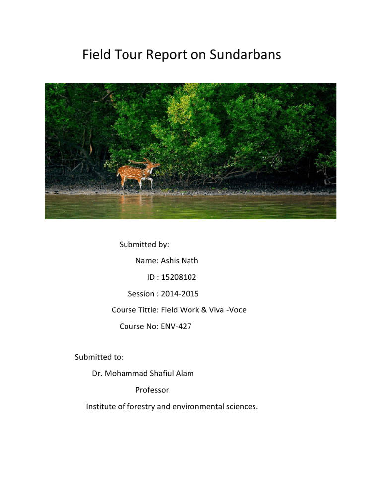
Field Tour Report on Sundarbans Submitted by: Name: Ashis Nath ID : 15208102 Session : 2014-2015 Course Tittle: Field Work & Viva -Voce Course No: ENV-427 Submitted to: Dr. Mohammad Shafiul Alam Professor Institute of forestry and environmental sciences. In 5th January our class teacher Dr. Mohammad Shafiul Alam ensured that, we the students of 8th semester go to Sundarbans for our last academic tours. IFESCU academic committee decided and fixed date from 9th February to 14th February for this tour. We the students both 7th and 8th semesters along participated in this tour. Five respected faculty members were along with us. They are : • • • • • Professor Dr. Mohammed Kamal Hossain Professor Dr. Md. Aktar Hossain Associate Professor Dr. S.M. Mijan Uddin Assistant Professor Dr. Shyamal Karmakar Lecturer Morgubatul Jannat. Date and Schedules: 9th February (Day 1): ➢ 06:30 am: Started our journey from IFESCU ➢ 09:30 pm: Reached in Khulna ➢ 12:00 am: Started our journey to Sundarban by Launch MV Rajdhani 10th February (Day 2): ➢ 11:45 am: We entered Supati forest ➢ 4:15 pm: Dimer Char 11th February (Day 3): ➢ 8:00 Am: Kochikhali ,Chonkhola, Badamtola beach, Jamtala beach. ➢4:00 pm: Kotka forest 12th February (Day 4): ➢10:00 am: Hiron point 2:30 pm: Alurkol. 13th February (Day 5): ➢ 7:15am: Harbaria Eco-tourism Center ➢2:00 pm: Karamjol Eco-tourism center ➢ 06:00 pm: Started our journey to Chittagong. 14th February : 7:30 am we reached Chittagong. Objectives of the study: The study gave prior emphasis on introducing the students to different ecologically important areas and different types of environment, natural diversity and resources in Bangladesh. Objectives of the study were: ▪ To assess the ecological condition of Sundarban and Kuakata sea beach. ▪ To find the present status of the selected region. ▪ To know about the available flora & fauna. ▪ To get the possible strategy for conserving the resources and biodiversity. ▪ To know the present condition of the sea beach. ▪ To know the benefits of these resources obtained by the people. Figure: Map of Sundarbans Introduction: The Sundarbans is the largest single block of tidal halophytic mangrove forest in the world. The name Sundarban can be literally translated as “beautiful jungle” or “beautiful forest” in the Bengali language (Sundar, “beautiful” and ban, “forest” or “jungle”). The name may have been derived from the Sundari trees that are found in Sundarbans in large numbers. Alternatively, it has been proposed that the name is a corruption of Samudraban . But the generally accepted view is the one associated with Sundari trees. Sundarbans is the largest productive contiguous mangrove forest in the world, located in the south-western part of Bangladesh. The Sundarbans mangrove have been in a state of progressive deterioration since the 1970s. The Sundarban Reserve Forest (SRF), which constitute the core area of the World Heritage Site. It became inscribed as a UNESCO world heritage site in 1997. The mangrove-dominated Ganges Delta – the Sundarbans – is a complex ecosystem comprising one of the three largest single tract of mangrove forests of the world. Shared between two neighboring countries, Bangladesh and India, the larger part (62%)is situated in the southwest corner of Bangladesh. To the south the forest meets the Bay of Bengal; to the east it is bordered by the Baleswar River and to the north there is a sharp interface with intensively cultivated land. The natural drainage in the upstream areas, other than the main river channels, is everywhere impeded by extensive embankments and polders. The Sundarbans was originally measured (about 200 years ago) to be of about 16,700 km². Now it has dwindled to about 1/3 of the original size. The total land area today is 4,143 km² (including exposed sandbars: 42 km²) and the remaining water area of 1,874 km² encompasses rivers, small streams and canals. Rivers in the Sundarbans are meeting places of salt water and freshwater. Thus, it is a region of transition between the freshwater of the rivers originating from the Ganges and the saline water of the Bay of Bengal . The Sundarbans along the Bay of Bengal has evolved over the millennia through natural deposition of upstream sediments accompanied by intertidal segregation. The physiography is dominated by deltaic formations that include innumerable drainage lines associated with surface and subaqueous levees, splays and tidal flats. There are also marginal marshes above mean tide level, tidal sandbars and islands with their networks of tidal channels, subaqueous distal bars and proto-delta clays and silt sediments. The Sundarban’s floor varies from 0.9 m to 4.0 m above sea level. The mangrove vegetation itself assists in the formation of new landmass and the intertidal vegetation plays an important role in swamp morphology. The activities of mangrove fauna in the intertidal mudflats develop micro morphological features that trap and hold sediments to create a substratum for mangrove seeds. The morphology and evolution of the eolian dunes is controlled by an abundance of xerophytes and halophytic plants. Creepers and grasses and sedges stabilizes sand dunes and uncompacted sediments. The Sundarbans mudflats are found at the estuary and on the deltaic islands where low velocity of river and tidal current occurs. The flats are exposed in low tides and submerged in high tides, thus being changed morphologically even in one tidal cycle. The interior parts of the mudflats are magnificent home of luxuriant mangroves. Area and Location: The Sundarbans, the single largest chunk of productive mangrove forest in the world, is located in the estuary of the river Ganges, spanning an area of about one million hectares in south-west Bangladesh in the district of Bagherhat, Khulna, Satkhira and south-western part of India. It occupies an area between longitudes 89°00’E & 89°55’E and latitudes 21°30’N & 22°30’N. The western boundary of Sundarban follows the Hariabangha-Raimangal-kalindi rivers and about with the Indian Sundarbans. To the south the forest meets the Bay of Bengal and the approximate ̋ Curtis line ̏ and the national boundary line; to the east it is bordered by the Baleswar river and to the north there is a sharp interface with intensively cultivated land, all of which is intersected by a tidal rivers and canals. There are four range in Sundarban. These are: 1.Khulna 2. Smoronkhola 3. Satkhira 4. Bagerhat Various Point in Sundarban: There are 13 tourist point in Sundarban. These are ▪ Karamjol ▪ Hiron point ▪ Katka ▪ Nilkomol ▪ Harbaria ▪ Smoronkhola ▪ Tiger Point ▪ Dobeki ▪ Kodomtola ▪ Notabeki ▪ Haldibunia ▪ Dubla Char ▪ Akram Point This forest have 3 wildlife sanctuaries. These are1. Sundarbans East Wildlife Sanctuary 2. Sundarbans West Wildlife Sanctuary 3. Sundarbans South Wildlife Sanctuary Apart from these, Sundarbans have two exclusive dolphin sanctuary. Working circles Of Sundarban: 1.Sundari working circle 2. Gewa working circle 3.Keora working circle 4. Goolpata working circle 5.Firewood working circle 6.Wildlife and ecotourism working circle 7.Fisheries resources working circle 8.Mixed working circle Mangrove species characteristics: 1. Pneumetaphore 2. Root penetration 3.Salt gland 4. Muddy sediment 5.Viviparous germination 6.Leaf succulent 7. Selective ion transport 2nd Day of Sundarbans: Supati Forest and Dimer Char Key information that were delivered by our respected teachers and we recorded in our diary in several days during our tour: • • • • Dhangmari Gate —Entry of Sundarban Mangrove silviculture —BFRI (Mangrove Division) Rivers -450 Length of all rivers 12000 km Rupsha (khulna) Poshur (Mongla) World Mangrove position—7th • Total area —10000 sq km Bangladesh—6017 sq km (62%) • India—3083 sq km (38%) Age —Sundarbans mangrove (7000 years), Chakaria sundarbans (10.000 years, 8510 ha area, declared 1903) Name Name Species number Plants Mammal Reptile Fish Bird Amphibians 334 49 87 300 355 14 Approximate Numbers Tiger 114 Deer 1-1.5 lakhs Monkey 20-25 thousands Wild boar 20-22 thousands Crocodile 160-180 Dolphin 190-200 Red mangrove: Rhizophorus Black mangrove: Sundari„ Baen White mangrove : Gewa World 31% Forest (4 billion hector) World 114mangrove species 66 genus, 43 families) Bangladesh — (68-69 ) mangrove species Royal Bengal Tiger survey 2004— UUDP —440 tigers 2006—200 tigers (not published camera trial) 2010—140450) tigers (FDand wildlife trust of 2016—114tigers (mark camera trial) Others animals: Mammals—49 species Reptile —87 species Fish -300 species Bird -350 species Amphibians— 14 species Total —505 species overall People dependent: 30-35 lakh Annual value of Sundarbans: 7115.20 M/USD) or 56921 crore taka (1 year) Ecological critical area: around 10 km of sundarbans 13 no ECA —Sylhet river 14 no ECA - Halda river Per hector Sundari tree: 1959 year—296 ha trees—Sundari 211 pieces per ha 1983 year—180 ha trees—Sundari 125 pieces per ha 1996 year—144 ha trees—Sundari 106 pieces per ha 2020 year—109 ha trees—Sundari go pieces per ha Area of Sundarbans by FAO in Bangladesh: 1841—9279 sq km 2015—5467 sq km(FAO) Succession- 2 types In the south-west region, along the upper catchment area of the rivers in the Sundarbans more than 41 polders have been constructed; n-ninly to control salinity and high tide intrusion into the agricultural fields. NCC: Non cover crop area Salinity types: Strong saline—more than 35 ppt Moderate saline-- 2-4 ppt Fresh saline -- less than 2 p pt • • 1991 Cyclone 4 billion taka loss 15 November,2007 (Sidr)— • Affected families 2,064,026 • Affected persons 81923259 • Dead people 3,363 • Injured people55,282 • Missing people 871 Damaged houses Damage to crops in hectare I518492 Damage to trees 4,065316 Total livestock dead 2634609 Damage to educational Institutions (full & partial) 16,954 Damage to road (complete & partial) in km 8075 Damaged embankment (km) 1,875 Damage to bridges and culverts 1;687 Elevation area are depending on sea level rise: Elevation area level rise Less than 50cm 2.83% .5m-1m 10.49%1m-1.5m 20.33%1.5m-2.0m 28.79%2m-2.5m 22.884 2.5m-3m 10.44%3m-3.5m 2.94% 3.5m-4 m .8% More than 4 m Field Visit Description: ( 2nd DAY) SUPATI FOREST: We went to the Supati on 10th February by crossing Shela River. Here, station officer Mohammad Alamgir Hossain gave us a briefing about Supati range which is in Sharankhola. There were two patrol post (Shapla & Chandeswar). We saw some species of flora and fauna both. This spot was prohibited for fishing and other illegal activities. The station offiecer along with 5 boatman and 1 forest guard is the all in all manpower of this range. We saw some pugmarks of Panthera tigris tigris in the forest. There was pond of freshwater and some inland species were also introduced alongside the pond. DIMER CHAR: After the launch, we went to the Dimer Char by boat. Here at first, we crossed the beach and saw a lot of solid waste which was very much surprised for us as we didn’t expect to see them. Then, we crossed some canals which were muddy and some marshy sun grass land. Here we saw that keora was rotated by geoa. We also saw some wild boars, spotted eagle, deers etc. Figure: Supati Forest 3rd Day of Sundarbans (Kachikhali, Kotka Jamtola beach, Kotka wildlife sanctuarv): Gewa- slow growing species Eat- wild bore One island: Dimer chor Forest department tried to establish agricultural crops but failed for inundation • kotka jamtola Beach area Dominant species: Goran Other species: Nunia, Jhau, Keora„ Gewa, Tiger farns, Hetal, Sundari 3 Portions 40-50% velocity loss—around 50 km belt SuMarban N.S approx.. 80 km 55 compartment (Bangladesh), 20 compartment (lndia) 3 wildife sanctuary : Sundarban East (Kotka, Kachikhali, Sumoti) 31227 ha Sundarban west (Nilkamol,Duberki)36971 ha Sundarban west (Lotabeki Mundorbari» Pushpokhali), 71502 ha Animals: Tiger, deer, bore, monkey AlurkoI: famous for dry fish Bay of gengal: 1 lakh km squarer gangladesh rights 664 km gangladesh, Thailand, Srilankaj India Fish caught in bay of Benga : Total fish: 80 lakh tons, Bangladesh caught 1 lakh ton only Blue economy- based on sea resources Proposed park: N-E of coxsbazar Dolphin sanctuary 2 Collection of Hetal per year: 1000 m. ton Collection Of Grass year: 4700 mton Collection of Honey per year: 130 ton Shoronkhola range: Therabaka, Panir Ghat, 3holay Tasher vaban Morabhola, Charua, Chorkhali, Supathi, Shapla, Dudhmukhiy Kochikha Chadpai range: Chadpai Station; Choraputia, Amurpuniaj Gulishkhal Koromjal, Moraposhur Harbaria, Bighamari etc Dubra jela Palli: Choto ambaria, Soro ambariay Malikkhali, Marikelbaria, Meheraliy Majherkilla, KokiImuni„Ziarchoretc BLC: aoat licensescertificate 100m tk per seasons (3-4 months) 2m tk per day/launch 20 tk per student 50tk13angladesh), 350 tk (Foreigner) —with camera 10tk C&angladesh, —with no camera 400 per day guard (2 persons) gangladesh researchers (30tk) Foreign researchers (100tk) Child (10tk) Problems: Manpower, Budget, Communication, safety, image crisis etc Economic valuation: 1. Provisioning (Honey ,food) 2. Regulatory (cyclone, water cycle) 3. Supporting ( wildlife, breed'ngsite) 4. Cultural (Rashmela) Field Visit Description: ( 3rd DAY) KOCHIKHALI: We went to the Kochikhali range in the morning of 11th February. Here the range officer Mr. Sadiq Mahmud gave us so many information about the area and its surroundings. He told that this was a tiger prone area. It was also under a sanctuary. They do SMART patrol duty for reducing the illegal activities in Sundarban. Then we crossed the Chankhola Math by walking. It was a non-cover crop area and a big corridor for the wild animals of Sundarban. We saw some deers, monkeys, wild boars etc. Then we went to the Jamtala Beach. JAMTALA BEACH: We crossed the Jamtala beach by walking. Here we did some environmental works. We collected all the solid waste from the beach up to 500 m. Then we categorize the in some category and managed them. Our honorable teachers also gave us some information about the wastes and their management. There was a watch tower from where we can see the Sundarban with a greater view. KOTKA BEACH: Then we went to the Kotka range. Here we saw some deer and they were eating keora leaf and the scenario was very awesome. Then we went to the tiger tilla and saw that a deer was murdered by a Royal Bengal Tiger some hours ago. That was a mournful scene but we also understood the actual composition of Sundarbans. Then we went to the beachside to see the carbon sequestration scenario of Sundarbans. This was visible for the Sidr cyclone which took place in 2007. Then the station officer told us about the area and we came to know that it is a tourist spot also. Supati, Dimer Char, Kochikhali, Jamtala Beach, Kotka were in the Sundarban East Division. Figure: Photographs of 3rd Day (Kachikhali,Jamtala,Kotka) 4th Day Of Sundarbans (Hiron point, Dublar char): Heron point (80 km area) Ecotourism and tourist Animals: tiger, deer, monkey, monitor, crocodile, birds Plants: sundari, gewa, posur, baen, kakra, keora, shingra, goran, golpata Visitor: (October to February) Drinking water -filtration and rain water harvest Solid waste: Incineration Honey: Khalshi(white), Goran(Deep) No help— Rab, porce, coastguard Rash mela— karthik season Vegetation type in Sundarbans: (17) 1. Sundari—gewa 2. Sundari—passur 3. Sundari—passur- Kakra 4. Only gewa 5.Gewa— goran 6.Gewa—sundari 7.Only goran 8.Garan —gewa 9.Passur—keora 11. Only baen 12.Kewra 10. Possur— kakra— baen • RamsarSite: 560, land area: 411230 ha, water area: 189156 ha • Language: kolla, kalabon, Ghugu(small boat), Boro mistry,' (Tiger) Machi (robbers), barani (crossing between canal and river) • 13 char land at Dublarchar • 2 Dolphin Sanctuary Field Visit Description: (4th DAY) Hiron Point and Alurkol: At 12th February, we went to the Hiron Point which was also known as Nilkomol. We went there after observing the NAVY, the Port, and The Coastguard colony and Goran plantation. All these situated at Sundarban West Division.Here forester, Mr. Anwar Hossain told us about hiron point. He told that it was announced that Sundarban became UNESCO World Heritage Site in 1987. The area was 1,65,315 ha. There was no pass permit given and no revenue is collected. We also walked by the trail and saw a lot of flora and some faunal composition. Then after launch, we went to the Alurkol jele polli. Here, the fishermen catch fish and processed them into dry fish. In short, it can be called as fry fish industry. We saw a lot of fish and dry fish. Some students among us also bought dry fish as per their requirements. Figure : Photographs of 4th Day (Herion point and Alurkol) 5th Day of Sundarbans (Harbaria ecotourism center, Karamjal ecotourism center) • Foot trail: 2km • Tiger : 3 • Plant: Sundari» keora» baen Possur» Kakra • Animals: Deer, wild cocky rnonkey, tiger • Sundåri— Top dying • Deer, Monkey, Crocodile (Karamjal) • Romio juliet (karamjal ) • Water collection —pond Field Visit Description: (5th DAY) Harbaria Eco-tourism Center: At 13th February, the last day, we went to the Harbaria eco-tourism center which was situated at Sundarban West Division. Here we saw the top dying of sundari trees. We also came to know about the harvesting of golpata. We saw a lot of floral species. We also bought honey from Harbaria eco-tourism center. Karamjal Eco-tourism Center After Harbaria, we went to the Karamjal ecotourism center. Here, forester Mr. Anwar Hossain told us many aspects of Karamjal. Here we saw the crocodile breeding center and hatchery. We also saw monkeys and deers. We walked on a trail of 2 km and saw many trees and monkeys. There were a lot of tourists. After that, we started our journey to the Khulna City. In the midway, we saw many industries such as LPG terminal, Rampal Power Plant etc. At the evening, we started our journey to Chittagong by bus. Figure: Photographs of 5th Day.(Harbaria,Karamjal) Observed Floral and Faunal Species It is not possible to see all the species by our eyes on the short tour. The species which we observed, are given below with their local and scientific names. Floral Species: Table 1: Floral Species That we observed Local Name Hargoza Tiger Fern Amur Baen Kangkra Dagor Goran Sitki Shingra Gewa Ban Jam Scientific Name Acanthus ilicifolius Acrostichum aureum Amoora cucullate Avicennia officinalis Bruguiera gymnorrihiza Cerbera manghas Ceriops decendra Clerodendrum inerme Cynometra ramiflora Excoecaria agallocha Eugenia fruticosa Local Name Kripa Sundori Golpata Kewa Katta Hantal Khalsi Keora Garjan Jhao Dhundul Passur Scientific Name Lumnitzera recemosa Heritiera fomes Nypa fruticans Pandanus foetidus Phoenix paludosa Aegicerus corniculatum Sonneratia apetala Rhizophora mucronate Tamarix indica Xylocarpus granatum Xylocarpus mekongensis Faunal Specis Table 2: Faunal Species that we observed Local Name Tiger Wild Boars Monkey Crocodile Scientific Name Panthera tigris tigris Sus scorfa Macaca mulatta Crocodylus porosus Observed Problems 1) A lot of solid waste in almost all areas 2) Top dying of Sundari trees 3) Exploitation of resources 4) Excessive number of tourists Local Name Spotted Deer Ganges Dolphin Eraboti Dolphin Scientific Name Axis axis Platanista gangetica Delphinus capensis 5) Erosion and accresion 6) Wastes from the industries. Importance of Sundarbans The Sundarbans play an important role in the economy of the southwestern region of Bangladesh as well as in the national economy. It is the single largest source of forest produce in the country. The forest provides raw material for wood based industries. In addition to traditional forest produce like timber, fuel wood, pulpwood etc., large scale harvest of non wood forest products such as thatching materials, honey, bees-wax, fish, crustacean and mollusk resources of the forest takes place regularly. The vegetated tidal lands of the Sundarbans also function as an essential habitat, nutrient producer, water purifier, nutrient and sediment trap, storm barrier, shore stabilizer, energy storage unit and aesthetic attraction. The forest also has immense protective and productive functions. Constituting 51% of the total reserved forest estate of Bangladesh it contributes about 41% of total forest revenue and accounts for about 45% of all timber and fuel wood output of the country (FAO 1995). A number of industries (e.g. newsprint mill, match factory, hardboard, boat building, furniture making) are based on the raw material obtained from the Sundarbans ecosystem. Various nontimber forest products and plantations help generate considerable employment and income generation opportunities for at least half a million poor coastal population. Besides production functions of the forest, it provides natural protection to life and properties of the coastal population in cyclone prone Bangladesh. CONCLUSION: Study tour or field trip or practical classes always make a clear sense about theoretical knowledge. Sundarbans covers almost half of Bangladesh's total forest area. So, if we didn't have the opportunity of this tour we would be in dark about the magnificent features of mangrove forests. As a student of Environmental sciences, I am really grateful to my honorable teachers and also to my beloved institute for letting enjoy and lean about one of the most unique ecosystems of the earth. Having visited Sundarbans now our forestry knowledge level has been upgraded to a new height. Importance of Sundarbans Mangrove Forest is something that can't be understands without understanding the complex ecosystem of Sundarbans. Our most awaited tour gave us that opportunity. Now are done with visiting major forest types of Bangladesh, it was our last academic tours, I think the knowledge we gathered from this tour will help us our future professional life.
