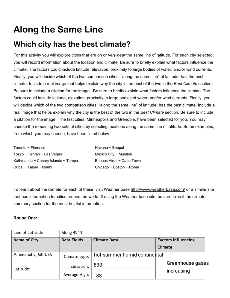
Along the Same Line Which city has the best climate? For this activity you will explore cities that are on or very near the same line of latitude. For each city selected, you will record information about the location and climate. Be sure to briefly explain what factors influence the climate. The factors could include latitude, elevation, proximity to large bodies of water, and/or wind currents. Finally, you will decide which of the two comparison cities, “along the same line” of latitude, has the best climate. Include a real image that helps explain why the city is the best of the two in the Best Climate section. Be sure to include a citation for the image. Be sure to briefly explain what factors influence the climate. The factors could include latitude, elevation, proximity to large bodies of water, and/or wind currents. Finally, you will decide which of the two comparison cities, “along the same line” of latitude, has the best climate. Include a real image that helps explain why the city is the best of the two in the Best Climate section. Be sure to include a citation for the image. The first cities, Minneapolis and Grenoble, have been selected for you. You may choose the remaining two sets of cities by selecting locations along the same line of latitude. Some examples, from which you may choose, have been listed below. Toronto ~ Florence Havana ~ Bhopal Tokyo ~ Tehran ~ Las Vegas Mexico City ~ Mumbai Kathmandu ~ Canary Islands ~ Tampa Buenos Aires ~ Cape Town Dubai ~ Taipei ~ Miami Chicago ~ Boston ~ Rome To learn about the climate for each of these, visit Weather base http://www.weatherbase.com/ or a similar site that has information for cities around the world. If using the Weather base site, be sure to visit the climate summary section for the most helpful information. Round One: Line of Latitude Along 45°N Name of City Data Fields Climate Data Factors Influencing Climate Minneapolis, MN USA Latitude: Climate type: hot-summer humid continental Elevation: 830 Average High: 83 Greenhouse gases increasing Longitude: Average Low: Precipitation: Type of Precipitation: Average days of precipitation: Line of Latitude Along 45°N Name of City Data Fields 23 1% snow and rain 100 days Climate Data Factors Influencing Climate Climate type: Grenoble, France Elevation: 696 Average High: 75 Latitude: Longitude: Temperate Average Low: Precipitation: Type of Precipitation: Average days of precipitation: 45 0% Rain and snow 3.2 months Image of City: Best Climate Award goes to: Minneapolis Reason: Decent weather with cool summers Cite the source for the image above: https://commons.wikimedia.org/wiki/File:Minneapolis_ SkyLine.jpg Round Two: Line of Latitude Along Name of City Data Fields Climate Data Factors Influencing Climate Miami Climate type: Latitude: 25.7617° N, 88 Average Low: -80.191788 Precipitation: Type of 63 18% Rain and Drizzle and Hurricanes Precipitation: Average days of precipitation: Line of Latitude Along Name of City Data Fields Close to equator 6.5 Elevation: Average High: Longitude: Tropical Monsoon Climate 129 Climate Data Factors Influencing Climate Dubai Latitude: Longitude: Climate type: hot desert climate close to equator Elevation: 25.2 52 ft Average High: 100 Average Low: 58 55 Precipitation: Type of 0% Thunderstorms rainfall and drizzle Precipitation: Average days of precipitation: 57 Image of City: Best Climate Award goes to: Dubai Reason: Warm summers Cite the source for the image above: https://www.google.com/search? q=dubai&safe=active&rlz=1CAEOEW_enUS978&tbm=isch&source=iu&ictx=1&vet=1&fir=LZ MK2uPHMuT3aM%252C_vmlVSjTGg1ocM%252C%252Fm%252F01f08r&usg=AI4_kSlWPUK2bGGOp170zNRqm69ba9bg&sa=X&ved=2ahUKEwiU8vC84O75AhVxm2oFHbiyBdUQ_B16BQiGARAB#im grc=LZMK2uPHMuT3aM Round Three: Line of Latitude Along Name of City Data Fields Climate Data Factors Influencing Climate Chicago Latitude: Climate type: 41 Longitude: 87 continteal Elevation: 597 Average High: 90 Average Low: Precipitation: Type of The sun and Lake michigan 27 20% Snow rain thunderstorms drizzle Precipitation: Average days of precipitation: Line of Latitude Along Name of City Data Fields 106 Climate Data Factors Influencing Climate Boston Climate type: Elevation: continental 141 Latitude: Longitude: Average High: 76 lack of sunlight Average Low: Precipitation: Type of Coastal flooding and 29 1% snow rain hail thunderstorms Precipitation: Average days of precipitation: 130 Image of City: Best Climate Award goes to: CHicago Reason: Cool winters with warm summers Cite the source for the image above: https://www.google.com/search? q=chicago+++%5C&safe=active&rlz=1CAEOEW_enUS978&tbm=isch&source=iu&ictx=1&vet= 1&fir=3IIiviAwG07EQM%252CcvHK8Thxf5L-4M%252C%252Fm%252F01_d4&usg=AI4_kSiVylZNVVjA4BqRz_IFWY8iPqJsg&sa=X&ved=2ahUKEwiP8_rT4e75AhXtmWoFHVPPCw8Q_ B16BQiRARAB#imgrc=3IIiviAwG07EQM Take-away: Although climate is a significant factor, it is NOT the only factor that influences a region’s climate.


