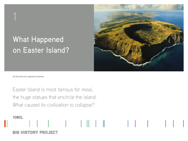
1 What Happened on Easter Island? By David Burzillo, adapted by Newsela Easter Island is most famous for moai, the huge statues that encircle the island. What caused its civilization to collapse? 1080L Introduction In the spring of 1722, Dutch explorers landed on Easter Island. Upon arrival, they found a most puzzling and fascinating sight – hundreds of massive stone statues were all over this tiny island. What are they? What do they mean? Why are they placed where they are? How did they get there? The huge stone figures of Easter Island have fascinated explorers, researchers, and just about anyone who has seen them for hundreds of years. In spite of many years of research, scholars still don’t agree on the answers to the puzzle of the statues. Even more intriguing, perhaps, are the questions surrounding the rise and fall of the population that built them. Easter Island, which native Polynesians call Rapa Nui, is located in the eastern Pacific Ocean. Today it is part of Chile, where it is called Isla de Pascua. The island is more than 2,000 miles from nearly all its neighbors. Easter Island is 700,000 years old, which is fairly young for an island. It was formed by volcanic activity, and now its landscape is dominated by three dormant volcanoes. The island is very small—around 60 square miles. This makes it less than one tenth the size the Hawaiian island of Maui, or just about the size of Gainesville, Florida. Location of Easter Island in the southeastern Pacific Ocean BIG HISTORY PROJECT Scholars do not agree on when people first settled on Easter Island. The first arrived by boat sometime between 300 and 800 CE. These settlers probably rowed there from a Polynesian island about 4,000 miles away. They brought bananas, taro, sugarcane, chickens, and rats with them, adding to the natural life already on the island. Today, Easter Island is home to over 7,600 people1 and attracts over 100,000 tourists a year2. Why is Easter Island so fascinating? For such a small piece of land, Easter Island has been given a lot of attention for a long time. One source of this interest is the beauty of the island and its potential for supporting life. The Dutch ship captain Jacob Roggeveen wrote the following description of the island in 1722: Nor can the aforementioned land be termed sandy, because we found it not only not sandy but on the contrary exceedingly fruitful, producing bananas, potatoes, sugarcane of remarkable thickness, and many other kinds of the fruits of the earth; although destitute of [lacking] large trees and domestic animals, except poultry. This place, as far as its rich soil and good climate are concerned, is such that it might be made into an earthly Paradise…..3 Satellite image of Easter Island, Earth Observatory, NASA, public domain. WHAT HAPPENED ON EASTER ISLAND? 2 Anthropologists, archaeologists, and historians have been digging for clues about this fascinating place for many years, but there are no simple answers. Terry Hunt and Carl Lipo, both experts in anthropology and archaeology, took on these tough questions. In 2011, they published an article that re-created how the Easter Islanders may have been able to move the statues. Then, in January 2019, a research team including Hunt and Lipo published another article explaining the location of the statues. They suggested that the moai may have been placed in areas where fresh or brackish water was found, as a way of marking the location of this important resource4. But by far, Easter Island is most famous for the moai. The moai (pronounced moe-eye or mah-eye) are huge statues that encircle the island. These enormous statues of elongated faces are so popular there is even a moai emoji. There are between 887 and 1,000 moai on Easter Island. The largest are 33 feet high and weigh as much as 80 tons. Most of them are located miles from the quarries that provided the stone for them. The size, number, and location of the moai raise a number of questions that scholars have puzzled over for many years. How did the people carve these statues without metal tools? How did they move them without the help of large animals? What purpose did they serve for the islanders? Exciting answers (or at least theories) are still being published, and the many questions about Easter Island will probably continue to inspire research across many disciplines. In recent years, researchers have also begun to ask questions about the history of environmental change and population decline on the island. These changes are represented in the following two charts. Moai at Rano Raraku, Easter Island, by Aurbina, Public Domain. What were the causes of the changes represented in these graphs? How could such changes have happened to an island with such an isolated but advanced society? Detailed topographic map in Spanish of Easter island, by Eric Gaba, translation Osmar Valdebenito, CC BY-SA 2.5 BIG HISTORY PROJECT WHAT HAPPENED ON EASTER ISLAND? As they’ve explored these questions, historians, archaeologists, and botanists have uncovered evidence. Some of this evidence is in the form of written documents. Some is in the form of artifacts and other material remains. Historians have studied the accounts of the first European visitors to the island. These impressions that people 3 wrote when they first came ashore to this new and intriguing place provide information about what the island was like hundreds of years ago. Archaeologists have uncovered artifacts and excavated the remains of buildings from ancient settlements. A variety of scientists have studied the plants, animals, and geology of the island. Easter Islanders did have a form of writing, called rongorongo, but scholars have not yet discovered a way to read this writing. Easter Islanders may have written about the challenges they faced, but we may never know what they thought. How have scholars explained the environmental and population changes on Easter Island? Some scholars place the blame for changes on the island on humans. Geographer Jared Diamond illustrates this somewhat controversial opinion: In short, the reason for Easter’s unusually severe degree of deforestation isn’t that those seemingly nice people really were unusually bad or improvident [careless]. Instead, they had the misfortune to be living in one of the most fragile environments, at the highest risk for deforestation, of any Pacific people…. Easter’s isolation makes it the clearest example of a society that destroyed itself by overexploiting [overusing] its own resources5. Many of the explanations that blame humans for these problems have focused on the issue of the overuse of the resources available on Easter Island. Deforestation (removal of trees) is the primary cause in these explanations. Easter Islanders cut down trees for a variety of purposes. Trees were probably used to move the moai. Trees also provided the materials for making rope. People also used trees for fuel. Terry Hunt, the anthropologist/archaeologist mentioned earlier, has found that “Between 1300 and 1650…inhabitants burned wood from trees, but they used grass, ferns and other similar plants for fuel after that point.”6 This tells us that deforestation was underway by the time Europeans arrived. the island’s large rat population. Rats did not have many competitors and their population could grow rapidly. Rats were big consumers of palm nuts, the seeds for growing trees on Easter Island. Hunt and Lipo write, “It takes several years for the tree to form a trunk and sixty or more years to produce seeds. With rats consuming so many of the palm nuts, as the record suggests, few trees could regrow naturally.”8 Many researchers have focused on the impact of diseases brought by European visitors to the island. Because Easter Island is so remote, it had very little contact with other human communities for hundreds of years. The people there developed no immunity to the diseases brought by Europeans. As a result, sickness would have spread quickly. Hunt and Lipo point out that the Europeans were probably unaware of the enormous effect disease would have had on the island’s population. They write that Captain Cook and his men, who visited the island around 1770, “were perplexed by the small population size, what they perceived as poverty, and generally the disheveled [messy] state of things; in hindsight, this is precisely what the aftermath of an epidemic and population crash would look like.”9 Conclusion Scholars from many disciplines continue to study Easter Island in an attempt to understand how it changed over the centuries, and in particular how humans were affected by or caused these changes. The moai are a stunning visual reminder of the deeper mysteries that surround the island and its inhabitants. Perhaps those statues are the perfect guarantee that scholars will continue trying to understand how and why the population of this remote corner of the world developed as it did. Some researchers argue that trees were cut down using a method known as “slash and burn” to create more farmland. One research team found “a single layer of charcoal and ashes several millimeters in thickness can be found deep below the recent surface…. The extensive distribution of charcoal layers can only have one explanation: widespread fires in the woodland of Rapa Nui…. the beginning of intensive slash and burn….”7 Other experts have focused more on the role of environmental factors in the changes on Easter Island. Some of these researchers, including Hunt and Lipo, have focused on BIG HISTORY PROJECT WHAT HAPPENED ON EASTER ISLAND? All 15 standing moai at Ahu Tongariki, excavated and restored in the 1990s, by Bjørn Christian Tørrissen, CC BY-SA 3.0. 4 Endnotes Cover image 1. “Censo Todos Contamos 2017,” El Instituto Nacional de Estadísticas, 2017, Accessed 18 December 2018, https://redatam-ine.ine.cl/redbin/ RpWeb Engine. exe/Portal?BASE=CENSO_2017&lang=esp 2. Casey, Nicholas. (2018). “Easter Island is Eroding,” New York Times, Retrieved from https://www.nytimes.com/interactive/2018/03/14/climate/easter-islanderosion.html Rano Kau volcano in Rapa Nui National Park, Easter Island, Chile. © Yann ArthusBertrand / Getty Images The Voyage of Captain Don Felipe González: In the Ship of the Line San Lorenzo, with the Frigate Santa Rosalia in Company, to Easter Island in 1770-1. Preceded by an Extract from Mynheer Jacob Roggeveen’s Official Log of His Discovery of And Visit to Easter Island in 1722. Trans. and Ed. Bolton Glanvill Corney (Cambridge:Hakluyt Society, 1908), 21. Retrieved from https://books.google.com/ books?id=S9jCjUe-m2AC&printsec=frontcover&dq= jacob+roggeveen&hl=en&sa =X&ved =0ahUKEwjIlZ2mjqzfAhUJyFkKHQLtD60Q6AEINTAD#v=onepage&q=jac ob%20roggeveen&f=false 3. Hunt, Terry and Lipo, Carl. (2011). The Statues that Walked. New York: Free Press. DiNapoli, R. J., Lipo, C. P., Brosnan, T., Hunt, T. L., Hixon, S., Morrison, A. E., & Becker, M. (2019). Rapa Nui (Easter Island) monument (ahu) locations explained by freshwater sources. PLOS One 14(1). https://doi.org/10.1371/journal. pone.0210409 4. Diamond, Jared. (2005). Collapse: How Societies Choose to Fail or Succeed. New York: Penguin, 118. 5. Hunt, Terry. (2007). Rethinking Easter Island’s ecological catastrophe. Journal of Archaeological Science 34, 485-502. 6. Mieth, A., & Bork, H-R. (2009). Humans, climate or introduced rats – which is to blame for the woodland destruction on prehistoric Rapa Nui (Easter Island). Archaeological Science 37(2), 417-426. doi:10.1016/j.jas.2009.10.006. 7. Hunt and Lipo. (2011). The Statues that Walked. New York: Free Press, 49. 8. Hunt and Lipo, The Statues that Walked, 157-158 and 163. BIG HISTORY PROJECT WHAT HAPPENED ON EASTER ISLAND? Articles leveled by Newsela have been adjusted along several dimensions of text complexity including sentence structure, vocabulary and organization. The number followed by L indicates the Lexile measure of the article. For more information on Lexile measures and how they correspond to grade levels: http://www.lexile.com/about-lexile/lexile-overview/ To learn more about Newsela, visit www.newsela.com/about. The Lexile® Framework for Reading The Lexile® Framework for Reading evaluates reading ability and text complexity on the same developmental scale. Unlike other measurement systems, the Lexile Framework determines reading ability based on actual assessments, rather than generalized age or grade levels. Recognized as the standard for matching readers with texts, tens of millions of students worldwide receive a Lexile measure that helps them find targeted readings from the more than 100 million articles, books and websites that have been measured. Lexile measures connect learners of all ages with resources at the right level of challenge and monitors their progress toward state and national proficiency standards. More information about the Lexile® Framework can be found at www.Lexile.com. 5
