Geography 3053 Cartography - University of Colorado Boulder
advertisement

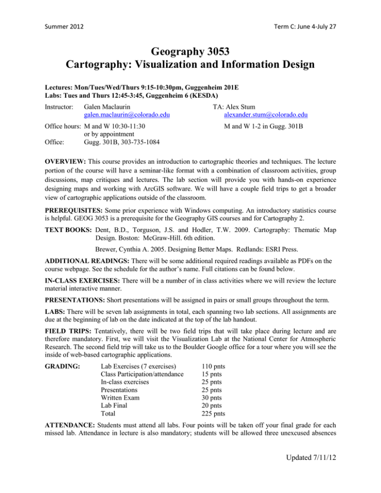
Summer 2012 Term C: June 4-July 27 Geography 3053 Cartography: Visualization and Information Design Lectures: Mon/Tues/Wed/Thurs 9:15-10:30pm, Guggenheim 201E Labs: Tues and Thurs 12:45-3:45, Guggenheim 6 (KESDA) Instructor: Galen Maclaurin galen.maclaurin@colorado.edu Office hours: M and W 10:30-11:30 or by appointment Office: Gugg. 301B, 303-735-1084 TA: Alex Stum alexander.stum@colorado.edu M and W 1-2 in Gugg. 301B OVERVIEW: This course provides an introduction to cartographic theories and techniques. The lecture portion of the course will have a seminar-like format with a combination of classroom activities, group discussions, map critiques and lectures. The lab section will provide you with hands-on experience designing maps and working with ArcGIS software. We will have a couple field trips to get a broader view of cartographic applications outside of the classroom. PREREQUISITES: Some prior experience with Windows computing. An introductory statistics course is helpful. GEOG 3053 is a prerequisite for the Geography GIS courses and for Cartography 2. TEXT BOOKS: Dent, B.D., Torguson, J.S. and Hodler, T.W. 2009. Cartography: Thematic Map Design. Boston: McGraw-Hill. 6th edition. Brewer, Cynthia A. 2005. Designing Better Maps. Redlands: ESRI Press. ADDITIONAL READINGS: There will be some additional required readings available as PDFs on the course webpage. See the schedule for the author’s name. Full citations can be found below. IN-CLASS EXERCISES: There will be a number of in class activities where we will review the lecture material interactive manner. PRESENTATIONS: Short presentations will be assigned in pairs or small groups throughout the term. LABS: There will be seven lab assignments in total, each spanning two lab sections. All assignments are due at the beginning of lab on the date indicated at the top of the lab handout. FIELD TRIPS: Tentatively, there will be two field trips that will take place during lecture and are therefore mandatory. First, we will visit the Visualization Lab at the National Center for Atmospheric Research. The second field trip will take us to the Boulder Google office for a tour where you will see the inside of web-based cartographic applications. GRADING: Lab Exercises (7 exercises) Class Participation/attendance In-class exercises Presentations Written Exam Lab Final Total 110 pnts 15 pnts 25 pnts 25 pnts 30 pnts 20 pnts 225 pnts ATTENDANCE: Students must attend all labs. Four points will be taken off your final grade for each missed lab. Attendance in lecture is also mandatory; students will be allowed three unexcused absences Updated 7/11/12 Summer 2012 Term C: June 4-July 27 during the term. After that, four points will be taken off your final grade for each additional absence. Exceptions require permission from the instructor prior to the absence. LATE POLICY: Lab assignments must be turned in to the TA at the beginning of the lab session on the date they are due. For late lab assignments, 10% will be taken off the assignment grade for each weekday they are late. There will be no make-up exams without a documented excuse. TENTATIVE SCHEDULE: We will adjust the schedule as needed during the term. Week Date 6/4 1 6/5 6/6 6/7 6/11 2 6/12 3 4 5 6 7 8 Lecture Course introduction Cartographic process and Map types Visual variables Visual variables Visual variables in ArcMap Color Readings/Resources Lab Exercise Dent 1 Dent 12 Brewer 1 Cartwright Brewer 4,5 Lab 0: ArcGIS Introduction 6/13 6/14 Color in ArcMap Scale and Resolution Dent 14, ColorBrewer Dent 2 6/18 6/19 6/20 6/21 Map Projections Map Projections Generalization Generalization Dent 3 USGS Map Projections Regnauld & McMaster Dent 9 6/25 6/26 6/27 6/28 Typography Type Placement Thematic Map Symbols Data Classing Dent 13, TypeBrewer Wu & Buttenfield Brewer 2,3 Dent 5 7/2 7/3 7/4 7/5 NCAR Field Trip (Tentative) Data Classing Fourth of July—No class! Mapping Uncertainty 7/9 7/10 7/11 7/12 Mapping Uncertainty Exam Review Exam 1 Cartograms MacEachren 7/16 7/17 Interactive Cartography Animation Display Peterson NYT Animation 7/18 7/19 7/23 7/24 Bing Maps Field Trip Mobile and Web Cartography Cognitive Mapping Participatory Mapping 7/25 7/26 ArcScene Wrap-up and Debriefing Lab 1: Intro to ArcMap Lab 2: ArcMap Layouts (Lab 1 due) Lab 3: Figure Ground (Lab 2 due) Lab 3 continued Lab 4: Terrain and Hydro (Lab 3 due) Lab 4 continued Lab 5: Transportation (Lab 4 due) Dent 6 Lab 5 continued Buttenfield Lab 6: Residuals and Choropleth (Lab 5 due) Lab 6 continued Dent 10, Cartograms Lab 7: Greyscale (Lab 6 due) Lab 7: Population & natural resources Cloudmade Lab 7: Green spaces Nietschmann Lab 7 continued (Lab 7 due at end of lab) Lab Final Updated 7/11/12 Summer 2012 Term C: June 4-July 27 READINGS Buttenfield, B. P. 2001. Mapping Ecological Uncertainty. Chapter 6 in: Hunsaker, C., Goodchild, M.F., Friedl, M. and Case, T. (Eds.) Uncertainty in Spatial Data for Ecological Analyses. New York: SpringerVerlag Cartwright, W. 2009. Art and Cartographic Communication. Chapter 1 in: Cartwright, W. (Eds.) Cartography and Art. New York: Springer Verlag MacEachren, A. M. 1992. Visualizing Uncertain Information. Cartographic Perspectives 13: 10-19 Nietschmann, Bernard. 1995. Defending the Miskito Reefs with Maps and GPS: Mapping With Sail, Scuba, and Satellite. Cultural Survival Quarterly. 18 (4): 34. Peterson, M. P. 2007. The Internet and Multimedia Cartography. In: Multimedia cartography. ed. by W. Cartwright, M. Peterson and G. Gartner. Second edition. Berlin: Springer: 35-48 Regnauld, N. and McMaster, R.B.2007. A Synoptic View of Generalisation Operators. Chapter 3 in Mackaness, W. A., Ruas, A., and Sarjakoski, L.T. (Eds) Generalization of Geographic Information: Cartographic Modeling and Applications: 37- 66 Wu, V. and Buttenfield, B.P. 1991. Reconsidering Rules for Point Feature Name Placement. Cartographica 28(1): 1-27 WEB RESOURCES “Bing Maps” http://www.bing.com/maps is Microsoft’s free web mapping tool. In its current version it has more functionality then Google Maps "Cartograms" in the course schedule refers to a web site showing cartogram animations built by Dan Dorling in 2008. See geographical space morph into a projected cartogram, as well as cartograms that morph from one time period to the next. http://www.worldmapper.org “CartoTalk” http://www.CartoTalk.com is a site which contains general discussion about cartographic methods; to which you can post questions. Professional cartographers and students from all over the world participate - a simple registration process gives you access to additional resources (online journals, new books, sample maps). “ColorBrewer” in the course schedule above refers to an excellent Web site on color theory and cartography built by Cindy Brewer, showing guidelines for designing color maps, along with specific mapped examples. http://www.colorbrewer.org “Cloudmade” is an online mapping and mobile application development framework. http://www.cloudmade.com Updated 7/11/12 Summer 2012 Term C: June 4-July 27 “ESRI Mapping Center” http://mappingcenter.esri.com/ contains an assortment of cartographic tips, articles and whitepapers, general discussion about cartographic methods, particularly but not exclusively in an ArcGIS environment. “ESRI ArcGis.com” http://www.arcgis.com is an online framework for creating simple map overlays and showing your own data on the web. “Google SketchUp!” http://sketchup.google.com/ is a simple but powerful tool to create 3D objects or any kind which can be easily displayed in Google Earth or exported in many different formats. “Google Maps” http://maps.google.com/ is the most popular free web mapping with a lot of functionality. “NYT Animation” This New York Time Immigration Explorer website provides an interactive map for browsing immigration data of the USA. http://www.nytimes.com/interactive/2009/03/10/us/20090310immigration-explorer.html “OpenStreetMap.org (OSM)” http://www.openstreetmap.org/ is a free editable map of the whole world. Everyone can contribute new data to it. It can be described as the “Wikipedia for maps”. "TypeBrewer” in the course schedule refers to a web site that lets you see the consequences of various type fonts, families, and styles on the overall map appearance. Built by Ben Sheesley in 2006. http://www.typebrewer.org “USGS Map Projection Poster” http://egsc.usgs.gov/isb/pubs/MapProjections/projections.html is a collection of all major map projection commonly used when generating maps. This website gives in depth details about major map projections without going to deep into the mathematical foundations of map projections. Updated 7/11/12 Summer 2012 Term C: June 4-July 27 Department of Geography Code of Conduct: In the Department of Geography, instructors strive to create an atmosphere of mutual trust and respect in which learning, debate, and intellectual growth can thrive. Creating this atmosphere requires that instructors and students work to achieve a classroom in which learning is not disrupted. At the most basic level, this means that everyone attend class, be prepared with readings and assignments completed, and that students pay attention. This means no conversations with friends, reading the newspaper, coming late, or leaving early. Such behavior is disruptive to the instructor and to your fellow classmates. These basics of classroom etiquette are an important means of building and showing mutual respect. Inevitably, however, disagreements will arise. Sometimes these disagreements will be about content, sometimes about grades or course procedures, and sometimes they will be about the treatment of participants in the class. In order to facilitate the resolution of these disagreements, the following guidelines should be followed by everyone: ° All interactions must be guided by mutual respect and trust. ° If you are bothered by some aspect of the class, identify what it is that is bothering you and center the discussion on that issue. ° Address issues that concern you early. Problems are easier to resolve before they fester. ° Consider whether it is best to address your concerns in class or in a separate appointment with the instructor. Remember, behavior that disrupts your fellow classmates is not acceptable. ° Abusive speech or behavior will not be tolerated in any interaction between students or between student and instructor. If an instructor feels that your speech or behavior is abusive, you will be asked to leave the room. If you believe an instructor has become abusive, you may leave the room and talk with the department chairperson. Debate and discussion can continue when all parties proceed with mutual respect. ° If mutual respect cannot be restored, either you or the instructor may take the issue to the department chairperson or the Campus Ombuds Office. Policy on Plagiarism Plagiarism is the act of using someone else's words, pictures, ideas, or procedures without proper acknowledgement, or to present them as if they originated with you. In science and especially in academics, plagiarism is unacceptable. In an exam, for example, copying from someone else's test booklet and handing it in as if it were your own work is plagiarism. In some instances it is difficult to document whether plagiarism has occurred. In other situations, particularly learning situations, it is possible that students who do not know the protocols of academic expression can inadvertently plagiarize. In some cultures, direct use of another person's words bring great honor to the quoted person. In this university, plagiarism constitutes a form of cheating, and will not be tolerated. If you are unsure whether to cite someone else's work as you work through an assignment, come talk with me about it. The Honor Code THE PLEDGE "On my honor, as a CU Boulder student, I have neither given nor received unauthorized assistance on this work." Students may be asked to include this pledge on their written assignments and tests. The full Honor Code is available for your review on line, at http://www.colorado.edu/academics/honorcode/. Updated 7/11/12


