P-Sea WindPlot II 3D Seabed option adds a whole new dimension
advertisement

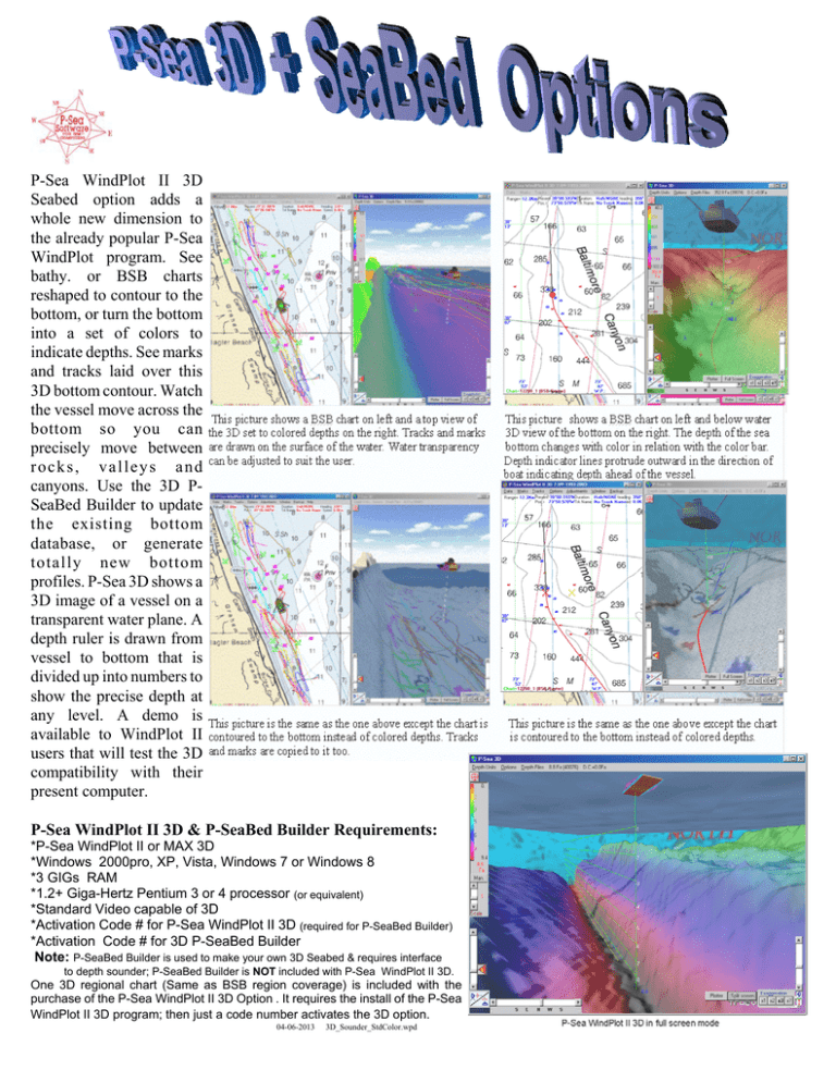
P-Sea WindPlot II 3D Seabed option adds a whole new dimension to the already popular P-Sea WindPlot program. See bathy. or BSB charts reshaped to contour to the bottom, or turn the bottom into a set of colors to indicate depths. See marks and tracks laid over this 3D bottom contour. Watch the vessel move across the bottom so you can precisely move between rocks, valleys and canyons. Use the 3D PSeaBed Builder to update the existing bottom database, or generate totally new bottom profiles. P-Sea 3D shows a 3D image of a vessel on a transparent water plane. A depth ruler is drawn from vessel to bottom that is divided up into numbers to show the precise depth at any level. A demo is available to WindPlot II users that will test the 3D compatibility with their present computer. P-Sea WindPlot II 3D & P-SeaBed Builder Requirements: *P-Sea WindPlot II or MAX 3D *Windows 2000pro, XP, Vista, Windows 7 or Windows 8 *3 GIGs RAM *1.2+ Giga-Hertz Pentium 3 or 4 processor (or equivalent) *Standard Video capable of 3D *Activation Code # for P-Sea WindPlot II 3D (required for P-SeaBed Builder) *Activation Code # for 3D P-SeaBed Builder Note: P-SeaBed Builder is used to make your own 3D Seabed & requires interface to depth sounder; P-SeaBed Builder is NOT included with P-Sea WindPlot II 3D. One 3D regional chart (Same as BSB region coverage) is included with the purchase of the P-Sea WindPlot II 3D Option . It requires the install of the P-Sea WindPlot II 3D program; then just a code number activates the 3D option. 04-06-2013 3D_Sounder_StdColor.wpd P-Sea BedBuilder Option Some of the 3D data files provided with the program are incomplete. Connect any depth sounder to P-Sea WindPlot and save depth data to your track files. Then use P-Sea BedBulder with any of the track files with depth data to rebuild the bottom as shown here. Before After Build as you go. Now you do not have to have the bottom builder to see the difference in the bottom. It requires that you have some kind of 3D charts for the area. When this feature is turned on you will see the bottom move up or down according to the depth that is fed in by a an external depth sounder. See mark color, symbol, printing, RB flags, Linked marks, Routes, Waypoints and Boundaries in 3D now. If you set marks to have something printed next to them on the screen like TD #’s you can see this on the 3D screen as well. Place mouse arrow on mark to get even more info. 3D charts sold by Regions 3D now includes new HD highdefinition areas outlined here in outlined in RED Region 17


