Badlands Master Plan presentation
advertisement

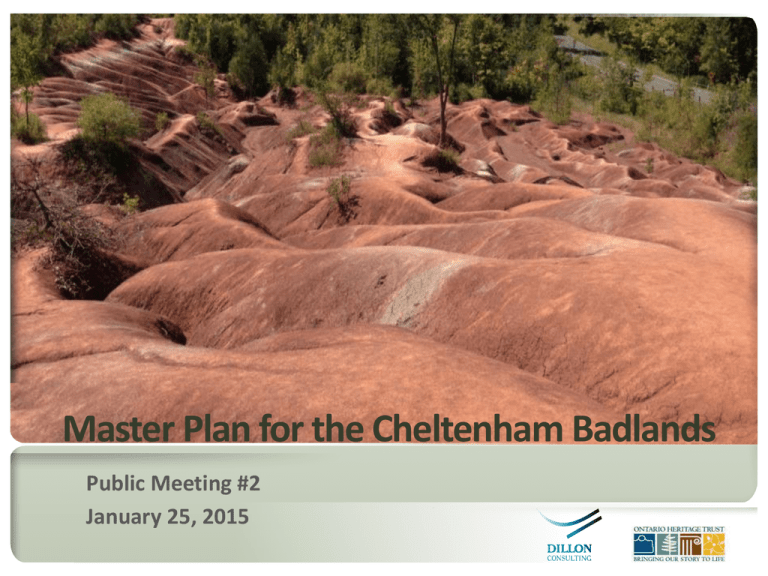
Master Plan for the Cheltenham Badlands Public Meeting #2 January 25, 2015 Master Plan for the C h e l t e nh am B a d l and s Public Meeting #2 • Sign-in / Review display boards 7 – 7:30 PM • Presentation of Stage 1 findings (Dillon/OHT) 7:30 PM – 8 PM • Questions and answers (Dillon/OHT) • Closing remarks • Open house / Complete comment forms Meeting adjourns at 9 PM 2 Master Plan for the C h e l t e nh am B a d l and s Public Meeting #2 • Public consultation update (display boards) – Online survey results; public meeting #1 input • Master Plan analysis – Review of Stage 1 report (Presentation & Display Boards) – Priority protection mapping; Key management strategies 3 Master Plan for the C h e l t e nh am B a d l and s Public Meeting #1 • Respect the moderator and each other • Be brief and to the point - allow time for others to be heard • Seek common ground and understanding • Success depends on participation • Adhere to schedule • Put away electronic devices 4 5 Inventory & Analysis Concepts Background Review Environmental Analysis Public Meeting #1 Visual Analysis Priority Protection and Enhancement Areas Public Meeting #2 Management Zones Public Meeting #3 TBD Site Concepts Master Plan Public Meeting #4 TBD Master Plan for the Cheltenham Badlands • Cheltenham Badlands fall within the Escarpment Protection Area land use designation of the Niagara Escarpment Plan. • Identified as an Escarpment Access park in the Niagara Escarpment Parks and Open Space System. • Escarpment access parks provide opportunities for public access to the Niagara Escarpment. May provide modest facilities to support day use activities at view points, scenic areas, or other points of interest. Master Plan for the C h e l t e nh am B a d l and s Public Meeting #2 (NEPOSS planning manual) Informing Mail/email notices Newspaper ads Notices at the site Website postings Social media Engaging participation One-on-one; group discussions Open houses, presentations, twoway information sharing • Site visits • Moderated on-line forums Creating partnerships Joint decision making (Planning Team) One-on-one; group discussions Meetings with local interest Survey groups (Caledon Countryside Requests for comments and Alliance on planning team, others input (online or via mail) welcome) Information gathering = used in the Master Plan process 7 Master Plan for the C h e l t e nh am B a d l and s Public Meeting #2 1. Conservation of the property’s cultural and natural heritage values. 2.Safety for all individuals who visit the site. 3.Improved accessibility for those who wish to access the site. 4.Enhanced opportunities for interpretation and public education. 8 Master Plan for the C h e l t e nh am B a d l and s Public Meeting #2 • Builds on past technical studies and site assessments, supplemented by field investigations. • Assessment of resources and management issues for: natural heritage, cultural heritage, recreation, visual resources, and visitor management. • Priority protection areas mapping & evaluation. • Recommended management zones (NEPOSS). • Development considerations to inform site concepts. 9 Master Plan for the C h e l t e nh am B a d l and s Public Meeting #2 • Uses framework of integrated natural heritage system planning, i.e. natural core areas, natural corridors. • Identifies a level of protection from 1 to 5 (highest to lowest) based on the relative significance and sensitivity of features. Applied to the features on site. • In areas of overlap, the highest Priority protection area prevailed. • Includes cultural heritage resources, recreation features (e.g. Bruce Trail), and views. • Priority protection areas will inform boundaries of management zones, uses, and management strategies. 10 Master Plan for the C h e l t e nh am B a d l and s Public Meeting #2 • Natural features that are considered to be particularly sensitive( e.g. provincially significant wetlands, cold-water streams, steep scarp face slopes. • The Badlands features were ranked Level 1 relative to other features on the site, due to their sensitive and unique characteristics. 11 Master Plan for the C h e l t e nh am B a d l and s Public Meeting #2 • High-quality natural areas that contribute essential components to the natural heritage system. • Identified Level 2 areas on the site include: - non-provincially significant wetland/marsh - watercourses and their buffers (typically 15 metres/49 feet) - habitat for species at risk 12 Master Plan for the C h e l t e nh am B a d l and s Public Meeting #2 • Similar purpose to Levels 1 and 2 but includes features that are typically more resilient. • Identified Level 3 areas on the site include: - interior forest (> 100 metres/328 feet from the edge) - critical function and habitat for provincially rare species - significant views and viewsheds - cultural heritage features (stone foundation) 13 Master Plan for the C h e l t e nh am B a d l and s Public Meeting #2 • Areas that buffer or contribute to the protection of other sensitive natural features and functions (e.g., fringe forest areas < 100m/328 feet in size), plantations, regenerating forest and shrub thickets). • On the site, these areas are overlaid by areas identified as Priority Protection Levels 2 and 3 (higher protection). Therefore, no Level 4 areas appear on the map. 14 Master Plan for the C h e l t e nh am B a d l and s Public Meeting #2 • Natural features that support broader ecological functions and species diversity (e.g., cultural meadows, agricultural fields). • There were no identified Level 5 areas on the site. 15 16 Master Plan for the C h e l t e nh am B a d l and s Public Meeting #2 • Monitors for ongoing physical, biological and social indicators. • Includes reiterative evaluation of goals. • Management re-direction is based on changing conditions, new information or changing public expectations. • Further studies and/or monitoring for species of conservation concern and species at risk may be required, depending on future uses of the property. 17 Master Plan for the C h e l t e nh am B a d l and s Public Meeting #2 Invasive species • Invasive plant species include phragmites, garlic mustard, European buckthorn. • Emerald Ash Borer infestations are present on the site. • Management via removal / replanting is needed to encourage desirable species and improve floristic diversity. • Additional assessment of invasive species locations is needed to inform a maintenance and monitoring regime. 18 Master Plan for the C h e l t e nh am B a d l and s Public Meeting #2 Species of conservation concern /species at risk • Are present on the site and considered within the evaluation and ranking of Priority Protection Areas. • Further site-specific assessments may be needed if future development is proposed (e.g., trails) which has the potential to impact the species or their habitat. • Ongoing monitoring will be an important component of a management plan. 19 Master Plan for the C h e l t e nh am B a d l and s Public Meeting #2 Badlands feature • Limit public access of the feature to viewing, due to physical impacts (erosion and compaction) and social impacts (sense of crowding, interruption of views). • Potential access solution is a viewing deck/boardwalk adjacent to Olde Base Line, potentially extending along the perimeter of the badlands (to be further examined in Stage 2 – Concepts). • Explore ways to manage erosion run-off from the Badlands into wetland/watercourses. 20 Master Plan for the C h e l t e nh am B a d l and s Public Meeting #2 Natural areas • Control access through natural areas via a managed system of trails /footpaths. • Limit trails and visitor support facilities to more resilient areas. • Close/manage rogue trails. 21 Master Plan for the C h e l t e nh am B a d l and s Public Meeting #2 Trails and viewing areas • Consider social carrying capacity (comfort level of users), visual and physical impacts of developed features. • Explore opportunities for loop trails to enhance visitor experience and allow pedestrian flow. • Incorporate interpretive/educational messaging. 22 Master Plan for the C h e l t e nh am B a d l and s Public Meeting #2 • Requirement of Niagara Escarpment Plan for NEPOSS sites. • Guides permitted sites uses, development options and management priorities and policies. • Subject to the management planning process. Boundaries are linked to the development of site concepts. • 6 NEPOSS Management Zones that were considered are: Nature reserve zone, natural zone, access zone, historical zone, development zone, and resource management zones. 23 Master Plan for the C h e l t e nh am B a d l and s Public Meeting #2 Nature reserve zone Description: Habitat of endangered, threatened and rare species or species of special concern, wildlife and fish habitat, streams/wetlands, woodlands, ANSIs Permitted uses (NEPOSS): Trails, signage, interpretive facilities, temporary research facilities, conservation practices. Location on the Badlands: Majority of the site 24 Master Plan for the C h e l t e nh am B a d l and s Public Meeting #2 Access zone Description: Staging areas to support uses in other zones Location: Bruce Trail trailheads, planned parking lot(s) on Olde Base Line Road, potential parking lot on Creditview Road (requires further evaluation) Permitted Uses (NEPOSS): Minimal facilities to support uses (e.g., trailheads, signage, walkways, parking lots. 25 Master Plan for the C h e l t e nh am B a d l and s Public Meeting #2 • • • • Complete draft of Stage 1 Inventory and Analysis report Local resident group discussion forum Preparation of preliminary site concepts. Public meeting #3 – Site concepts - Workshop format - Spring 2016 (timing to be determined) - Possible relocation to Inglewood Community Centre. 26 Master Plan for the C h e l t e nh am B a d l and s Public Meeting #1 27


