Kilchis River Watershed Tillamook, Oregon Prepared by: GENERAL GEOLOGY INTRODUCTION
advertisement

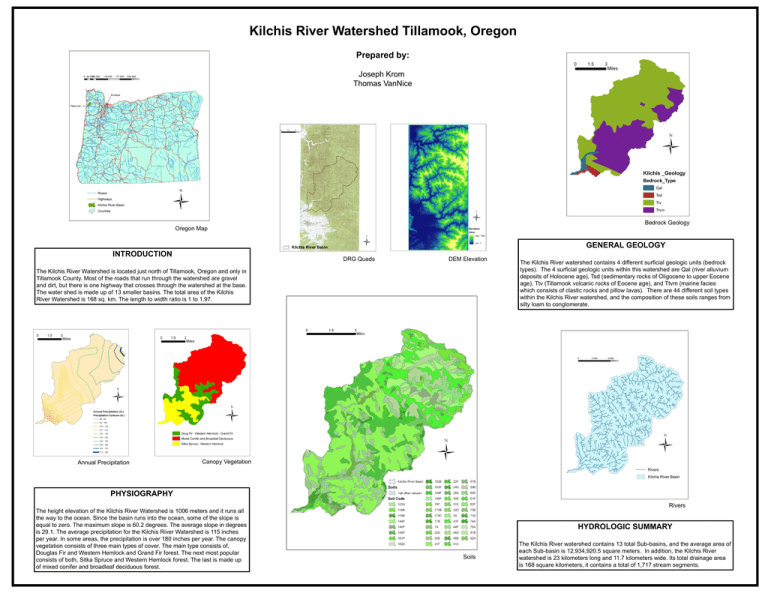
Kilchis River Watershed Tillamook, Oregon Prepared by: Joseph Krom Thomas VanNice Bedrock Geology Oregon Map GENERAL GEOLOGY INTRODUCTION DRG Quads DEM Elevation The Kilchis River Watershed is located just north of Tillamook, Oregon and only in Tillamook County. Most of the roads that run through the watershed are gravel and dirt, but there is one highway that crosses through the watershed at the base. The water shed is made up of 13 smaller basins. The total area of the Kilchis River Watershed is 168 sq. km. The length to width ratio is 1 to 1.97. Annual Precipitation The Kilchis River watershed contains 4 different surficial geologic units (bedrock types). The 4 surficial geologic units within this watershed are Qal (river alluvium deposits of Holocene age), Tsd (sedimentary rocks of Oligocene to upper Eocene age), Ttv (Tillamook volcanic rocks of Eocene age), and Ttvm (marine facies which consists of clastic rocks and pillow lavas). There are 44 different soil types within the Kilchis River watershed, and the composition of these soils ranges from silty loam to conglomerate. Canopy Vegetation PHYSIOGRAPHY Rivers The height elevation of the Kilchis River Watershed is 1006 meters and it runs all the way to the ocean. Since the basin runs into the ocean, some of the slope is equal to zero. The maximum slope is 60.2 degrees. The average slope in degrees is 29.1. The average precipitation for the Kilchis River Watershed is 115 inches per year. In some areas, the precipitation is over 180 inches per year. The canopy vegetation consists of three main types of cover. The main type consists of, Douglas Fir and Western Hemlock and Grand Fir forest. The next most popular consists of both, Sitka Spruce and Western Hemlock forest. The last is made up of mixed conifer and broadleaf deciduous forest. HYDROLOGIC SUMMARY Soils The Kilchis River watershed contains 13 total Sub-basins, and the average area of each Sub-basin is 12,934,920.5 square meters. In addition, the Kilchis River watershed is 23 kilometers long and 11.7 kilometers wide. Its total drainage area is 168 square kilometers, it contains a total of 1,717 stream segments.


