SIGNIFICANCE AND UNCERTAINTY OF LAND-USE MODEL IN TRAVEL DEMAND FORECAST:
advertisement
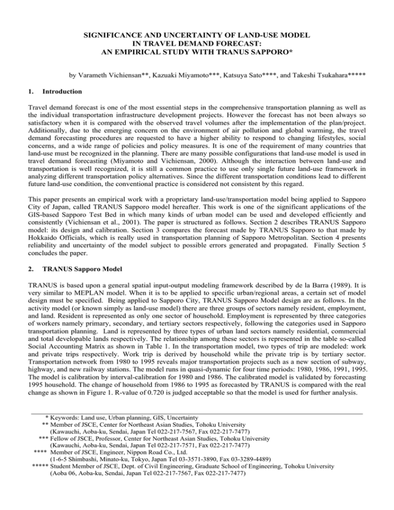
SIGNIFICANCE AND UNCERTAINTY OF LAND-USE MODEL IN TRAVEL DEMAND FORECAST: AN EMPIRICAL STUDY WITH TRANUS SAPPORO* by Varameth Vichiensan**, Kazuaki Miyamoto***, Katsuya Sato****, and Takeshi Tsukahara***** 1. Introduction Travel demand forecast is one of the most essential steps in the comprehensive transportation planning as well as the individual transportation infrastructure development projects. However the forecast has not been always so satisfactory when it is compared with the observed travel volumes after the implementation of the plan/project. Additionally, due to the emerging concern on the environment of air pollution and global warming, the travel demand forecasting procedures are requested to have a higher ability to respond to changing lifestyles, social concerns, and a wide range of policies and policy measures. It is one of the requirement of many countries that land-use must be recognized in the planning. There are many possible configurations that land-use model is used in travel demand forecasting (Miyamoto and Vichiensan, 2000). Although the interaction between land-use and transportation is well recognized, it is still a common practice to use only single future land-use framework in analyzing different transportation policy alternatives. Since the different transportation conditions lead to different future land-use condition, the conventional practice is considered not consistent by this regard. This paper presents an empirical work with a proprietary land-use/transportation model being applied to Sapporo City of Japan, called TRANUS Sapporo model hereafter. This work is one of the significant applications of the GIS-based Sapporo Test Bed in which many kinds of urban model can be used and developed efficiently and consistently (Vichiensan et al., 2001). The paper is structured as follows. Section 2 describes TRANUS Sapporo model: its design and calibration. Section 3 compares the forecast made by TRANUS Sapporo to that made by Hokkaido Officials, which is really used in transportation planning of Sapporo Metropolitan. Section 4 presents reliability and uncertainty of the model subject to possible errors generated and propagated. Finally Section 5 concludes the paper. 2. TRANUS Sapporo Model TRANUS is based upon a general spatial input-output modeling framework described by de la Barra (1989). It is very similar to MEPLAN model. When it is to be applied to specific urban/regional areas, a certain set of model design must be specified. Being applied to Sapporo City, TRANUS Sapporo Model design are as follows. In the activity model (or known simply as land-use model) there are three groups of sectors namely resident, employment, and land. Resident is represented as only one sector of household. Employment is represented by three categories of workers namely primary, secondary, and tertiary sectors respectively, following the categories used in Sapporo transportation planning. Land is represented by three types of urban land sectors namely residential, commercial and total developable lands respectively. The relationship among these sectors is represented in the table so-called Social Accounting Matrix as shown in Table 1. In the transportation model, two types of trip are modeled: work and private trips respectively. Work trip is derived by household while the private trip is by tertiary sector. Transportation network from 1980 to 1995 reveals major transportation projects such as a new section of subway, highway, and new railway stations. The model runs in quasi-dynamic for four time periods: 1980, 1986, 1991, 1995. The model is calibration by interval-calibration for 1980 and 1986. The calibrated model is validated by forecasting 1995 household. The change of household from 1986 to 1995 as forecasted by TRANUS is compared with the real change as shown in Figure 1. R-value of 0.720 is judged acceptable so that the model is used for further analysis. * Keywords: Land use, Urban planning, GIS, Uncertainty ** Member of JSCE, Center for Northeast Asian Studies, Tohoku University (Kawauchi, Aoba-ku, Sendai, Japan Tel 022-217-7567, Fax 022-217-7477) *** Fellow of JSCE, Professor, Center for Northeast Asian Studies, Tohoku University (Kawauchi, Aoba-ku, Sendai, Japan Tel 022-217-7571, Fax 022-217-7477) **** Member of JSCE, Engineer, Nippon Road Co., Ltd. (1-6-5 Shimbashi, Minato-ku, Tokyo, Japan Tel 03-3571-3890, Fax 03-3289-4489) ***** Student Member of JSCE, Dept. of Civil Engineering, Graduate School of Engineering, Tohoku University (Aoba 06, Aoba-ku, Sendai, Japan Tel 022-217-7567, Fax 022-217-7477) Table 1 Social Accounting Matrix of TRANUS Sapporo ● ● ● ● ● Work Private 10,000 forcasted by TRANUS Dev Land Com Land Res Land ● ● ● 1986-1995 Change of Househol Primary Secondary Tertiary Household Res Land Com Land Household Tertiary Primary Consuming Sectors Secondary Producing Sectors R=0.720 6,000 2,000 -4,000 - 4,000 8,000 12,000 -2,000 ● 1986-1995 Change of Household in reality ● Figure 1 Change of Household 1986 to 1995: Tranus Forecast versus Reality 3. Significance of Land-Use Modeling A single official projection of resident in 1995 (in population unit, and called (called PT population forecast hereafter) was used in the transportation analysis in 1985 (Hokkaido Development Bureau; 1985, 1995) where a number of policy alternatives were analyzed. Similarly TRANUS Sapporo model produced two forecasts of 1995 residents (in household unit) according to two simulated scenarios: cases with and without new subway section respectively. These three forecasts are compared with the observed number of population and household in 1995 in this section. Figure 2 shows the comparisons in the area along the new subway section and in the remote area respectively. From Figure 2a, firstly, there appears significant discrepancy between the PT forecast and real population especially for those left zones, this is hypothesized to cause by using single land-use framework. Secondly, TRANUS forecasts of with and without cases show relatively significant difference, so it is clear that transport project has strong effect to future land-use. Thirdly, in zone 1414 in which transport project has induced competition in household location choice, the with-case has less number of household than without-case. Thus, it is not misleading to say that TRANUS Sapporo could produce satisfactory forecast in the area close to the transportation development project. Likewise, in Figure 3b, it can be seen that the difference of forecasts for with and without cases are negligibly small. Therefore, similar to the previous case, TRANUS Sapporo could also produce satisfactory forecast for the area with less effect of transportation project. This section has proved that it is necessary to use a land-use/transportation model in analyzing the absence/presence of certain transportation project. 4. Uncertainty in Quasi-Dynamic Land-Use Modeling Since TRANUS model is a quasi-dynamic model where land-use and transportation is modeled to interact each other with time-lag through discrete time periods, it is generally used for integrated land-use/transportation analysis and planning. It is more consistent than a static model in the sense that it can better represent the interaction of land-use and transportation. As empirical evidence, it is shown in Figure 3 that a quasi-dynamic TRANUS model produces better forecast than a static projection (although using TRANUS framework but single time step) according to their R-values. 76% 64% 62% 1615 Area along the1417 project 27% 22% 36% New Subway Section 14% 4% 栄町 Area in Distance 24% 20% 112% 1416 11% 19% 9% 99% 5% 79% 1414 7% 16% 元町 20% 1415 24% 1617 47% 43% 33% -4% 1413 6% 1% -7% 1km 23% 123% 12% 121% -4% -8% 1414 29% 167% 1% 新道東 -21% 43% 1616 w/ 11% 10% Real 環状通東 東区役所前 Real w/o PT Population Household 59% 43% w/ 18% Real PT 3% Population 1km Real w/o Household 1619 Figure 2 a, b Official Forecast and TRANUS Forecast Compared with Reality 1 9 8 6 -1 9 9 5 C h an 1986-1995 HH Change fo rcasted b by y TTRANUS RAN Forecasted 1 9 8 6 HH - 1 9 9Change 5 C 1986-1995 f o r e c a by s t e dTRANUS by Forecasted 1 0 ,0 0 0 Static Model R=0.635 6 ,0 0 0 2 ,0 0 0 - 2 ,0 0 0 - 2 ,0 0 0 2 ,0 0 0 6 ,0 0 0 1 0 ,0 0 0 6 ,0 0 0 2 ,0 0 0 - 4 ,0 0 0 1 9 8 6 - 1 9 9 5 Real R e a l HH C h a nChange ge o f H H 1986-1995 Quasi-Dynamic Model R=0.720 1 0 ,0 0 0 - 2 ,0 0 0 4 ,0 0 0 8 ,0 0 0 1 2 ,0 0 0 1 9 8 6 -1 9 9 5Real R ealHH C hange of HH 1986-1995 Change Figure 3 Forecast by Static and Quasi-Dynamic Models Figure 4 Sensitivity Analysis Nevertheless it is very likely that error or uncertainty exists during the modeling process. The generated error will accumulate over and over throughout the modeling periods so that the final model output becomes less accurate. Up to the present there are not many researches regarding the error analysis in land-use modeling. While Pradhan and Kockelman (2002) presented an empirical results with UrbanSim land-use model, this paper presents that with TRANUS Sapporo model. It takes a further step in that the uncertainty of outputs in the disaggregate level (in all zones) are monitored. In the typical modeling, there are possible sources of error and uncertainty such as incorrect input data, improper model structure, poor calibration, inaccurate projected control total, etc. This study focuses uncertainty arising from uncertain increment model input and model parameters. The numerical experiment represents variation in four model parameters. Default values of each parameter are varied to lower and higher values as summarized in Table 2. In total, 81 combinations of the variations, or 81 scenarios, have been modeled. Table 2 Variation in Input of TRANUS Sapporo Model Total employment control (incremental model) Volume factor Logit parameter of land use model Trip generation elastic Low 15% 1 0.5 0.5 Default 19.154% 1.4 0.8 0.8 High 25% 1.8 1 1 The sensitivities of model outputs to input values were determined by regressing outputs on input parameters. The statistical and practical significance of any independent variable can be assessed by two indexes. Firstly, a p-value is the level of significance for a two tailed t-test of the hypothesis that the variable has no impact on the dependent variable (i.e., its regression coefficient is zero). A variable with a p-value of less than 0.05 is considered very statistically significant. Secondly, a standardized coefficient represents the change in the dependent variable (measured in multiples of its standard deviations) caused by a change of one standard deviation in the independent variable. The outputs of the land-use model that are examined are tertiary worker by zone, household by zone, and the three land sectors. By using a tool developed in Sapporo Test Bed, the sensitivity analysis results of all years (1980, 1986, 1991, 1995) for all zones can be monitored efficiently. Figure 4 shows a sample result in zone 23 of year 1995. Consider the sensitivity of outputs to total employment control. The relatively large magnitude of the Figure 5 a, b Uncertainty Propagation over Time standardized coefficient and the small p-value for the total employment control indicate that the employment control has an impact that is both statistically significant, and significant in practical terms. However, the small magnitude of the standardized coefficient for Logit parameter to the tertiary employment output indicates that while their impact is statistically significant (indicated by a small p-value), it is not significant in practical terms. By considering the overall results, in terms of external model input, the control total of employment is the major source of variation in the model output. In terms of model parameter, the Logit model parameter is significant to variation in the household output as well as the residential land. However, the trip generation elasticity has no significant role to the land-use outputs. Next, the propagation of uncertainty over time is depicted in Figure 5. The level of uncertainty (as measured by the coefficient of variation; COV), which is defined as the standard deviation of a variable divided by its mean) appears to accumulate over the modeling periods in most zones, as shown in Figure 5a. However, in the zones in which intermediate external information is input, the variation is less pronounced. Figure 5b shows the land-use results of zone 29 where the amount of land use is externally given to represent the residential development project, the resident related variables (household and residential land) have lesser variation. To conclude this section, it is learnt from the empirical experiment that parameter estimation plays significant role to the variation in the model outputs. Enough care should be taken to some of TRANUS parameter although it is sometimes not emphasized in the normal model application. On the other hand, some model parameters may need not to be very certain as long as it is proved to play less effect to the model output, e.g., trip generation elasticity as presented earlier in this paper. 5. Concluding Remarks It is shown empirically that land-use must be taken into consideration in the long-range travel demand forecasting. However, uncertain model parameters as well as model inputs may contribute to large variation of model output and in turn make the final output less reliable. Although only land-use output variation is presented in this paper, that of transportation will be presented in a subsequent paper. In addition, it is also meaningful to explore the uncertainty in land-use modeling from an analytical approach. It was not possible in the present study simply because TRANUS model was taken as a black box. Finally, this paper is specific to TRANUS model, the similar works is recommended for other urban models as well. References De la Barra T. (1989) Integrated Land Use and Transport Modeling. Cambridge University Press, Cambridge. Hokkaido Development Bureau, Japanese Ministry of Construction. (1985) The 2nd Person Trip Survey of Sapporo Metropolitan Area. (in Japanese). Hokkaido Development Bureau, Japanese Ministry of Construction. (1995) The 3rd Person Trip Survey of Sapporo Metropolitan Area. (in Japanese). Miyamoto K. and Vichiensan V. (2000) Review of Land-use Model Applications in Transportation Demand Forecasting. Proceedings of the 9th International Conference CODATU IX, Mexico City, Mexico, 449-454. Pradhan and Kockelman (2002) “Uncertainty Propagation in an Integrated Land Use and Transportation Modeling Framework: Output Variation via Urbansim”. Paper presented at the 81st Annual Meeting of the Transportation Research Board, Washington D.C. Vichiensan V., Miyamoto K., and Shizukuishi K. (2001) GIS Test Bed Building for Land-use and Transportation Models. Proceeding of the 7th International Conference on Computers in Urban Planning and Urban Management (CD-ROM), Honolulu, Hawaii, 18-21 July 2001.
