Analysis of Management Efforts at North Beach Park Dune, Michigan
advertisement
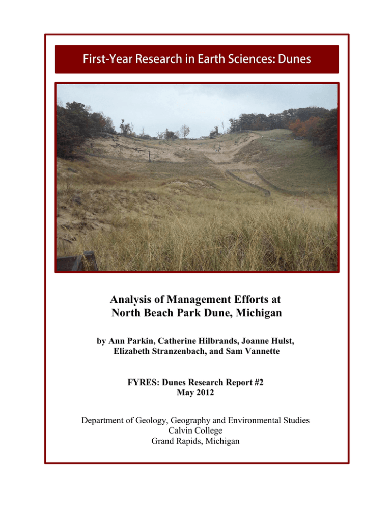
Analysis of Management Efforts at North Beach Park Dune, Michigan by Ann Parkin, Catherine Hilbrands, Joanne Hulst, Elizabeth Stranzenbach, and Sam Vannette FYRES: Dunes Research Report #2 May 2012 Department of Geology, Geography and Environmental Studies Calvin College Grand Rapids, Michigan 1 Abstract Few studies have focused on the management of Lake Michigan coastal dunes. This project investigates the efforts to stabilize North Beach Park dune, a large parabolic dune in Ottawa County, Michigan. In 2004, dune advance was documented at 0.67 m/yr. in the direction of the only access road to more than 300 houses. Since 2004, Ottawa County implemented a variety of management measures including an elevated boardwalk, sand fences, and planted vegetation. In Fall 2011, we analyzed these management techniques and how they affect the current dune advance rate presently. We mapped each management effort using GPS, constructed a timeline of management activities, measured dune advance against monitoring posts, analyzed photos from different years, and compared the 2011 measurements with results from 2004. Results show that the advance rate and bare sand areas of the dune have decreased. The sand fences cut down walking on existing pathways and the total number of unmanaged trails decreased. We conclude that the management efforts have significantly decreased the advance of the dune towards the road. Introduction Coastal dune systems are extremely dynamic. Some dune systems move at a slow rate, while others move at a quick rate. Human impacts on a dune system have the ability to speed up a dune’s advance rate, and dune management has the potential to slow down a dune’s advance. While there are studies from coastal dunes around the world illustrating these patterns, there has been almost no research on how management can affect dune advance rates in Lake Michigan dune settings. The North Beach Park dune in Ottawa County, Michigan, is an example of a dune with a rapid advance rate (Jamieson and van Dijk 2004) that has undergone some changes in management strategies. Our study investigates whether management efforts on a dune system can effectively slow the dune advance rate. Our research question is: How effective have the stabilization efforts been at North Beach Park in slowing down the landward advance of the dune? 2 Study Objectives To answer our research question, we had three research objectives: 1. To analyze the effectiveness of the stabilization efforts. 2. To find the current advance rate of the dune. 3. To the compare the present advance rate with the previously measured advance rate to see how the management efforts affected the dune’s advance rate. Study Area Our study area is the North Beach Park Dune located in Ferrysburg, Michigan, which is in the northwest corner of Ottawa County (figure 1). The dune is presently part of North Ottawa Dunes which is an Ottawa County Park that is managed by the Ottawa County Parks and Recreation Commission (OCPRC). Before the North Ottawa Dunes park was established, the west part of the dune was in North Beach Park (also an Ottawa County Park) and the east part of the dune was privately owned. North Park Beach Dune North Beach Park dune is a large coastal parabolic dune with a height of 45 meters. The dune has been of interest to the OCPRC since at least 2004 when a study was commissioned to investigate possible dune advance (Jamieson and van Dijk 2004). The dune was advancing towards North Shore Drive which connects over 300 houses to a local town. This road is the only access road to the houses. Since 2004, the OCPRC implemented a number of management strategies to slow the advance rate of the dune so that it would not cover the road – thus blocking access to the houses. Figure 1. Location of North Beach Park dune. (Map information from Ottawa County). 3 Background Coastal dune management encompasses understanding the coastal dune system and the strategies that are appropriate for specific management goals. Munoz et al. (2011) report that, out of all the factors that affect a dune system, human impacts have the greatest effect. Therefore, understanding and managing human behavior can be as important as understanding and managing dune behavior (Thomas 1999). Humans can impact dune systems in a variety of ways ranging from trampling by pedestrians (Bowles and Maun 1982) to alteration by off-road vehicles (Priskin 2003) and severe anthropogenic disturbance including farming and logging (Catto et al. 2002) and development (El Banna 2004). The effects of human trampling are of the most interest to our study of North Beach Park dune. Trampling damages or destroys vegetation, thereby reducing the vegetation cover and making a dune surface more vulnerable to erosion by wind (Rickard et al. 1994). Studies have shown that the impacts of trampling increase with the number of pedestrian passes over an area (Boorman and Fuller 1977; Hylgaard and Liddle 1981; Bowles and Maun 1982). This may be one person walking many times along the same pathway, but it is more likely to be the cumulative effects of many individual visitors walking in the same areas. Many visitors to a dune area may produce a large number of “unmanaged trails” (van Dijk and Vink 2005) which are pathways that are not planned or intended by the dune managers. Dune management strategies include a) techniques that work with dune processes such as reducing sand transport in an area or protecting a surface from wind erosion and b) actions to lessen the impacts of human activities such as restricting visitor access to dune areas. Dune surfaces can be stabilized by covering the surface with some measure of protection such as a straw mat, planting vegetation to increase vegetation cover, or reducing wind speed and/or encouraging sand deposition with sand fences (Brooks and Agate 2001). Lessening human impacts either involves concentrating activities in certain areas so as to decrease impacts on other areas or dispersing dune use over a broad area so that specific parts of the dune system are not heavily affected (Burden and Randerson 1972). Carlson and Godfrey (1989) provide examples of a variety of management strategies available where the impacts of large numbers of visitors need to be controlled, including boardwalks, observation platforms, designated trail routes, involving visitors in dune plantings, permanent fences to restrict visitor access to areas, public education including signs, pamphlets and nature walks. 4 Few studies have investigated coastal dune management on Lake Michigan coastal dunes. Studies by Amsterburg Jr. (1973) and Reinking and Gephart (1978) describe how increasing vegetation cover stabilizes dune surfaces. In contrast, a study by van Dijk and Vink (2005) focused on the impacts of high visitor numbers to dune vegetation, topography and activity. While van Dijk and Vink (2005) propose some management actions to mitigate the effects of the human impacts, reporting on the effects of the management efforts was beyond the time-frame of their study. The North Beach Park dune was first studied in 2004 by Jamieson and van Dijk. The study was commissioned by the Ottawa County Parks and Recreation Commission out of concern that the dune was advancing towards an important access road. Jamieson and van Dijk (2004) concluded that the dune was indeed advancing towards the road at a rate of 0.67 m/year. Their survey of dune topography and characteristics provided evidence of dune activity including a large deflation area on the windward slope, a bare dune crest, and widespread deposition on the slipface that included partial burial of some trees. Furthermore, the study suggested that human impacts could be accelerating dune activity by trampling vegetation and increasing erosion on the upper windward slope. Jamieson and van Dijk (2004) recommended some management strategies to the OCPRC, including stabilizing the windward slope by planting vegetation and installing sand fences, and restricting human activity in these areas by extending the boardwalk to the top of the dune and installing fences across unmanaged trails. The North Beach Park dune provides an opportunity to evaluate how management efforts have been effective (or not) in the Lake Michigan coastal dune setting. A set of reference data is available in the form of the 2004 study (Jamieson and van Dijk 2004). Since that study, the OCPRC has implemented a number of management strategies with the goal of stabilizing dune areas and slowing down dune advance. 5 Methods We documented management efforts by Ottawa County Parks staff at North Beach Park dune by creating a timeline. Sources of information included Ottawa County Parks newsletters, personal communications from park staff, and data on monitoring posts that were installed and maintained by Ottawa County Parks staff. We investigated the planted vegetation and amount of bare sand area by focusing on the percent of bare sand on the dune at specific times. To find this percentage we used aerial photographs from 1999, 2004, 2008, and 2011 (figure 2). We brought the images into ArcGIS where we measured the total area of bare sand on the windward side of the dune, the total area of planted vegetation, and the total area of the windward side of the dune. We calculated the percent bare sand area as bare sand area divided by dune windward area. We also took photographs in October 2011 and compared them with photographs taken by previous researchers to determine patterns of change in vegetation cover of the dune. Figure 2. North Beach Park dune as seen on an air photo. In October 2011, we used GPS Trimble units to map out the length and orientation of the sand fences present on both the windward and leeward sides of the dune. For comparison, we also used measuring tapes to record the length of the sand fences. A primary focus of the sand fence analysis was to determine if the sand fences were used to promote sand deposition (evidence was orientation perpendicular to the main wind direction) or if the sand fences were 6 used to decrease human traffic on the unmanaged trails (evidence was position/orientation across a trail; figure 3). We analyzed the data to determine the main use for the sand fences present in 2011. Figure 3. Sand fences positioned across an unmanaged trail are recorded in this 2008 photo of North Beach park dune. To investigate changes in unmanaged trails, we collected and analyzed photographs from different years that had been taken of the windward side of the dune. We were able to find photos from each year from 2004 through 2011 (including photos that we took ourselves in October 2011). We determined the number of unmanaged trails by looking at photos from different angles during the same year, and counting the amount of unmanaged trails present for that year. We also recorded the severity of the unmanaged trails: how wide each unmanaged trail was, and the amount of vegetation present within the trail. We used data from monitoring posts at the bottom of the dune slipface to investigate the rate of dune advance. Ottawa County Park staff had previously installed the monitoring posts and collected data on an irregular basis. Kristy Jamieson collected data in 2004 (Jamieson and van Dijk 2004) and we made measurements in October 2011. Data is collected by measuring the height of the exposed monitoring post, and the distance between post and the leading edge of the leeward side of the dune. These numbers can be used to calculate the dune advance rate by comparing the change in position of the dune edge to the time interval between data collection. 7 Results The North Beach Park dune timeline highlights significant dune management activities from 1997 through 2011 (figure 4). One of the earliest recorded management activities on the dune is the planting of vegetation to stabilize the dune surface. Volunteers have been recruited annually since 1990 to plant dune grass (Ammophila breviligulata), and in 2011 Ottawa County Park staff added dune willow (Salix cordata) to the lower windward slope of the dune. Four monitoring posts were installed at the edge of the dune slipface in October 1997; in November 2004 five new monitoring posts were installed at the dune edge because the previous posts were close to being buried. A study commissioned by the OCPRC in summer 2004 (Jamieson and van Dijk 2004) used data from the first set of monitoring posts to determine that the dune was advancing at 0.67 m/year in 2004. The Jamieson and van Dijk (2004) study also outlined further management strategies to stabilize the dune including sand fences, more vegetation planting, and restricting visitor access to the dune’s windward slope. Figure 4. Timeline of significant events in the management of North Beach Park dune. 8 Ottawa County did not own the entire dune until 2005 when the property containing the east half of the dune was purchased. Therefore structures (such as boardwalks) could not be installed on the highest parts of the dune until after 2005. A complete management plan for the dune was presented to the OCPRC in spring 2006. The plan was approved, and in September of 2007, the park was granted a contract of $138,000 to begin construction of major management efforts. The substantial extension of the boardwalk was completed in September 2008. By this time, management actions on the dune included sand fences, biodegradable erosion mats, and signs to control dune access along with the dune grass plantings and boardwalk. North Beach Park dune characteristics and management activities are mapped in figure 5. The map uses a 2011 air photo as a base, with GPS data collected in October 2011 showing areas of planted vegetation and bare sand, the sand fences, the boardwalk that surrounds the entire windward side of the dune, the unmanaged trails, and the monitoring post locations. Figure 5. North Beach Park dune in 2011. 9 Analysis of the bare sand and planted vegetation areas on the dune’s windward slope shows that the bare sand area has been decreasing since 1999 (figure 6). In 1999 the windward side of the dune was 43% bare sand. Since then, the bare sand area has decreased to 5%. The areas that were previously bare sand have been replaced by planted vegetation which is primarily Ammophila breviligulata. The change in surface cover is visible when photographs from different years are compared (figure 7). Figure 6. Percentage of bare sand area on windward slope of North Beach Park dune from 1999 to 2011. Figure 7. Photos of windward slope of North Beach Park dune show the increase in vegetation cover between 2004 and 2011. The 2011 data collection shows fifteen sand fences present on the North Beach Park dune. Twelve of these sand fences are present on the windward side of the dune (some are 10 visible in figure 7). Three of the sand fences are oriented perpendicular to the wind and can slow down wind and sand movement, while the remaining nine sand fences are constructed across unmanaged trails. Between 2004 and 2011, the number of unmanaged trails decreased. In 2004 there were nine unmanaged trails; in 2011 that number had decreased to seven unmanaged trails. The severity of the unmanaged trails that were present on the dune had also decreased as trails became narrower and vegetation presence on the trails increased (figure 8). In particular, the major unmanaged trail that runs up the center of the dune greatly decreased in surface area from 2004 to 2011. Figure 8. Vegetation (Ammophila breviligulata) is growing on this unmanaged trail that was previously completely bare. The monitoring post data show that the advance rate of North Beach Park dune was at its highest in 2004 with a rate of 0.67 m/year (figure 9). Since then, dune advance has slowed greatly to 0 m/year in 2008. Since 2008, the dune advance rate has been hovering around 0 m/yr. Figure 9. North Beach Park dune advance rate (m/yr) measured at monitoring posts. 11 Discussion The timeline allowed us to understand the dune in better detail. One of the interesting facts we were able to see was that in 2005 the park was able to purchase the entire property of the dune system. Before 2005 the park only owned the beach and about half of the windward slope of the dune. Because of this constraint, the Ottawa County Parks and Recreation Commission could not introduce any management efforts on the entire dune system because it was not their property. By looking at past park newsletters and talking to the park staff, we were able to find out that they had wanted to implement management efforts prior to 2005, but were unable to act. Substantial decreases in dune advance rate after 2004 (figure 8) and substantial decreases in bare sand area after 2008 (figure 6) may reflect the changes in dune management activities that were put into place after 2005. The decrease in bare sand area since 1999 is directly related to the management strategy of planting vegetation on the windward slope of the dune. The planted vegetation encourages sand deposition and reduces wind erosion, both activities that help to stabilize the dune. The large decrease in bare sand area (from 43% in 1999 to 5% in 2011), most of which occurred after 2004, corresponds to the significant slow-down in dune advance rate. Although dune advance is measured at inland edge of the dune, the supply areas for sand movement are the windward slope of the dune along with the dune crest. By stabilizing dune surfaces in the supply area with vegetation, there is less sand transport by wind over the crest of the dune and therefore less sand movement by gravity down the dune slipface. Stabilization of the dune has been enhanced by two management strategies which restrict visitor access to dune areas: the boardwalk and signs. Instead of having the visitors walk on the windward slope of the dune, Ottawa County Parks built a boardwalk that encircles the entire windward slope of the dune. This allows visitors to climb the dune and see the view from the top without having to disturb the dune environment. Also, the park restricted access to the windward slope of the dune by putting up signs prohibiting anyone from walking on the windward slope of the dune. Both of these strategies supported the planted vegetation by keeping visitors from trampling vegetation, thereby damaging or destroying it and reducing its ability to stabilize the dune surface. The decrease in number and severity of unmanaged trails on the windward slope of North Beach Park dune is another indicator that dune stabilization is taking place. Unmanaged trails 12 are found within a dune system only if there is human or animal traffic present on the dune. If there are many unmanaged trails present on a dune, then there would be evidence of traffic within the dune system. The management strategy of placing sand fences perpendicular to existing unmanaged trails is a contributing factor to dune stabilization. People could not walk on the unmanaged trails, which allowed them to decrease in severity, and eventually be overtaken by the natural vegetation that was present. Most of the sand fences on the windward slope (9 out of 12) were positioned across unmanaged trails where they could deter people from walking on the trails. Small trails parallel to some of the unmanaged trails with sand fences are evidence that some dune visitors are still walking on the windward slope of the dune despite the boardwalk and signs; these visitors are finding alternate routes to the trails that have been blocked by the fences. The most convincing evidence that the dune management strategies implemented since 2004 are stabilizing the dune is the reduction in dune advance rate from from 0.67 m/yr to 0 m/yr. Ottawa County Park staff should be greatly encouraged by this result in light of the time and money they have invested to stop the dune from overtaking the road. We recommend that the park continue to make measurements at the dune monitoring posts on an annual basis. These measurements are crucial to identifying and documenting trends or changes in dune behavior such as increasing stabilization or reactivation. Ideally, the measurements should be taken at the same time of the year, every year. A consistent dataset will aid in the interpretation of future data. Conclusions In 2004, the North Beach Park Dune was described as a very active dune system (Jamieson and van Dijk 2004). In 2011, only seven years later, our results indicate that the dune is being stabilized. The dune advance rate has slowed down from 0.67 m/year to 0 m/year, and the windward slope of the dune is 95% covered by vegetation (figure 10). These changes can be attributed to the management efforts implemented by the Ottawa County Parks and Recreation Commission during the same time period: planted vegetation, sand fences, the construction of a boardwalk that encircles the windward slope of the dune, and restricting public access to the windward slope of the dune. Our study demonstrates that dune management efforts can be successful in slowing down the advance of a Lake Michigan coastal dune. 13 Figure 10. Photos from 2004, 2008 and 2011 illustrate the stabilization of the windward slope. Acknowledgments Our group would like to acknowledge Dr. Deanna van Dijk for all of her hard work in being our mentor throughout this entire research project and FYRES:Dunes course. We would also like to acknowledge our fellow research mentors and students within the FYRES:Dunes course. We would like to thank Melanie Manion, Natural Resources Management Supervisor for Ottawa County Parks, who helped us obtain the past park data and was our main contact with the park system. We also would like to thank the National Science Foundation (Grant #0942344) for funding to carry out this research project. Without all of this help, our project would not have been completed. Thank you! Works Cited Amsterburg Jr., R. J. 1973. "Sand, wind, and grass - the healing of a dune." In Geology and the Environment: Man, Earth and Nature in Northwestern Lower Michigan, 69-70. Ann Arbor: Michigan Basin Geological Society. Boorman, L.A., and R.M. Fuller. 1977. "Studies on the impact of paths on dune vegetation at Winterton, Norfolk, England." Biological Conservation no. 12:203-315. Bowles, J. M., and M.A. Maun. 1982. "A study of the effects of trampling on the vegetation of Lake Huron sand dunes at Pinery Provincial Park." Biological Conservation no. 24:273283. Brooks, A., and E. Agate. 2001. Sand Dunes: A Practical Handbook. Wallingford, UK: British Trust for Conservation Volunteers. Burden, R.F., and P.F. Randerson. 1972. "Quantitative studies of the effects of human trampling on vegetation as an aid to the management of semi-natural areas." The Journal of Applied Ecology no. 9 (2):439-457. 14 Carlson, L. H., and P. J. Godfrey. 1989. "Human impact management in a coastal recreation and natural area." Biological Conservation no. 49:141-156. Catto, N., K. MacQuarrie, and M. Hermann. 2002. "Geomorphic response to Late Holocene climate variation and anthropogenic pressure, northeastern Prince Edward Island, Canada." Quaternary International no. 87:101-117. El Banna, M. M. 2004. "Nature and human impact on Nile Delta coastal sand dunes, Egypt." Environmental Geology no. 45:690-695. Hylgaard, T., and M. J. Liddle. 1981. "The effect of human trampling on a sand dune ecosystem dominated by Empetrum nigrum." The Journal of Applied Ecology no. 18 (2):559-569. Jamieson, K., and D. van Dijk. 2004. A study of the active parabolic dune in North Beach Park, Ottawa County, Michigan. Grand Rapids: Department of Geology, Geography and Environmental Studies, Calvin College. Munoz, S., J. Fernandez, and C. Dellafiore. 2011. "Dune Vulnerability in Relation to Tourism Pressure in Central Gulf of Cadiz (SW Spain), a Case Study." Journal of Coastal Research. 27. 2: 243-251. Priskin, J. 2003. "Physical impacts of four-wheeled drive related tourism and recreation in a semi-arid, natural coastal environment." Ocean and Coastal Management no. 46:127155. Reinking, R. L., and G. D. Gephart. 1978. "Pattern of revegetation of a shoreline dune area, Allegan County, Michigan." Michigan Academician no. 11 (2):147-155. Rickard, C. A., A. McLachlan, and G. I. H. Kerley. 1994. "The effects of vehicular and pedestrian traffic on dune vegetation in South Africa." Ocean and Coastal Management no. 23:225-247. Thomas, D. S. G. 1999. "Coastal and continental dune management into the twenty-first century." In Aeolian Environments, Sediments and Landforms, edited by A. S. Goudie, I. Livingstone and S. Stokes, 105-127. Chichester: John Wiley & Sons, Ltd. van Dijk, D., and D. R. Vink. 2005. "Visiting a Great Lakes sand dune: The example of Mt. Pisgah in Holland, Michigan." The Great Lakes Geographer no. 12 (2):45-63.

