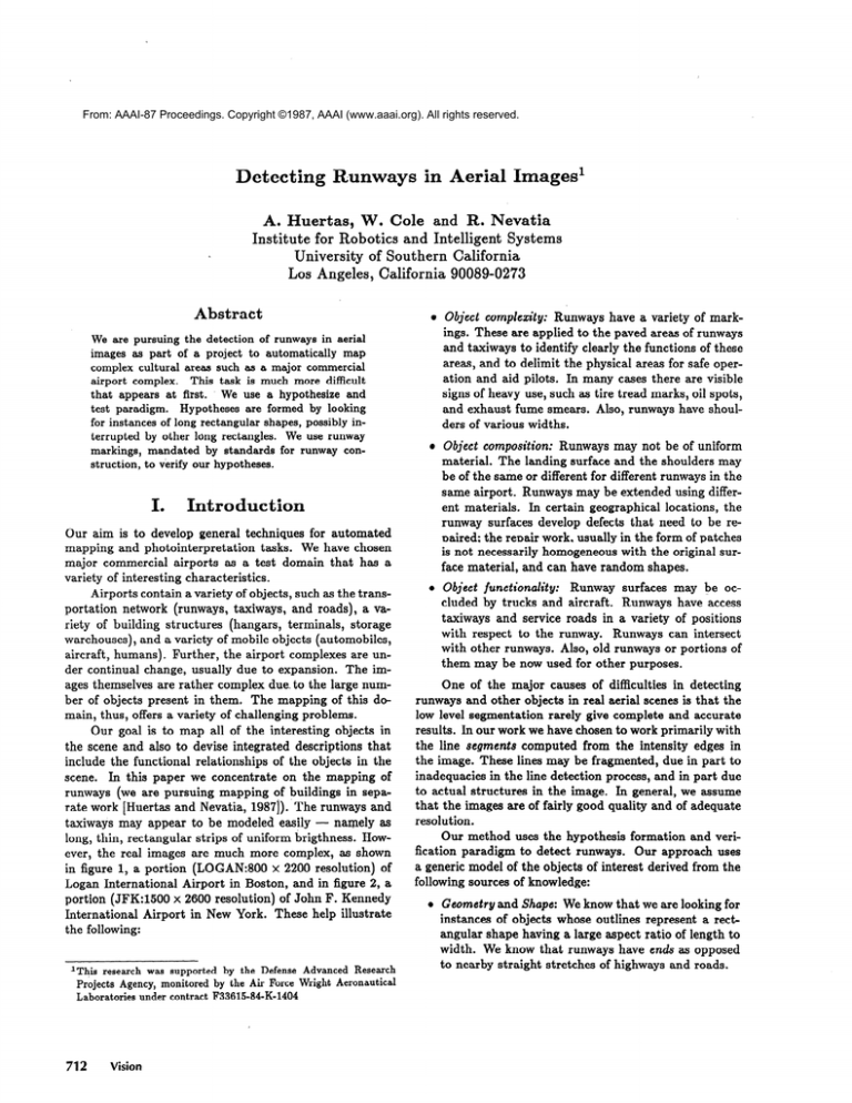
From: AAAI-87 Proceedings. Copyright ©1987, AAAI (www.aaai.org). All rights reserved.
Detecting Runways in Aerial Images’
4
A. Huertas, W. Cole and R. Nevatia
Institute for Robotics and Intelligent Systems
University of Southern California
Los Angeles, California 90089-0273
Abstract
Object complexity: Runways have a variety of markings. These are applied to the paved areas of runways
and taxiways to identify clearly the functions of these
areas, and to delimit the physical areas for safe operation and aid pilots. In many cases there are visible
signs of heavy use, such as tire tread marks, oil spots,
and exhaust fume smears. Also, runways have shoulders of various widths.
We are pursuing the detection of runways in aerial
images as part of a project to automatically
map
complex cultural areas such as a major commercial
This task is much more difficult
airport complex.
that appears at first. _ We use a hypothesize and
test paradigm.
Hypotheses are formed by looking
for instances of long rectangular shapes, possibly interrupted by other long rectangles.
We use runway
markings, mandated by standards for runway construction, to verify our hypotheses.
I.
Introduction
Our aim is to develop general techniques for automated
mapping and photointerpretation tasks. We have chosen
major commercial airports as a test domain that has a
variety of interesting characteristics.
Airports contain a variety of objects, such as the transportation network (runways, taxiways, and roads), a variety of building structures (hangars, terminals, storage
warehouses), and a variety of mobile objects (automobiles,
aircraft, humans). Further, the airport complexes are under continual change, usually due to expansion. The images themselves are rather complex due. to the large number of objects present in them. The mapping of this domain, thus, offers a variety of challenging problems.
Our goal is to map all of the interesting objects in
the scene and also to devise integrated descriptions that
include the functional relationships of the objects in the
scene. In this paper we concentrate on the mapping of
runways (we are pursuing mapping of buildings in separate work [Huertas and Nevatia, 19871). .The runways and
taxiways may appear to be modeled easily - namely as
long, thin, rectangular strips of uniform brigthness. However, the real images are much more complex, as shown
in figure 1, a portion (LOGAN:800 x 2200 resolution) of
Logan International Airport in Boston, and in figure 2, a
portion (JFK:1500 x 2600 resolution) of John F. Kennedy
International Airport in New York. These help illustrate
the following:
Advanced Research
Wright Aeronautical
712
Vision
Object composition: Runways may not be of uniform
material. The landing surface and the shoulders may
be of the same or different for different runways in the
same airport. Runways may be extended using different materials. In certain geographical locations, the
runway surfaces develop defects that need to be reDaired: the reuair work. usually in the form of patches
is not necessarily homogeneous with the original surface material, and can have random shapes.
Object functionality:
Runway surfaces may be occluded by trucks and aircraft. Runways have access
taxiways and service roads in a variety of positions
with respect to the runway. Runways can intersect
with other runways. Also, old runways or portions of
them may be now used for other purposes.
One of the major causes of difficulties in detecting
runways and other objects in real aerial scenes is that the
low level segmentation rarely give complete and accurate
results. In our work we have chosen to work primarily with
the line segments computed from the intensity edges in
the image. These lines may be fragmented, due in part to
inadequacies in the line detection process, and in part due
to actual structures in the image. In general, we assume
that the images are of fairly good quality and of adequate
resolution.
Our method uses the hypothesis formation and verification paradigm to detect runways. Our approach uses
a generic model of the objects of interest derived from the
following sources of knowledge:
l
Geometry and Shape: We know that we are looking for
instances of objects whose outlines represent a rectangular shape having a large aspect ratio of length to
width. We know that runways have ends as opposed
to nearby straight stretches of highways and roads.
l
l
Specific Knowledge of airport design: We know the
features that make a visible long strip in the image
an airport runway: the standard markings applied to
the surfaces, according to FAA specifications.
From
airport engineering we also know the range of angles
between runways, range of widths and so on.
Photometric
Knowledge:
Intensity data may be of
some help in’verifying runway hypotheses when runway markings are non existent or not available due
to lack of contrast or lack of resolution. Our current
implementation does not make use of this knowledge
but only uses the image resolution information.
In work reported here, our verification step consists
only of finding the various markings we expect. We have
not yet combined the different criteria. to give an overall
confidence value. This process should, ideally, take place
in the context of the larger system that is also reasoning
about other objects in the scene, such as the remainder
of the transportation
network, buildings and the mobile
objects. Location of these objects will mutually affect the
confidence levels of the descriptions of other objects. Thus,
the system described here should be viewed as a module
for the larger system to operate on.
The software architecture in our system consists of
collections of functions that operate on linear features on
the basis of constraints imposed by the object’s geometry. Extensive work on rule based systems for aerial image
analysis has been reported by McKeown at CMU (see for
example [McKeown et al, i987]). Their approach however
is based on region features rather than linear features.
II.
A.
Description
of the Method
Formation of Runway Hypothesis
1. Detection
of Line Segments and Apars
We have chosen to work primarily with line segments
extracted from the image. Geometric knowledge of the desired structures indicate that they should be characterized
by parallel lines of opposite contrast. We call such pairs of
lines “anti-parallel”, and abbreviate them as upurs. Apars
form the basic unit of our further analysis.
We use the USC “LINEAR” line detection system
[Nevatia and Babu, 19801 to obtain line segments and
apars. Each linear segment is described by its length, orientation, contrast, and position of its end points. Additionally we also know if a segment connects to another
Huertas,Cole, Nevatia
713
segment at either end. Figure 3 shows the 8262 line segments computed from our LOGAN example. The center
axis lines of 9,498 apars, shown in figure 4, were computed
from the LOGAN segments by specifying the minimum (in
our examples, 1 pixel) and maximum (60 pixels) distance
between the anti-parallel pairs ofbsegments. The range is
derived from the known image resolution. The apars are
described by their length, orientation, end points, width
and color (b&ghter or darkeJ than surround).
We also
know if apars are connected to other apars at either end.
Figure 5: Length-Weighted
t ions
Histogram of Apar Orienta-
Figure 3: Line Segments from LOGAN image.
Figure 4: Anti-Parallels from Segments in LOGAN image
2.
Reduction
of Search Space
Each line segment may contribute to many apars, as is
the case along runway features where there may be a large
number of linear features parallel to the runway. This leads
to a large search space that we reduce by implementing a
focus of attention mechanism that facilitates the detection
of “targets” in the presence of a large number of “distractars”. We accomplish this by computing estimates of the
directions and widths of potential runways. Using these
estimates we extract from the set of apars, those in the
selected directions and having a range of widths, and form
sets of apars presumably representing fragments of runways.
First, we estimate the direction of the runways by
computing a length-weighted histogram of the apar orientations. The histogram for the LOGAN apars is shown
in figure 5. The three sharp peaks denote the dominant
orientations of the linear features (including runways) in
the image.
To estimate the runway widths we compute a lengthweighted histogram of the apar widths including only those
apars oriented in the estimated runway directions. This
histogram (not shown) typically shows three width groups:
a group of wide apars including runway and shoulder
fragments, a middle group including taxiways and service
roads, and in some cases, narrow shoulders, and a group
of thin apars including the surface markings.
714
Vision
Figure 6: Apars representing initial set of Runway Fragments
We extract form the set of apars those in the selected
directions and belonging to the width group for possible
runways. We construct one set of runway fragments for
each orientation peak, allowing for a tolerance of 5O on
both sides of the peaks. The three sets for the LOGAN
example are combined and shown in figure 6. We show the
apars as rectangles to depict their width. A comparison of
the original set of 9,498 apars to the 518 shown in figure 4
gives, in this example, a 94% reduction in the search space.
3.
Joining
Apars
on the Basis
of Conti-
nuity
Apars are usually broken due to noise in the image and
inadequacies in the low-level processes. However, some of
the breaks are due to real structures in the image. Gonsider for example where taxiways join runways. One one
of the boundaries of the runway is continuous while the
other boundary is broken at the junctions. The runway
portions on both sides of the junction form collinear apars
having the same width. We join these apars allowing a 5O
tolerance in collinearity and 5 pixels tolerance in width.
The resulting longer apar must have an orientation that
is compatible with the estimated direction of the runway
within a small tolerance (5O).
In some cases, as in our LOGAN example, there is
sufficient resolution and contrast in the image for the edge
detector to be able to resolve both boundaries of the white
side stripes that bound the landing surfaces of some runways. In these cases the outside boundaries of the side
stripes result in apars that contain apars resulting from
the inside boundaries of the same side stripes. We remove
properly contained apars from the sets. Apars that overlap however are preserved. We also remove apars having
an aspect ratio smaller than 1, as they are considered unreliable. The result of these processes is shown in figure
7.
Figure 7: Apars joined on the basis of boundary continuity
and filtered on containment and aspect ratio.
4.
Joining
Apars
Gap Texture
on Collinearity
and. Analysis
of
Next we join collinear (within 5”) apars that have similar widths (within 5 pixels) on the basis of examining the
gap between the fragments. Many runway apars may remain fragmented due to noise and occlusion. Consider for
example where two runways cross or when there are aircraft on the runways.
In general, this process is quite liberal in the analysis
of the information in the gaps, as long as the resulting apar
has a direction consistent (within *) with the hypothesized runway direction. For instance, if the gap contains
mostly segments that are oriented in the direction of the
apars, we join them. If the gap contain mostly segments
oriented at an angle consistent with the angles allowed between crossing runways then we join them. However, as
in our JFK example, repair work, changes in surface material, signs of heavy use, oil spots and tire tread marks,
can result in basically random arrangements of segments
(texture) in the gaps. Thus, we also consider the lengths
of the apar candidates and the size of the gap. A more precise way to support these decisions would include the use
3-D information to determine if the surface is smooth and
flat. The result of this process for our LOGAN example is
shown in figure 8.
Figure 8: Apars joined on segment texture and gap analysis.
5.
Final
Runway
Hypotheses
At the end of the joining process, short apars are removed from the sets if they have an aspect ratio smaller
than 20% This will preserve those apars possibly representing partially visible runways. The resulting apars constitute the instances of the shapes found in the image that
match our geometric model for airport runways. These are
shown in figure 9.
Figure 9: Runway Hypotheses.
B.
Runway Verification
Hypotheses disambiguation and verification of runways
is accomplished primarily by detection and identification
of runway markings.
We currently look for centerlines,
side stripes, threshold marks, touchdown marks, distance
marks, and blast pad marks. Most of these are shown in
figure 10 (from [Ashford and Wright, 19841).
We have specific knowledge of their dimensions and position [Federal
Aviation Administration, 19801.
We map these knowledge onto the image’s coordinate
system for the available image resolution.
Fractions of
pixel indicate lack of resolution and, instead of looking
for, say two close markings, we look for one wider marking, equivalent to the fusion of the individual non-resolved
markings.
The visibility of runway markings is primarily determined by the following factors:
Image Resoluttbn:
resolved.
Determines if the markings can be
Surface Muterid: The contrast between markings and
background depends on the underlying surface. White
markings on a dark asphalt surface are quite visible.
Concrete runways are brighter and perhaps make it
more difficult to detect the markings. In some cases
contrast depends also on the material in the runway
shoulders.
Uscrge und Upkeep: Tire tread marks, oil spots and
exhaust fumes obscure the markings along and at the
ends of runways. On the other hand, tire tread marks
form quite visible and high contrasting dark regions
in the center of concrete runways, and can be used for
verification purposes. Our current technique relies on
markings detected elsewhere to predict the presence
of obscured markings.
The size and position of each runway hypothesis determines the window where we search for the markings. To
find them we first look for thin bright apars in the window.
If necessary we also look at the line segments. Figure 11
shows the markings found for our LOGAN example. The
two overlapping (competing) hypotheses in figure 10 are
disambiguated early because the incorrect hypothesis has
only a few centerlines compared to those in the hypothesis
that remains valid.
H uertas, Cole, Nevatia
715
apar between them. In our search first look for the bright
apars. These apars must be oriented in the direction of the
runway (within a lie tolerance). If we find only one of these
apars, we hypothesize the position of the missing mark,
and look in the line segment information for line segments
to support our hypothesis. If no bright apar is found we
look for the dark apar. It must meet the length and orientation constraints for the dark zone between the threshold
marks. From its position and orientation we predict the
position and orientation of the two threshold marks, and
look for support evidence in the set of line segments.
4.
Figure 10:Standard
Runway Markings
Touchdown Mark Detection
Touchdown marks are located at a specific distance
from the threshold marks, on each side of the runway.
When present, at the resolution in our examples, they generate two bright apars and a bright apar between them. We
look for these, and test them for consistent orientation.
5. Distance Marking Detection
Figure 11:LOGAN Runways with Markings Detected.
1.
Detection
of Runway
Centerlines
Centerlines are equally spaced along the landing surface of runways. To detect these we look in the middle
of the hypothesized runway for bright apars having the
desired dimensions. We do not enforce the separation constraint between centerlines to allow detection of broken
or incomplete individual markings due to exhaust burns,
tread marks, etc. We also look for individual segments
(that do not form thin apars) down the middle of the runway.
2, Detection
of Side Stripe Markings
The sides of the landing surface of runways are bound
by side stripes. They result in thin bright apars. We look
for these, at or near the boundaries of OUF runway hypotheses, and test that they are oriented parallel to the
estimated runway direction.
These thin apars are often
broken mostly due to lack of contrast, and we do not attempt to join them. We however require that the fragments
be collinear and that they have a consistent width.
3. Threshold Mark Detection
The threshold are probably the most important set
of markings that can be used to verify a runway; they
give pilots the position of the start and end of the runway.
Often, these marks are partially worn away by exhaust
fumes due to their position, so we expect our search to
look for partial markings.
At the resolution-in our examples the threshold marks
appear as white rectangles separated by a dark zone. This
results in two bright wide apars for each mark and a dark
716
Visiori
Runways have a series of distance markings extending
from the touchdown marks, equally spaced but of varying width. They generate specific bright and dark apars
that we can look for. We look foti the first (large) pair nf
distance marks first. For this we rely on the position of
the threshold marks to predict their approximate position.
Locating the small distance markings proceeds in a similar
manner. We estimate their position from the large distance
marks (if these are available, otherwise we use the position
of the threshold marks) and do a search in the area for
apars of the desired characteristics.
6.
Blast Pad Mark Detection
Blast pad markings are optionally located at the ends
of runways. They consist of pairs of white lines oriented
at 45O angles with respect to the runways, and meet at the
runway central axis. The separation between these pairs of
lines varies thus, we detect them by looking for thin bright
apars in the proper configuration.
III.
More Results
The runways at LOGAN consist of dark asphalt, well maintained surfaces and markings, while JFK present a wide
variety of problems.
We therefore selected a portion of
this airport as our second example. The level of complexity of most major commercial airports lies between our two
examples.
In our JFK example, the partially visible apparent
runways have no discernable markings on them. The complete runway running across the image shows increasing
amounts of repair work, of a different material than that of
the original surface. The darker material, however, makes
some of the markings more visible. On the left side of
the runway, the end of the runway becomes narrower as it
turns into a taxiway. The accurate detection of the runway end thus depends on being able to locate the threshold
markings. As shown below, we were able to locate them.
Figure 12: Line Segments from JFK Image.
Figure 14: Runway Hypotheses.
L
Figure 13: Initial Set of Runway fragments in JFK Image
The line segments computed from the JFK image are
shown in figure 12. The reduced search space and apars
representing the initial set of runway fragments is shown
in figure 13. The rynway hypotheses are shown in figure
14. Figure 15 shows the results of the verification process.
IV.
Conclusion
We have described a technique, based on geometry and
shape as the sources of knowledge suitable to form and
test hypotheses representing instances of a known object
shape, airport runways, using linear features.
We presented results on two very different airports
to show the strength of the hypotheses formation process.
Together with a sound search space reduction mechanism,
and an object-specific feature verification technique, our
method represents the state-of-the-art in runway detection.
We have tested the technique on images of several major
airports, varying in complexity between our two examples,
with very encouraging results. In all our test the system
parameters were the same.
Our basic technique can be easily extended to use
the intensity image if necessary, feedback mechanisms, and
analysis of non-standard markings. We point out that our
hypotheses formation/verification
technique can be useful
for similar tasks, such as road detection and in general,
transportation network detection.
Figure 15: JFK Runway and Markings Detected.
We have not yet combined the different criteria to give
confidence values. This process should, ideally, take place
in the context of the larger system that is alsoreasoning
about other objects in the scene, such as the remainder
of the transportation network, buildings and the mobile
objects. Location of these objects will mutually affect the
confidence levels of the descriptions of other objects. Thus,
the system described here should be viewed as a module
for the larger system to operate on.
References
[Ashford and Wright, 19841 N. Ashford and P.H. Wright.
Airport Engineering, 2nd Ed. Wiley and Sons, 1984.
[Federal Aviation Administration, 19801 FAA Advisory Circular. AC 150/5340-13, November 4, 1980.
Huertas
1:
and Nevatia, 19871 A. Huertas and R. Nevatia.
Detecting Buildings in Aerial Images. To appear in
Computer Vision, Graphics and Image Processing.
McKeown
1:
et al, 19871 D.M. McKeown and W.A. Harvey.
Automatic Knowledge Acquisition for Aerial Image
Interpretation. In Proceedings, Image Understanding
Workshop, Vol. 1, February 1987, pp. 205-226.
[Nevatia and Babu, 19801 R. Nevatia and R. Babu. Linear Feature Extraction and Description. In Computer
Vision, Graphics and Image Processing, Vol. 13,1980,
pp. 257-269.
Huertas, Cole, Nevatia
717

