M P IDTERM ROPOSAL
advertisement
Midterm - Group One
MIDTERM PROPOSAL
GROUP ONE
OBJECTIVES
z
z
z
Create a physical connection that complements and
reinforces the Cardener River's role as natural
connection between communities, historic sites and
natural assets.
Create a physical framework to rationalize
preservation and management of:
{ agricultural lands, wetlands, forests and other
natural assets within the Cardener watershed
{ historic structures within the Cardener
watershed
Create a framework to stimulate and coordinate
economic and physical development in a balanced
and targeted manner.
FIVE ASSUMPTIONS
z
z
z
z
z
Mix of locally appropriate but regionally important
economic strategies avoids over-reliance on single
industries
Changing economies bring new industry/service
sector opportunities into existing structures
Increasing connectivity through digital infrastructure
provides opportunities to market local products, build
local capacities.
Public recreation infrastructure enhances local
quality of life while attracting regional tourism
Strongest stories relate to industrialization and labor.
Implicit tensions are made explicit in the landscape
PROPOSALS
z
z
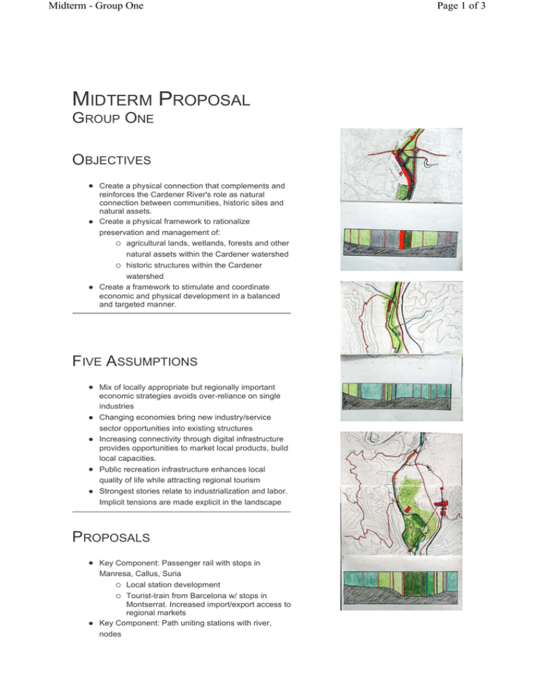
Key Component: Passenger rail with stops in
Manresa, Callus, Suria
{ Local station development
{ Tourist-train from Barcelona w/ stops in
Montserrat. Increased import/export access to
regional markets
Key Component: Path uniting stations with river,
nodes
Page 1 of 3
Midterm - Group One
z
z
z
z
Agriculture
{ Promotion of appellation agricultural niches:
wine, oil, pork products
{ Preservation of horts, fishing (hunting?)
Tourism: Important to differentiate between different
types of visitors
{ sport (fishing, hiking, biking)
{ leisure (weekend farmhouse rentals)
{ historic: preservation of pobles vells, macias,
mills, churches, ermitas, torres
{ nature: maintenance of forests, river quality
{ Packaging of tourism opportunities should
situate the Cardener as a corridor of
opportunities between two major visitor
destinations: Cardona and Montserrat
Industrial
{ Better transportation connections through rail
{ Benefits of clustered developments
{ Adaptive reuse of historic structures
Coordinate relationships between existing local
organizations
{ walking/hiking groups (senders)
{ fishing organizations
{ preservation groups
{ local municipal plans and initiatives
{ large industries (SuriaK, Pirelli, etc.)
{ labor organization
GROWTH GUIDELINES
z
z
z
z
Cluster growth in urban areas
Protect scarce agricultural land from encroachment
Protect watershed from impervious cover, non-point source pollution
Allow for centralized treatment of water
PATH CHARACTERISTICS
z
z
z
z
z
Hierarchy: As a result of our economic development
scenario analysis, the idea of the path became a
hierarchy of paths.
Main paths serve multiple functions (industrial and
touristic, for example) and connect main nodes.
Accommodate large volume of traffic.
Secondary Paths connect less important nodes, and
accommodate less frequent travel.
Tertiary Paths are "side loops" for infrequent and
highly purposive use. For example, just to visit an
ermita, or just to travel through an hort.
Responsiveness to context: path shape, size, edge,
furniture and lighting are highly responsive to
immediate context: urban (civic), industrial,
agricultural, forest, etc. Particular segments could be
designed and managed by local groups.
Page 2 of 3
Midterm - Group One
z
Materials used should be local in nature: brick,
recycled rubber, perhaps even potash byproducts.
{ Connectivity to existing systems is of
particular concern.
{ To existing trails (e.g. PC-C131): coordinate
signage and marketing
{ To urban fabric: transition areas into town
centers should highlight the importance of the
connection
{ To garden paths: balance concerns of a
public trail with private gardens
{ To forest: emphasize "pathlessness" or multipath
{ To river: echo water quality, river shape
{ To industrial edge: opportunity for historical
allusion; hard-edge design
{ To specific nodes: (list of sites)
{ To transportation systems: interface with
roads, bus stations, and proposed rail station
PHASING
z
z
z
Phase 1
{ Begin passenger service; stations established
{ Build Main Paths, perhaps along axes
established by existing groups, such as
Preservation Group (San Mateu, Santpedor,
Suria, Manresa)
{ Establish principles of reuse of historic
structures
Phase 2
{ Secondary Paths: linkages between stations,
to other nodes, especially to historic
structures
Phase 3
{ Reuse of mine infrastructure: phosphate mine
in Suria develops into new commercial or
research center, with coordinated
development in the Pla de Reguant and
Colonia Antius.
Page 3 of 3
