Edge-Based Detection of Sky Regions in Images for Solar
Exposure Prediction
N. Laungrungthip, A.E. McKinnon, C.D. Churcher, K. Unsworth
Applied Computing Group, Lincoln University, Canterbury, New Zealand.
Email: mckinnon@lincoln.ac.nz
Abstract
A device for predicting the solar exposure at a location operates by gathering image data from that location with a known
camera orientation. The image data is then processed to identify the sky regions and the solar exposure is predicted using a
standard sun path model and tracing the rays from the sun through the processed images.
Critical to the success of this technique is the image processing used to separate the sky from the rest of the image. This work
is concerned with developing a technique which can do this for images taken under different weather conditions. The general
approach to separate the sky from the rest of the image is to use the Canny edge detector and the morphology closing
algorithm to find the regions in the image. The brightness and area of each region are then used to determine which regions
are sky. The FloodFill algorithm is applied to identify all pixels in each sky region.
Keywords: Solar exposure, skyline, image processing, image segmentation.
1 Introduction
Being able to predict the exposure to the sun at a
particular site can be very useful in situations such as
heating domestic water or powering a solar house [1].
The position of the sun in the sky changes continually
during the day and seasonally throughout the year.
The exposure to the sun at a particular location at
different times of the year, can also be affected by
obstructions such as hills, trees or buildings.
Knowing the solar exposure at a particular location
would help an architect to design an energy efficient
house and also help a builder determine the position
where a solar collector would get the most sunlight.
The solar exposure at a location may be of interest for
a specified time or integrated over a time period such
as an hour, day, week, or month.
A number of devices have been proposed [2, 5, 13]
based on the following principles:
1.
Take a series of digital images from the location
of interest with the camera pointing known
directions.
2.
Find the sky in each image using image
processing techniques.
3.
Use a standard sunpath model [14] to calculate
the azimuth and elevation of the sun at any
time(s) of the year.
4.
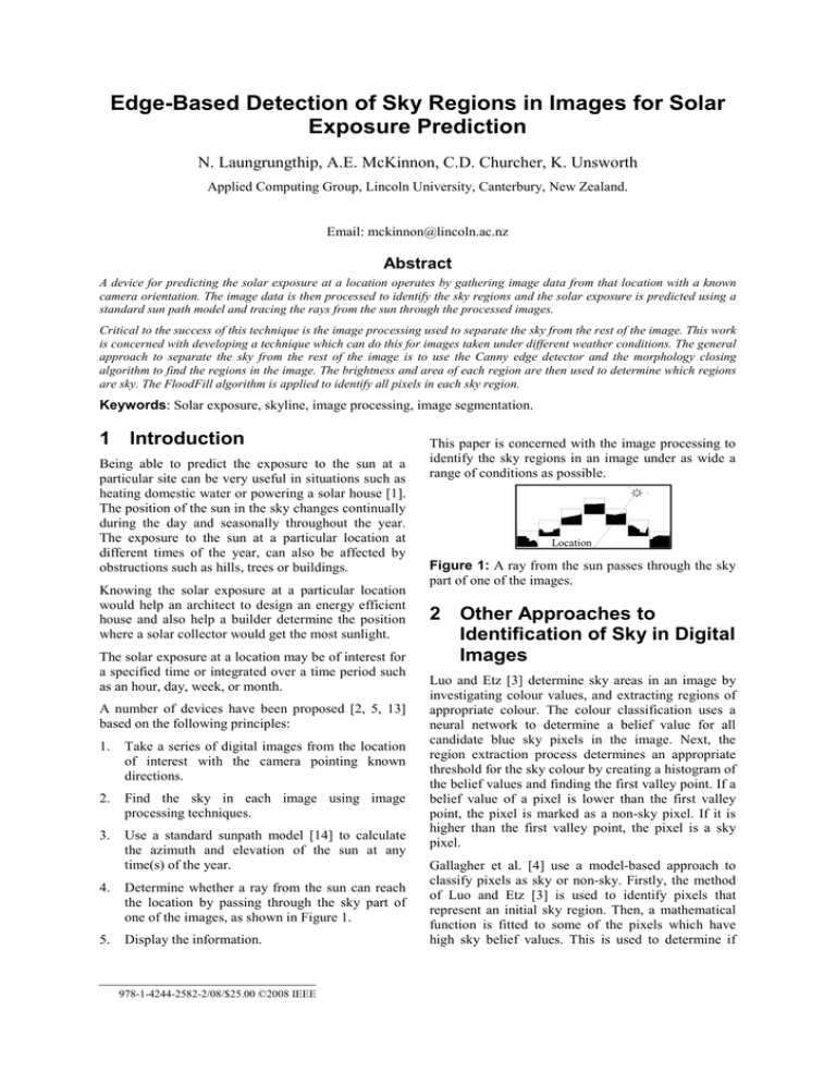
Determine whether a ray from the sun can reach
the location by passing through the sky part of
one of the images, as shown in Figure 1.
5.
Display the information.
978-1-4244-2582-2/08/$25.00 ©2008 IEEE
This paper is concerned with the image processing to
identify the sky regions in an image under as wide a
range of conditions as possible.
Location
Figure 1: A ray from the sun passes through the sky
part of one of the images.
2 Other Approaches to
Identification of Sky in Digital
Images
Luo and Etz [3] determine sky areas in an image by
investigating colour values, and extracting regions of
appropriate colour. The colour classification uses a
neural network to determine a belief value for all
candidate blue sky pixels in the image. Next, the
region extraction process determines an appropriate
threshold for the sky colour by creating a histogram of
the belief values and finding the first valley point. If a
belief value of a pixel is lower than the first valley
point, the pixel is marked as a non-sky pixel. If it is
higher than the first valley point, the pixel is a sky
pixel.
Gallagher et al. [4] use a model-based approach to
classify pixels as sky or non-sky. Firstly, the method
of Luo and Etz [3] is used to identify pixels that
represent an initial sky region. Then, a mathematical
function is fitted to some of the pixels which have
high sky belief values. This is used to determine if
additional pixels outside the initial sky region should
be considered as part of the sky. The approach is
limited to images with blue sky.
The SAMD patent application [5] outlines various
gradient and other approaches for detecting the
skyline in the image but it is not clear how this is
done in the SunEye device currently available for
purchase.
(1)
(2)
(3)
(4)
(5)
(6)
(7)
(8)
3 This Study
This paper describes the development of a robust
image processing technique for identifying the sky
region of an image to enable accurate calculation of
the solar exposure at a location at any time of the
year.
The general approach is to determine the edges of the
sky regions. The following steps are involved:
1.
2.
Extract a colour plane.
Apply the Canny edge detection algorithm [6] to
determine the boundary lines in the image.
3.
Apply the morphological closing algorithm [7] to
close gaps in the boundaries.
4.
Identify which of the enclosed regions represent
sky.
5.
Display the segmented image.
4 Exploration of
Implementation Options
In order to implement the algorithm described in
section 3, it is necessary to investigate the most
appropriate settings for the colour channel and other
algorithm parameters to ensure that the final
implementation is as robust as possible enabling it to
work successfully on a wide range of images. In order
to do this a set of images was selected and subjected
to a series of experiments. This section describes
these investigations.
4.1
The following method was used to determine the
colour channel best suited for separating the sky from
the rest of the image.
1.
On each test image, a rectangular region
containing only sky and a rectangular containing
no sky were manually selected, as shown for test
image 4 in Figure 3.
(b)
The Images
Different weather conditions can have an effect on the
ability to determine the sky regions. For example each
of these conditions can pose different challenges:
bright sky- no cloud, bright sky – scattered clouds,
overcast sky – white clouds, and overcast sky – grey
clouds. The set of images in Figure 2 were used as the
test set.
4.2
Figure 2: Test images: (1 and 2) bright sky- no
cloud, (3 and 4) bright sky – scattered clouds, (5 and
6) overcast sky – white clouds, (7 and 8) overcast
sky – grey clouds.
(a)
Figure 3: The original test image 4 (a), sky region
(b) and non-sky region (c).
2.
The desired colour channel was extracted from
the sky and non-sky regions. All colour channels
were normalized to the range 0 to 255.
3.
The average pixel values of the sky and non-sky
regions were calculated for the extracted colour
channel.
4.
The average pixel value of the non-sky region
was subtracted from the average pixel value for
the sky region and displayed.
Choosing a Colour Channel
The objective of extracting a colour channel is to
increase the contrast between the sky and the rest of
the image. The colour channels from the following
colour models: (blue, red, green and greyscale), (H, S,
V), (Y, Cr, Cb), (X, Y, Z) [8] and (L, a, b) [9] were
tested.
(c)
Figure 4 shows that the Z, Blue and V colour channels
gave the highest contrast for test image 4 (bright sky –
scattered clouds). When applied to all images, the
blue colour channel was consistently among the three
channels that give the highest contrast across all test
images and was therefore used in subsequent
processing.
The morphology closing algorithm [7] uses a dilation
operation followed by an erosion operation. The
dilation and erosion operations use a structure element
(e.g. 3 x 3 or 5 x 5).
Gaps
200
150
100
50
S
Cr
b
H
a
Cb
L
Red
X
Y
xYz
Grey
V
Green
Z
0
-50
Blue
The Difference of
Average Pixel Value
Colour Channel Comparison Analysis (Image 4)
Colour Channel
Figure 6: The effect of a gap in the skyline. The grey
colour represents the sky.
Figure 4: The difference of the average value of the
sky and non-sky regions for each different colour
channel in image 4.
Having determined the boundaries of all the regions
in the image we can find all the pixels in any given
region using the FloodFill algorithm [11].
4.3
4.5
Finding the Regions in an Image
The objective of this step is to find the edges of all the
regions in an image so as to determine the boundaries
between contrasting regions.
There are several methods to perform edge detection
such as the Sobel, Roberts Cross, Prewitt, Laplace,
and Canny edge detector methods [10]. The most
widely accepted of these, the Canny edge detector, is
used here.
The Canny edge detector may find edges around
clouds in the sky. However we can adjust the upper
and lower thresholds in the algorithm to avoid those
edges. The results of using different thresholds are
shown in Figure 5.
(a)
(b)
(c)
Figure 5: Image (a) shows the blue colour channel
prior to the application of Canny edge detection.
Image (b) shows the edges detected when the upper
and lower thresholds are set to low values, while
image (c) shows the result when the upper and lower
thresholds are adjusted to avoid the edges around
clouds.
4.4
In order to determine the sky regions in an image, it is
necessary to determine values for the upper threshold
and the lower threshold for the Canny edge detector,
the size of the structuring element for the
morphological closing algorithm, a FloodFill starting
pixel for the FloodFill algorithm, and which of the
bounded regions are sky.
To make the image processing as robust as possible it
is necessary to use values for the threshold settings
and the size of the structuring element so that they
successfully identify the sky regions in a wide rage of
images. As there is no theoretical basis for setting
these parameters, an empirical study was undertaken
to find the most appropriate settings as described in
the following sections.
4.6
Determining edge detector upper
and lower thresholds and the
structure element size
The following approach was used.
1.
Manually adjust the thresholds for each test
image using the blue colour channel, until the sky
boundary was seen to coincide visually with the
boundary obtained by inspecting the image. The
sky region was then identified manually and its
area and perimeter were determined. We refer to
these as the actual area (AA) and perimeter (PA)
in the next steps.
2.
Calculate the area (CA) and perimeter (CP) of the
sky region for each test image when the upper
and lower thresholds and size of structuring
element are varied. The lower thresholds ranged
from 1 to 1000, the upper thresholds from 1 to
1000, and the structure element from 3×3 to
21×21 in steps of 2 in each direction.
Closing Gaps in Edges
The approach taken to finding the sky is to find the
edges surrounding all possible sky regions. Although
the Canny edge detector will help to do that, it may
leave gaps in some edges. If these are not closed the
area of sky may “spill” through the gap as shown in
Figure 6. To counter this, the morphology closing
operation [7] is applied to the binary image of edges.
Selecting Image Processing
Parameters
Threshold Ranges Identifying Sky Region
Thresholds suitable for all
images except image 4
Lower Threshold
80
Image 5
60
40
Image 4
A ll
images
Thresholds suitable for all
images except image 5
Image 8
Thresholds suitable for all
images except image 7
20
Image 7
0
0
50
100
150
200
250
300
Upper Threshold
Thresholds suitable for all
images except image 8
Thresholds suitable for all
images
Figure 7: The threshold ranges which gave area and perimeter values of the sky region within 0.3% and 5%
respectively of the correct values for all images (centre area) and for all but one image (other areas).
3.
For each set of parameters tested, the maximum
fractional error (EA) between the calculated (CA)
and actual (AA) areas was determined across all
the images according to equation (1).
Undesirable
cloud edges
EA = maxi(|CAi – AAi| / AAi) {i = 1…n} (1)
where n is the number of images.
The smallest value of EA that could be achieved
was 0.3% of the actual area.
4.
{i = 1…n}
(2)
The ranges of parameters which gave on EA ≤
0.3% and on EP ≤ 5% were determined.
The smallest value of EA (0.3%) and EP (5%) both
occurred only with a structure element size of 3×3.
The ranges of upper and lower threshold values for
the smallest area and perimeter tolerances for all
images are 186 to 217 and 16 to 61 respectively, as
shown by the "All Images" region in Figure 7. Figure
7 also shows the ranges for the lower and upper
threshold values which met the smallest area and
perimeter tolerances criteria in all but one of the test
images.
The following describes why some threshold values
failed to meet the minimum criteria for images 4, 5, 7
and 8 as shown in Figures 8 and 9.
Figure 8(a) shows the result for image 4 when the
upper threshold is 150 and lower threshold is 40 and
Figure 8(b) shows the result for image 7 when the
upper threshold is 200 and lower threshold is 10.
These values produce spurious edges in the clouds
which violate the perimeter criterion.
Figure 9(a) shows the result for image 5 when the
upper threshold equals 200 and lower threshold equals
65 and Figure 9(b) shows the result for image 8 when
the upper threshold equals 225 and lower threshold
equals 40. These values give a sky area more than
0.3% larger than the correct area in both images.
(b)
Figure 8: Image 4(a) and image 7(b) failed to meet
the perimeter criterion.
Additional area of sky
Similarly for the maximum fractional error (EP)
in the perimeter, according to equation (2). The
EA was kept at 0.3% for this step. The smallest
value of EA that allowed all images to be
represented was 5% of the actual perimeter (AP).
EP = maxi(|CPi – APi| / APi)
5.
(a)
(a)
(b)
Figure 9: Image 5(a) and image 8(b) failed to meet
the area criterion.
4.7
Determining sky regions
automatically
In section 4.6 the ranges of upper and lower
thresholds, and the structure element size were
determined to identify the boundaries of all the region
in an image. However, in that analysis those bounded
regions corresponding to sky were manually
identified. This section describes the initial
development of an algorithm to automatically
determine which of the identified bounded regions are
actually sky. The algorithm is based on the brightness
of the pixels and the area of the regions.
For a region to be a candidate sky region it must
contain one or more pixels whose value is greater than
a brightness threshold. The brightness threshold
selected is based on an image histogram as shown in
Figure 10.
Figure 10: Example of determining the brightness
threshold.
The algorithm to determine which of the candidate
regions are sky is based on the size of the region. The
basic idea is that possible sky regions are ranked by
area and each is considered in turn to see if it should
be classified as a sky region. The criterion chosen is
that the region under consideration (in ranked order)
should have an area greater than a specified area
threshold of the accumulated sky area thus far.
The correct sky regions for all of the test images were
identified only if the brightness threshold was set
where 20% of the pixels were brighter than the
threshold values and the area threshold was set at
50%. Although the values of 20% for the brightness
threshold and 50% for the area criterion selected as a
result of these tests work for all the test images, they
may not be successful for other images. An example
which would probably fail is where the image consists
of a number of small bright areas of sky such as
would be obtained if the image was taken through the
branches of a tree. Further testing and revision of the
algorithm is required to address these cases.
4.8
User Interaction
Although this work has found settings for the
structure element size and threshold values that give
satisfactory results across a wide range of images,
there will be some situations where image processing
alone will not correctly determine sky area
boundaries. For example, images which are taken
directly into the sun or which involve sunlight
reflection off very shiny surfaces will require some
user interaction to identify the boundary of the sky
area. User interaction tools have been developed to
allow the user to draw the sky boundary, paint the sky
or the non-sky region.
4.9
Displaying and storing the
segmented image
After identification of the sky region, the image is
converted to binary form with white used to represent
sky pixels and black to represent non-sky pixels as
shown in Figure 11. This image is stored for
subsequent processing to enable prediction of solar
exposure.
images. There are other situations we have not yet
fully explored which we discuss here.
5.1
In some image processing situations, it may be
appropriate to control the camera's settings to
optimise the image so that subsequent image
processing is more likely to succeed. However,
images to predict solar exposure will be taken in a
wide range of conditions and it is therefore
inappropriate to control individual camera settings.
Rather, the approach that has been taken is to make
the image processing as robust as possible by
ensuring that it works successfully on a range of
images, such as those in the test set, using the
camera's automatic settings.
5.2
5 Discussion
The technique we have discussed successfully
determined the sky regions in our sample set of
The Appropriate Upper
Threshold, Lower Threshold, the
Size of the Structure Element
The range of upper and lower thresholds that work
well for the test images is 186 to 217 and 16 to 61
respectively, and the size of the structure element is 3.
However, the threshold values depend on the image
resolution (800 × 600 in these tests) and the particular
implementation of the Canny edge detector used
(OpenCV [12] in this case). The tests would need to
be repeated for other situations.
When the results of this investigation are applied to a
new image, only a single value for each of the upper
and lower thresholds needs to be specified. All the
values in the range remove unwanted edges in the sky
area. There will be many edges remaining in the nonsky area and the different upper and lower thresholds
will affect the regions that are bounded by these
edges. The lower values of both thresholds result in
smaller bounded regions. These smaller areas are less
likely to be mistakenly identified as sky in subsequent
processing. If low values of the thresholds are used,
more non-sky regions are found, but the area of each
region is smaller. Smaller regions are less likely to be
large enough to be classified as sky regions using the
technique discussed in section 5.2. Therefore, it is
appropriate to use the lowest values of the upper and
lower threshold ranges, 186 and 16 respectively.
5.3
Figure 11: The final image after identifying the sky
region. The white colour represents the sky. The black
frame shown around it is not part of the image.
Camera Settings
Other Image Factors
The set of images used for this study, Figure 1, does
not include an image for an overcast sky with black
clouds. However, as long as there is sufficient
contrast between the sky and other objects in the
image, we would expect the threshold and structure
element values found here to work satisfactorily for
such an image.
6 Conclusions
8 References
In this paper, image processing techniques are used to
identify the sky regions in an image. We have shown
that the Canny edge detector followed by the closing
morphology algorithm applied to the blue colour
channel can satisfactorily find the boundaries of the
sky region of an image.
[1]
We have shown that with a 3 x 3 structure element
and with the upper thresholds in the range 186 and
217 and lower thresholds in the range 16 to 61, the
boundaries of the sky region can be accurately
determined across a wide range of images.
Although, the brightness and area criteria are used to
determine which of the identified regions are sky,
another situation where the bounded region is
incorrectly identified is where the bottom part of the
image is identified as sky. These incorrectly identified
regions may not affect the solar exposure calculation
because the sunpath never passes through that area.
However, it might be possible to improve the
identification of sky regions by using the location of
the region as a guide, i.e. regions at the bottom of an
image are unlikely to be sky.
Although the technique developed in this paper is
shown to work well with a range of sky conditions, it
has not been tested with a large number of images.
However, provided an image exhibits contrast similar
to the test images it is likely the algorithm will
successfully identify the sky regions.
Although the approach described in this paper should
enable the sky region to be identified in a wide range
of sky conditions, there will be some situations where
image processing alone does not correctly determine
sky area boundaries, for example, if an image is taken
directly into the sun or sunlight reflects off very shiny
surfaces. These situations will require some user
interaction to identify the boundaries of the sky area.
Thus we allow the user to draw the sky boundary and
manually identify the sky or non-sky region.
The techniques developed in this paper work
successfully across a wide range of sky conditions
and can be readily combined with software which
calculates the sunpath and traces the path of a ray
through the processed images to predict solar
exposure at a location at any time of the day for any
day of the year.
[2]
[3]
[4]
[5]
[6]
[7]
[8]
[9]
[10]
[11]
[12]
[13]
7 Acknowledgements
Nuchjira Laungrungthip received support from the
Lincoln University Image Processing and Solar
Radiation Masters Scholarship while carrying out this
work.
[14]
Energy Information Administration. 2006.
Solar – Energy from the sun. “Home Page”,
http://www.eia.doe.gov/kids/energyfacts/sou
rces/renewable/solar.html, visited on
4/4/2007.
A.E. McKinnon, 2007. Estimate Solar
Exposure at a Particular Location –
Demonstration of Concept. Unpublished
report, Applied Computing Group, Lincoln
University.
J. Luo, and S. Etz, 2003. Method For
Detecting Sky In Images. United States
Patent Application Publication. US
6,504,951 B1.
A. C. Gallagher, J. Luo, and W. Hao, 2005.
Detection of sky in digital color images.
United States Patent Application Publication.
US 2005/0147298 A1.
W.S. MacDonald, 2007. Solar Access
Measurement Device. United State Patent
Application Publication. US 2007/0150198.
J. Canny, 1986. A computational Approach
To Edge Detection, IEEE Trans. Pattern
Analysis and Machine Intelligence, 8:679714.
J.R. Parker1 1997. Algorithms for Image
Processing and Computer Vision. Wiley
Computer Publishing. US.
D. Hearn and M.P. Baker, 2004, Computer
Graphics. Pearson Prentice Hall. US.
E. Tittle, S. Price, & J.M. Stewart. 1997.
Web Graphics. Wiley Computer. US.
M. Roushdy, 2006. Comparative Study of
Edge Detection Algorithms Applying on the
Grayscale Noisy Image Using Morphological
Filter. GVIP Journal, 6, 4.
J. D. Foley, A.V. Dam, & S.K.Feiner. 1997.
Computer Graphics: Principles and Practice.
Addison – Wesley Publishing Company. US.
Intel Corporation. Open Source Computer
Vision Library. “Home Page”,
http://www.intel.com/technology/computing/
opencv/, visited on 2/3/2007.
Solar Pathfinder. (2008). Solar Pathfinder.
“Home Page”,
http://www.solarpathfinder.com/, visited on
26/1/2008.
M. Iqbal. (1983). An Introduction to Solar
Radiation. Toronto: Academic Press. US.


