Civil Engineering Students: Andre Forestiere, David Halopoff, Zaki Niaz ABSTRACT
advertisement
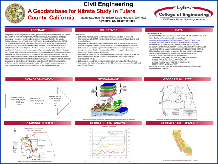
Civil Engineering Students: Andre Forestiere, David Halopoff, Zaki Niaz Advisors: Dr. Wiliam Wright ABSTRACT OBJECTIVES The purpose of this project was to collect, gather, and organize water quality and system data for Small Public Drinking Water Systems in Tulare County, California, and begin developing a computer-based model to process the data and display the results. California Department of Public Health’s (CALDPH) Water Quality Monitoring (WQM) database was used to collect the necessary information. Focus was placed in Tulare County only, due to shear volume of the data available. Additional counties may be added once a database with proper structure and ease of use for Tulare County is established. Furthermore, the water system information collected will be tied through user-friendly algorithm or computer software to zip codes by specific congressional, state assembly, and state senate districts. The goal of the project is to eventually create a model, which will return information on the water systems that have had nitrate levels above the Nitrate Maximum Contaminant Level (MCL) in the respective district. The user can choose to display the information on a map along with statistical analysis of the violation records. Ideally, the computer model will eventually be amended to return information on any contaminate records found in the available databases. DATA ORGANIZATION DATABASE: CHEMICAL FIELDS: PRIM_STA_CDE STORE_NUM FINDING OBJECTIVES: 1. Determine the adequacy of California Water Testing Database in obtaining information on Nitrate MCL violations in wells/water systems in Tulare County and across California. 2. Determine an effective process to match the location of the well/water systems violators to a given California Senate, Assembly, or Federal Congressional District. 3. Determine an appropriate algorithm for performance of a statistical analysis on the testing information that is in violation of the MCL in a respective California Government District, as given by the user. 4. Determine an appropriate GIS computer program (mapping software) to locate the wells/water systems that are in violation of the Nitrate MCL and provide this information on a map. 5. Determine an appropriate computer program that can merge the MCL violation information, the statistical analysis, and the GIS information in a comprehensible and user-friendly format. GEODATABASE DATA DATA ACQUISITION: • CALDPH WQM database can be downloaded from CALDPH’s “EDT Library and Water Quality Analyses Data and Download Page” http://www.cdph.ca.gov/certlic/drinkingwater/Pages/EDTlibrary.aspx • The WQM is compromised of four water quality analyses databases [CHEMXARC (01/01/1960 – 12/31/1999), CHEMARCH (01/01/2000 – 12/31/2005), CHEMHIST (01/01/2006 – 12/31/2010), CHEMICAL (01/01/2011 – current)] and three supporting databases (SITELOC, WATERSYS, STORET). • All the databases are needed to correlate the water quality analyses to a specific location (water systems/wells) and contaminant (nitrate). • The field of interest in each database are as follows: CHEMICAL: “PRIM_STA_CDE”, “STORE_NUM”, and “FINDING” SITELOC: “PRIM_STA_CDE”, and “SYSTEM_NO” WATSYS: “SYSTEM_NO”, “ADDRESS”, “CITY”, and “ZIP” STORET: “STORE_NUM”, and “MCL” • A total of 4,182 nitrate tests are being used for the study, of which 845 exceeded the MCL, or 20%. GEOGRAPHIC LAYER DATABASE: WATSYS DATABASE: SITELOC FIELDS: SYSTEM_NO FIELDS: PRIM_STA_CDE SYSTEM_NO ADDRESS CITY ZIP The data is then taken from the database an assembled into thematic layers which forms the Geodatabase. CONTAMINATED SITES GEOSTATISTICAL ANALYSIS A map can then be created using the geographic information from the geodatabase. GEODATABASE EXPANSION Sample graphics . Taken from Internet When the geodatabase is assembled, various types of statistical analysis can be performed comparing the water systems. The geodatabase can be expanded to cover other counties in California.
