Location and Evolution of the South Atlantic Anomaly
advertisement
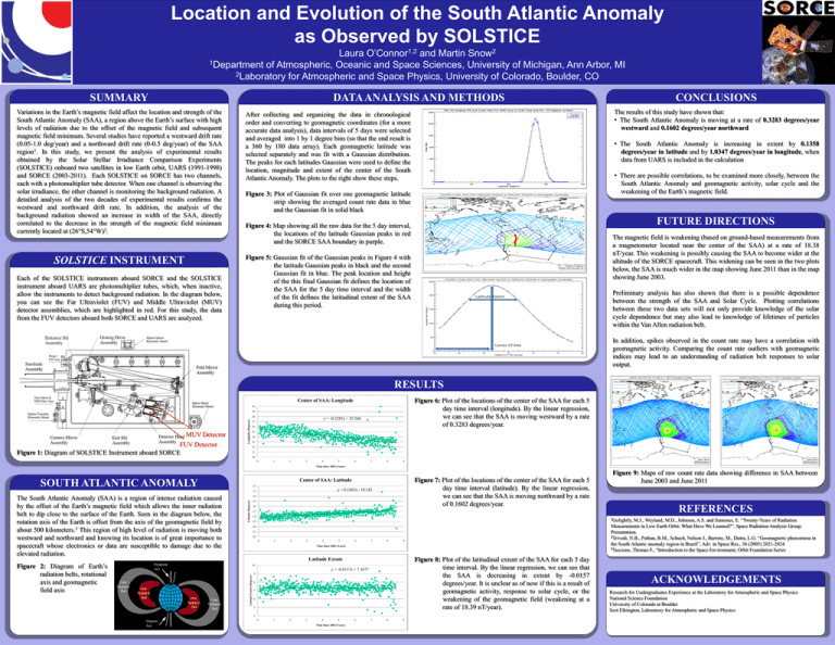
Location and Evolution of the South Atlantic Anomaly as Observed by SOLSTICE Laura O’Connor1,2 and Martin Snow2 1Department of Atmospheric, Oceanic and Space Sciences, University of Michigan, Ann Arbor, MI 2Laboratory for Atmospheric and Space Physics, University of Colorado, Boulder, CO SUMMARY DATA ANALYSIS AND METHODS Variations in the Earth’s magnetic field affect the location and strength of the South Atlantic Anomaly (SAA), a region above the Earth’s surface with high levels of radiation due to the offset of the magnetic field and subsequent magnetic field minimum. Several studies have reported a westward drift rate (0.05-1.0 deg/year) and a northward drift rate (0-0.5 deg/year) of the SAA region1. In this study, we present the analysis of experimental results obtained by the Solar Stellar Irradiance Comparison Experiments (SOLSTICE) onboard two satellites in low Earth orbit, UARS (1991-1998) and SORCE (2003-2011). Each SOLSTICE on SORCE has two channels, each with a photomultiplier tube detector. When one channel is observing the solar irradiance, the other channel is monitoring the background radiation. A detailed analysis of the two decades of experimental results confirms the westward and northward drift rate. In addition, the analysis of the background radiation showed an increase in width of the SAA, directly correlated to the decrease in the strength of the magnetic field minimum currently located at (26°S,54°W)2. SOLSTICE INSTRUMENT Each of the SOLSTICE instruments aboard SORCE and the SOLSTICE instrument aboard UARS are photomultiplier tubes, which, when inactive, allow the instruments to detect background radiation. In the diagram below, you can see the Far Ultraviolet (FUV) and Middle Ultraviolet (MUV) detector assemblies, which are highlighted in red. For this study, the data from the FUV detectors aboard both SORCE and UARS are analyzed. CONCLUSIONS The results of this study have shown that: • The South Atlantic Anomaly is moving at a rate of 0.3283 degrees/year westward and 0.1602 degrees/year northward After collecting and organizing the data in chronological order and converting to geomagnetic coordinates (for a more accurate data analysis), data intervals of 5 days were selected and averaged into 1 by 1 degree bins (so that the end result is a 360 by 180 data array). Each geomagnetic latitude was selected separately and was fit with a Gaussian distribution. The peaks for each latitudes Gaussian were used to define the location, magnitude and extent of the center of the South Atlantic Anomaly. The plots to the right show these steps. • The South Atlantic Anomaly is increasing in extent by 0.1358 degrees/year in latitude and by 1.0347 degrees/year in longitude, when data from UARS is included in the calculation • There are possible correlations, to be examined more closely, between the South Atlantic Anomaly and geomagnetic activity, solar cycle and the weakening of the Earth’s magnetic field. Figure 3: Plot of Gaussian fit over one geomagnetic latitude strip showing the averaged count rate data in blue and the Gaussian fit in solid black FUTURE DIRECTIONS Figure 4: Map showing all the raw data for the 5 day interval, the locations of the latitude Gaussian peaks in red and the SORCE SAA boundary in purple. The magnetic field is weakening (based on ground-based measurements from a magnetometer located near the center of the SAA) at a rate of 18.38 nT/year. This weakening is possibly causing the SAA to become wider at the altitude of the SORCE spacecraft. This widening can be seen in the two plots below, the SAA is much wider in the map showing June 2011 than in the map showing June 2003. Figure 5: Gaussian fit of the Gaussian peaks in Figure 4 with the latitude Gaussian peaks in black and the second Gaussian fit in blue. The peak location and height of the this final Gaussian fit defines the location of the SAA for the 5 day time interval and the width of the fit defines the latitudinal extent of the SAA during this period. Preliminary analysis has also shown that there is a possible dependence between the strength of the SAA and Solar Cycle. Plotting correlations between these two data sets will not only provide knowledge of the solar cycle dependence but may also lead to knowledge of lifetimes of particles within the Van Allen radiation belt. In addition, spikes observed in the count rate may have a correlation with geomagnetic activity. Comparing the count rate outliers with geomagnetic indices may lead to an understanding of radiation belt responses to solar output. RESULTS Figure 6: Plot of the locations of the center of the SAA for each 5 day time interval (longitude). By the linear regression, we can see that the SAA is moving westward by a rate of 0.3283 degrees/year. Center of SAA: Longitude 30 29 MUV Detector FUV Detector Figure 1: Diagram of SOLSTICE Instrument aboard SORCE Longitude (Degrees) 28 y = -0.3283x + 25.566 27 26 25 24 23 22 21 20 0 1 2 3 4 5 6 7 8 9 Time Since 2003 (Years) SOUTH ATLANTIC ANOMALY -12 y = 0.1602x - 18.183 -13 -14 Latitude (Degrees) The South Atlantic Anomaly (SAA) is a region of intense radiation caused by the offset of the Earth’s magnetic field which allows the inner radiation belt to dip close to the surface of the Earth. Seen in the diagram below, the rotation axis of the Earth is offset from the axis of the geomagnetic field by about 500 kilometers.3 This region of high level of radiation is moving both westward and northward and knowing its location is of great importance to spacecraft whose electronics or data are susceptible to damage due to the elevated radiation. Figure 7: Plot of the locations of the center of the SAA for each 5 day time interval (latitude). By the linear regression, we can see that the SAA is moving northward by a rate of 0.1602 degrees/year. Center of SAA: Latitude -15 -16 -18 M.J., Weyland, M.D., Johnson, A.S. and Semones, E. “Twenty-Years of Radiation Measurements in Low Earth Orbit: What Have We Learned?”. Space Radiation Analysis Group. Presentation. 2Trivedi, N.B., Pathan, B.M., Schuch, Nelson J., Barreto, M., Dutra, L.G. “Geomagnetic phenomena in the South Atlantic anomaly region in Brazil”, Adv. in Space Res., 36 (2005) 2021-2024 3Tascione, Thomas F., “Introduction to the Space Environment, Orbit Foundation Series 1Golightly, -19 -20 -21 -22 0 1 2 3 4 5 6 7 8 9 Time Since 2003 (Years) Figure 8: Plot of the latitudinal extent of the SAA for each 5 day time interval. By the linear regression, we can see that the SAA is decreasing in extent by -0.0157 degrees/year. It is unclear as of now if this is a result of geomagnetic activity, response to solar cycle, or the weakening of the geomagnetic field (weakening at a rate of 18.39 nT/year). 10 y = -0.0157x + 7.3677 Latitude Extent (Degrees) REFERENCES -17 Latitude Extent Figure 2: Diagram of Earth’s radiation belts, rotational axis and geomagnetic field axis Figure 9: Maps of raw count rate data showing difference in SAA between June 2003 and June 2011 9 8 7 6 5 ACKNOWLEDGEMENTS Research for Undergraduates Experience at the Laboratory for Atmospheric and Space Physics National Science Foundation University of Colorado at Boulder Scot Elkington, Laboratory for Atmospheric and Space Physics 4 0 1 2 3 4 5 Time Since 2003 (Years) 6 7 8 9 printed by www.postersession.com
