SUMMARY OF THE TTR‐18 CRUISE
advertisement

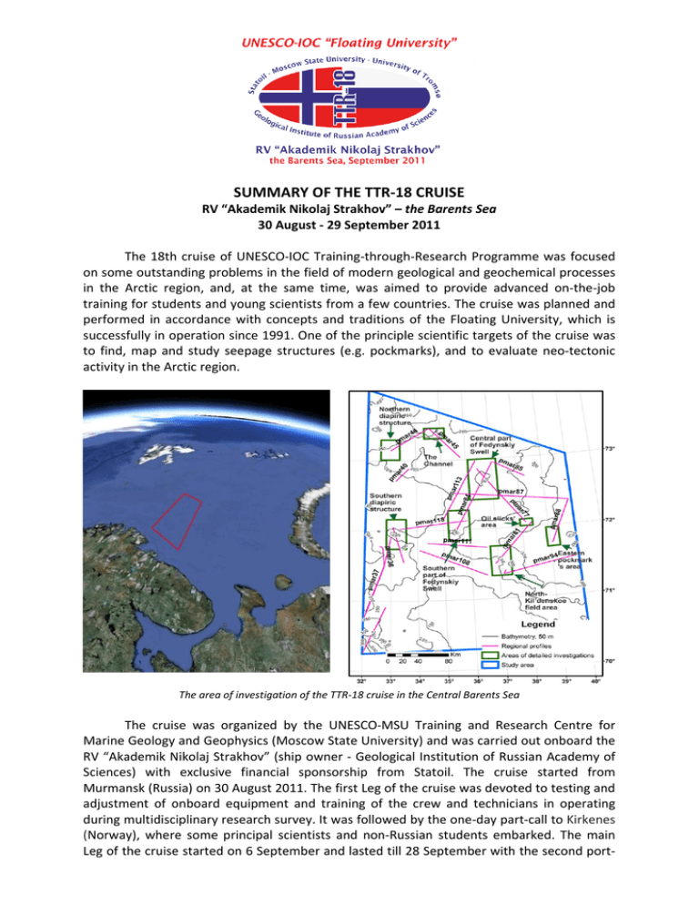
SUMMARY OF THE TTR‐18 CRUISE RV “Akademik Nikolaj Strakhov” – the Barents Sea 30 August ‐ 29 September 2011 The 18th cruise of UNESCO‐IOC Training‐through‐Research Programme was focused on some outstanding problems in the field of modern geological and geochemical processes in the Arctic region, and, at the same time, was aimed to provide advanced on‐the‐job training for students and young scientists from a few countries. The cruise was planned and performed in accordance with concepts and traditions of the Floating University, which is successfully in operation since 1991. One of the principle scientific targets of the cruise was to find, map and study seepage structures (e.g. pockmarks), and to evaluate neo‐tectonic activity in the Arctic region. The area of investigation of the TTR‐18 cruise in the Central Barents Sea The cruise was organized by the UNESCO‐MSU Training and Research Centre for Marine Geology and Geophysics (Moscow State University) and was carried out onboard the RV “Akademik Nikolaj Strakhov” (ship owner ‐ Geological Institution of Russian Academy of Sciences) with exclusive financial sponsorship from Statoil. The cruise started from Murmansk (Russia) on 30 August 2011. The first Leg of the cruise was devoted to testing and adjustment of onboard equipment and training of the crew and technicians in operating during multidisciplinary research survey. It was followed by the one‐day part‐call to Kirkenes (Norway), where some principal scientists and non‐Russian students embarked. The main Leg of the cruise started on 6 September and lasted till 28 September with the second port‐ call to Kirkenes (Norway). After the short transit the cruise was completed in Murmansk (Russia) on 29 September 2011. A set of geophysical and geological equipment and teams of different specialization were onboard to obtain and process different types of data – seismic, profiler, side‐scan sonar, multi‐beam echosounder, underwater TV system, geological and biological bottom sampling (gravity core, dredge, grab). The principal area of interest was located at the south Central Barents Sea and included a southern part of the earlier disputed territory (“grey zone”). The Floating University was the first who brought research vessel in this area after signing the Russian‐ Norwegian maritime border agreement. That is reflected on the official logo of the TTR‐18 cruise where two countries are merged by Floating University international slogan – Training through research. Within the study area several objects were chosen, mapped and studied in more details. The investigation started with mapping and sampling of well‐expressed on the seafloor salt dipiric domes in the western part of the study area. Very extensive set of data, combining bathymetric and acoustic investigations, video observations of the seafloor and bottom sampling of recent sediments and ancient hard rocks from caprock of the diapirs were obtained. On the transit from the Norwegian sector to the Russian one, occasionally very impressive underwater channel system was discovered and then studied. That was followed by exploring of the shallow structure, Cenozoic erosion amplitude, and fluid seepage characteristics of the Fedynskii High. After that in the area above the North Kildin gas field a geochemical mapping of subsurface sediments was performed in order to understand how significant could be gas emanation above the proven gas accumulations. Finally some time and research efforts were devoted to the place of dense distribution of pockmarks at the very east of the study area. The participants of the TTR‐18 cruise The Scientific Party of the TTR‐18 cruise consisted of 15 researchers and 18 students from Moscow State University and University of Tromso. The list of institutions that co‐ operated in the execution of the cruise programme amounted to 8. Together with on‐the‐ job training, in which all took part, there were on‐board daily lectures or seminars each day of the cruise. ‐ ‐ ‐ ‐ ‐ ‐ ‐ ‐ ‐ Scientific highlights of the TTR‐18 cruise are: the high resolution mapping of the areas where Permian salts form dome‐like structures on the seafloor; the first bottom sampling of the sites of fluid discharge along salt diapir flanks; the first collection of species representing benthic community around the salt diapirs outcropping on the seafloor; the first collection of the fragments of Palaeozoic and Mesozoic rocks captured from deeply buried strata and brought to the surface by salt diapirs in the Central Barents Sea; the estimation of recent “growing” activity of the salt diapirs in the study area; the discovery and high resolution mapping of an underwater channel‐valley system; the first collection of species representing benthic community within the underwater channel‐valley system; the set of high resolution seismic profiles to estimate the Cenosoic erosion character and amplitude; the geochemical mapping of subsurface sediments in the area of the North Kil’din gas field to characterize gas emanation into sea‐water and atmosphere.


