ReseaRch Putting Research into Practice: Refining Noxious Weed Management
advertisement

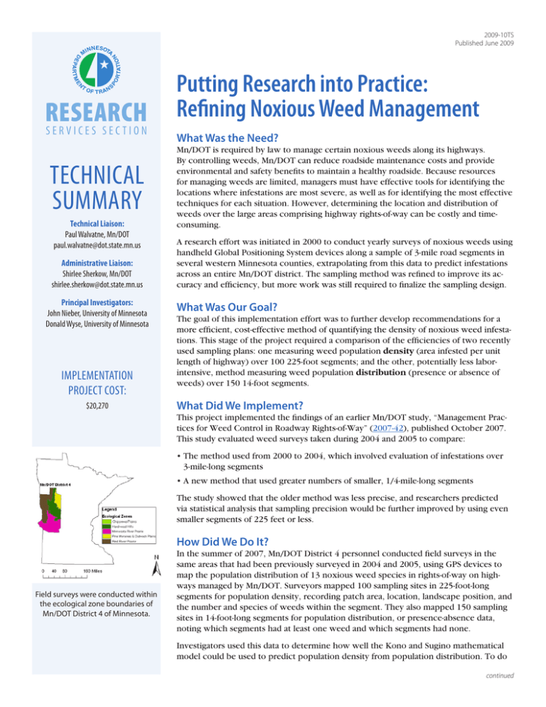
2009-10TS Published June 2009 Research Services section Technical Summary Technical Liaison: Paul Walvatne, Mn/DOT paul.walvatne@dot.state.mn.us Administrative Liaison: Shirlee Sherkow, Mn/DOT shirlee.sherkow@dot.state.mn.us Principal Investigators: John Nieber, University of Minnesota Donald Wyse, University of Minnesota Implementation Project cost: $20,270 Putting Research into Practice: Refining Noxious Weed Management What Was the Need? Mn/DOT is required by law to manage certain noxious weeds along its highways. By controlling weeds, Mn/DOT can reduce roadside maintenance costs and provide environmental and safety benefits to maintain a healthy roadside. Because resources for managing weeds are limited, managers must have effective tools for identifying the locations where infestations are most severe, as well as for identifying the most effective techniques for each situation. However, determining the location and distribution of weeds over the large areas comprising highway rights-of-way can be costly and timeconsuming. A research effort was initiated in 2000 to conduct yearly surveys of noxious weeds using handheld Global Positioning System devices along a sample of 3-mile road segments in several western Minnesota counties, extrapolating from this data to predict infestations across an entire Mn/DOT district. The sampling method was refined to improve its accuracy and efficiency, but more work was still required to finalize the sampling design. What Was Our Goal? The goal of this implementation effort was to further develop recommendations for a more efficient, cost-effective method of quantifying the density of noxious weed infestations. This stage of the project required a comparison of the efficiencies of two recently used sampling plans: one measuring weed population density (area infested per unit length of highway) over 100 225-foot segments; and the other, potentially less laborintensive, method measuring weed population distribution (presence or absence of weeds) over 150 14-foot segments. What Did We Implement? This project implemented the findings of an earlier Mn/DOT study, “Management Practices for Weed Control in Roadway Rights-of-Way” (2007-42), published October 2007. This study evaluated weed surveys taken during 2004 and 2005 to compare: • The method used from 2000 to 2004, which involved evaluation of infestations over 3-mile-long segments • A new method that used greater numbers of smaller, 1/4-mile-long segments The study showed that the older method was less precise, and researchers predicted via statistical analysis that sampling precision would be further improved by using even smaller segments of 225 feet or less. How Did We Do It? Field surveys were conducted within the ecological zone boundaries of Mn/DOT District 4 of Minnesota. In the summer of 2007, Mn/DOT District 4 personnel conducted field surveys in the same areas that had been previously surveyed in 2004 and 2005, using GPS devices to map the population distribution of 13 noxious weed species in rights-of-way on highways managed by Mn/DOT. Surveyors mapped 100 sampling sites in 225-foot-long segments for population density, recording patch area, location, landscape position, and the number and species of weeds within the segment. They also mapped 150 sampling sites in 14-foot-long segments for population distribution, or presence-absence data, noting which segments had at least one weed and which segments had none. Investigators used this data to determine how well the Kono and Sugino mathematical model could be used to predict population density from population distribution. To do continued “This project gets us closer to applying a systems approach to reducing weed numbers by establishing a solid performance measure for evaluating weed management methods on a district basis.” –Paul Walvatne, Supervisor, Mn/DOT Roadside Vegetation Management Unit “Results currently suggest that measuring weed infestations using 225foot surveys is more efficient than using 14foot surveys, although further data will help establish these results more conclusively.” –Donald Wyse, Professor, University of Minnesota Department of Agronomy and Plant Genetics Produced by CTC & Associates for: Minnesota Department of Transportation Research Services Section MS 330, First Floor 395 John Ireland Blvd. St. Paul, MN 55155-1899 (651) 366-3780 www.research.dot.state.mn.us Investigators used the 225-foot sampling approach to map the distribution of species infestation patches in a segment of the US 10 right-of-way. so, they first calibrated the model by dividing data recorded with 225-foot segments into 14-foot segments, determining the proportion of these subdivisions that were infested, and then relating these proportions to the population densities of the 225-foot segments of which they were a part. Once calibrated, this model was applied to population density data collected from actual 14-foot segments to calculate population densities and measure the accuracy of these calculations against expected results. What Was the Impact? Investigators’ efforts to evaluate the relative costs of conducting surveys using the two sampling plans were only partially successful, primarily because of incomplete survey data. Survey results did not include a complete record of time spent by surveyors traveling between sampling sites, and there were other irregularities with time data. While not conclusive, after investigators corrected as much as possible for this lack of data, the results of this project suggest that while the 14-foot presence-absence surveys required less than half the time to conduct, they were less precise than the 225-foot surveys at quantifying infestation density. What’s Next? A Mn/DOT report to be published in October 2009 will include data collected from 225-foot and 14-foot sampling surveys conducted in 2008. Investigators hope to use this data to better quantify the precision of the 14-foot survey results, further test the Kono and Sugino model, and develop conclusive results as to which sampling plan is more efficient and cost-effective, within a specified sampling precision, for assessing weed population distribution in highway rights-of-way. This Technical Summary pertains to Report 2009-10, “Implementation of Methodology for Weed Management Practices,” published February 2009. The full report can be accessed at http://www.lrrb.org/PDF/200910.pdf. The research being implemented via this project is Report 2007-42, “Management Practices for Weed Control in Roadway Rights-of-Way,” published October 2007. This report can be accessed at http://www.lrrb.org/PDF/200742.pdf.


