Major Focus Earth Observations Technology: Ecological Integrity Monitoring &
advertisement
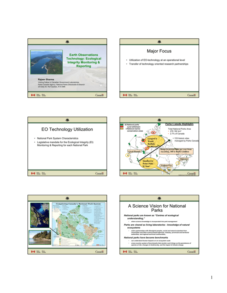
Major Focus Earth Observations Technology: Ecological Integrity Monitoring & Reporting • Utilization of EO-technology at an operational level • Transfer of technology oriented research partnerships Rajeev Sharma Visiting Fellow in Canadian Government Laboratories Parks Canada Agency, National Parks Directorate EI Branch 25 Eddy St, Hull Quebec, K1A 0M5 EO Technology Utilization Parks Canada Highlights 42 National parks Land withdrawn 3 National marine conservation areas • National Park System Characteristics Total National Parks Area • 276 182 km2 • 2.7% of Canada + 153 historic sites managed by Parks Canada Largest is Wood Buffalo 44 802 km2 • Legislative mandate for the Ecological Integrity (EI) Monitoring & Reporting for each National Park Range in person-visits per year from Auyuittuq, 300 to Banff, 5 million Gwaii Haanas Saguenay Smallest is Point Pelee 8.3 km2 Fathom Five Modified from D. Welch, Parks Canada, 2004 A Science Vision for National Parks National parks are known as “Centres of ecological understanding,” • where science knowledge is incorporated into park management Parks are viewed as living laboratories - knowledge of natural ecosystems • active partnerships with Aboriginal peoples, social and natural scientists from universities and other science-based agencies, industry, provincial and territorial authorities, and regional and local communities,. National parks have become benchmarks • can understand human impacts on an ecosystem scale • cross-country system of benchmarks that monitor such things as the persistence of species at risk, changes in biodiversity, and the impact of climate change. 1 PCA Mandate Ecological Integrity (EI) "…a condition that is determined to be characteristic of its natural region and likely to persist, including abiotic components and the composition and abundance of native species and biological communities, rates of change and supporting processes." EI Monitoring and Reporting Ecological Integrity Program… • National EI Monitoring and Reporting Programme (2003) “Maintenance or restoration of ecological integrity through the protection of natural resources and natural processes, shall be the first priority of the Minister when considering all aspects of the management of parks” • State of the Park Report every 5 year for each Park – EI in the context of Greater Park Ecosystem (GPE) – Progress made towards achieving the goals of previous park management plan • State of the Protected Heritage Areas Reports every 2 years at National Level (Canada National Parks Act, 2000) Ecological integrity assessment framework Fundamental Monitoring Questions BIODIVERSITY Species Richness Changes Number, extent of exotics 1. What is our vision of EI for our park? 2. What is the present state of park EI? Population dynamics of indicator species 3. How has overall park EI changed over the last 5 years? 4. Are we approaching T H E IN F O R M A T IO N IC E B E R G F in d in g C o m m o n L a n g u a g e or departing from our vision? IN D IC A T O R S o r IN D I C E S P u blic E n viron m ent Scien tific E n viron m ent S T A T IS T IC S DATA ECOSYSTEM FUNCTION Succession/ Retrogression Disturbance frequency size - fire, insects, flooding Vegetation age class STRESSORS Land use patterns Land use, road density Population density Population density Habitat fragmentation Mortality/birth rates Immigration/emigration Population viability Productivity Landscape or by site Patch size Interpatch distance Forest interior Trophic structure Decomposition Pollutants Size class distribution of all taxa Predation levels By site Long-range transportation Nutrient retention Ca, N by site Climate Weather data Frequency of extreme events M E A SU RE M E N TS 2 EI Monitoring Framework Example: State and Trends of EI Indicators, Gros Morne NP Research Support • Canadian Space Agency – Government Related Initiatives Programme (GRIP) • Phase-I (2004 - 2008) • Phase-II (2008 – 2011) – Earth Observation Application Development Programme (EOADP) • In-House Research GRIP – Phase i Using Satellite Remote Sensing Technology to Monitor and Assess Ecosystem Integrity and Climate Change in Canada’s National Parks GRIP Phase -ii “ParkSPACE Arctic: Towards an Operational Satellite – based System for Monitoring Ecological Integrity of Arctic National Parks” • Make optimum use of RS-Earth observation for ‘Ecological Integrity’ Monitoring; • Contribution in the development of national EI indicators • Plant growth and seasonality changes • Standards approaches for monitoring landscape changes in and around national parks; • Permafrost change • Integration of RS-EO data and derived environmental parameters into geospatial information • Land cover change • Changes in wetlands and lakes (Object-based methods, special focus) 3 GRIP-I Pilot sites Satellite Images Application types… Glacier margins mapping Auyuittuq NP Fire Severity Analysis Riding Mountain NP Predictive Pine Beetle Habitat National Research Needs t 1. Transboundary impact of adjacent lands ou and water 0 2. Landscape-level strategies – species persistence r 1 ics – TB, CWD 3. Introduced and emergent wildlife fo odiseases p by ecozone 4. Minimum park size and tconfiguration u (hunting, t fishing, p 5. Sustained management and trapping) h n i structure rc and function 6. Marine ecosystem S history ea characteristics 7. Species at-R risk life s especies and GMO to be invasive 8. Potential EOof1exotic 3 rwildlife 9. Hyperabundant – definition and prediction 10. Climate change - adaptation and planning 11. human use impacts – models by activity type 12. Cumulative impact assessments 13. Kinds of park experiences sought by Canadians PCA EO Capacities • Distributed across Field Units, Service Centres (5), National Office • < 5 staff devoted near full time to EO; • Some land managers, scientists & technicians use some aspect of EO in their work; • Often same individual performs work in the RS/GIS/GPS/DBMS fields; • Rely on Academia and Private Sector Some Challenges (1 of 2)… Some Challenges (2 of 2)… • Culture shift in terms of EO-RS applications • “Operational” by the end of year 2008 • Potential for high profile stories and reporting • Better linkages to other GRIP projects executed by (EC,NRCan, CFS, AAFC) International Polar Year (IPY) Program • Partnerships (CSA, NRCan, US NPS, NASA…) • Consistent protocols / accessibility / data collection, data management, metadata, etc. Banff NP • Radarsat-2 • Manage expectations ! 4 Our Requirements • Development of EO-based methods followed by Transfer of Technology Thank You – Details of Methods / User Manuals – Tutorials / Hands on training – Workshops 5
