REMOTE SENSING AND GIS : AN AID TO SELECTING HABITABLE... CENTRAL HIMALAYA, INDIA Dr. S.K. Sharma
advertisement

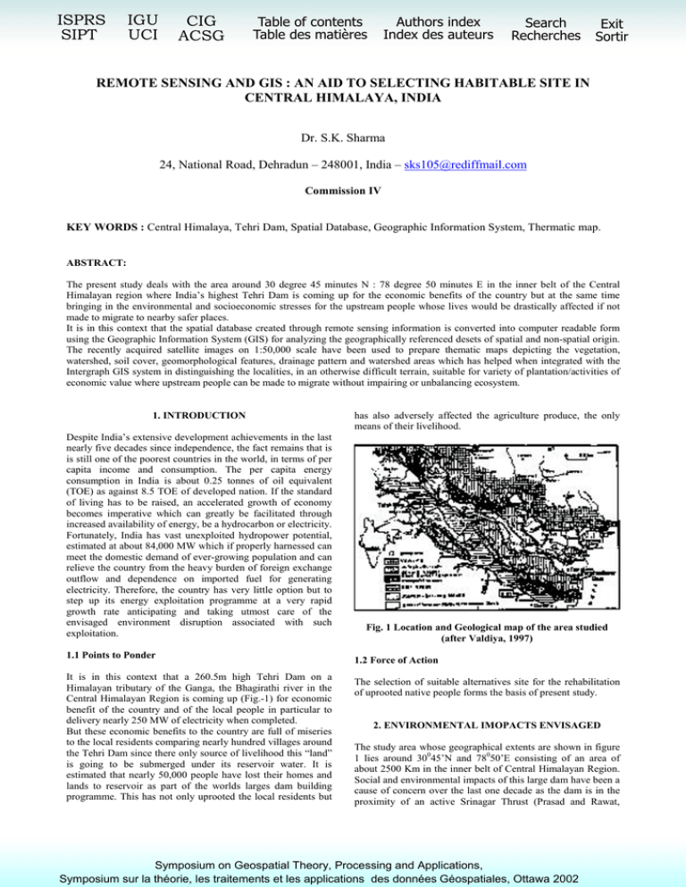
ISPRS SIPT IGU UCI CIG ACSG Table of contents Table des matières Authors index Index des auteurs Search Recherches Exit Sortir REMOTE SENSING AND GIS : AN AID TO SELECTING HABITABLE SITE IN CENTRAL HIMALAYA, INDIA Dr. S.K. Sharma 24, National Road, Dehradun – 248001, India – sks105@rediffmail.com Commission IV KEY WORDS : Central Himalaya, Tehri Dam, Spatial Database, Geographic Information System, Thermatic map. ABSTRACT: The present study deals with the area around 30 degree 45 minutes N : 78 degree 50 minutes E in the inner belt of the Central Himalayan region where India’s highest Tehri Dam is coming up for the economic benefits of the country but at the same time bringing in the environmental and socioeconomic stresses for the upstream people whose lives would be drastically affected if not made to migrate to nearby safer places. It is in this context that the spatial database created through remote sensing information is converted into computer readable form using the Geographic Information System (GIS) for analyzing the geographically referenced desets of spatial and non-spatial origin. The recently acquired satellite images on 1:50,000 scale have been used to prepare thematic maps depicting the vegetation, watershed, soil cover, geomorphological features, drainage pattern and watershed areas which has helped when integrated with the Intergraph GIS system in distinguishing the localities, in an otherwise difficult terrain, suitable for variety of plantation/activities of economic value where upstream people can be made to migrate without impairing or unbalancing ecosystem. 1. INTRODUCTION Despite India’s extensive development achievements in the last nearly five decades since independence, the fact remains that is is still one of the poorest countries in the world, in terms of per capita income and consumption. The per capita energy consumption in India is about 0.25 tonnes of oil equivalent (TOE) as against 8.5 TOE of developed nation. If the standard of living has to be raised, an accelerated growth of economy becomes imperative which can greatly be facilitated through increased availability of energy, be a hydrocarbon or electricity. Fortunately, India has vast unexploited hydropower potential, estimated at about 84,000 MW which if properly harnessed can meet the domestic demand of ever-growing population and can relieve the country from the heavy burden of foreign exchange outflow and dependence on imported fuel for generating electricity. Therefore, the country has very little option but to step up its energy exploitation programme at a very rapid growth rate anticipating and taking utmost care of the envisaged environment disruption associated with such exploitation. 1.1 Points to Ponder It is in this context that a 260.5m high Tehri Dam on a Himalayan tributary of the Ganga, the Bhagirathi river in the Central Himalayan Region is coming up (Fig.-1) for economic benefit of the country and of the local people in particular to delivery nearly 250 MW of electricity when completed. But these economic benefits to the country are full of miseries to the local residents comparing nearly hundred villages around the Tehri Dam since there only source of livelihood this “land” is going to be submerged under its reservoir water. It is estimated that nearly 50,000 people have lost their homes and lands to reservoir as part of the worlds larges dam building programme. This has not only uprooted the local residents but has also adversely affected the agriculture produce, the only means of their livelihood. Fig. 1 Location and Geological map of the area studied (after Valdiya, 1997) 1.2 Force of Action The selection of suitable alternatives site for the rehabilitation of uprooted native people forms the basis of present study. 2. ENVIRONMENTAL IMOPACTS ENVISAGED The study area whose geographical extents are shown in figure 1 lies around 30045’N and 78050’E consisting of an area of about 2500 Km in the inner belt of Central Himalayan Region. Social and environmental impacts of this large dam have been a cause of concern over the last one decade as the dam is in the proximity of an active Srinagar Thrust (Prasad and Rawat, Symposium on Geospatial Theory, Processing and Applications, Symposium sur la théorie, les traitements et les applications des données Géospatiales, Ottawa 2002 1986). The evidence suggested that the elites living far from the dam site will enjoy the benefits of the irrigation and power, it is the indigenous people who with low social status and little potential power will suffer the negative effects of dam. In addition to the anticipated increase in the incidence of waterborne disease such as the debilitating schistosomiasis (nilharzias), malaria and onchocerciasis (river blindness). Other potential costs which can be triggered by the construction of this dam in the geologically sensitive area are the economic costs of submergence of valuable resources such as fertile land, lumber and medicinal plants and the loss of hardwoods and biological resources. Therefore, while selecting the alternative site nearby for the displaced people, the scientific knowledge of the soil, its stability and the ecological balance of the selected site will permit the appropriate eco-friendly use of the land. Fig. 2 Land Cover Themes – IRS LISS-II November 1993 3. INVESTIGATION PROCEDURE 5. CONCLUSION The published topographic cultural/physiographic map by the Survey of India at 1 : 50000 scale is used to prepare the base map and the landset TM data obtained from IRS LISS II of November 11, 1993 is being used as remote sensing output. The geological map of the area is digitized at original mapping scale of 1 : 50,000 and the areas if misties have been solved using remote sensing data. The maps have been generated in Polyconic projection system having Everest Ellipsoid for 30045’N Latitude and 78050’E Longitude. Such special data maps in the form of topography, hydrology, geology, soil types, forest/land cover stored as layers in digital form in the computer. And finally, the presentation of results based on the outcome of comparing/overlaying the spatial data with different sets of features, their distribution in space and actual field checks. Therefore, based on the latest available remote sensing information on water and land resources, integrated with the GIS provides an insight for planning the rehabilitation of about 50,000 uprooted people from Upstream which is about 60 Km North-East of Dehradun city, can be thought of, without endangering the existing environment. 4. RESULTS AND DISCUSSIONS 7. REFERENCES The Indian Space Programme has been developed with multifacet vision for using space technology and the agriculture being the foremost. The Indian remote Sensing Satellite (IRS) picture LISS-II offers the valuable dissemination of information on improved land, soil, water, vegetation utilization capabilities. The field checks show the variation of slopes from 100-300 m/km having southern aspect. The soil is of alluvial type containing soil moisture of about <20 to 40% on an average. The soil is of clayey to sandy loamtype having moderate quantity of organic matter. On the basis of false colour composite (FCC), figure 2 has been generated from the digitized data of Derhadun and is surroundings covering an area of about 2500 Km between the two major river the Yamuna in the west and the Ganga in the east, in order to demarcate various themes distinguishable from different colours. The red colour covering and area of about 1500 Km2 shows the forest envelope at higher altitudes (more than 2300m above sea level marked with A and B) which is vital for man, plant and animals, fulfilling the basic needs of fuel fodder, manure, medicines and raw materials for industries. The plant area (marked with X,Y and Z), the yellow colour depicts the agricultural area of about 700 Km2 where the soil is very fertile having the moderate organic content. The green and orange colour together shows the plantation of various kind covering an area of about 350 Km2. The Urban area is very less and the area covered by the water is about 20 Km2 shown in blue colour. Pearce, F (1996) Superdams – have their altractions been oversheated? Journal of Geosciences and development No. 3, pp 7-10 Prasad, C. and Rawat, G.S. (1986) Studies in recent reactivation along the Srinagar Thrust. Garhwal Himalaya Proc. Inter. Symp. Neotectonics in South Asia, Survey of India, Dehradun pp 301-312. Saxena, P.B., Bishnoi, Antium, Bhatia, D.K. and Saxena Bhuwan (1998) Investigations of eco-restorations of the Asarori-Mussoorie water divided to twin water sheds (SuswaAsan) in the Derhadun Jr. Himal. Inst. of Action Research & Development, pp 19-29. Tiwari, R.S. and Garg, P.K. (1995) Land form and Land uses of Doon Valley and their role in resource development. Jr. Himalayan Geology, Vil. 6(2), pp 9-15. Valdiya, K.S. (1997) High Dams in Central Himalaya in context of active faults seismicity and societal problems. Jr. Geol. Soc. of India, vol. 49, pp 479-497. 6. ACKNOWLEDGEMENTS The author is grateful to various local agencies who have helped him during field checks. Several useful discussions were held with the Staff of Garhwal vikas Mandal, Derhadun during the preparation of this paper. The help rendered by the staff is thankfully acknowledged.


