Document 11867312
advertisement

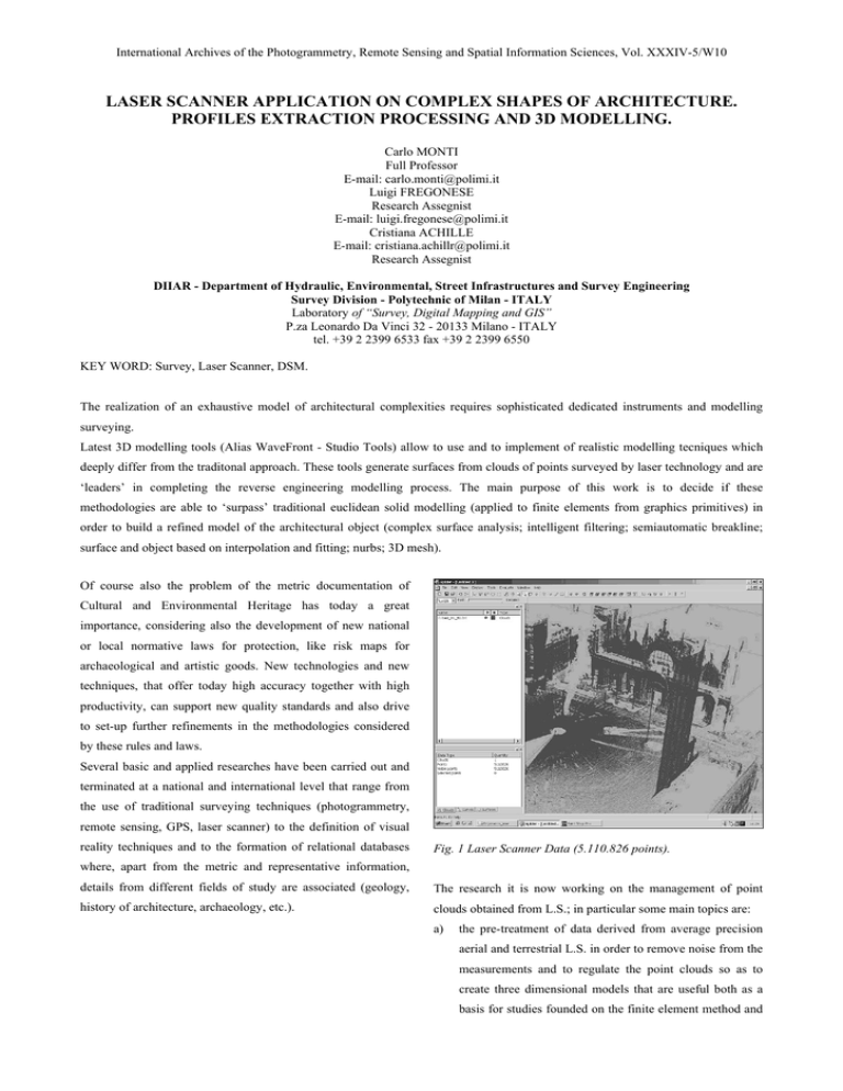
International Archives of the Photogrammetry, Remote Sensing and Spatial Information Sciences, Vol. XXXIV-5/W10 LASER SCANNER APPLICATION ON COMPLEX SHAPES OF ARCHITECTURE. PROFILES EXTRACTION PROCESSING AND 3D MODELLING. Carlo MONTI Full Professor E-mail: carlo.monti@polimi.it Luigi FREGONESE Research Assegnist E-mail: luigi.fregonese@polimi.it Cristiana ACHILLE E-mail: cristiana.achillr@polimi.it Research Assegnist DIIAR - Department of Hydraulic, Environmental, Street Infrastructures and Survey Engineering Survey Division - Polytechnic of Milan - ITALY Laboratory of “Survey, Digital Mapping and GIS” P.za Leonardo Da Vinci 32 - 20133 Milano - ITALY tel. +39 2 2399 6533 fax +39 2 2399 6550 KEY WORD: Survey, Laser Scanner, DSM. The realization of an exhaustive model of architectural complexities requires sophisticated dedicated instruments and modelling surveying. Latest 3D modelling tools (Alias WaveFront - Studio Tools) allow to use and to implement of realistic modelling tecniques which deeply differ from the traditonal approach. These tools generate surfaces from clouds of points surveyed by laser technology and are ‘leaders’ in completing the reverse engineering modelling process. The main purpose of this work is to decide if these methodologies are able to ‘surpass’ traditional euclidean solid modelling (applied to finite elements from graphics primitives) in order to build a refined model of the architectural object (complex surface analysis; intelligent filtering; semiautomatic breakline; surface and object based on interpolation and fitting; nurbs; 3D mesh). Of course also the problem of the metric documentation of Cultural and Environmental Heritage has today a great importance, considering also the development of new national or local normative laws for protection, like risk maps for archaeological and artistic goods. New technologies and new techniques, that offer today high accuracy together with high productivity, can support new quality standards and also drive to set-up further refinements in the methodologies considered by these rules and laws. Several basic and applied researches have been carried out and terminated at a national and international level that range from the use of traditional surveying techniques (photogrammetry, remote sensing, GPS, laser scanner) to the definition of visual reality techniques and to the formation of relational databases Fig. 1 Laser Scanner Data (5.110.826 points). where, apart from the metric and representative information, details from different fields of study are associated (geology, The research it is now working on the management of point history of architecture, archaeology, etc.). clouds obtained from L.S.; in particular some main topics are: a) the pre-treatment of data derived from average precision aerial and terrestrial L.S. in order to remove noise from the measurements and to regulate the point clouds so as to create three dimensional models that are useful both as a basis for studies founded on the finite element method and International Archives of the Photogrammetry, Remote Sensing and Spatial Information Sciences, Vol. XXXIV-5/W10 for the creation of three dimensional orthophotos obtained through the use of geo-referenced digital images; b) the use of multi-instrumental approach based on the integration of laser measurements with 3D profilometer and roundness data to survey small objects in particular in archaeology and in the study of remodeled samples, with partial reconstructions (surface and 3d) and the presence of different materials (i.e.: archeological reconstructed in the first of '900;. Fig. 2 Venice Ducal Palace Fig. 3 Pre-treatment of data(619.345 points) Fig. 4Tthe first level of elaboration: Mesh artifacts International Archives of the Photogrammetry, Remote Sensing and Spatial Information Sciences, Vol. XXXIV-5/W10 Fig. 5 The first level of smoothing product by Spider- Alias WaveFront software Fig. 6 The complex surface (Spider software) and legend error with mesh International Archives of the Photogrammetry, Remote Sensing and Spatial Information Sciences, Vol. XXXIV-5/W10 c) the handling and intelligent filters for rough models; For third world applications it is necessary to develop “ad hoc” d) construction of complex surfaces beginning with simple, approaches that could permit to acquire the data for the Cultural complex, and isoparametric curves (NURBS); Heritage sites surveying and risk estimation. the study in mathematical surfaces constructed on edge Latest 3D modelling tools allow to use and to implement of curves (of various types and degrees) and cloud points; realistic modelling techniques with high accuracy. extraction of "on surface" curves; In phase of editing some options are possible: e) f) g) h) the integration between different surveying techniques as - filtering of the mesh in function of dimension; L.S., - interpolation for the zones not covered from points; topography; - smoothing of the surface; the automatic extraction of edges from the laser scanned - production of profiles and automatic extraction object; Of the sections on preestablished directions or according to the integration between points clouds and images of the constant steps along the three cartesian directions. digital photogrammetry, direct surveying, object. Fig. 7 The profile extraction from point data Fig. 9 The profile extraction Fig. 8 The profile extraction from complex surface International Archives of the Photogrammetry, Remote Sensing and Spatial Information Sciences, Vol. XXXIV-5/W10 Fig. 10 the surface constructed on edge curves Fig. 11 the wireframe windows: geometric border The research will be continue to: - modelling laser scanner clouds on complex surfaces and starting from filtering digital images or starting from implementation and use algorithms for treatment of laser "geometric reasoning” (along with computing techniques scanning data and processing of different surfaces able developed in different environments (Studio Tool, Menci, discontinuous lines inside a group of points known in a 3D Spider,…) on two levels: for finished elements (vectorial system); - to show individual points and fundamental construction of complex surfaces starting with early 3D, of more evolved surfaces (developed in advanced breaklines, simple, composed and isoparametric curves modellation environments, generated by families of (NURBS), edge curves (of different types and degrees) curves); integrated by internal point clouds using interpolation realization of a series of software able to automatically techniques (fitting,…); extract early geometries intended to simplify the final three-dimensional model; - research into geometric borders directly on the point clouds 3D orthophotos; mesh exportable in DXF standard format) and for analysis - - - implementation and use in photogrammetric SW of processed models. emphasis through suitable operators (Laplaciano della Gaussiana, Foerstner filter, etc.) automatically the radiometric edges which correspond to geometric borders on the point cloud for definition of DSM (Digital Surface Model) in order to describe the correct morphology of the Fig. 12 Callidus terrestrial L.S. object with limited memory; Fig. 13 The clouds of points: S. Marco Basilica - Venice Fig. 14 The surface generate from points surveyed by laser International Archives of the Photogrammetry, Remote Sensing and Spatial Information Sciences, Vol. XXXIV-5/W10 Fig. 14 DTM: 3D representation Bibliography MONTI C., BRUMANA R., FREGONESE L., ACHILLE C., MONTI C., GALETTO R. (2000). The morphological survey of VIO E. (2001). Basilica di San Marco e Piazza. Controlli, rilievi architectural structures a short review of relevant application. e modelli. Tecnologia laser scanning: nuove opportunità per il "Quarry - Laboratory - Monument" Internationa Congress. 26- rilievo dei Beni Culturali. Congresso AUTEC. (vol. 1, pp. 109- 30 settembre 2000, Pavia. (vol. -, pp. 35-62). 120).


