30
advertisement

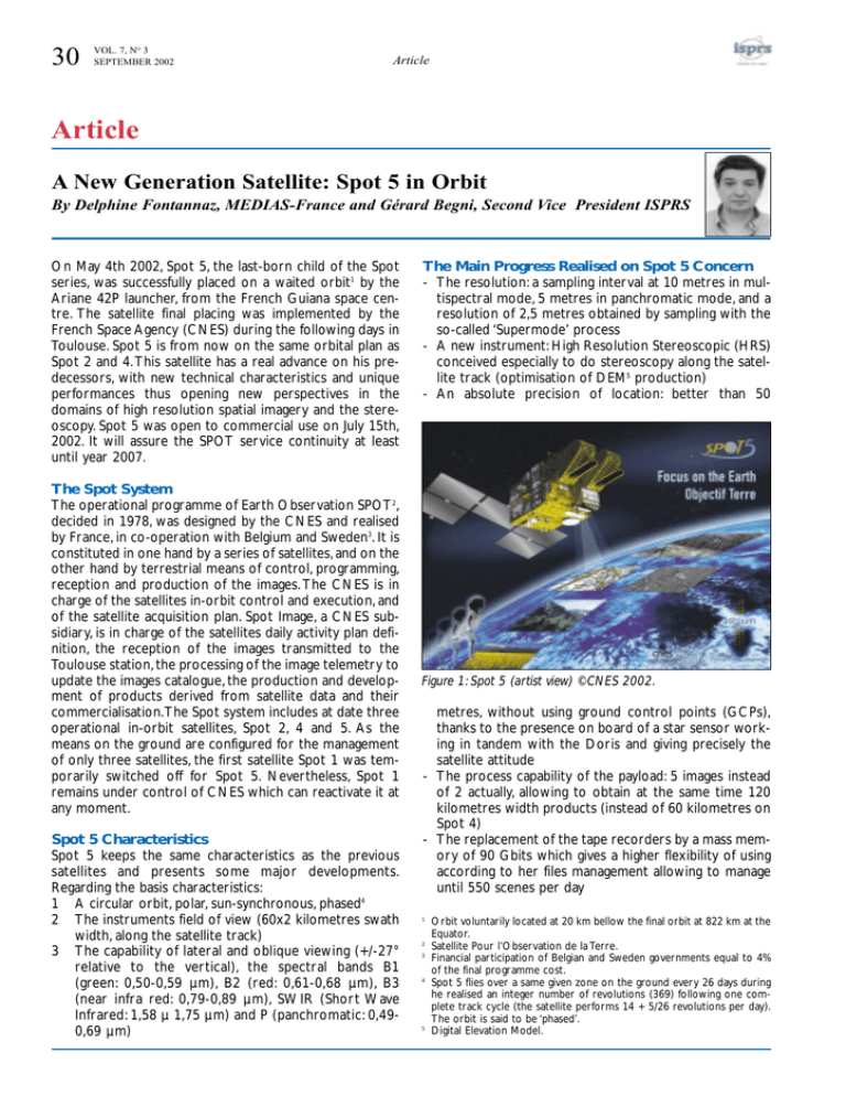
30 VOL. 7, NO 3 SEPTEMBER 2002 Article Article A New Generation Satellite: Spot 5 in Orbit By Delphine Fontannaz, MEDIAS-France and Gérard Begni, Second Vice President ISPRS On May 4th 2002, Spot 5, the last-born child of the Spot series, was successfully placed on a waited orbit1 by the Ariane 42P launcher, from the French Guiana space centre. The satellite final placing was implemented by the French Space Agency (CNES) during the following days in Toulouse. Spot 5 is from now on the same orbital plan as Spot 2 and 4. This satellite has a real advance on his predecessors, with new technical characteristics and unique performances thus opening new perspectives in the domains of high resolution spatial imagery and the stereoscopy. Spot 5 was open to commercial use on July 15th, 2002. It will assure the SPOT service continuity at least until year 2007. The Spot System The operational programme of Earth Observation SPOT2, decided in 1978, was designed by the CNES and realised by France, in co-operation with Belgium and Sweden3. It is constituted in one hand by a series of satellites, and on the other hand by terrestrial means of control, programming, reception and production of the images. The CNES is in charge of the satellites in-orbit control and execution, and of the satellite acquisition plan. Spot Image, a CNES subsidiary, is in charge of the satellites daily activity plan definition, the reception of the images transmitted to the Toulouse station, the processing of the image telemetry to update the images catalogue, the production and development of products derived from satellite data and their commercialisation.The Spot system includes at date three operational in-orbit satellites, Spot 2, 4 and 5. As the means on the ground are configured for the management of only three satellites, the first satellite Spot 1 was temporarily switched off for Spot 5. Nevertheless, Spot 1 remains under control of CNES which can reactivate it at any moment. Spot 5 Characteristics Spot 5 keeps the same characteristics as the previous satellites and presents some major developments. Regarding the basis characteristics: 1 A circular orbit, polar, sun-synchronous, phased4 2 The instruments field of view (60x2 kilometres swath width, along the satellite track) 3 The capability of lateral and oblique viewing (+/-27° relative to the vertical), the spectral bands B1 (green: 0,50-0,59 µm), B2 (red: 0,61-0,68 µm), B3 (near infra red: 0,79-0,89 µm), SWIR (Short Wave Infrared: 1,58 µ 1,75 µm) and P (panchromatic: 0,490,69 µm) The Main Progress Realised on Spot 5 Concern - The resolution: a sampling interval at 10 metres in multispectral mode, 5 metres in panchromatic mode, and a resolution of 2,5 metres obtained by sampling with the so-called ‘Supermode’ process - A new instrument: High Resolution Stereoscopic (HRS) conceived especially to do stereoscopy along the satellite track (optimisation of DEM5 production) - An absolute precision of location: better than 50 Figure 1: Spot 5 (artist view) ©CNES 2002. metres, without using ground control points (GCPs), thanks to the presence on board of a star sensor working in tandem with the Doris and giving precisely the satellite attitude - The process capability of the payload: 5 images instead of 2 actually, allowing to obtain at the same time 120 kilometres width products (instead of 60 kilometres on Spot 4) - The replacement of the tape recorders by a mass memory of 90 Gbits which gives a higher flexibility of using according to her files management allowing to manage until 550 scenes per day 1 2 3 4 5 Orbit voluntarily located at 20 km bellow the final orbit at 822 km at the Equator. Satellite Pour l’Observation de la Terre. Financial participation of Belgian and Sweden governments equal to 4% of the final programme cost. Spot 5 flies over a same given zone on the ground every 26 days during he realised an integer number of revolutions (369) following one complete track cycle (the satellite performs 14 + 5/26 revolutions per day). The orbit is said to be ‘phased’. Digital Elevation Model. Article VOL. 7, NO 3 SEPTEMBER 2002 31 - The capability of the payload storage on board: 3 images of 50 Mbits - The capability of transmission: 2 images at 50 Mbits (image telemetry connection at 8 GHz) - The instrument Vegetation 2, which detectors and optical processes have been improved, enables the continuity of the global planet observation system already set up on Spot 4.Vegetation 2 keeps the characteristics of its predecessor: 2 250 kilometres wide-swath, 1 kilometre spatial resolution, four spectral6 bands (red, near infra red, mean infra red and one blue band for atmospheric corrections). Vegetation allows covering almost all of the globe's land masses in one day For details on the Supermode, the HRS and HRG instruments, see below. New Spot Data Format: DIMAP (Digital Image Map) In collaboration with CNES and Metria7, Spot Image designed the Dimap format in order to facilitate the exchanges of geographic information comprising images, between the different users. Dimap describes a unit of detailed information layers concerning the logic and physic products organisation, the data characteristics and their format of storage. It uses XML8 language for the descriptive data and the GeoTIFF format for the images. Thus, it offers a facilitated access to the meta-data9 (just one descriptive file) which can be consulted from the main web navigators and allow to process huge volume of images. Finally, Dimap proves to be the adapted format to the futures e-business exchanges, XML language is considerate as the base development language of B to B, Business to Business. Spot Images Applications With its new performances, Spot 5 positions in strategic way on the satellite imagery world market while privileging the trio « high resolution, wide swath and stereoscopy ».The digital geographic information obtained from Spot 5 imagery answer to the diversified and traditional applications as cartography, topography, agriculture of precision, forest, natural hazard management, urban planning, or defence. Moreover, the satellite images have taken place recently in a new domain of applications, the telecommunications. The products generated from Spot 5 offers to users a very diversified information source, easily accessible and even more powerful. Its characteristics, continuity, revisit capability and programming flexibility, make of Spot a major element in the civil systems of the actual satellites of Earth observation. Brief description of the instruments on board: The ‘Haute Résolution Géométrique’ Instrument (HRG) The Spot 5 payload comprises two identical HRG instruments capable to generate data at four resolution levels with the same swath of 60 km: images in the SWIR band Figure 2: Les Tuileries (Paris, France), 16th May 2002, panchromatic image at a resolution of 2,5m ©CNES 2002 - Spot Image Distribution. at a resolution of 20 meters, multispectral images at 10 meters, panchromatic images at 5 meters, Supermode panchromatic images at 2,5 meters. Both instruments can acquire indifferently images in panchromatic (P) or multispectral mode (B1, B2, B3 & SWIR bands), and can operate in each mode individually or simultaneously. The ‘Supermode’ (THR) Thanks to an original concept of registration developed under a CNES patent, the ‘Supermode’, Spot 5 gives images at a resolution of 2,5 metres. This technique consists in producing one image sampled at 2,5 metres (in the two initial images geometry) from two panchromatic scenes acquired simultaneously at a sampling interval of 5 metres. The acquisition is realised by a specific detector comprising two linear arrays of CCD detectors shifted in the focal plan. Each linear array acquire one image at a resolution of 5 metres, and the two images obtained are then shifted of 2,5 metres one to the other. Three steps of images process are done: interleaving (superposition of both images), interpolation (missing information deduction), restoration (noise reduction induced by the instrument and correction of blur in the image). The ‘Haute Résolution Stéréoscopique’ Instrument (HRS) The HRS instrument acquires simultaneously stereopairs images in just one single satellite passage, in quasi real time. At the time of the same passage of the satellite, the front telescope (viewing angle of 20° relative to the verti6 7 8 9 Same bands as Spot 4 HRVIR instrument: B2, B3, MIR and one B0 (blue: 0,43-0,47 µm). Sweden company, previously Satellus. eXtended Markup Langage, descriptive language of Internet documents (based on same principle as HTML). Descriptive data associated to the images. 32 VOL. 7, NO 3 SEPTEMBER 2002 Article cal) records images on the ground, followed one minute and a half later by the back telescope (same viewing angle) which covers the same ground area. The simultaneous acquisition of both images constitutes an important advantage for the HRS MNT quality and precision. The automatic correlation process is facilitated by the perfect radiometric resemblance of the two images. The HRS instrument does not have a viewing system outside the satellite track and its swath of 120 kilometres allows to observe a same area every 26 days. The width of the observed scene is 120 kilometres (centred on the satellite track) over 600 kilometres.The sampling interval is equal to 10 metres perpendicularly to the track, 5 metres along the track, and the absolute location accuracy is better than 15 metres. The spectral domain is the panchromatic band (0,49 - 0.69 µm). Contacts CNES : Alain Baudoin, Programme Manager Email : alain.baudoin@cnes.fr Benoît Boissin, Project Manager SPOT 5 Email : benoit.boissin@cnesfr Spot Image : Philippe Munier, Deputy Director Email : philippe.munier@spotimage.fr Bibliographical references: - Information File, Spot 5 – CNES - CNES Internal newspaper – April 2002, Nr109 - Spot Image documentation - Spot Image and CNES web sites Vegetation – Antwerp – 2002, International Conference, International SPOT 4/5-VEGETATION Users Conference under the Auspices of OSTC / CNES / SNSB / ASI / EC Antwerp, Belgium from 19th – 22nd November 2002 Scope The VEGETATION – Antwerp - 2002 Conference will take place in Antwerp (Belgium) form Monday 18th, till Friday 22nd of November 2002. It will be the second Conference where the users of the VEGETATION instrument will have the opportunity to present the results of their investigations.The meeting will demonstrate, that a continuous delivery of products of state-of-the-art quality can support a broad range of applications through the combined efforts of the Project Team, Steering Committee, International Users Committee and the Production Entity. Today, Europe offers to the international community a truly global Earth Observing System with a high standard of performance for monitoring the resources and the environment of our planet. The successes of the last few years have provided strong incentives for the continuation of the programme with VEGETATION 2, successfully launched on May 4th, 2002. A broad range of applications will be presented at the Conference. Many of them were envisaged at the start of the Vegetation (Preparatory) Programme. They relate to the monitoring of crops, for- est, land cover and use, surface hydrology and to the assessment of biospheric productivity. Other applications, however, are new for the Vegetation Programme e.g., snow cover characterisation and more recently ocean and atmospheric applications. Innovative applications are also being developed for extracting biophysical variables, for which a European validation initiative (VALERI) has now been organised. As a whole, the VEGETATION programme now provides a viable and useful model for an operational information system on the state of the Earth’s resources. A registration form and template for sending your abstract can be found on our web-site www. vgt.vito.be/vgtapen2002.htm. Location: ’t Elzenveld - Lange Gasthuisstraat 45 - B-2000 Antwerpen Pre-registration You are also kindly invited to fill out the pre-registration form to be found on the Conference web site http://www.vgt.vito.be/vgtapen2002.htm. Secretary Organising Committee: June Cools, E-mail: june.cools@vito.be


