Coastal Observation System for Northern and Arctic Seas COSYNA approach
advertisement
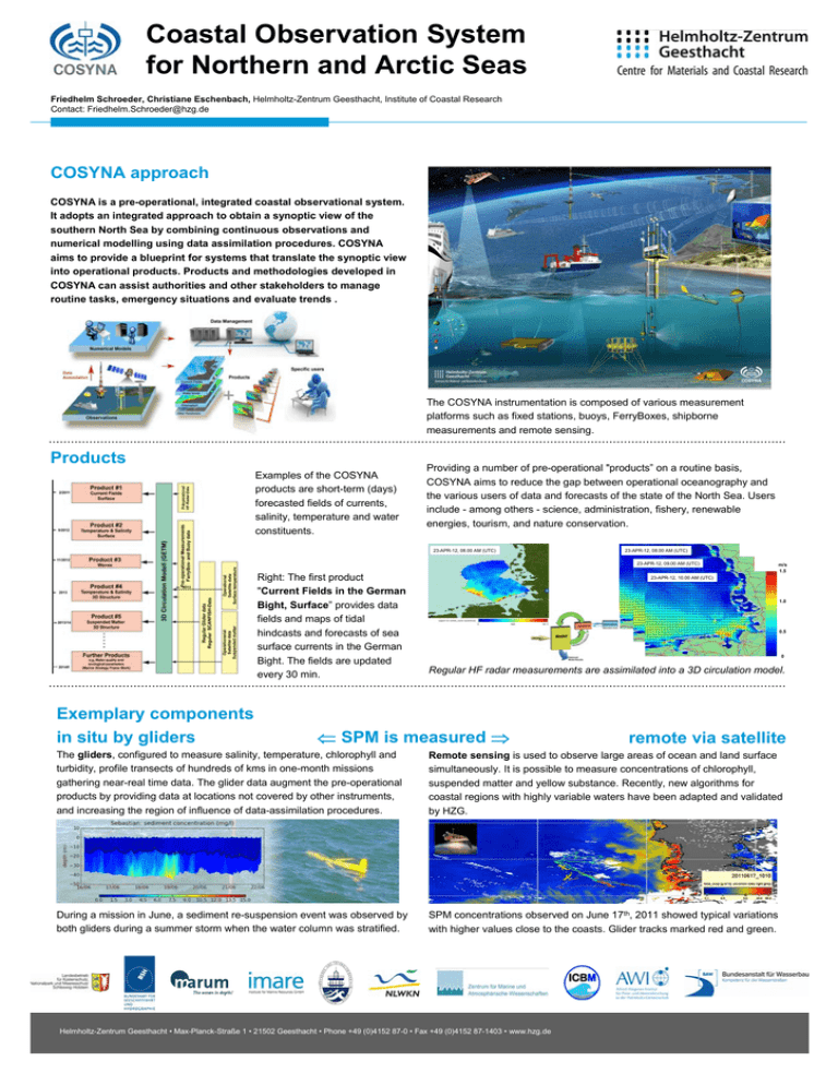
Coastal Observation System for Northern and Arctic Seas Friedhelm Schroeder, Christiane Eschenbach, Helmholtz-Zentrum Geesthacht, Institute of Coastal Research Contact: Friedhelm.Schroeder@hzg.de COSYNA approach COSYNA is a pre-operational, integrated coastal observational system. It adopts an integrated approach to obtain a synoptic view of the southern North Sea by combining continuous observations and numerical modelling using data assimilation procedures. COSYNA aims to provide a blueprint for systems that translate the synoptic view into operational products. Products and methodologies developed in COSYNA can assist authorities and other stakeholders to manage routine tasks, emergency situations and evaluate trends . Foto The COSYNA instrumentation is composed of various measurement platforms such as fixed stations, buoys, FerryBoxes, shipborne measurements and remote sensing. Products Examples of the COSYNA products are short-term (days) forecasted fields of currents, salinity, temperature and water constituents. Providing a number of pre-operational "products” on a routine basis, COSYNA aims to reduce the gap between operational oceanography and the various users of data and forecasts of the state of the North Sea. Users include - among others - science, administration, fishery, renewable energies, tourism, and nature conservation. 23-APR-12, 08.00 AM (UTC) 23-APR-12, 08.00 AM (UTC) 23-APR-12, 09.00 AM (UTC) Right: The first product "Current Fields in the German Bight, Surface” provides data fields and maps of tidal hindcasts and forecasts of sea surface currents in the German Bight. The fields are updated every 30 min. Exemplary components in situ by gliders m/s 1.5 23-APR-12, 10.00 AM (UTC) 1.0 0.5 0 Regular HF radar measurements are assimilated into a 3D circulation model. SPM is measured remote via satellite The gliders, configured to measure salinity, temperature, chlorophyll and turbidity, profile transects of hundreds of kms in one-month missions gathering near-real time data. The glider data augment the pre-operational products by providing data at locations not covered by other instruments, and increasing the region of influence of data-assimilation procedures. Remote sensing is used to observe large areas of ocean and land surface simultaneously. It is possible to measure concentrations of chlorophyll, suspended matter and yellow substance. Recently, new algorithms for coastal regions with highly variable waters have been adapted and validated by HZG. During a mission in June, a sediment re-suspension event was observed by both gliders during a summer storm when the water column was stratified. SPM concentrations observed on June 17th, 2011 showed typical variations with higher values close to the coasts. Glider tracks marked red and green. Helmholtz-Zentrum Geesthacht • Max-Planck-Straße 1 • 21502 Geesthacht • Phone +49 (0)4152 87-0 • Fax +49 (0)4152 87-1403 • www.hzg.de
