Highway Development 1

Highway Development
1
Peter M. Harvard and Bernard L. Chaplin
2/
Abstract: Highways are something we see, and something we see the landscape from. They exert tremendous visual influence on our national landscape and will continue to do so. While most interstate mileage is in place, major unbuilt urban segments remain, and rural and suburban trunk roads are receiving renewed emphasis. Nationwide programs of bridge replacement, safety and environmental improvements, changing design speeds, and the public's demand for a high quality visual environment will all have their effect.
Highways are the cumulative product of numerous small decisions, from corridor location through alignment selection, design, construction and maintenance. Through simulation techniques and effective public involvement, we can minimize and mitigate these cumulative impacts.
INTRODUCTION
Driving for pleasure is a favorite American form of recreation, and much of the pleasure comes from looking at our national landscape, diverse and beautiful as no other nation's, spreading from sea to sea in a rolling, changing sequence of hills and plains, mountains and river valleys. Chances are that nearly everyone has driven the "Trans Am" -- or parts of it -- at one time or another. Whether you started in
New England, and drove along coastal plain landscapes hallowed in history, out of the
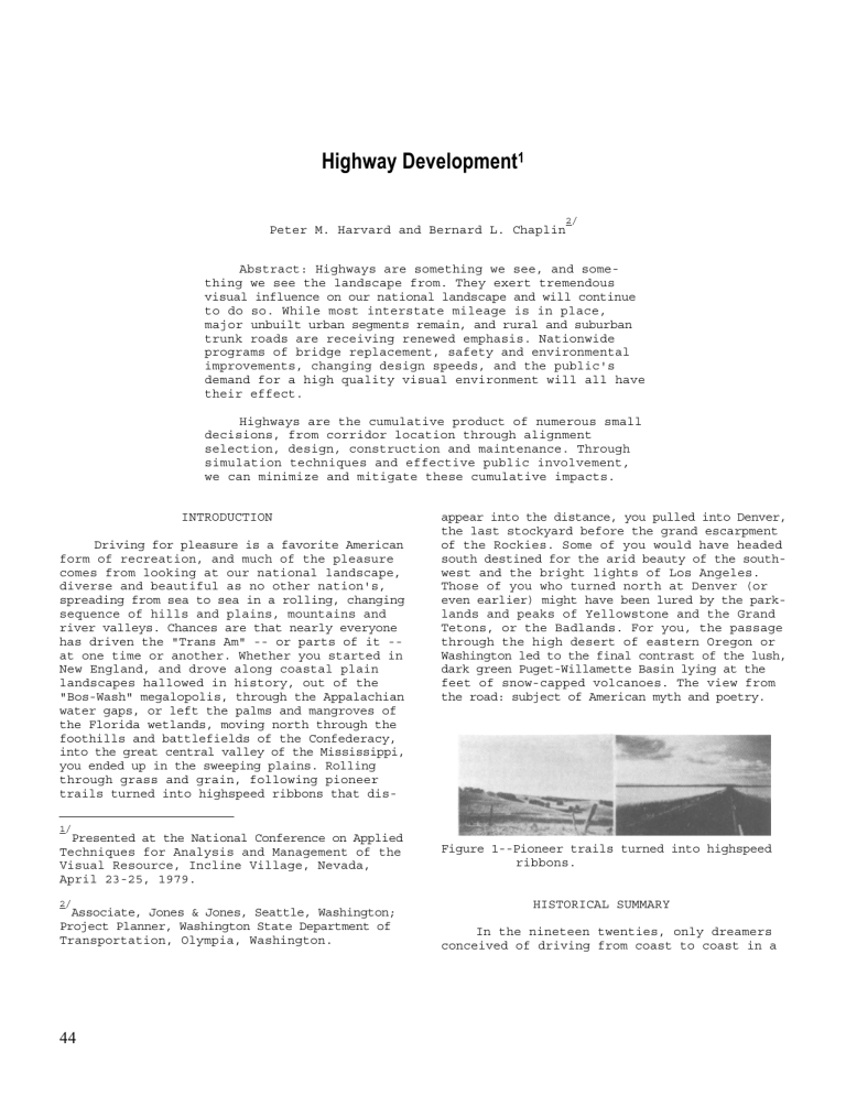
"Bos-Wash" megalopolis, through the Appalachian water gaps, or left the palms and mangroves of the Florida wetlands, moving north through the foothills and battlefields of the Confederacy, into the great central valley of the Mississippi, you ended up in the sweeping plains. Rolling through grass and grain, following pioneer trails turned into highspeed ribbons that dis-
1/
Presented at the National Conference on Applied
Techniques for Analysis and Management of the
Visual Resource, Incline Village, Nevada,
April 23-25, 1979.
2/
Associate, Jones & Jones, Seattle, Washington;
Project Planner, Washington State Department of
Transportation, Olympia, Washington.
44 appear into the distance, you pulled into Denver, the last stockyard before the grand escarpment of the Rockies. Some of you would have headed south destined for the arid beauty of the southwest and the bright lights of Los Angeles.
Those of you who turned north at Denver (or even earlier) might have been lured by the parklands and peaks of Yellowstone and the Grand
Tetons, or the Badlands. For you, the passage through the high desert of eastern Oregon or
Washington led to the final contrast of the lush, dark green Puget-Willamette Basin lying at the feet of snow-capped volcanoes. The view from the road: subject of American myth and poetry.
Figure 1--Pioneer trails turned into highspeed ribbons.
HISTORICAL SUMMARY
In the nineteen twenties, only dreamers conceived of driving from coast to coast in a
few days. Roads, where they existed, were cart tracks, built with little thought to efficiency and none to esthetics. As the automobile increased in numbers new roads were designed and built, often under the direction of a single person or small team. In some cases, esthetics were considered and the results included some of the beautiful rural roads and scenic parkways that we are rediscovering today as the superhighways become too congested. During the thirties, strong-willed individuals were often able to influence the visual quality of a state's entire road system, inspecting each segment as it was being built and hand-fitting it into the landscape. Later, the demands of a nation at war and a generation of Americans increasingly dependent on the open road for communication, recreation and commerce led to rapid and virtually uncontrolled growth.
Figure 2--Recreation and uncontrolled growth.
FACILITY TYPES
By the late fifties there was a full hierarchy of roadways in the United States that reflected land uses and the mighty grid of the
Public Land Survey. These roads may be divided into functional classes, starting with our familiar urban and rural interstate highways connecting cities of 50,000 or more in population. Urban principal arterials serve the heaviest long distance and passenger traffic, and with their rural counterpart, serve economic development areas. Urban and rural minor arterials vary widely in character but generally serve to connect residential areas to areas of job opportunity. Finally, the vast bulk of the roads in our country is collector and familiar local roads. As engineering techniques grew to meet new needs, designs were developed to solve problems of location, safety and capacity, and the new roads leapt across former barriers and swept, unheeding, past and onward.
VISUAL IMPACTS
As design standards changed to accommodate increased speeds and safety requirements, the visual impact of these new roads became more severe. Now the view of the road and its corridor was offsetting the view from the road.
Figure 3--Roads that cut across the land or flow with it.
Many of the impacts can be attributed to the sheer scale of the new highway system and the design short cuts adopted to build it. Initially, decisions on transportation corridors were made using least economic cost as the primary criterion, and highways tended to follow existing rail or parkway alignments. Other corridors were selected that cut across the landscape, rather than flowing with it. As specific alignments were chosen little attention was paid to variations in landform, and highways cut arbitrarily through differing landcovers with little regard for their environmental, social or visual capacity to absorb change. Design effort was sometimes lavished on isolated structures or features. While a cleanly-designed object has its own internal beauty, it is also possible to forget the context of a bridge or roadway and cause the effort expended in design to miscarry.
Major civil engineering works take time, and the scars created during construction can remain for long periods. Many will never heal entirely, leaving contrasting patterns forever.
"Forever," is really the realm of the maintenance crews, and their impact on the highway can be considerable. Routine roadside maintenance, replacement of damaged guardrails, patching, and a host of other so-called "minor" actions can seriously affect the visual appearance of the highway and its corridor.
Highway visual impacts fall into three main areas: first, while highways reveal the landscape to us, they also remove pieces of it from our view; they both create and block views.
Figure 4--Highways reveal and conceal views.
Second, highways alter the visual character of their settings, simply by being there. While
45
a highway can fit compatibly into its landscape, maximum contrast and disruption are too often the case. Highways can introduce forms not previously found in the setting. The linear quality of the highway and corridor right-ofway frequently contrasts with the landscape.
The colors of the road and accompanying elements such as signs, signbridges, fences, and plantings often contrast rather than blend into their surroundings. The texture of the smooth roadway and its neatly mown edges may contrast even with grassland landscapes. It takes a large scale landscape to accept the introduction of a modern highway, but there are other reasons that a highway can dominate its setting: the distance from viewers, or contrasting combinations of form, line, color and texture. Highways are also great simplifiers of landscapes, reducing the natural diversity of the setting to a simple swath of grass and concrete, punctuated at regular intervals by lights and signs.
All too often an alignment also ignores the
"lay of the land," and disrupts the continuity of landforms and patterns of vegetation or human development.
Figure 5--Impacts vary with viewer distance and contrasting combinations of form, line, color and texture.
The third major visual impact of highways goes beyond their lack of compatibility with the setting. Once in place, a highway is the setting, and the impact on the overall visual quality can be devastating. Landscapes containing highways may not be highly vivid, but frequently they do have a memorable quality that is a questionable attribute. The presence of a highway or ancillary highway functions (often outside the R.O.W.) like borrow pits, automobile graveyards and signs can encroach, even upon settings with a strong visual pattern. Often the impact is very site specific, a sign or bridge or retaining wall out of place. Sometimes it seems that highways that leave the landscape intact are the exception. It is unusual to find a highway at any scale that actually adds to the overall sense of visual balance and harmony in a setting, for the overall quality of unity in a landscape is a fragile one. All of these factors vary with the time of day, and change of seasons, as well as the attitudes of the viewer.
46
Figure 6--Point impacts: signs and walls.
VIEWER RESPONSE
The last fifteen years have brought about major changes in the way the public holds its agencies accountable. All over the world, protests have aimed at halting public works because of real or perceived social, environmental or economic impacts. Whether the project would take the wetland portion of a major city park and arboretum of national stature, or would carve at rooftop level through an east coast historic district, would open previously wild areas, or bypass aging commercial districts...visual effects have been a frequent cause of public concern, and, in many cases, rightfully so.
NATIONAL ENVIRONMENTAL POLICY ACT
With the passage of the National Environmental Policy Act of 1969 (NEPA) and the subsequent development of regulations, the Federal
Highway Administration and individual state highway agencies have all tried to comply with the letter of NEPA. These agencies have been able to address many primary impacts -- for example, air and water quality, noise, and to a lesser extent, secondary development.
Nevertheless, few highway professionals have felt comfortable with the issue of visual or esthetic impacts. Training programs are now being conducted which will help them move beyond the "beauty is in the eye of the beholder" response and give them techniques to identify and deal with specific visual issues on a point-by-point basis.
Figure 7--New viewers and old will respond.
SPECIFIC TECHNIQUES
The most important tools for dealing with visual impacts are an explicit resource management process, an effective public involvement process that transcends the traditional impasse of the public hearing, and the use of accurate simulations to convey the landscape setting, the facility characteristics and the alternative solutions. The concept of VRM alternatives and objectives discussed elsewhere in these proceedings (Blair, et al.) can be used to link these approaches to management decision-making.
Figure 8--Simulations convey context, character and alternatives.
Visual simulations must be more than the
"artists concept," too often seen by the public as a "visual swindle." Computer techniques of visual simulation range from simple sequential plots to more detailed photomontage techniques pioneered by several federal and state agencies.
Whether the site is in the Colorado mountain passes or a major eastern forest preserve, computer generated graphics, supplemented by models, are very helpful in developing a common understanding and eliminating distrust due to lack of information.
Where resources and issues permit or dictate, the use of retouched photographs is recommended. This allows the comparison of accurate, true color, before-and-after images. simple or elaborate techniques are used, accurate simulations repay the effort with better projects that are more likely to pass the test of community acceptability.
FUTURE ISSUES
Our national highway system has always exerted tremendous visual influence upon our national landscape. This influence will continue into the future. While most interstate mileage is in place, major unbuilt urban segments remain. Rural and suburban trunk roads will receive renewed emphasis. A nationwide program of bridge replacement is underway, along with continuing safety and environmental improvements such as noise barriers and impact attenuators. Guardrails, right-of-way fence and roadside maintenance must be included with traffic signals, lighting and signage on the list of the seemingly humble considerations that have significant visual effects. The visual appearance of the highway is the cumulative result of many individual actions. There will probably never be another burst of freeway construction to match the sixties, but every time we repair or replace a bridge, add a guard rail, change a light standard, or patch a road, we have the opportunity -- and responsibility -to consider the visual impact of our actions.
Figure 9--Comparisons from key viewpoints.
Care must be taken to pick key viewpoints and provide the artist with explicit data on the appearance of alternatives, possibly through the use of the computer techniques just mentioned. If resources are limited, simple sketches taken from slides at key, pedestrianeye-level viewpoints can be effective. Whether
Figure 10--Even changing light standards presents an opportunity.
With increasing interest in rural and wildland travel, we will be facing pressure to upgrade many "country" roads, as recreational travelers flee from the ever-more-crowded superhighways, and rest area design is also becoming important once more; with reduced speeds, we need more pit stops. No matter how hard we strive, esthetics -- like economics -- will always retain its mysteries; but in both cases we must clearly understand the units of value and rates of exchange. We must move beyond cosmetic, add-on solutions that are vulnerable to budgetcutting and offer only symptomatic relief, toward integration of the highway with the landscape. We must base our actions on the recognition that these powerful transportation forms can be at once beautiful objects and visually compatible with their surroundings -
-our national landscape.
47


