Document 10993551
advertisement
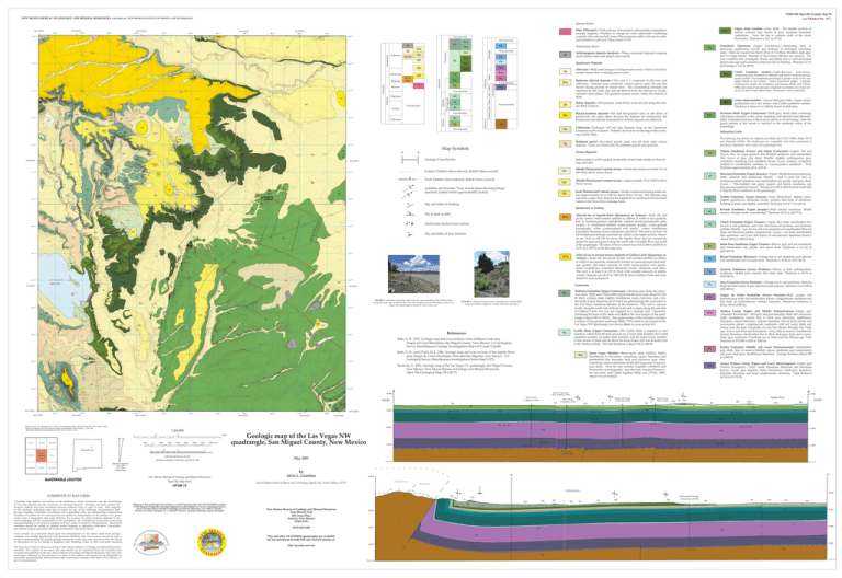
NEW MEXICO BUREAU OF GEOLOGY AND MINERAL RESOURCES NMBGMR Open-file Geologic Map 78 Last Modified May 2012 A DIVISION OF NEW MEXICO INSTITUTE OF MINING AND TECHNOLOGY Igneous Rocks Kcl Qt2 Kcj ! ! ! ! ! Kcl 3955000 ! o 6 Ä Kg 3 Holocene Qt1 Qt2 Pleistocene Qc Pliocene 3954000 Qpl QTg Knl Qt2 3953000 Qp Kcl Kcj Knl Qpl Qt3 ! ! ! ! ! ! ! ! ! ! ! ! ! o ! 4 ! ! ! ! ! ! ! ! ! ! ! ! ! ! ! ! ! Fault: ȱ ȱǰȱĴȱ ȱǯȱ ! ! ! %% ! ! F 3950000 ! ! ! Anticline and Syncline: Trace of axial plane showing plunge direction; dashed where approximately located. o A' ! ! Early Pleistocene(?) stream terrace—Gently southward-sloping basal conȱ ¡¢ȱ řŖȱ ȱ ǻŗŞŖȱ Ǽȱ ȱ ȱ¢ǯȱ ȱ ȱ ¢ȱ ȱȱȬĚ ȱȱȱȱȱ ȱȱȱ ȱȱȱȱȱȱǯȱȱ Qt3 Dip and strike of bedding. 60 Quaternary or Tertiary ! 50 ! Kcu ! ! ! ! ! ! ! ! ! ! ! ! ! ! ! 3949000 ! ! ! ! ! ! Alluvial fan of Sapello River (Quaternary or Tertiary)—Sand, silt, and ¢ȱǰȱ Ȭȱȱȱȱȱ ȱȱȱĵǰȱ ęȬȱ ȱ Ȭȱ ǰȱ ȱ Ȧǰȱ ǰȱ weakly- to moderately-foliated coarse-grained granite, coarse-grained ǰȱ ȱ Ȭȱ ȱ ĵǰȱ ȱ ȱ ȱ ǻǼȱǰȱ ȱǰȱȱǯȱȱȱȱȱȱşȱȱ ǻřŖȱǼȱȱȱ¢ȱȱ¢ȱȱȱȱȱǯȱȱ ȱ ŗśȬŚśȱ ȱ ǻśŖȬŗśŖȱ Ǽȱ ȱ ȱ ȱ ȱ ȱ ȱ ¡¢ȱ mined for sand and gravel along the north side of Sapello River just north ȱȱǯȱȱȱȱȱȱȱȱŘǰŖŜŖȱȱǻŜǰŞŖŖȱǼȱȱ ŘǰŗśŗȱȱǻŝǰŗŖŖȱǼȱȱȱȱǯȱ QTa 50 Fault Joints: ȱȱǯ 60 ȱȱȱȱĚ ȱǯ ! ! ! ! ! ! ! ! ! ! ! ! ! ! ! ! ! ! o ! ! ! ! ! ! ! ! ! ! ! ! ! ! ! ! ! ! ! ! ! ! 3 ! ! ! o ! ! ! ! ! F 17 ! ! 2 ! ! ! ! o ! W ! ! o ! ! o ! ! ! ! ! Kg ! ! ! ! ! ! ! ! ! 2 ! ! o af ! ! ! ! o ! ! ! ! ! ! ! !  3 ! ! FIGURE 1—Bioclastic limestone slabs of Juana Lopez member of the Carlisle Shale along the south side of Storrie Lake near dam. Sangre de Cristo Mountains west of Las Vegas NW quadrangle in distance. View to the west. o ! ! Qca ! ! F ! ! af ! ! 3946000 ! 3946000 FIGURE 2—Pliocene(?) dike (arrow) intruded into Carlisle Shale along New Mexico Highway 3 north of Storrie Lake Dam. ! ! Kcl Niobrara Formation (Upper Cretaceous)—Medium-gray shale and calcarȱǯȱȱĵȱȱȂȱǻŗşŞŜǼȱȱȱȱ ȱǰȱȱŞȱȱǻŘŜȱ ft) thick, contains shale, slightly fossiliferous marly claystone, and a few ȱȱȱ¢ȱȱȱȱ ȱȱ¢ȱȱȱ ȱ ȱ ¢ȱ ȱ ȱ ȱ ȱ ǯȱ ȱ ȱ ȱ ȱ ¡ȱ locally along the south side of Storrie Lake and in slopes along the east side ȱ ȱ ǰȱ ȱ ȱ ȱ ȱ ȱ ȱ ȱ ǯȱ ȱ ¡ȱ remaining thickness of the shale unit (KnlǼȱȱȱ ȱȱȱȱȱȱȱŗŖŖȱȱǻřřŖȱǼǯȱȱȱȱȱȱȱȱȱ ȱȱȱęȬȱȱǻĵǰȱŗşŝŘǼȱ ȱȱȱȱȱȱ ȱȱȱǰȱȱ ȱǻKnsǼȱȱȱȱȂǯ Kn ! ! !  ! ! 5 ! ! ! ! 4 3 Qca References ! ! Kcl o 2 o Âo o o o Qpl 7 3 ! ! o ! ! ! ! Kcj ! ! af af ! 2 o ! Knl 3 Kcu 3944000 Qca Kg ! ! ! Qca ! Qp M Qc Qp Qp Kg Qp 479000 o 35°37'30"N Kcl Kcc 480000 481000 482000 105°12'30"W OJITOS FRIOS LAS VEGAS 0.5 1000 LOMA PARDA NEW MEXICO MONTEZUMA 483000 484000 485000 105°10'0"W 486000 487000 35°37'30"N Qca 488000 Qg Kc Qca 0 1 0 1000 2000 0.5 3000 ONAVA 1 MILE 4000 5000 0 6000 7000 FEET NATIONAL GEODETIC VERTICAL DATUM OF 1929 Magnetic Declination June, 2009 9º 2' East At Map Center New Mexico Bureau of Geology and Mineral Resources Open-file Map Series OFGM 78 Kgr Qca 6,000 35°37'30"N Jm + Jt + Je 35°37'30"N Kd Qca Qc Geologic map of the Las Vegas NW quadrangle, San Miguel County, New Mexico by Alvis L. Lisenbee ^c + ^s Pb + Py +Pg 4,000 Psc *a + *s TD= 4817 ft. TD= 4813 ft. 2,000 Ma TD= 5030 ft. TD= 5184 ft. (\ at 5058? 5002?) \ \ \ Sea Level Sea Level A' A 10,000 Cerro Colorado Fault South Dakota School of Mines and Technology, Rapid City, South Dakota, 57701 Creston Anticline *s Cañon Bonito Qt1 Qca Kcj 6,000 8,000 Kns Kcc New Mexico Bureau of Geology and Mineral Resources New Mexico Tech 801 Leroy Place Socorro, New Mexico 87801-4796 6,000 Jm + Jt + Je *a + *s Kgr Mapping of this quadrangle was funded by a matching-funds grant from the STATEMAP program of the National Cooperative Geologic Mapping Act, administered by the U.S. Geological Survey, and by the New Mexico Bureau of Geology and Mineral Resources, (Dr. Peter A. Scholle, Director and State Geologist, Dr. J. Michael Timmons, Geologic Mapping Program Manager). Qt2 Ti Qca Kcj Qt3 Qp Qt3 Monument Energy #1 Sue Ann (1974) Kg Kcl Qca Kg Qca Kn Jm + Jt + Je Kd Kgr 6,000 Jm + Jt + Je ^c + ^s + Pb p_ ^c + ^s + Pb Py [575] 835-5490 4,000 Py 4,000 Psc Psc This and other STATEMAP quadrangles are available for free download in both PDF and ArcGIS formats at: http://geoinfo.nmt.edu North Qt2 Qca TD= 2073 ft. 2,000 May 2003 QTg Kg Psc COMMENTS TO MAP USERS The map has not been reviewed according to New Mexico Bureau of Geology and Mineral Resources standards. The contents of the report and map should not be considered final and complete until reviewed and published by the New Mexico Bureau of Geology and Mineral Resources. The views and conclusions contained in this document are those of the authors and should not be interpreted as necessarily representing the official policies, either expressed or implied, of the State of New Mexico, or the U.S. Government. Sapello River Kcj ^c + ^s MDte Cross sections are constructed based upon the interpretations of the author made from geologic mapping, and available geophysical, and subsurface (drillhole) data. Cross-sections should be used as an aid to understanding the general geologic framework of the map area, and not be the sole source of information for use in locating or designing wells, buildings, roads, or other man-made structures. Kc Kd Jm + Jt + Je ^c + ^s MDte A geologic map displays information on the distribution, nature, orientation, and age relationships of rock and deposits and the occurrence of structural features. Geologic and fault contacts are irregular surfaces that form boundaries between different types or ages of units. Data depicted on this geologic quadrangle map may be based on any of the following: reconnaissance field geologic mapping, compilation of published and unpublished work, and photogeologic interpretation. Locations of contacts are not surveyed, but are plotted by interpretation of the position of a given contact onto a topographic base map; therefore, the accuracy of contact locations depends on the scale of mapping and the interpretation of the geologist(s). Any enlargement of this map could cause misunderstanding in the detail of mapping and may result in erroneous interpretations. Site-specific conditions should be verified by detailed surface mapping or subsurface exploration. Topographic and cultural changes associated with recent development may not be shown. Kg Kcc Kc 1 CONTOUR INTERVAL 25 FEET QUADRANGLE LOCATION Hoover, et al. NM #1 (1929) Kg Kilometers LAS VEGAS SE Monument Energy #1 Sue Ann (1974) 4,000 1:24,000 1 Las Vegas NW Kgr Ti? Mon. Energy #1 Sedberry (1974) Pb + Py +Pg Base map from U.S. Geological Survey 1948, from photographs taken 1946, field checked in 1947, edited in 1948. Polyconic Projection,1927 North American datum, Reprojected to UTM projection -- zone 13N 1000-meter Universal Transverse Mercator grid, zone 13, shown in red LAKE ISABEL B 2 Kgr DW St. Clair #1 Sedberry (1968) 8,000 ? 105°15'0"W 478000 Qp J 35°37'30"N Kcj Qca B' James D. Hancock 1 Wm. Sedberry (1959) Kg Kg o Qt1 Qca Ä Qp Qca 2 B South Qp Qt1 8,000 Kgr Kcj SAPELLO 3943000 Qca Qca Arroyo Peñasco Group (Upper and Lower Mississippian)—Upper part (Terrero Formation) – Gray, sandy limestone, limestone and limestone ǯȱ ȱ ȱ ǻȱ ȱ ǼȯȬ¢ȱ ǰȱ ȱ ȱ ȱ ȱ ȱ ǯȱ ȱ ȱ ȱ ŚǯŜȬřŚȱȱǻśȬŗŗŖȱǼǯ Ma ? 3943000 Sandia Formation (Middle and Lower Pennsylvanian)—Interbedded, gray shale, thin- to massive-bedded, arkosic sandstone and conglomerate ȱȱȬ¢ǰȱȱǯȱȱȱȱȱřŖśȱ ȱǻŗŖŖŖȱǼǯ Qca Kg ! Qp Madera Group (Upper and Middle Pennsylvanian)—Upper part (Alamitos Formation) -- Red-gray and greenish-gray shale and calcareous shale, fossiliferous marine thin to thick gray limestone, argillaceous limestone, arkosic limestone, nodular limestone, thin to thick marine and non-marine arkosic conglomeratic sandstone with red marly shale and ȱ ȱ ȱ ǯȱ ȱ ȱ ȱ ȱ ȱ ȱ ȱ ȱ DZȱȱ ȱȱǻȱǼȱȬȬȱ¢ǰȱȱȱǰȱȱ marine limestone, interbedded thin to thick dark-gray shale and a minor ǰȱ¢ȱǯȱȱȱȱȱȱȱȱǯȱȱ ȱȱŘŝŚȬŜŖŞȱȱǻŞŘŖȱȱŘŖŖŖȱǼǯȱ *m ! ! Knl Sangre de Cristo Formation (Lower Permian)—Red, purple, and greenish-gray shale and interbedded arkosic, conglomeratic sandstone and ȱ ȱ ȱ ȱ ȱ ǯȱ ¡ȱ ȱ ȱ ȱřşŚȱȱǻŗřŖŖȱǼǯ QTg ? Qp Yeso Formation (Lower Permian)—Ȭȱȱȱǰȱǰȱ ȱȱȱȱȱ¢ȱȱȱ¢ǯȱȱȱŜŗȬŗśŖȱȱ ǻŘŖŖȬŚśŖȱǼǯȱȱ Psc Juana Lopez Member— Ȭ¢ȱ ¢ȱ ǰȱ ¢ȱ fossiliferous to bio-clastic, arenaceous, sparry limestone and ȱ ȱ ȱ ȱ ȱ ȱ ¢ȱ ǯȱȱ Limestone contains abundant needle-like fragments of Inoceraȱ ǯȱ ȱ ȱ ȱ ǰȱ ȱ ȱ ęȱ ȱ ¢ȱ ¢DZȱȱȱȱȱȱ¢ȱ ǰȱ ȱ ȱ ȱ ǻĵȱ ȱ Ȃǰȱ ŗşŞŜǼǯȱ ȱśȱȱǻŗŜȱǼȱǯ Kcj ǰȱǯǰȱŘŖŖřǰȱȱȱȱȱȱȱŝǯśȂȱǰȱȱȱ¢ǰȱ ȱ ȱ¡DZȱ ȱ¡ȱȱȱ¢ȱȱȱǰȱ ȱ ȱȱȱǰȱȬȱŝŘǯ Qt2 Qp Py ? ! ! Qp Kcj ! ! Kcu o 3944000 Glorieta Sandstone (Lower Permian)— ȱ ȱ ěȱ ĵȱ ǯȱ ȱ ȱ ȱ ȱ ȱ ǯȱ ȱ ȱ řŖȬŝřȱ ȱ ǻŗŖŖȬŘŚŖȱǼǯȱ *s ĵǰȱǯȱ ǯǰȱȱȂǰȱǯȱǯǰȱŗşŞŜǰȱȱȱȱȱȱȱȱȱȱ ȱ ǰȱȱȱȱǰȱȱȱȱǰȱ ȱ¡DZȱȱǯǯȱ ȱ ȱ¢ȱȱȱȱȱȬŗśŝśǯȱȱ 3 ! ! ! Knl 2 Kcc ! o ! ! 2 Kg o ! ! Kcl Pg Carlile Shale (Upper Cretaceous)—ȱ ȱ ȱ ȱ ȱ ȱ ȱ ǰȱ ȱȱȱȱ ȱǰȱȱ ȱȱǰȱȱȱ ȱǰȱȱȱȱǰȱȱȱȱ£ȱǯȱȱ A thin section of shale may lie above the Juana Lopez, but was included here ȱȱȱǯȱȱȱȱȱȱȱŗŖŚȱȱǻřŚŖȱǼǯ Kc ĵǰȱǯȱ ǯǰȱŗşŝŘǰȱȱȱȱȬȱȱȱȱȱǰȱ ȱ ȱȱȱǰȱȱȱ¢ǰȱ ȱ¡DZȱǯǯȱȱ ȱ ¢ȱȱȱȱȱȬŜŝřǰȱȱŗDZŘŚǰŖŖŖǯ o ! ! ! Kcu ! ! ! 4 Qca Qa Qca Ä o ! ! 3 3 ! ! af 4 3945000 ! 3945000 Qt2 Ä Qt2 Kcl Kg 5 6 Kcc 3 Qp oo o o o o o o o Ä Kcj 1 Qt3 Qt3 ! Kcl ! 5 3 Bernal Formation (Permian)—Ȭȱ ȱ ȱ ȱ ȱ ȱ ȱȱȱȱȱǯȱȱȱřśȬŚŘȱȱǻŗŗśȬŗŚŖȱǼǯȱ ! Qca 3 Pb ! Q Qf 3 Kg Ä Knl Kg Santa Rosa Sandstone (Upper Triassic)— ǰȱ¢ȱȱȱȱ ȱ ȱ ǰȱ ǰȱ ȱ ȱ ǯȱ ȱ ȱ ŜŗȬŗŘŘȱ ȱ ǻŘŖŖȬŚŖŖȱǼǯȱ ! Qca 4 Kcl ^s ! 4 ! ! ! 10 ! ! 3 ! Kcc ! o o oo Qt2 ! ! Kcj ! ! Kg 35°40'0"N ! ! Qa Qt2 Cretaceous ! ! Kcc af 3947000 Qca ! o Qc ! ! ! 3 Kcj Kg ! ! Kcj 3 ! ! ! 2 3947000 2 ! ! ! Kcc ! ! 3 Chinle Formation (Upper Triassic)—DZȱȱǰȱȱȱ brown to red sandstone, and a few thin lenses of limestone and limestone DZȱȱȬȬȱǰȱ ǰȱȱȱȱȱȱȱȱ ȱȱȬȱDZȱȱ ȱȬȬȱȱǰȱȱ ȱǰȱȱȱ ȱȱ¢ȱȱ¢ȱȱǻ Ǽǯȱ ȱřŘŖȱȱǻŗǰŖŚŖȱǼȱǯȱȱ ^c Alluvial fan or ancient terrace deposits of Gallina Creek (Quaternary or Tertiary)—Sand, silt, and poorly sorted, well-rounded pebbles to cobbles ȱ ȱȱȱĵǰȱ¢ȬȱȱȬȱȱȱ ȱ ȱ ȱ ȱ ȱ ȱ Ȭȱ ȱ ĵǰȱȱ ȱ ȱ ǻǼȱ ǰȱ ȱ ǰȱ ȱ ǯȱ ȱ ȱ ȱ ȱ ȱ Ŝȱ ȱ ǻŘŖȱ Ǽȱ ȱ ȱ ȱ ȱ ȱ ȱ ǯȱȱȱŜŖȬŝŜȱȱǻŘŖŖȬŘśŖȱǼȱȱȱȱȱ ȱ ȱȱȱȱǯȱ 7 ! o o ! ! ! ! ! 3948000 QTg Âo o ! M o M o Ä ! ! ÄÄ o 4 ! ! ! ! ! ! ! o o ! ! ! ! ! ! ! Qt2 ! 4 Kg Kg ! ! ! ! ! ! ! Kcc Kcj 4 Kg Kcl ! Kcu 2 Kg Ä ! ! 3 Qt2 ! ! !  Qt2 3 Qt2 !  Kcc ! ! ! Kcu ! ! W Kcl ! Kcl 4 o 3 ! o Kg Entrada Sandstone (Upper Jurassic)—ěȱ ȱ ǯȱ ¢ȱ ǰȱȱ¢ȱȬǯȱȱŗŞȬŘřȱȱǻŜŖȬŝśȱǼǯȱ Je Dip of fault or dike. ! Kcc Todilto Limestone (Upper Jurassic)—Gray bituminous, slightly sandy, ¢ȱ ¢ȱ Dzȱ ¢ȱ ȱ ȱ ȱ ȱ ǯȱ ȱȱęȱȱ¢ȱǯȱȱȱŖȱȱŝǯŜȱȱǻŘśȱǼǯȱ Jt ! ! Middle Pleistocene(?) stream terrace—¡¢ȱřŖȱȱǻŗŖŖǼȱȱȱ ȱ¢ǯȱ Qt2 ! Kg Morrison Formation (Upper Jurassic)—DZȱȱȬ¢ȱ ǰȱ ǰȱ ȱ ǼDZȱ ȱ ȬȬȱ ěȱ ȱ ȱ ǰȱ ęȬȱ ȱ Ȭȱȱȱȱǰȱǰȱȱ¢ȱDZȱ Lower -- Thin-bedded red, green, purple and brown mudstone and ęȬȱȱǻ ǼǯȱȱȱȱŗřŞȱȱǻŚśŖȱǼȱȱȱȱȱ ȱȱȱ ȱȱȱǯȱȱ Jm ! ! ! Middle Pleistocene(?) stream terrace—ȱĚȱȱȱȱşȬŗŘȱȱ ǻřŖȬȱŚŖȱǼȱȱ¢ȱĚǯ Qt1 ! %%% %%%%% %%  ! ! ! ! ! ! 5 Kg oW W WW W o ! Kcl Dakota Sandstone (Lower? and Upper Cretaceous)—DZȱ ȱ ȱ ǰȱ ęȬȱ ȱ Ȭǰȱ Ȭȱ ȱ ȱ ȱ ȱ ¢ȱ ȱ ¢ȱ ¢ȱ ǯȱ DZȱ ¢ȱ ǰȱ ¢ȱ ȱ ȱ ȱ ȱ ǯȱ DZȱ ǰȱ ¢ȱ ȱ ȱ ǰȱ Ȭȱ ȱ Ȭȱ ǯȱ ȱ ȱ ȱ¡¢ȱŚśȱȱǻŗŚşȱǼǯȱȱ Kd Subrounded to well-rounded, moderately sorted clasts similar to those in ȱȱǯ ! ! 4  4 ȱ ȱȱȱȱȱĵȱȱȂȱǻŗşŞŜǼǰȱĵȱǻŗşŝŘǼȱ ȱ ȱ ǻŘŖŖřǼǯȱ ȱ ȱ ȱ ȱ ȱ ȱ ȱ ȱ ȱ¡ȱȱ ȱȱȱǯȱ Pediment gravel—Reworked gravel, sand, and silt from older terrace ǯȱȱȱȱ¢ȱȱȱȱĵǯȱȱ ! ! ! ! ! ! ! ! ! ! ! o %%%% % % 3 ! ! Kcu Subsurface Units Terrace Deposits ! ! ! ! o 5 ! Kcj o ! ! ! ! ! ! ! ! o ! 3 F 3 3 Colluvium—Dark-gray silt and clay deposits lying on the Greenhorn ȱȱȱǯȱȱ¢ȱȱ¢ȱ ȱȱȱ¢ȱȱǯȱȱ Qp ! ! ! ! ! ! ! Kcc Qt2 3948000 o Ä Kcj Kcu 35°40'0"N ! ! o o  o ! ! ! ! ! Knl Storrie Lake ! ! o ! ! ! ! ! ! ! ! ! ! ! Qt1 Kcj ! ! ! ! ! ! o o ! ! ! ! ! ! ! ! ! Qt3 Kcj Kcj Kcj Qca o %%%%%%%% % % 5 5 Kcc Ä Qp ! ! ! ! ! ! o ! ! ! Qca 3 2 ! ! ! Knl ! ! Kcu Kcj o ! ! 5 ! ! ! ! ! ! 4 5 3 ! ! ! ! ! ! ! Kcj ! ! ! 9 Kcj Kcj M ! 3949000 6 W 8 ! ! ! ! ! ! ! o oo oo o% % % % %% %% Kcu Kcl ! ! ! ! Kcj 3 W ! ! Ä Â o ! Kcl ! ! ! ! oo o ! ! ! o 20 3 5 Kcc ! ! ! o ! ! ! af ! ! ! Qp Kcj ! ! ! ! 4 o 3 Ä% % % % % Knl Qt2 ! ! Kcj Knl ! ! ! ! ! ! ! ! ! o ! ! ! ! Kcj : ! ! 5 Kcj ! ! 3 Qt3 ! 3 ! 7 Qpl Qp Qt1 ! ! Ä J ! ! ! o Knl Qt1 3951000 ! Kcl Kcj Knl 4 Knl A ! S S 3950000 ! ! Qp Qp Qc Graneros Shale (Upper Cretaceous)—ȱ ¢ǰȱ ęȱ ȱ ȱ subordinate amounts of thin, platy sandstone and siltstone beds (Skotniki, ŘŖŖřǼǯȱȱȱȱȱŚŘȱȱǻŗŚŖȱǼȱȱȱȱǯȱȱ¢ȱȱ ȱ ȱ ȱ ȱ ȱ ȱ ¡ȱ ȱ ȱ ȱ ȱ ȱ ȱ ǯȱȱ Kgr p_ Contact: ȱ ȱǰȱĴȱ ȱǯ ! ! Âo ! 5 % Ä %%%%o oÄ Kcj Qt1 ! Qt3 Qca Knl ! Qc Knl Playa/Lacustrine deposits—ȱ ȱ ęȬȱ ȱ ȱ ȱ Ěȱ ȱ Ȭ¢ȱ ¢ȱ ¢ȱ ǯȱ ȱ ȱ ȱ ȱ ǰȱ ȱ ȱȱȱȱȱȱȱȱ ǯȱ Geologic Cross Section ! Ä o 2 2 Qp 3 Kcj ! ! ! ! ! ! ! Knl Ä Ä Qt1 Qpl Lower shale memberȯ¢ȱȱȬ¢ȱǯȱȱȱȱ ȱȱȱ ȱȱ ȱȱȱǯȱ ȱȱȱŜŗȱȱǻŘŖŖȱǼǰȱȱȱȱǯȱ Kcl ! Qpl Kcj A' 35°42'30"N Kcc Knl 3 A 3 ! ! ! ! ! 3 5 Qe Eolian deposits—Fine-grained, wind-blown sand and silt along the eastȱĚȱȱ¢ǯȱȱ Qca Qpl 3 o o Qca  Knl Qp M 4 ! ! ! ! Qca Kcu o Kg  ! o 6 4 Qt3 6 Knl 3951000 Ma Nonconformity Codell Sandstone member—Light-olive-gray, rusty-brown ǰȱȱȱȱȱȱęȬȱȬȱ ĵȱǯȱȱȱȱȱȱȱȱ ȱȱ ȱ ȱ ȱ ȱ ǯȱ ȱ ȱ ȱ ǯȱ ȱ ȱ ¢ȱ ¢Ĵȱ ȱ ȱ ȱ ǻĵȱ ȱ Ȃǰȱ ŗşŞŜǼȱȱ£ȱȱ¢ȱȱȱȱśǰȱŞȱȱŗŜǰŝȱ ȱǻŗŜǰȱŘŝȱȱśśȱǼȱȱǯȱȱȱȱŗŞǯŞȱȱǻŜŘȱǼǯȱȱ Kcc Holocene alluvial deposits—This unit is a composite of alluvium and ǯȱ ȱ ȱ ȱ ¢ȱ ȱ ǰȱ ǰȱ ȱ ȱ ¢ȱ ȱ ȱ ȱ ȱ ȱ Ě ǯȱ ȱ ȱ ȱ ȱ ȱ ȱ¢ȱęȱǰȱ¢ȱȱȱȱȱȱȱǰȱ¢ǰȱ ȱĚȱǯȱȱȱ¡ȱȱ ȱȱȱȱ ǯȱȱ Qca Unconformity Map Symbols ! Ä ! Qt3 Qt2 ! ! ! ! ! ! Kcj 3 Qt3 ! ! Qca ! ! o Qt1 ! o ! ! o ! 3952000 Kcj o %( ! Kcj Qt1 *s 4 Ä 3952000 35°42'30"N *m o o 2 Qp Disconformity Alluvium—Mud, sand and gravel along stream courses which is moved by ȱȱĚ ȱȱȱȱǯȱ Qa Qe? %( Knl Knl Qca %%% % %% % %% % % % %% Qpl ^s o o 3 Qt3 ^c 6 ! Knl Qpl Paleocene J Qp Triassic Qca Qca Qa Qt1 Je Unconformity o 3953000 Jt Qca af M Qt2 Eocene F Qt1 Unconformity Jm Greenhorn Limestone ǻȱ Ǽȯȱ ȱ ȱ dark-gray, argillaceous micrite and medium- to dark-gray calcareous ǯȱȱȱȱȱ¢ȱȱȱŖǯŚśȱȱǻŗǯśȱǼȱǯȱȱȬ¢ȱ ȱȱȱȱǯȱȱȱȱȱȱȱǯȱȱȱ rock weathers into rectangular blocks and plates due to well-developed ȱȱ¡¢ȱȱȱǯȱȱȱȱȱ ȱȱȱŗŚǯŞȱȱǻŚşȱǼǯȱȱȱȱ Kg Quaternary Deposits Psc Kd Oligocene Kcl Pg Upper shale memberȯ¢ȱ ǯȱ ȱ ȱ ȱ ȱ ȱ section contains four bands of gray septarian limestone ǯȱ ȱ ȱ ȱ ȱ ȱ ȱ ȱ ȱ ȱ ȱ ¢ǯȱȱȱȱŗŜǯŝȱȱǻśśȱǼǯ Kcu Anthropogenic deposits (modern)—These constructed deposits comprise ȱȱȱȱȱȱȱęǯȱ af Py Unconformity Knl Qp Ti Miocene Tertiary Qpl Knl Sedimentary Rocks Disconformity Kcc Kgr Not Exposed Qpl Cenozoic Kcu Kcu Kg Qt3 QTa/ QTg 4 Knl Kcl Jurassic o Kcu Qa QTg Knl Kc Mesozoic Knl QTg Qp/Qe Qc Qa Knl Qc Kns Kcj Cretaceous Quaternary o Knl Kg 3954000 Qca Qa Kcl Qa Kn af Qt2 Qca 3955000 Pb Unconformity 3956000 Knl QTg Disconformity 488000 B' QTg Kcu 487000 Not Exposed ! ! ! Knl Kcj Knl ! Knl 486000 Permian Kcj Qt2 ! Qa 485000 Penn. 484000 Camb. Ord. Silur. Dev. Miss. 483000 Ti Paleozoic 482000 ! Qca 481000 Dike (Pliocene?)—Ȭǰȱ ęȬǰȱ ȬDZȱ ¢ȱ ǯȱ ȱ ȱ Ȭȱ DZȱ ȱ ȱ ǯȱȱȱȬȱȱǻśǼȱ¡ȱ ȱ ȱ ȱȱȱȱ ȱǯȱȱȱǯŗśȘ 35°37'30"N 105°10'0"W Precam. 480000 ! 479000 ! 478000 105°12'30"W J 3956000 35°37'30"N ! 105°15'0"W *m + *s 2,000 *m + *s 2,000 *m + *s TD= 5030 ft. Ma Sea Level Ma p_ Sea Level

