Maps and Cartography: Map Projections A Tutorial Created by the GIS Research
advertisement
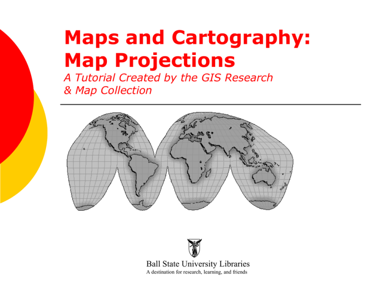
Maps and Cartography: Map Projections A Tutorial Created by the GIS Research & Map Collection Ball State University Libraries A destination for research, learning, and friends What is a map projection? Map makers attempt to transfer the earth—a round, spherical globe—to flat paper. Map projections are the different techniques used by cartographers for presenting a round globe on a flat surface. Angles, areas, directions, shapes, and distances can become distorted when transformed from a curved surface to a plane. Different projections have been designed where the distortion in one property is minimized, while other properties become more distorted. So map projections are chosen based on the purposes of the map. Keywords •azimuthal: projections with the property that all directions (azimuths) from a central point are accurate •conformal: projections where angles and small areas’ shapes are preserved accurately •equal area: projections where area is accurate •equidistant: projections where distance from a standard point or line is preserved; true to scale in all directions •oblique: slanting, not perpendicular or straight •rhumb lines: lines shown on a map as crossing all meridians at the same angle; paths of constant bearing •tangent: touching at a single point in relation to a curve or surface •transverse: at right angles to the earth’s axis Models of Map Projections There are two models for creating different map projections: projections by presentation of a metric property and projections created from different surfaces. • Projections by presentation of a metric property would include equidistant, conformal, gnomonic, equal area, and compromise projections. These projections account for area, shape, direction, bearing, distance, and scale. •Projections created from different surfaces would include cylindrical, conical, and azimuthal projections. Types of Map Projections The number of map projections made possible is limitless, and hundreds have been published. The focus of this study of map projections, however, will involve twenty types of map projections and their characteristics, with examples given using maps from the GIS Research & Map Collection, University Libraries, Ball State University. 1) Mercator Projection… The best known map projection is named for its inventor, Gerardus Mercator, who developed it in 1569. The Mercator projection is a cylindrical projection that was developed for navigation purposes. The Mercator projection was used for its portrayal of direction and shape, so it was helpful to the sailors of that time. The straight lines crossing at right angles of this map projection make it useful for navigation, but it distorts the size of areas away from the equator. Polar areas appear to have a larger scale than areas near the center. (Note Greenland). Over small areas the shapes of objects will be preserved, however, so this projection is conformal. Mercator Projection… Map Projections map, Department of the Interior, U.S. Geological Survey Mapping Division, 1989, GRMC, University Libraries, Ball State University. Mercator projection: World Heritage Map, 2001, GRMC, University Libraries, Ball State University. 2) Transverse Mercator The Transverse Mercator projection is a cylindrical projection often used to portray areas with larger northsouth than east-west extent. Distortion of scale, distance, direction and area increase away from the central meridian. The Universal Transverse Mercator (UTM) projection is used to define horizontal positions worldwide by dividing the earth’s surface into 6-degree zones, each mapped by the Transverse Mercator projection with a central meridian in the center of the zone. Transverse Mercator Map Projections map, Department of the Interior, U.S. Geological Survey Mapping Division, 1989, GRMC, University Libraries, Ball State University. Transverse Mercator projection: Benin, 2007, GRMC, University Libraries, Ball State University. 3) Oblique Mercator The Oblique Mercator projection is a cylindrical projection often used to portray areas along great circles. This map projection is typically used for areas that are long, thin zones (like coastal areas) at a diagonal with respect to the north. Distances are true along a great circle defined by the tangent line formed by the sphere and the oblique cylinder. In other regions distance, shape, and areas are distorted. Oblique Mercator Map Projections map, Department of the Interior, U.S. Geological Survey Mapping Division, 1989, GRMC, University Libraries, Ball State University. Oblique Mercator projection: China Coast and Korea, 1953, GRMC, University Libraries, Ball State University. 4) Space Oblique Mercator The Oblique Mercator projection was replaced by the Space Oblique Mercator projection for Land-sat map images in 1972 with the launching of an earth-mapping satellite by NASA. This map projection allowed mapping of the scanned orbit cycles, with the ground-track continuously at a correct scale and the swath on a conformal projection with minimal scale variation. The Space Oblique Mercator projection is the only one that takes into account the rotation of the earth. Space Oblique Mercator Map Projections map, Department of the Interior, U.S. Geological Survey Mapping Division, 1989, GRMC, University Libraries, Ball State University. Space Oblique Mercator projection: Berry Islands, the Bahamas, GRMC, University Libraries, Ball State University. 5) Miller Cylindrical The Miller Cylindrical projection was a compromise cylindrical projection created by Osborn Maitland Miller of the American Geographical Society. This projection is sometimes referred to as a “modified Mercator.” The parallels of latitude are scaled by a factor of 0.8, projected according to Mercator, and then the result is divided by 0.8 to retain scale along the equator. Thus, the equator is free of all distortion. The entire earth, including the poles, can be presented in a rectangle without as much size exaggeration and shape distortion in the high latitudes as in the Mercator projection and with less shape distortion in the high latitudes as in rectangular equal-area projections. Miller Cylindrical Map Projections map, Department of the Interior, U.S. Geological Survey Mapping Division, 1989, GRMC, University Libraries, Ball State University. Miller Cylindrical projection: Southern Asia, 1994, GRMC, University Libraries, Ball State University. 6) Robinson The Robinson projection was a compromise projection developed by Arthur Robinson, a leading educator in cartography. The Robinson projection is considered a pseudocylindrical projection. This projection shows the whole earth uninterrupted with reasonable shapes. It departs somewhat from equalarea in order to provide better shapes in the middle- and low-latitude regions. The Robinson projection was used by Rand McNally, the National Geographic Society, and others. Robinson Map Projections map, Department of the Interior, U.S. Geological Survey Mapping Division, 1989, GRMC, University Libraries, Ball State University. Robinson projection: Political Map of the World, 1995, GRMC, University Libraries, Ball State University. 7) Sinusoidal Equal Area The Sinusoidal Equal Area map projection is considered a pseudo-cylindrical projection. In the Sinusoidal Equal Area projection all parallels and the central meridian are standard lines. All meridians are curved lines. This projection compresses shapes in higher latitudes, but shapes are good in the central section. All parallels and the central meridian are at correct scale; there is also no distortion of the area scale. The Sinusoidal Equal Area projection is often used in areas with a larger north-south than east-west extent. Sinusoidal Equal Area Map Projections map, Department of the Interior, U.S. Geological Survey Mapping Division, 1989, GRMC, University Libraries, Ball State University. Sinusoidal Equal Area projection: South America Climate Zones, 1944, GRMC, University Libraries, Ball State University. 8) Orthographic The Orthographic map projection is one of the oldest; it was used by Egyptians and Greeks thousands of years ago. The orthographic projection is used for perspective views of planets and regions as a means of presenting a threedimensional object in two dimensions. This projection is useful for presenting individual hemispheres placed in the center where the shapes are not significantly distorted, but area and shape can be distorted by perspective. Directions are true only from the center point of the projection, and any straight line through the center point is a great circle. Distances are true along the equator and other parallels. Orthographic Map Projections map, Department of the Interior, U.S. Geological Survey Mapping Division, 1989, GRMC, University Libraries, Ball State University. Orthographic projection: Pictorial Representation of Mars map, 1965, GRMC, University Libraries, Ball State University. 9) Stereographic The Stereographic map projection is another ancient projection, dating back to the second century B.C. The Stereographic map projection is most useful for maps of polar regions (for navigation purposes) or large continent-sized areas of similar extent in all directions. The Stereographic map projection is conformal but not equal area or equidistant. Directions are true from the center point, and scale increases away from the center point, as does distortion in area and shape. Stereographic Map Projections map, Department of the Interior, U.S. Geological Survey Mapping Division, 1989, GRMC, University Libraries, Ball State University. Stereographic projection: Operation World Prayer Map, 1991, GRMC, University Libraries, Ball State University. 10) Gnomonic The Gnomonic or central projection, another early azimuthal, is projected from the center of the earth onto a tangent plane. The Gnomonic map projection displays all great circles as straight lines. Thus the shortest path between two points in reality corresponds to that on the map. This projection is often used by navigators to gauge distance and in seismic work because seismic waves tend to travel along great circles. Directions are true only from the center point of projection. Scale and the distortion of shape increase away from the center point. Gnomonic Map Projections map, Department of the Interior, U.S. Geological Survey Mapping Division, 1989, GRMC, University Libraries, Ball State University. Gnomonic projection: Eastern Asia and Western Pacific Ocean, 1943, GRMC, University Libraries, Ball State University. 11) Azimuthal Equidistant The Azimuthal Equidistant map projection is centered on one point of the map. Its purpose is to show all great circle routes through the center as straight lines with correct azimuths at the center and to show the distances along the straight-line great circles with a uniform scale. This projection is not equal-area, and shapes in the outer half are greatly distorted. The Azimuthal Equidistant map projection is useful because it can be centered on one city, for example, showing airline distances from that point. An example of a polar Azimuthal Equidistant map projection can be seen on the United Nations flag. Azimuthal Equidistant Map Projections map, Department of the Interior, U.S. Geological Survey Mapping Division, 1989, GRMC, University Libraries, Ball State University. Azimuthal Equidistant projection: Azimuthal Equidistant Projection Centered Near Khartoum map, 1942, GRMC, University Libraries, Ball State University. 12) Lambert Azimuthal Equal Area The Lambert Azimuthal Equal Area map projection was developed by Johann Lambert in 1772. This equal-area projection is useful when mapping large ocean areas. Directions are true only from the center point. Scale decreases away from the center point, as distortion of shapes increases. Distances are true along the equator and other parallels. Lambert Azimuthal Equal Area Map Projections map, Department of the Interior, U.S. Geological Survey Mapping Division, 1989, GRMC, University Libraries, Ball State University. Lambert Azimuthal Equal Area projection: Forest Type Groups of the United States, 1993, GRMC, University Libraries, Ball State University. 13) Albers Equal Area Conic The Albers Equal Area Conic map projection was developed by Heinrich Christian Albers in 1805. This projection uses two standard parallels. No distortion occurs along the two standard parallels, and parallels gradually decrease in spacing away from the central parallel. Scale and shape are not preserved, but directions are reasonably accurate in limited regions. This projection is useful for mapping areas that are mainly east-west in extent and that require equal-area representation like the regions of Europe, the United States, Alaska, and Hawaii. Albers Equal Area Conic Map Projections map, Department of the Interior, U.S. Geological Survey Mapping Division, 1989, GRMC, University Libraries, Ball State University. Albers Equal Area Conic projection: Spain and Portugal, 1998, GRMC, University Libraries, Ball State University. 14) Lambert Conformal Conic The Lambert Conformal Conic was another map projection developed by Johann Lambert in 1772. This projection superimposes a cone over the sphere of the earth, with two reference parallels secant to the globe and intersecting it. Directions are reasonably accurate, and the distortion of shapes and areas is minimal at, but increases away from, the standard parallels. Shapes on large-scale maps of small areas are essentially true. The Lambert Conformal Conic map projection is one of the most widely used map projections in the United States. The USGS uses this projection for many 7.5and 15-minute topographic maps. It is also commonly used for aeronautical charts. Lambert Conformal Conic Map Projections map, Department of the Interior, U.S. Geological Survey Mapping Division, 1989, GRMC, University Libraries, Ball State University. Lambert Conformal Conic projection: Muncie West topographic map, 1992, GRMC, University Libraries, Ball State University. Lambert Conformal Conic projection: Europe, 2007, GRMC, University Libraries, Ball State University. 15) Equidistant (Simple) Conic A prototype of the Equidistant Conic, Simple Conic, map projection was used by Ptolemy in 150 A.D. It was improved in 1745. This map projection is not conformal or equal area. The Equidistant Conic projection commonly has one or two parallels that have the same scale, suffering from no distortion. Direction, area, and shape are fairly accurate but distorted away from standard parallels. This map projection is commonly used in atlases to show areas in the middle latitudes, usually on one side of the equator. Equidistant (Simple) Conic Map Projections map, Department of the Interior, U.S. Geological Survey Mapping Division, 1989, GRMC, University Libraries, Ball State University. Equidistant (Simple) Conic projection: Spravochna´i`a Karta masshtab, 1975, GRMC, University Libraries, Ball State University. 16) Polyconic The Polyconic map projection is associated with F.R. Hassler around 1820. This map projection is based on an infinite number of cones tangent to an infinite number of parallels. The central meridian is straight. Other meridians are complex curves. The parallels are non-centric circles. Directions, shapes, and areas are true only along the central meridian. Distortion increases away from the central meridian. The Polyconic map projection was used almost exclusively for large-scale mapping in the United States until the 1950’s, including most of the USGS early topographic maps. The projection was best suited for areas with a north-south orientation, but it is now nearly obsolete. Polyconic Map Projections map, Department of the Interior, U.S. Geological Survey Mapping Division, 1989, GRMC, University Libraries, Ball State University. Polyconic projection: Hearne Brothers Official Polyconic Projection Map of Greater Spokane, 1984, GRMC, University Libraries, Ball State University. 17) Bipolar Oblique Conic Conformal The Bipolar Oblique Conic Conformal map projection was developed by O.M. Miller and Briesemeister of the American Geographical Society strictly for the purpose of creating a map of North and South America. This map projection accommodated the tendency of North America to curve toward the east while South America tends to curve in the opposite direction. Scale is generally good near the center of the projection. The Bipolar Oblique Conic Conformal map projection is not equal area nor equidistant. Bipolar Oblique Conic Conformal Map Projections map, Department of the Interior, U.S. Geological Survey Mapping Division, 1989, GRMC, University Libraries, Ball State University. Bipolar Oblique Conic Conformal projection: Spain in the Americas, 1992, GRMC, University Libraries, Ball State University. 18) Gall-Peters The Peters Projection was created in 1974 to address some of the distortions of existing maps. The projection was similar to one created a century earlier by Gall, so it became known as the Gall-Peters projection. Gall-Peters preserves sizes and proportions, but shape distortions are great near the equator and poles. To be equal-area within the rectangle determined by using standard parallels of 45 degrees causes the equatorial regions to be greatly lengthened vertically and squeezed horizontally. The higher latitudes are greatly lengthened horizontally and squeezed vertically. Gall-Peters Projection Gall-Peters projection: World Map in Equal Area Presentation, 1984, GRMC, University Libraries, Ball State University. 19) Van der Grinten Alphons J. van der Grinten developed a map projection that was neither conformal nor equal-area. The Van der Grinten map projection is a compromise projection showing the entire earth within a circle. Shape and size distortions increase away from the central section, particularly in the high latitudes. Most of the greatly enlarged polar areas are omitted when this projection is used. Van der Grinten Map Projection Van der Grinten projection: What’s Up, South? World Map, 2002, GRMC, University Libraries, Ball State University. 20) Winkel Tripel Oswald Winkel developed the Winkel Tripel map projection in 1921 as a modified azimuthal projection. This projection is neither equal-area nor conformal, but shape distortions are moderate. Unlike the similar Robinson projection, parallels are straight at the equator and poles and curved elsewhere. Scales are constant but not equal at the equator and central meridian. The Winkel Tripel presents a balanced view of the entire world (usually in a circular shape), which led to its selection by the National Geographic Society for its new reference world map in 1998, replacing the Robinson projection. Winkel Tripel Winkel Tripel projection: Soccer Unites the World, 2006, GRMC, University Libraries, Ball State University. Winkel Tripel projection: The World map, 2001, GRMC, University Libraries, Ball State University. (This map projection is the new standard selected by the National Geographic Society in 1998). The Globe On a globe, directions, distances, shapes, and areas are all accurate and true. The shortest distance between any two points on the surface of the earth can be found quickly and easily along a great circle using a globe. However, even the largest globe has a very small scale and shows relatively little detail. Maps can accommodate an enormous range of scales, and can show a larger portion of the earth in one view. Globes are costly to reproduce and update. Globes are bulky to store and difficult to transport. Globes cannot be viewed easily on computer displays. The Globe Map Projections map, Department of the Interior, U.S. Geological Survey Mapping Division, 1989, GRMC, University Libraries, Ball State University. The “Best” Map Projection Every projection has its own set of advantages and disadvantages. Even the globe, a true representation of the earth, has disadvantages. There is no "best" projection. The mapmaker must select the one best suited to the needs of the specific map, reducing distortion of the most important features. For more information about any of the maps shown or the tutorial lesson Maps and Cartography: Map Projections, please contact the GIS Research & Map Collection, Ball State University Libraries, at (765) 285-1097. Visit the Web page at www.bsu.edu/library/collections/gcmc/ Information provided by Map Projections: A Reference Manual by Lev Bugayevskiy and John Snyder, Ball State University Libraries; and Introduction to Map Projections by Porter McDonnell, Jr., Ball State University Libraries. For further information about map projections and maps, visit the U.S. Geological Survey Web page at www.usgs.gov Click here to complete this tutorial: http://www.bsu.edu/library/collections/gcmc/feedbackform/ Ball State University Libraries A destination for research, learning, and friends
