Document 10896495
advertisement
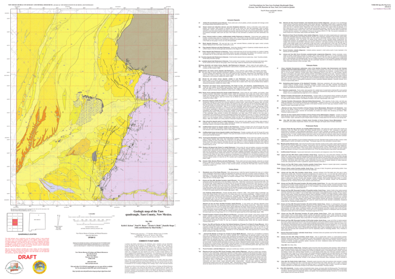
Unit Descriptions for Taos Area Geologic Quadrangle Maps (Carson, Taos SW, Ranchos de Taos, Taos, Los Cordovas Quads) NEW MEXICO BUREAU OF GEOLOGY AND MINERAL RESOURCES A DIVISION OF NEW MEXICO INSTITUTE OF MINING AND TECHNOLOGY 105°37'30"W 105°35'0"W 444000 445000 446000 447000 105°32'30"W 448000 449000 450000 105°30'0"W 451000 452000 453000 454000 455000 NMBGMR Open-file Map Series OFGM 43 Last Modified 15 March 2006 Paul W. Bauer and Keith I. Kelson July 2003 36°30'0"N Qc Qfy 36°30'0"N Qfy 4039000 4039 000 Qty Cenozoic Deposits Qfu Qfy Qty Qfy Artificial fill and disturbed ground (Recent) - Poorly sorted sand, silt and pebbles, primarily associated with drainage control and storage facilities along piedmont east of Taos. Qal Stream channel and valley-floor alluvium, and active floodplains (Holocene) - Poorly to well-sorted, poorly sorted sand, pebbles, and boulders; clasts primarily of quartzite and slate in the Carson and Taos SW quadrangles, clasts of granitic, metamorphic, volcanic, and sandstone rock types in the Taos, Ranchos de Taos, and Los Cordovas quadrangles; with clasts along Rio Lucero dominated by granitic lithologies and quartzite; clasts along Rio Pueblo de Taos dominated by granitic, quartzite, and sandstone lithologies; clasts south and east of Rio Pueblo de Taos dominated by sandstone and other sedimentary rock types. Qc Qty Qfy Af Qfy 4038000 4038 000 Qc Qal Qty Qal Qty Qt4 Qc Qc (Taos): Colluvial mantle on slopes, undifferentiated (middle Pleistocene to Holocene) - Poorly-sorted sand, pebbles and boulders; prevalent along bases of mountain-front facets; north of Rio Pueblo de Taos dominated by granitic lithologies and quartzite; south of Rio Pueblo de Taos dominated by sandstone and pebble conglomerate with minor limestone clasts; not shown in Rio Pueblo de Taos gorge in Carson and Taos SW quadrangles. Qm Marsh deposits (Holocene) - Silt, sand and clay in low relief, saturated flatlands; probable high organic content; primarily between Highway 64 and Taos Pueblo, bordering Rio Lucero. Qp Playa deposits (Holocene and latest Pliestocene) - Small playa deposits located on Quaternary landslide deposits along the northern canyon of the Rio Grande generally downstream of the village of Pilar. Qal Tplq (Ranchos de Taos): Picuris Formation, Llano Quemado breccia member (Oligocene) - Light gray to red, monolithologic volcanic breccia of distinctive extremely angular, poorly sorted, light-gray, recrystallized rhyolite clasts in a generally redddish matrix. Rhyolite clasts contain phenocrysts of biotite, sanidine, and quartz. Highly lithified, due to partial welding of the matrix rather than silica or carbonate cement. Ridge-former. Unit shows both clast and matrix support. Beds are generally 1-8 m thick. Clasts are up to 15 cm in diameter, and overall clast size decreases southward. Less than 1% of clasts are Proterozoic slate and weathered Tertiary volcanic rocks. 5-45 m thick. Described by Rehder (1986). New 40Ar/39Ar date on sanidine from a rhyolite clast from exposure 1 km southwest of Ponce de Leon spring is 28.35 ± 0.11 Ma. The breccia is interpreted as a series of flows from a now-buried, nearly rhyolite vent (Rehder, 1986). Tpl (Ranchos de Taos): Picuris Formation, lower member (Oligocene) - Boulder and cobble conglomerates and conglomeratic sandstones interbedded with thinly bedded sandstones. Boulder unit is distinctive, composed of well rounded, poorly sorted, mostly clast supported, Proterozoic quartzite clasts, with minor altered, intermediate Tertiary volcanics (Latir volcanics) and Paleozoic sedimentary rocks. The boulder unit grades (fines) upward to less indurated pebble conglomerate and conglomeratic sandstone, and variegated green, red, and white siltstone and claystone. Bedding is locally discontinuous, with multiple minor erosional unconformities. Carbonate cement is pervasive. Local layers of primary air fall ash that are well sorted, contain biotite crystals, and are yellow-gray to light olive brown, to gray-white.20-50 m thick. New 40Ar/39Ar ages of ashes from near Pete Tafoya's house and 1 km southwest of Ponce de Leon springs are 34.64 ± 0.16 Ma and 27.93 ± 0.08 Ma. Interpreted as a sequence of debris flow and alluvial fan deposits derived from Sangre de Cristo Mountains and Latir volcanic field to north and northeast (Rehder, 1986). Tpa Picuris Formation, andesite (Oligocene) - Andesite porphyry exposed in small outcrop south of Llano Quemado in the Ranchos de Taos quadrangle. Tpc (Carson and Taos SW): Picuris Formation, quartzite-boulder conglomerate (Oligocene) - Weakly consolidate, coarse, cobble to boulder conglomerate composed of rounded, white to gray quartzite clasts (up to 2 m) and subordinate granite clasts. Poorly sorted and unstratified. Sand matrix.40Ar/39Ar age of 34.5±1.2 Ma for a white ash adjacent to a conglomerate layer is a good estimate of the depositional age of the unit. Probably equivalent to a Picuris Formation quartzite conglomerate that is near a 34.6 Ma white ash in the Ranchos de Taos quadrangle. Equivalent to the Bradley Conglomerate of Leininger (1982). Estimated thickness is 450m (Leininger, 1982). Qal Qfy Qf4 Xu 4037000 Qal Qf1 4037 000 Qc Qe 85 Qfu Qty Qc Qf2? Qfy 4036000 Qfy Qal Qc 55 Xu Qf1 4036 000 55 50 80 88 Qf2? Qtu Qls Qc Qfu 80 70 Qf4 85 85 Qal 51 37 Qfu 4035000 4035 000 Qal Qc Qf2 Qfy Qt2 8 58 Qfy 36°27'30"N 45 60 25 35 35 47 Qfy 54 57 40 Qf2? Qty & Qfu Qfy Qf3 Qt3 76 &1st &1st 38 4034 000 61 82 &ss & 89 Qf2? 84 &ss Qt2 28 20 Qt4 25 27 95 15 &ss 19 25 56 22 20 74 20 89 35 Qfy 4033000 Qfo 11 Qal Qfy Qty 20 Qfy Qfy &cq Qfy 80 28 18 25 Qal Qfy & Qf2 Qt2 Qfy 41 15 70 86 Qfu Qfy 56 Qfy Qf2? Qfy Mes (Ranchos de Taos): Espiritu Santo Formation of Arroyo Penasco Group (Mississippian, Osagean) - Consists of basal Del Padre Sandstone member of thin basal conglomerate, quartz sandstone, and minor limestone beds at top. Grades into overlying Tererro Formation. Upper, carbonate-rich part of Espiritu Santo Formation is mostly absent from the Ponce de Leon springs area. 4032 000 Qfu 80 Qfu Qf2 Qfu Qfy Qf2 Qf2 Qfu Qal Qf2 Qf2 QTbh Qt4 Qf2 Qf2 Qf2 QTbh Qf2 &1st 7 Qfu &1st 38 Qfy Qt2 87 28 Qt4 Qfy &1st Qt3 Qfu QTbh Qf2 Qfy Qf2 Qfu &1st Qty Qf2 43 Qfu 17 20 10 &1st &1st &1st &1st &1st Qfy 85 TQg 5 & 65 Tertiary Rocks 45 Tr Rhyodacite cone of Tres Orejas (Pliocene) - Dark, phenocryst-poor, locally flow layered rhyodacite that crops out in northern Carson Quadrangle. Phenocrysts of augite and hypersthene are sparse and small; SiO2 is 62-64% (Lipman and Mehnert, 1979). Uppermost Tb flows locally overlap the flanks of Tres Orejas. Older Tb flows lie below rhyodacite volcanoes elsewhere on the Taos Plateau, so rhyodacite and olivine basalt (Tb) eruptions overlapped in time. 40Ar/39Ar ages from pyroxene dacites of Tres Orejas are 4.84 ± 0.02 Ma (Appelt, 1998). Tb (Carson and Taos SW): Servilleta Formation, basalt (Pliocene) - Dark-gray, diktytaxitic olivine tholeiite which forms thin, fluid, widespread pahoehoe basalt flows of the Taos Plateau volcanic field. These flows commonly form columnar-jointed cliffs in the Rio Grande Gorge. Tabular plagioclase and sparse olivine are the only phenocrysts. Individual flows, which are up to 12 m thick, are grouped into packages of from one to ten flows. These packages are separated by 0.3-4.5 m thick sedimentary intervals (Leininger, 1982). The mesa east of Pilar displays four basalt flows north of the Embudo fault and only one flow south of the fault. Five central volcanic vents to the north are sources for the Servilleta Formation (Lipman and Mehnert, 1979). 40Ar/39Ar ages from basalts exposed in the Rio Grande gorge range in age from 4.81 ± 0.03 Ma for the lowest basalt near the Gorge Bridge, to 3.12 ± 0.13 Ma for the highest basalt flow at the Gorge Bridge (Appelt, 1998). Qfy Qfu Qfy Qfu Qfu Qfy 9 75 Qfu Qfy QTbh 6 89 Qfu Qfy 4027 000 10 73 30 Qfu/QTbh 33 Qfy Qty Qt4 49 10 20 70 89 Qfu 4026000 45 89 50 88 60 82 17 Qfu Qfy Qal Qfy 60 Qfu Qtu &? Qtu & 89 Qty Qty Qfy Qfy 36°22'30"N 444000 445000 446000 447000 105°37'30"W 448000 449000 450000 451000 105°35'0"W 452000 1:24,000 ARROYO SECO 1 WHEELER PEAK NEW MEXICO LOS CORDOVAS TAOS TAOS 453000 0.5 1000 0 0 1000 2000 3000 1 MILE 4000 5000 6000 RANCHOS DE TAOS This draft geologic map is preliminary and will undergo revision. It was produced from either scans of hand-drafted originals or from digitally drafted original maps and figures using a wide variety of software, and is currently in cartographic production. It is being distributed in this draft form as part of the bureau's Open-file map series (OFGM), due to high demand for current geologic map data in these areas where STATEMAP quadrangles are located, and it is the bureau's policy to disseminate geologic data to the public as soon as possible. After this map has undergone scientific peer review, editing, and final cartographic production adhering to bureau map standards, it will be released in our Geologic Map (GM) series. This final version will receive a new GM number and will supercede this preliminary open-file geologic map. DRAFT Tch 7000 FEET May 2001 1 QUADRANGLE LOCATION 455000 Geologic map of the Taos quadrangle, Taos County, New Mexico. PUEBLO PEAK SHADY BROOK (Ranchos de Taos and Taos): Servilleta Formation, basalt (Pliocene) - In cross section only. Dark-gray, diktytaxitic olivine tholeiite, which forms thin, fluid, widespread pahoehoe basalt flows of the Taos Plateau volcanic field. These flows commonly form columnar-jointed cliffs in the Rio Grande Gorge. Tabular plagioclase and sparse olivine are the only phenocrysts. Individual flows, which are up to 12 m thick, are grouped into packages of from one to ten flows. These packages are separated by 0.3-4.5 m thick sedimentary intervals (Leininger, 1982). Five central volcanic vents to the north are sources for the Servilleta Formation (Lipman and Mehnert, 1979). 40Ar/39Ar ages from basalts exposed in the Rio Grande gorge range in age from 4.81 ± 0.03 Ma for the lowest basalt near the Gorge Bridge, to 3.12 ± 0.13 Ma for the highest basalt flow at the Gorge Bridge (Appelt, 1998). 105°30'0"W 0.5 0 1 KILOMETER by Keith I. Kelson , Paul W. Bauer , Kristie S. Diehl 3, Danielle Shapo 3, with contributions by Shari Kelley 2. 1 TAOS SW 454000 105°32'30"W Base map from U.S. Geological Survey 1995, from photographs taken 1961 and 1987, field checked in 1995. 1927 North American datum, UTM projection -- zone 13N 1000-meter Universal Transverse Mercator grid, zone 13, shown in red ARROYO HONDO Magnetic Declination March, 2006 9º 31' East At Map Center CONTOUR INTERVAL 40 FEET NATIONAL GEODETIC VERTICAL DATUM OF 1929 New Mexico Bureau of Geology and Mineral Resources Open-file Map Series OFGM 43 1 2 William Lettis and Assoc., 1777 Botelho, Walnut Creek, CA 94596 2 NMBGMR, 801 Leroy Pl., Socorro, NM, 87801 3 NMT EES dept., 801 Leroy Pl., Socorro, NM, 87801 New Mexico Bureau of Geology and Mineral Resources New Mexico Tech 801 Leroy Place Socorro, New Mexico 87801-4796 [505] 835-5490 http://geoinfo.nmt.edu This and other STATEMAP quadrangles are (or soon will be) available for free download in both PDF and ArcGIS formats at: http://geoinfo.nmt.edu/publications/maps/geologic/ofgm/home.html A geologic map displays information on the distribution, nature, orientation, and age relationships of rock and deposits and the occurrence of structural features. Geologic and fault contacts are irregular surfaces that form boundaries between different types or ages of units. Data depicted on this geologic quadrangle map may be based on any of the following: reconnaissance field geologic mapping, compilation of published and unpublished work, and photogeologic interpretation. Locations of contacts are not surveyed, but are plotted by interpretation of the position of a given contact onto a topographic base map; therefore, the accuracy of contact locations depends on the scale of mapping and the interpretation of the geologist(s). Any enlargement of this map could cause misunderstanding in the detail of mapping and may result in erroneous interpretations. Site-specific conditions should be verified by detailed surface mapping or subsurface exploration. Topographic and cultural changes associated with recent development may not be shown. Cross sections are constructed based upon the interpretations of the author made from geologic mapping, and available geophysical, and subsurface (drillhole) data. Cross-sections should be used as an aid to understanding the general geologic framework of the map area, and not be the sole source of information for use in locating or designing wells, buildings, roads, or other man-made structures. The map has not been reviewed according to New Mexico Bureau of Geology and Mineral Resources standards. The contents of the report and map should not be considered final and complete until reviewed and published by the New Mexico Bureau of Geology and Mineral Resources. The views and conclusions contained in this document are those of the authors and should not be interpreted as necessarily representing the official policies, either expressed or implied, of the State of New Mexico, or the U.S. Government. Chamita Formation of Santa Fe Group (Miocene and Pliocene) - Composition ranges vertically. Lower section consists of buffcolored, moderate to poorly sorted sands with clasts of intermediate volcanic rock, quartzite, and other metamorphic rocks. Middle section contains fewer volcanic clasts and more metamorphic clasts. Upper section is devoid of volcanic clasts. Overall, unit coarsens upwards, and dips decrease from 30o NW at base to horizontal at top. Exposure just north of Pilar contains an internal angular unconformity of about 15o near top of exposure. Interfingering basal contact with Ojo Caliente Sandstone. Thickness about 230 m. To (Carson, Taos SW, and Ranchos de Taos): Ojo Caliente Sandstone of Tesuque Fm of Santa Fe Group (Miocene) - Buff to white, well-sorted eolian sandstone. Dominant grain size is fine sand. Abundant 1.3-5.0 cm thick brown CaCO3 concretions. QFL proportions average 62% quartz, 28% feldspar, and 10% lithics. LvLsLm ratio averages 82% Lv, 8% Ls, and 10% Lm. Thin reddish-brown, finely laminated siltstone horizons are found locally. Tabular crossbeds are common, with sets over 4 m in height. Transport was from southwest to northeast. Deposited at 13-12 Ma (Steinpress, 1980). Best exposures are in roadcuts along NM-68, northeast of Pilar. About 250 m thick. Tce Chama-El Rito Member of Tesuque Fm of Santa Fe Group (Middle Miocene) - Volcanic-rich, non-fossiliferous sandstone (50%) and conglomerate (42%), with minor mudrock interbeds (8%). Conglomerates are generally purplish to gray due to predominance of pebble-size Tertiary volcanic clasts. Sandstones are pinkish-gray to buff, poorly to moderately sorted, with highly variable grain size. Sandstones are transitional between arkoses and volcanic arenites. Siltstone and clayey siltstone beds are reddish-brown and generally less than 1 m thick. Sandstone QFL percentages average 39% quartz, 31% feldspar, and 30% lithics. LvLsLm percentage averages 80% volcanic lithics. White beds of calcareous, pyroclastic volcanic ash, less than 2 m thick, are found locally. Fluvial and alluvial sedimentary structures are common. Represents braided stream deposits on a distal alluvial fan derived from a volcanic terrain to the northeast. Lower part contains 10-m-thick weakly consolidate, coarse, cobble to boulder conglomerate composed of rounded, white to gray quartzite clasts (up to 2 m) and subordinate granite clasts. Age is about 18-14 Ma (Steinpress, 1980). Pinches out to the southeast. Thickness up to 480 m. COMMENTS TO MAP USERS Mapping of this quadrangle was funded by a matching-funds grant from the STATEMAP program of the National Cooperative Geologic Mapping Act, administered by the U. S. Geological Survey, and by the New Mexico Bureau of Geology and Mineral Resources, (Dr. Peter A. Scholle, Director and State Geologist, Dr. J. Michael Timmons, Geologic Mapping Program Manager). xxx Pegmatite - Simple pegmatites of quartz-K-feldspar-plagioclase-muscovite. Pegmatite bodies typically are dikes or lenses, locally aligned parallel to country rock foliation and fold hinges. Thicknesses range from a few centimeters to several meters. Xmg Miranda granite (informal name) - East of the Picuris-Pecos fault. Generally consists of pink to white, medium-grained, mica-rich granitic rock with euhedral megacrysts of feldspar. These granitic rocks are everywhere weathered looking, fairly equigranular, and commonly crumbly. Appears to intrude the Rio Pueblo schist along southern contact. Pegmatites are locally voluminous. Contains at least one tectonic foliation. Three closely-spaced, orthogonal joint sets cause this rock to weather into small, angular blocks. Age unknown, but similar in occurrence and texture to the 1.6 Ga Tres Piedras Granite of east-central Tusas Mountains. Xu Undifferentiated Proterozoic - Supracrustal metamorphic rocks and plutonic and metaplutonic rocks of the Taos Range. Xhpl (Carson and Taos SW): Piedra Lumbre Formation, Hondo Group - Exposed only in two small areas northeast of the PilarVadito fault. Includes quartz-muscovite-biotite-garnet-staurolite phyllitic schist with characteristic sheen on crenulated cleavage surfaces, and finely laminated, light gray, phyllitic quartz-muscovite-biotite-garnet schist and darker bluish gray fine-grained biotite quartzite to metasiltstone. Euhedral garnets are 1 mm, biotite books are 2 mm, and scattered anhedral staurolites are up to 5 mm in diameter. Calc-silicate layers exist locally. Original sedimentary structures such as graded bedding are locally preserved. Contact with underlying Pilar Formation is gradational. Apparent thickness is 200-400 m. Xhplq (Carson and Taos SW): Piedra Lumbre Formation quartzite, Hondo Group - Massive to layered, light-colored, crossbedded micaceous quartzite. Locally garnet-bearing. Approximate thickness of 25 m. Xhplp (Carson): Piedra Lumbre Formation phyllite, Hondo Group - Dark gray to black, fine-grained, garnet-bearing phyllite. Crops out only in the core of the Hondo syncline east of the Pilar-Vadito fault. Xhp (Carson and Taos SW): Pilar Formation, Hondo Group - Exposed northeast of the Pilar-Vadito fault. Dark gray to black, carbonaceous phyllitic slate. Extremely fine-grained homogeneous rock except for rare 1- to 2-cm thick light colored bands of quartz and muscovite that may represent original sedimentary bedding. In thin section, fine-grained matrix consists of quartz (5070%), muscovite (15-30%), and prominent streaky areas of graphitic material. Lenticular porphyroblasts (0.1 to 0.5 mm) are altered to yellow-brown limonite. Pervasive slaty cleavage is locally crenulated. Small isoclinal folds locally. Basal 1.5 m-thick, black to blue-black, medium-grained, garnet quartzite is distinctive. Garnets are anhedral, oxidized, and red-weathered. Gradational with Hpl. Thickness unknown due to extreme ductile deformation. Xhr6 (Carson and Taos SW): Rinconada Formation, R6 schist member, Hondo Group - Tan, gray, silver quartz-muscovite-biotitestaurolite-garnet schistose phyllite interlayered with fine-grained garnetiferous muscovite quartzite. Euhedral staurolites (<5 cm) abundant in some layers. Small euhedral garnets (<2 mm) throughout. Strong parting along well-developed foliation. Sharp contact with Hp. Thickness is approximately 90 m. Xhr5 (Carson and Taos SW): Rinconada Formation, R5 quartzite member, Hondo Group - Variety of white to blue medium-grained quartzites interlayered with fine-grained schistose quartzites and quartzose schists. Measured section by Hall (1988) from an area just to the south, from top to bottom: 1) tan to white, friable, thinly layered, crossbedded micaceous quartzite; 2) blue, mediumgrained, thickly layered, resistant saccharoidal quartzite; locally crossbedded; 3) white to tan, friable schistose quartzite layered with blue, medium-grained saccharoidal quartzite; thin layers of fine-grained quartz-muscovite-biotite schist; basal 1.5 m massive blue medium-grained quartzite; 4) tan, thinly layered, micaceous quartzite layered with quartz-rich muscovite schist; abundant crossbedding; 5) blue and white streaked, thickly bedded, medium-grained quartzite with abundant crossbedding; and 6) tan, thinly layered, micaceous quartzite interlayered with quartz-rich quartz-muscovite schist; abundant crossbedding. Gradational contact with Hr6. Thickness is approximately 75 m. Xhr4 (Carson and Taos SW): Rinconada Formation, R4 schist member, Hondo Group - Medium- to coarse-grained, silvery gray, quartz-muscovite-biotite-staurolite-garnet schist containing one or more distinctive, 0.5-2.0 m thick, layers of glassy blue quartzite, rusty red weathering garnetiferous white quartzite, massive, extremely hard, red weathering, olive-brown biotite-staurolite-garnetorthoamphibole rock, white, glassy, hornblende quartzite, gray biotite-hornblende calc-schist, mylonitic blue to pink and blue, glassy quartzite, and white to gray calcite marble. In this area, Hr4 is a transitional sequence of interlayered schist and quartzite, making the contacts with Hr3 and Hr5 indistinct. Thicknesses range from 50-175 m. Xhr3 (Carson and Taos SW): Rinconada Formation, R3 schist member, Hondo Group - White, gray, bluish-green and blue, medium-grained, thinly to thickly bedded, resistant quartzite with abundant crossbeds (Hr3q). Locally includes two mappable layers of pelitic schist (Hr3s) that resemble Hr4 and upper Hr1/2. Distinctive marker layer near center of unit is 25 m-thick, white, thinly bedded, ridge-forming quartzite. Sharp contact with Hr4. Thickness is approximately 75 m. (Los Cordovas): Basalt (Pliocene) - Primarily Servilleta Basalt of Peterson (1984). Along western edge of quadrangle, may include other Tertiary basaltic rocks derived from Tres Orejas, west of the Los Cordovas quadrangle. In addition to source vents to the north identified by previous workers (Lipman et al., 1979; Peterson 1984; Dungan et al., 1984), newly postulated source vents are located near Taos Municipal Airport (N4034125, E0439650), within Taos Pueblo Tract A (N4033850, E0437550), and in the northeastern part of the Tres Orejas quadrangle (N4036350, E0432475). 40Ar/39Ar ages from basalts exposed in the Rio Grande gorge range in age from 4.81 ± 0.03 Ma for the lowest basalt near the Gorge Bridge, to 3.12 ± 0.13 Ma for the highest basalt flow at the Gorge Bridge (Appelt, 1998). 4026 000 Qfy 15 Qtu Qfy Qfy & 85 25 Qtu Qfy 36°22'30"N Qfy Qfy Qfu Qfu Qfy Qfy Qfy Qfy Qfy Qfu (Carson): Dacite dike (age unknown, but probably Middle Proterozoic) - Dark green-gray quartz diorite dikes intruded into Proterozoic rocks only. Dikes are vertical, with strikes clustered around an azimuth of 150 o. Composed of pale green clinopyroxene (Cr-diopside?), zoned plagioclase (labradorite?), and minor quartz, magnetite, and ilmenite. Commonly altered to chlorite and clay. Pyroxene and feldspar show normal plutonic textures. Locally, dikes are laced with carbonate veins. Dikes are generally less than 1 m wide. Contacts between diorite and country rock are sharp and commonly contain zones of brecciation and faulting. Faults are sub-vertical with dip slip fault striations. Dikes are parallel to the Pilar-Vadito fault and other southeaststriking faults. 22 Qfu Qfy (Carson): Older alluvium (Pliocene and early Pleistocene) - Poorly sorted sand and gravel deposits, preserved as remnant gravel on ridge tops and hill tops, commonly composed of large, rounded to subrounded quartzite boulders up to several meters in diameter; in Carson quadrangle, present on high erosional surfaces, and along the Pilar-Vadito fault; maximum thickness unknown but at least 10 m. 4028 000 15 Qfy Qfy dd &cq 30 20 40 45 &1st 5 4029 000 Blueberry Hill deposit (late Tertiary? to middle Pleistocene) - Poorly sorted silt, sand and pebbles; commonly cross-bedded, and stained with black manganese oxide and yellowish-orange iron oxide coatings; oxidized; clasts are weathered or grussified; contains distinct discontinuous sandy interbeds; clasts are granitic rock types, quartzite, metamorphic rock types, volcanic rock types and rare sandstone; commonly crudely imbricated; imbrication suggests southwesterly flow direction in areas south and east of Taos Municipal Airport; westerly flow direction in area north of Taos Municipal Airport; northwesterly flow direction in area southeast of Rio Pueblo de Taos; based on exposures at southwestern end of Blueberry Hill, unit thickness exceeds 25 m and may be considerably more; deposit may interfinger with unit Qt1rg in northwestern part of Los Cordovas quadrangle (relationship unknown); deposit overlies or is inset into unit Tb in southern part of quadrangle. Unit also referred to as "Basin Fill deposit" by Kelson (1986). 25 47 4027000 &cq 20 Qf2 Qty & &1st 31 Qal Qfy 7 78 &1st Qfu Qf2 &1st 30 30 28 QTbh 16 &cq & 4 22 (Taos SW): Del Padre member of Espiritu Santo Formation of Arroyo Penasco Group (Mississippian) - Quartz sandstone, local quartzite conglomerate, siltstone, and shale. Interfingers with Espititu Santo Formation carbonates. Proterozoic Rocks 76 15 &cq 20 2 &1st 27 84 Qfy Qty Fluvial gravel deposited by ancestral Rio Grande (early to middle? Pleistocene) - Poorly sorted sand, pebbles, and cobbles; clasts of basalt, quartzite, slate, schist, other metamorphic rock types, other volcanic rock types, and (rarely) sandstone and limestone; overlies Tb north of Pilar Mesa, but is inset into Tb on Pilar Mesa in Carson quadrangle; locally may contain clasts of Tertiary Amalia Tuff; where preserved, associated relict soils have stage III to IV calcium carbonate development, thick argillic Bt soil horizons, and 7.5YR to 10YR hues in soil Bt horizons; upper soil horizons commonly affected by surface erosion; may be mantled locally by unit Qe. &cq 5 20 Qfu Qal &1st 4 70 Qf1 Qf2 Qf2 Qt1rg 65 8 70 Qfy 10 20 85 &1st &1st &1st 8 15 af Qfy QTbh Undifferentiated stream terrace deposits (middle to late Pleistocene) - Probably correlative with units Qt1 through Qt4, poorly sorted silt, sand, pebbles and boulders; mapped in Taos quad only locally at mouth of Rio Pueblo de Taos near Taos Pueblo, and at the mouth of the Rio Fernando. 4030 000 &1st &1st &ss &1st 20 65 5 85 15 72 70 &1st &1st 88 70 &1st 89 Qfy QTbh Qtu &cq 27 Qfy Qf2 36°25'0"N 12 &1st 62 &cq Qfu 26 &cq &1st 80 &1st Qfu Qty Qt4 8 9 Qfy? Qf2 Qf2 Qf2 Undifferentiated alluvial fan deposits (middle to late Pleistocene) - Probably correlative with units Qf1 through Qf4, poorly sorted silt, sand, pebbles, and cobbles; mapped along majority of Sangre de Cristo range front, but nor correlated to other fan units because of lack of well-defined age control or distinct lithologic characteristics. &cq Qfu Qfy Qfy 4031 000 11 6 80 30 &1st 10 10 3 Qty Qf2 Qty Qfu Qal Qfy QTbh 25 10 Qfy Qfu 5 51 af Qf2 Older alluvial-fan deposits (early? to middle Pleistocene) - Poorly sorted silt, sand, pebbles, and boulders; clasts primarily of quartzite, slate, and schist; fan surface is highly dissected and eroded, soil characteristics unknown; on Pilar Mesa in Carson quadrangle, deposit is dominated by slate pebbles and cobbles. 26 12 5 9 Qfy Qf2 Qf2 82 67 Qfo 75 11 1 Qty Qf2 Mdp &cq 15 80 28 Alluvial-fan deposits (middle Pleistocene) - Poorly sorted silt, sand, pebbles, and boulders; stage III to IV calcium carbonate development, although soil horizons are commonly affected by surface erosion; clasts primarily of quartzite, slate, and schist; granitic clasts also present east of Arroyo del Alamo; finer grained to the north, away from the Picuris Mountains range front; in Taos SW quadrangle, ash probably within Qf1 deposits at locality near Stakeout Road dated at 1.27 ± 0.02 Ma (40Ar/39Ar method, W. McIntosh, personal communication, 1996); in Los Cordovas quadrangle, clasts primarily of granitic, intermediate volcanic, basalt, and metamorphic rock types; in Los Cordovas quad, Qf1 is correlative with Unit Q1p of Kelson (1986); Qf1 surface on the Los Cordovas quadrangle is dissected by numerous southwesterly-trending arroyos; deposit is more than 12 m thick in northeastern part of quadrangle, and is thinner from northeast to southwest; directly southwest of Taos Municipal Airport, Qf1 deposit is less than about 1 m thick and unconformably overlies unit Tb. Elsewhere, Qf1 appears to overlie unit QTbh or unit Tb; in Taos quadrangle, clasts primarily of granitic and metamorphic rock types; slope of Qf1 surface on the Taos quad is southwesterly, and is dissected by numerous southwesterly-trending arroyos; deposit is more than 12 m thick in northwestern part of quad, and is thinner from northeast to southwest; on Blueberry Hill, Qf1 deposit is about 3 m thick at Highway 64, but is thinner (about 2 m) to the southwest, where it unconformably overlies unit Qtbh; Qf1 is differentiated from QTbh by larger clast size (Kelson, 1986), less oxidation, poor sorting, absence of abundant manganese oxide staining, and clasts that are less weathered. 20 &cq 18 &1st 35 36 Qfy Qf2 15 75 6 82 Qfy 36°25'0"N 60 Qfy Qf2 4031000 4028000 (Ranchos de Taos): Tererro Formation of Arroyo Penasco Group (Mississippian, Meramecian and Chesterian) - Near Ponce de Leon springs, consists of 1-2 m of basal stromatilitic limy sandstone overlain by about 7 m of dolomitic limestone, overlain by about 12 m of calcitic dolomite with stromatilites and bedded and nodular chert (Armstrong and Mamet, 1990). Thickness is approximately 20 m. 16 22 Qf2 QTbh QTbh Mt 65 QTbh Qf2 Qal QTbh Flechado Formation (Pennsylvanian, Morrowan-Atokan-Desmoinesian) - Thick sequence of olive, brown, and dark gray shales and siltstones, with low-feldspar sandstones and conglomerates. Limestone is only 5-10% of the formation. Equivalent to La Posada Formation to the south, which is equivalent to the Sandia Formation and the "lower gray limestone member" of the Madera Formation. Approximately 760 m thick. 27 Qf2 Qfy Qt4 4029000 IPf QTbh Qt3 QTbh Tb Qf1 50 8 26 4030000 Alamitos Formation (Pennsylvanian, late Desmoinesian) - Consists chiefly of coarse-grained arkosic sandstone with lesser amounts of conglomerate, limestone, and gray and red shales. Grades upward from clastic-rich to limestone-rich. Equivalent to the "upper arkosic limestone member" of the Madera Formation to the south. Approximately 1200 m thick. 27 55 Qfy Qt2 IPa Qfy 17 38 Qtu Qtu IPcq Distinctive conglomerate - Poorly sorted, clast-supported, thin, isolated beds of conglomerate containing 99% round quartzite pebbles (2-20 cm in diameter) with a fine-grained matrix. Ledge former. Discontinuous along strike due to channel- and lensshapes. Occurs as isolated beds that range from 2-10 m in thickness. Qt2rg Stream terrace deposits flanking Rio Grande (middle Pleistocene) - Poorly sorted silt, sand, pebbles, and boulders; clasts primarily of granitic, metamorphic, intermediate volcanic, basalt, and sedimentary rocks; locally may contain clasts of Tertiary Amalia Tuff; associated soils have stage III to IV calcium carbonate development, thick argillic Bt soil horizons, and 7.5YR to 10YR hues in soil Bt horizons; upper soil horizons may be affected by surface erosion; may be mantled locally by unit Qe; modified from Kelson (1986). 6 Qm Alluvial-fan and stream terrace deposits flanking Rio Pueblo de Taos and tributaries (middle Pleistocene) - Poorly sorted silt, sand, pebbles, and boulders; clasts primarily of granitic, metamorphic, volcanic, and sedimentary rocks; associated soils have stage III to IV calcium carbonate development, thick argillic Bt soil horizons, and 7.5YR to 10YR hues in soil Bt horizons; upper soil horizons may be affected by surface erosion; modified from Kelson (1986). Nodular/brecciated limestone of the Alamitos(?) Formation - Bluish-gray, packestone with cross-cutting calcite veins. Contains fossils of fusilinids, crinoids, brachiopods, bryozoans, Rugose corals, and algae. Generally round-weathering outcrops. Fusilinids are Desmoinesian in age (B. Allen, 2000, personal communication). Interpreted as cyclic deposits in shallow, fully marine environment within the photic zone. 4033 000 & 11 Qfy Qf1 IPlst &ss 27 80 19 Qfy 4032000 Alluvial - fan and stream terrace deposits (middle to Late Pleistocene) - Poorly sorted silt, sand, pebbles, and boulders; stage II to III calcium carbonate development; clasts primarily of quartzite, slate, and schist; granitic clasts also present east of Arroyo del Alamo; possible Qt3 remnant inset into terrace Qt2 on western side of Taos may be artificial terrace related to residential development; modified from Kelson (1986). 63 50 25 Qal (Taos): Undivided Pennsylvanian sedimentary rocks of the Alamitos Formation (late Desmoinesian) and Flechado Formation (Morrowan-Atokan-Desmoinesian) - Consists chiefly of poorly exposed, olive, brown, red, and dark gray shale and siltstone plus fine- to coarse-grained sandstone with lesser amounts of conglomerate and limestone. Limestone (IPlst) is less than 1% of the formation. Distinctive, rounded quartz cobble conglomerate (IPcon) is less than 1% of the formation. Alamitos Formation is equivalent to the "upper arkosic limestone member" of the Madera Formation to the south. Flechado Formation is equivalent to La Posada Formation to the south, which is equivalent to the Sandia Formation and the "lower gray limestone member" of the Madera Formation. Fusilinids collected from the exposures southeast of Taos Pueblo are Desmoinesian in age (B. Allen, 2000, personal communication). In general, the volume of limestone decreases northward within the map area. Crossbeds examined in the Taos quad in coarse-grained sandstones all show a generally westward paleoflow. Thickness unknown, but a minimum of approximately 2000 m. Qf4 Alluvial-fan and stream terrace deposits (late Pleistocene) - Poorly sorted silt, sand, pebbles, and boulders; associated Qt4 soils have stage III calcium carbonate development, argillic Bt soil horizons and 10YR to 7.5YR hues in Bt horizons; clasts primarily of granitic and metamorphic rocks north of Rio Pueblo de Taos, and granitic, metamorphic, and sedimentary rock types south of Rio Pueblo de Taos; clasts also include basaltic rock types along Arroyo Seco and along Rio Pueblo de Taos downstream of Los Cordovas; modified from Kelson (1986). 27 Qfu Qt2 IP 69 Qfu 4034000 Qal Paleozoic Rocks 88 20 Qal Landslide deposit (late Pleistocene to Holocene) - Poorly sorted sand to boulders, includes large rotational slide blocks within the Rio Grande and Rio Pueblo de Taos gorges, which involve large, rotated and detached beds of Servilleta Basalt (Tb). Qfy Young alluvial-fan and stream terrace deposits (late Pleistocene to Holocene) - Poorly sorted silt, sand, pebbles, and Qty boulders; stage I to II calcium carbonate development; clasts primarily of quartzite, slate, schist, granite, and volcanic rock types; includes unit Qt6 of Kelson (1986). 80 55 Qal Qtr Travertine deposits (late Pleistocene to Holocene) - Small travertine deposits that are located along faults. Travertine probably formed along now-extinct springs. 143 Xu Qc Qfy 36°27'30"N Eolian deposits (late Pleistocene to Holocene) - Poorly to well-sorted sand and silt occurring primarily as a mantle or blanket; locally contains pebbles of basalt and intermediate volcanic rock types; predominant wind direction from southwest; where unit Qe mantles units Tb, Qt1rg, and Qt2rg, shown as units Qe/Tb, Qe/Qt1rg, and Qe/Qt2rg, respectively. Tp Picuris Formation, undivided (Oligocene) - Light gray to pinkish gray, immature, pumice-rich conglomeratic sandstone. Tpu (Ranchos de Taos and Taos SW): Picuris Formation, upper member (Oligocene) - Light gray to pinkish gray, immature, pumice-rich, ashy, polylithologic, conglomeratic sandstone. Consists mainly of sandstones with gravel-sized clasts of pumice and silicic volcanic rocks (mostly 26 Ma Amalia Tuff), and minor Precambrian quartzite and intermediate composition volcanic rocks (including the Latir Peak quartz latite). Most of gravel-sized fraction is pumice, with some clasts up to 25 cm in diameter. Most clasts are rounded to well rounded. Imbrication of clasts is common, although bedding features are indistinct due to the homogeneous nature of lithology and grain size, and the weak induration. Mostly, unit is matrix cemented, with local minor silica cement. Poorly to well lithified. Contains layers and lenses of resistant, well cememted, cobble conglomerates interlayered with easily eroded, weakly cemented pebble conglomerates. Generally gray weathering. Paleoflow measurements indicate source to the north (Rehder, 1986). Total thickness of upper member is 200-250 m. Interpreted as an alluvial fan deposit derived from the Latir volcanic field at around 26 Ma (Rehder, 1986). Xhr12 (Carson and Taos SW): Rinconada Formation, R1-R2 schist member, Hondo Group - Lower unit of fine- to medium-grained, tan to silver, quartz-muscovite-biotite schist with small euhedral garnets (<2mm) and scattered euhedral staurolite twins (<1.5cm). Near base are black biotite books (<2cm). Locally contains andalusite porphyroblasts up to 8 cm across. Upper unit of gray to tan, red weathering, coarse-grained quartz-muscovite-biotite-staurolite-albite-garnet schist containing interlayers of 1-10 cm, red, gray, or tan weathering, fine-grained muscovite-garnet quartzite. Abundant staurolites are twinned, euhedral, up to 3 cm; abundant garnets are euhedral and small (<2mm). Strong parting along foliation plane. Sharp to gradational contact with Hr3. Lower and upper units have previously been subdivided into R1 and R2, respectively, based on mineralogy (Nielsen, 1972). Thickness is approximately 265 m. Xhr (Carson): Rinconada Formation, undivided, Hondo Group - Undivided schists and quartzites near the Pilar-Vadito fault that are extensively fractured and faulted. Xho (Carson and Taos SW): Ortega Formation, Hondo Group - Gray to grayish-white, medium- to coarse-grained quartzite. Generally massive and highly resistant to weathering. Locally well-crossbedded, with kyanite- or sillimanite-concentrated in thin, schistose, muscovite-rich horizons. Crossbeds are defined by concentrations of black iron-oxide minerals. Common accessory minerals are ilmenite, hematite, tourmaline, epidote, muscovite, and zircon. Gradational contact with Rinconada Formation. Thickness is approximately 800-1200 m. (Taos SW): Xh0r, Xh0w, Xh0s. Xvg Glenwoody Formation, Vadito Group - Feldspathic quartz-muscovite schist and quartzose schist exposed in cliffs southwest of Pilar and locally along the northern flank of the Picuris Range on the west side of the Picuris-Pecos fault. White, light gray, pink, or green. Commonly contains megacrysts of feldspar and rounded and flattened quartz in a fine-grained matrix of quartz, muscovite and feldspar. Contact with overlying Ortega Formation is a south-dipping ductile shear zone. Pervasive extension lineation in schist plunges south. Upper 40 m of schist is pinkish, and contains anomalous manganese and rare earth elements, and unusual minerals such as piemontite, thulite, and Mn-andalusite (viridine). L.T. Silver reported a preliminary U-Pb zircon age of ca. 1700 Ma (Bauer and Pollock, 1993). May be equivalent to the ca. 1700 Ma Burned Mountain Formation of the Tusas Mountains. Probably equivalent to the Glenwoody Formation of the southeast Picuris Mountains. Base unexposed; minimum thickness is about 200 m. Xrp (Taos SW): Rio Pueblo Schist, Vadito Group - Feldspathic quartz-muscovite schist and quartzose schist exposed in isolated exposures in the southeast map area, on the east side of the Picuris-Pecos fault. White, light gray, pink, or green. Commonly contains megacrysts of feldspar and rounded and flattened quartz in a fine-grained matrix of quartz, muscovite and feldspar. Probably equivalent to the Glenwoody Formation of the northern Picuris Mountains. Thickness unknown. Xa (Taos SW): Amphibolite - Includes a variety of amphibolite bodies, lenses, and layers within the Miranda granite. The predominant rock type is fine- to medium-grained, dark gray-green to black, weakly foliated amphibolite composed of blue-green to olive-green hornblende, interstitial quartz and plagioclase, sphene, and epidote. Faint compositional layering is formed by 1-2 mm thick white layers. Epidote veins and zones are common.
