Information for the Elk Herd Debate in Arizona by Joanne Littlefield
advertisement

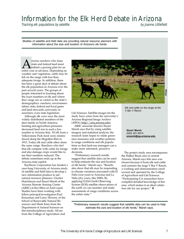
Information for the Elk Herd Debate in Arizona Tracking elk populations by satellite by Joanne Littlefield Studies of satellite and field data are providing natural resource planners with information about the size and location of Arizona’s elk herds. A M.Enns rizona ranchers who lease state and federal land must submit a grazing plan for an entire year in advance. Depending on weather and vegetation, cattle may be left on the range with less than adequate forage. In addition, there has been a great deal of debate about the elk population in Arizona over the past several years. The groups of people interested in learning about the exact numbers of elk and where they range are as varied as the state’s demographics: ranchers; environmentalists; state, federal and local game and land stewards; university researchers; even state legislators. Although elk were once the most widely distributed members of the deer family in North America, hunting and agriculture pressures decreased herd size to such a low number in Arizona that, 83 elk from a Yellowstone Park herd were reintroduced along the Mogollon Rim in 1913. Today elk and cattle often share the same range. Ranchers who feel that elk compete with cattle for forage and also damage crops would like to see their numbers reduced. The debate sometimes ends up at the Arizona state capitol. Raytheon Corporation has funded a year-long University of Arizona study of satellite and field data to develop a new information product to aid natural resource planners. Charles Hutchinson and Stuart Marsh of the Arizona Remote Sensing Center (ARSC) at the Office of Arid Lands Studies have been working with fellow principal investigators Paul Krausman and Larry Howery of the School of Renewable Natural Resources and Mark Enns from the Department of Animal Sciences on this interdisciplinary study. All are from the College of Agriculture and Life Sciences. Satellite images for the study have come from the university’s Arizona Regional Image Archive (ARIA): http://aria.arizona.edu). ARSC associate director Stuart Marsh says that by using satellite imagery and statistical analysis, the research team hopes to relate greenness measures and weather patterns to range conditions and elk populations so that land-use managers can a make more informed, proactive decisions. “Preliminary research results suggest that satellite data can be used to help estimate the size and location of elk herds,” Marsh says. “Results also show that elk may be responding to climate variations associated with El Niño (wet years in Arizona) and La Niña (dry years, like 2000). By applying NASA Earth Observing System (EOS) satellite observations of the earth we can monitor and make assessments of range conditions across the entire state.” Elk and cattle on the range at the V Bar V Ranch. Stuart Marsh (520) 621-8574 smarsh@ag.arizona.edu The project study area encompasses the Walker Basin area in central Arizona. Marsh says this area was chosen because it hosts elk and cattle and contains the large V Bar V Ranch, a working and demonstration ranch owned and operated by the College of Agriculture and Life Sciences. “Participating UA researchers have compiled detailed knowledge of this area, which makes it an ideal validation site for our project.” ❖ “Preliminary research results suggest that satellite data can be used to help estimate the size and location of elk herds,” Marsh says. The University of Arizona College of Agriculture and Life Sciences 7


