Chattooga River Project Overview
advertisement

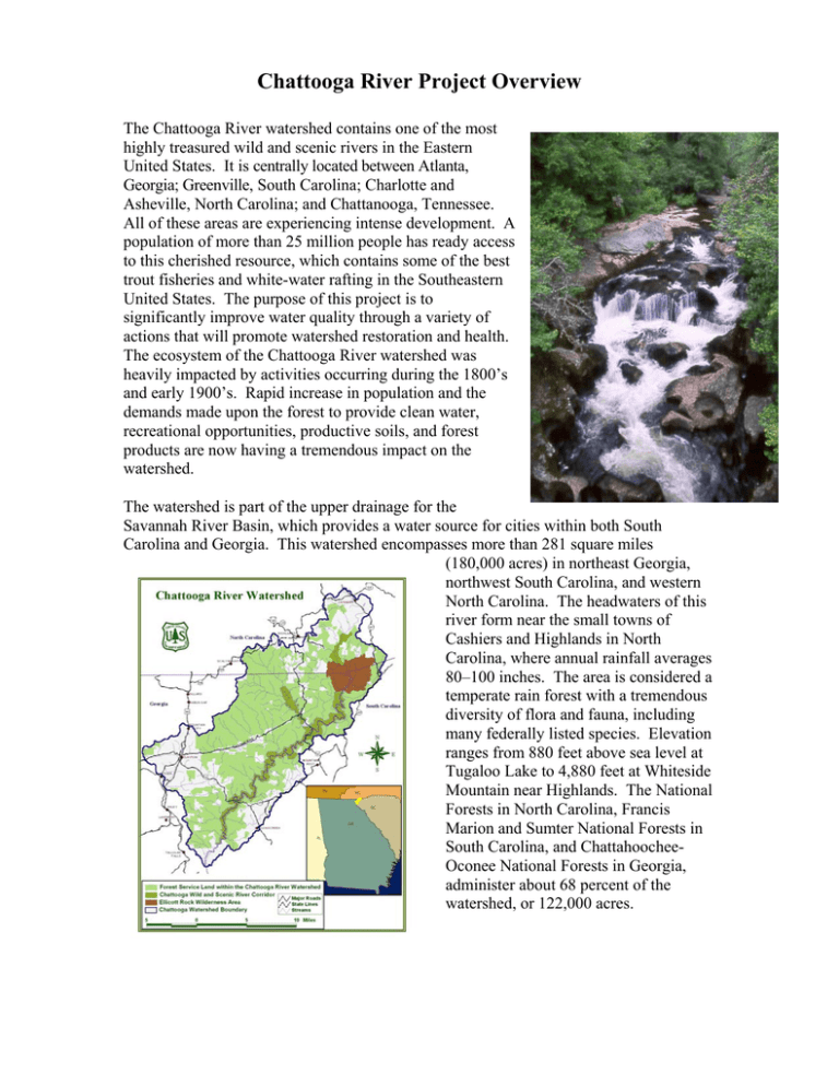
Chattooga River Project Overview The Chattooga River watershed contains one of the most highly treasured wild and scenic rivers in the Eastern United States. It is centrally located between Atlanta, Georgia; Greenville, South Carolina; Charlotte and Asheville, North Carolina; and Chattanooga, Tennessee. All of these areas are experiencing intense development. A population of more than 25 million people has ready access to this cherished resource, which contains some of the best trout fisheries and white-water rafting in the Southeastern United States. The purpose of this project is to significantly improve water quality through a variety of actions that will promote watershed restoration and health. The ecosystem of the Chattooga River watershed was heavily impacted by activities occurring during the 1800’s and early 1900’s. Rapid increase in population and the demands made upon the forest to provide clean water, recreational opportunities, productive soils, and forest products are now having a tremendous impact on the watershed. The watershed is part of the upper drainage for the Savannah River Basin, which provides a water source for cities within both South Carolina and Georgia. This watershed encompasses more than 281 square miles (180,000 acres) in northeast Georgia, northwest South Carolina, and western North Carolina. The headwaters of this river form near the small towns of Cashiers and Highlands in North Carolina, where annual rainfall averages 80–100 inches. The area is considered a temperate rain forest with a tremendous diversity of flora and fauna, including many federally listed species. Elevation ranges from 880 feet above sea level at Tugaloo Lake to 4,880 feet at Whiteside Mountain near Highlands. The National Forests in North Carolina, Francis Marion and Sumter National Forests in South Carolina, and ChattahoocheeOconee National Forests in Georgia, administer about 68 percent of the watershed, or 122,000 acres. Easy highway access and the close proximity to the metropolitan areas of Atlanta, Greenville-Spartanburg, and Asheville have caused an exponential increase in population, visitors, second-home owners, resorts, golf courses, and other developments. No decline in this growth is anticipated during the next few years. This is especially true in the sensitive headwater area near Highlands and Cashiers, North Carolina. Wildland/urban interface and conflicting land uses in the watershed have affected overall water quality and management in the watershed to the extent that some of the tributaries of the Chattooga have been recently declared as impaired by the Environmental Protection Agency. Many of the impaired streams listed are significantly impacted by private land activities. Partners in this project will be looking for ways to assist, educate, and inform area landowners on practices designed to mitigate and modify impacts on the health of the watershed. Partners include three state governments, four county governments, three national forests, private landowners, and numerous citizen and conservation organizations. Forest Service research is a critical partner, bringing with it a wealth of studies and collaboration from the G.W. Andrews Forestry Sciences Laboratory, Bent Creek Research Forest and Coweeta Hydrologic Laboratory. Project work will focus on sediment reduction from roads, trails, and areas of construction and cultivation and alleviating excess fecal coliform concentrations. In 1999, a Board of Directors was established for the project. Made up of fourteen representatives from the Forest Service, Forest Service Research, the Natural Resources Conservation Service, the Environmental Protection Agency, State and Private Forestry from Georgia, South Carolina, and North Carolina, and the US Fish and Wildlife Service, it serves to oversee the activities of the project and assure the projects transitions to a locally lead initiative. PROJECT GOALS The Chattooga River Project seeks to uphold and enhance the integrity of the wild and scenic river ecosystem while maintaining a full range of naturally occurring ecosystems and healthy forests. It also must assure that downstream users will have cool, clear water into the next millennium. Public and private interests will all have to share responsibility for the watershed. Long-lasting partnerships must be developed and continued in order to resolve future watershed issues across all ownerships and interest. To this end specific project goals are: 1) Significantly improve watershed health within the Chattooga watershed. The majority of projects focus on the reduction of sedimentation from roads, trails, and areas of construction, heavy use, and cultivation. One of the primary project goals is to reduce sedimentation in the watershed by fifty percent. This will involve the use of several key factors to determine the highest priority sites and use of available resources to correct them. In 1994, the Van Lear report (Van Lear, et. al.) documented hundreds of sediment producing sites through out the watershed, many attributed to roads and other heavy use areas. It is estimated that 80 percent of the sedimentation is associated with open gravel and unsurfaced roads. The project will work to correct many of these sites by reshaping, resurfacing, and improving water control devices, constructing sediment traps, and closing or obliterating parts or all of some existing roads. Work done by the US EPA that identified several impaired streams in the watershed will also be utilized. Sediment reduction efforts will also include stream bank stabilization and improvement of riparian areas on national forest lands and private lands utilizing opportunities such as Section 319(h) funds, conservation easements, trusts, working with state and federal agencies and non-governmental organizations. The development of additional trails, semideveloped campsites and the rehabilitation of existing camping areas will help to accommodate the increasing demands on the watershed from forest visitors wanting a recreational experience. Excess fecal coliform concentrations within the Stekoa Creek sub watershed in Georgia will also be addressed. Fecal coliform pollution is a concern, particularly in Stekoa Creek, which accounts for less than 10 percent of the flow of the Chattooga River and more than 50 percent of the fecal coliform in the river. The project will help in the building partnerships, development of plans, contracts, funding sources, and the implementation necessary to reduce or eliminate pollutants from these sources. Efforts will be made to help identify additional sources of fecal coliform that impact the watershed health. Prescribed burns and timber harvest will be pursued with the objective of restoring and maintaining native plant species, improving wildlife habitat, reducing hazardous fuels, and ensuring a sustainable forest ecosystem. Alternative silvicultural methods and harvesting techniques will be sought. 2) Transition to permanent watershed partnerships, building of local infrastructures through collaboration and recruitment. The Chattooga project is planned for five years of funding. Implementation of watershed interest must be ongoing. It will involve the transitioning from a board of directors made of federal agencies to an n organization of all watershed interest, private, public. A framework is established for making the transition from a Forest Service project to a partnership project; that is, establish prototypes and lead by example, make GIS databases available for all, establish a nonfederal-dominated partnership engaged in watershed health, and hire a coordinator who can facilitate the transition. 3) Improve awareness, appreciation, involvement and support for improving watershed health through a vigorous information and education program. Recruitment of new partners and the continued collaboration with existing partners will help raise the awareness of the private sector on the challenges and issues now facing the watershed. Working with our partners to help generate grants from non-Forest Service funds, creating awareness through workshops, and getting the public involved will help inform and educate them on watershed issues and concerns. 4) Develop key indicators to track watershed health, assess project success, and identify new research needs. Research is critical to the success of this project. Research coordinates and integrates the efforts among multiple investigations to ensure that work is relevant, timely, directly applicable, and of the highest quality. Research works closely with the board and implementation team to ensure that the planning, design, and implementation of specific proposals complement the goals of research and the project. Research helps guide the selection and execution of management strategies. The inventory and monitoring of existing conditions and project accomplishments is essential. 5) Proactively respond to opportunities to protect sensitive areas through collaborative efforts with local groups, organizations, agencies and individuals. This includes a continued strong acquisition program to identify and purchase critical tracts that have become available. ACCOMPLISHMENTS Chattooga Project Accomplishment Table Project 2000 2001 Total Forest Service Steams Inventoried 34 miles 20.4 miles 54.4 miles Stream Reaches Monitored 46 No. Trails Rehabilitated 65 miles 40 miles 105 miles Roads Rehabilitated 38 miles 22 miles 60 miles Heavy Road Maintenance 74 miles 150 miles 224 miles Illegal ATV Trails Re-vegetated 40 acres 15 acres 55 acres Recreation Sites Rehabilitated (camp sites) 4 No. 19 No. 23 No. County Roads Rehabilitated Using the Wyden Amendment 15 miles 6 miles 21 miles 46 No. Other Accomplishments Treatment of sediment problem sites identified in the Van Lear Report has been a top priority of the project. This includes correcting erosion caused by roads, trails, illegal ATV areas, dispersed camping sites, and other soil and water concerns. Establishment of the Stekoa Creek Watershed Group, comprised of representatives from the local governments in Rabun County, logging, agriculture, development, recreation and environmental concerns. Their mission is to assist the local community in restoration efforts and Total Maximum Daily Load implementation in the Stekoa Creek watershed, an impaired stream and the first in Georgia to receive a TMDL standard for sediment in Georgia. Stekoa Creek is a sub-watershed of the Chattooga. Building partnerships with other state and federal agencies and local governments The University of Georgia funded a $16,566 graduate study of water quality and economic analysis for the restoration of the Stekoa Creek Watershed. Received approval of a section 319(h) grant from Georgia Environmental Protection Division and EPA for the development of a watershed restoration action strategy for the Chattooga River Watershed, including Stekoa Creek. The grant totals $183,208 and includes numerous partners. It will operate through the University of Georgia and under the direction of NRCS for the development of an Environmental Assessment. Upon completion of the assessment, funding for Best Management Practice (BMP) implementation will be sought from various resources. The “Stream Team”, comprised of college students trained by the Center for Aquatic Technology Transfer, completed its second year of stream inventory and monitoring on impaired streams in the watershed. Monitoring of these streams was one of the recommendations made in the 1995 Van Lear report (Van Lear, et. al.). Teams have completed 20.4 miles of stream inventory; over 100 pebble counts in three stream segments of impaired streams, and conducted approximately 25 surveys for macro invertebrates in watercourses. This work is helping to establish baseline data. Community service projects were completed by the US Probation Office, US District Court, Northern District of Georgia. They contributed over $4500 in work to the project. Scientific research within the Chattooga River Watershed by various individuals and organizations has been conducted in cooperation with the Highlands Ranger District. These include the University of North Carolina, University of Missouri, University of Georgia, Western Carolina University, Clemson University, St. Johns University, Highlands Biological Stations, American Chestnut Society, and the American Chestnut Cooperators Foundation. Rabun Gap Nachoochee School has performed several community service projects including stream clean up days for Stekoa Creek in Georgia. Two dump truck loads of trash and debris were removed from a three-mile segment of the project this year. Assess the application of Proper Functioning Condition techniques in the watershed. The technique will be a useful tool in the East for inventory of streams and is certain to provide an excellent communication tool for use in the public/private interface. A volunteer agreement was completed with an Appalachian State University graduate student to complete his census of known green salamander (a listed species) sites with the Chattooga River watershed. Some new sites were also discovered. A predictive model was developed by the student, which can be used to assist in identifying potential sites. This project saved the Forest Service approximately $10,000. The Highlands District assisted the American Chestnut Foundation in locating prospective chestnut seed source. One tree in the watershed has been bagged to collect nuts under permit. The Forest Service is also protecting 20 chestnut seedlings, which are expected to bear nuts next year. Actively involved with the Nantahala botanist working with the Lands Stewards of the Highlands Plateau, a combination of two local garden clubs, in identifying native plants. They also “rescue” plants from areas within the Chattooga and surrounding watersheds prior to land being developed or otherwise permanently disturbed. In conjunction with NC State Wildlife, work has continued in 2001 to study nesting habits for Peregrine Falcons within the watershed. Working with the local climbers in the community, they have developed closures and restrictions, which are intended to reduce conflict between climbers and the Falcons. Work has also continued at several locations within the watershed for bat trapping and monitoring. The Little Tennessee River Watershed Association through the Partners for Wildlife program provided funds for a streambank stabilization project in the Little Tennessee Watershed in Georgia. The Little Tennessee watershed boarders the Chattooga watershed and the technology utilized in this demonstration project will be implemented in the Chattooga next year. During 2001, US EPA Region 4 completed TMDL calculations for eight streams identified as impaired in the Georgia portion of the watershed. Adverse impacts to the biological community and habitat conditions in the streams were identified. The TMDL’s were developed to address the pollutant of concern, excessive sedimentation, in these streams. Construction related runoff and runoff related to unpaved roads were identified as the primary sources of sediment in these watersheds. Information regarding these TMDL’s can be found on the EPA Region 4 website at www.epa.gov/region4/water/. Scotsman Creek Restoration Scotsman Creek: This recently acquired tract of land in the North Carolina portion of the Chattooga watershed contained the remains of a commercial trout farming operation, including the trout runs, an extensive network of pipes and valves, a small weir dam in Scotsman Creek, a dilapidated building used for processing, an eroding road, and an earthen borrow pit. The Environmental Protection Agency made $50,000 available for the restoration of the site. Extensive studies were made by private Dam before work and Forest Service fisheries biologists, hydrologists, and engineers. The Center for Aquatic Technology Transfer conducted an assessment of the potential effects of removing the dam. Fish and habitat surveys were performed and macro invertebrate samples collected on a 2.5 km stretch of Scotsman Creek. During their sampling process, a species of dragonfly was discovered that has never been documented in North Carolina. The concrete dam, processing building, trout runs and much of the piping was removed. A revetment was created to protect the stream bank in an area artificially eroded by a breached section of the old dam. Large amounts of deposited sediment were removed from the streambed prior to removal of the dam. Root wads were placed in the stream above the old dam site creating pools for fish habitat in order to replace what was lost by the removal of the dam. Creek after dam removal Trout were observed using the new pools before work on the project was completed. An old borrow site was also rehabilitated, sloped, seeded and mulched to allow for natural re-vegetative growth. Special measures were taken to protect Frazier’s loosestrife, a listed plant species, during the project. Trout runs before removal Runs removed, area re-vegetated Thrift’s Lake Cost Share Project Thrift’s Lake is a 21-acre lake on private property in Oconee County, South Carolina. It was constructed years ago by building a dam on Licklog Creek, a stream that flows onto the National Forest 100 feet below the dam, eventually reaching the Chattooga River. Conventional top-water riser systems drain the warmest waters from the top of the lake into the stream. These warm waters from Thrifts Lake were being detected for miles downstream, even after its confluence with the Chattooga River. Warmed waters significantly reduce habitat for native trout and other cold-water aquatic life. Thrift’s Lake The Forest Service and the Foothills Resource Conservation and Development Council, Inc., Greenville, SC entered into an agreement to help accomplish mutually beneficial objectives related to restoring habitat for cold-water fisheries and other aquatic life on the Chattooga River. This was accomplished by the installation of a bottom-water release/siphon system on the privately owned Thrift’s Lake. The addition of a bottom-water release/siphon system mitigated the negative impacts associated with the manmade lake and restored more natural stream temperatures and conditions. Public benefits were cooler water temperatures and increased dissolved oxygen contents, which resulted in increased Preparing diver for work recreational trout fishing opportunities and overall watershed health. The total cost of the project was $11,300.00, which was shared on a 50/50 basis by the Forest Service using Chattooga watershed restoration funds and by the RCD Council using Wildlife Habitat Incentive Program grant funds. Another project this year set aside $40,000 for the Natural Resources Conservation Service to assist private landowners in the Whetstone Creek drainage area of the watershed. The goal is to improve water quality and riparian conditions through the implementation of cost-share Best Management Practices on these intensively farmed agricultural areas. Activities will include fencing cattle out of streams, stream crossings and watering facilities, stream bank stabilization, and riparian re-vegetation. Stream Structure Workdays More than sixty volunteers, some driving more than two hours, came to three Trout Unlimited workdays to repair and maintain stream structures in tributaries of the Chattooga River. Forty-two structures were repaired and eleven cover logs were strategically installed while the work was being completed. Many of the stream structures repaired date back to the 1960’s. Workday in Upper Sarah’s Creek The local Rabun County Trout Unlimited Chapter purchased the materials and equipment to make the structure repairs with a Trout Unlimited Embrace A Stream grant they received. The Embrace A Stream grant was for over 7000 dollars, and was matched with over 14,000 dollars of in kind services and materials. Improvement to the structures will enhance trout habitat by creating cooling pools and protective cover. Approximately eight miles of Chattooga River are stocked by helicopter with 25,000 to 60,000 fish annually. Financial assistance in this effort comes Volunteers installing a cover log from the local Trout Unlimited Chapter and the Georgia Trout Unlimited Council. Repairs completed on a K-dam structure over thirty years old Coweeta Hydrologic Station Research Coweeta Hydrologic Research Station has two studies nearing completion. The first is “Sediment and petroleum hydrocarbon production from forest roads”. The objectives of this study were to compare sediment production and movement across a range of road surface types and to quantify the amount and movement of petroleum-based hydrocarbons from paved surfaces. Four road surface types were identified for the study. They included a 2-yr-old paved surface, a graveled road section receiving routine maintenance levels, a graveled road section receiving high maintenance and sediment control features, and an unimproved graveled road section. Results indicate large differences in TSS among road surface types (paved < high maintenance < routine maintenance < unimproved). These data will be coupled with road sediment models to assess road restoration effectiveness at watershed scales. Preparing Monitoring Station Manuscript in preparation: Clinton, B.D., and J.M. Vose. In prep. Sediment and petroleum hydrocarbon production from forest roads in the Chattooga River Watershed. Southern Journal of Applied Forestry. The second study, “Watershed Health: Stream Water Quality Monitoring Study” Seeks to determine the “fit” of EPA assessments to streams based upon short-term assessments of water quality and to determine the effectiveness of watershed restoration efforts on stream water quality. Coweeta is conducting detailed monitoring of water quality, biotic indices, and stream flow on four tributaries of the Chattooga River to determine how these relate to EPA 303(d) listing status. These streams include one benchmark stream, two threatened streams, and one impaired Research Monitoring Station stream. Initial results indicate that TSS is not a good variable with which to represent stream impairment. Consequently, additional analyses to differentiate between suspended sediment and particulate organic matter has been initiated. Manuscript and Seminar in preparation: Riedel, Mark S., James Vose. 2002. The dynamic nature of sediment and organic constituents in TSS. National Monitoring Conference, National Water Quality Monitoring Council, Madison, WI, May 21 – 23, 2002. Seminar: Riedel, Mark S. 2001. Sediment Loading in the Chattooga River – Issues of TSS, SSC, Organic Matter and Bed Material Load. LTER Semi Annual Sciences Meeting, Athens, GA, June 2001. Challenges and Changes Forest Health – Researchers and scientist are telling the Districts to brace for a catastrophic outbreak of southern pine beetles, a native pest that is causing economic destruction to southern pine forest through out the Southeast. In addition to the esthetic and economic loss of the pine trees, the down timber is creating a heavy fire fuel loads in an area impacted by urban interface. The Hemlock Woolly Adelgid has been found in the watershed. This insect, native to Asia, sucks the sap from young twigs retarding or preventing tree, growth causing the needles discolor and drop prematurely. Loss of the new shoots and needles seriously impact the tree health, defoliation and tree death can occur within several years. The possibility of loosing the Hemlock over story and its’ cooling effect on stream temperature could have a catastrophic impact on many resource areas in the watershed. If the scientific predictions are correct, numerous actions with in the watershed will be directed to combat the problem. Future Actions and Opportunities Projects in 2002 will see an increase in activity with private landowners. Work on correcting sediment sites on both public and private lands will continue to be a strong emphasis of the project as they were credited with causing 80% or more of the sediment concerns in the watershed. The project will continue to forge new partnerships while strengthening existing ones. Research will continue to be vital to the corrective actions and monitoring of the watershed projects. Some of the projects for 2002 include establishing more native brook trout habitat, reestablishing native cane in several areas, implementing stream bank stabilization projects, prescribed burning, and gully stabilization. Partnership Budget/Costs Partner Contributions Forest Service FY2001 - $500,000 FY2001 - $2,340,000 Total $2,840,000 Fiscal Year 2001 Project Dollars Partners Forest Service Total Project - $4,100,000 Total Project - $4,840,000 Total $8,940,000 Total Project Dollars Partners Forest Service Partnership Contacts Contact Affiliation Tom Speaks Board Chairman US Forest Service Ray Johnston Project Liaison US Forest Service Atlanta, GA 404-347-4807 rjohnston@fs.fed.us David Melgaard Board Member US EPA Atlanta, GA 404-562-9265 melgaard.david@EPA.gov Tim Garrett Board Member USDA NRCS SWNC RC&D Waynesville, NC 828-452-2519 swrcd@dnet.net Robert Butler Board Member US Fish & Wildlife Service Ashville, NC 828-258-3939 ext.235 bob_butler@mail.fws.gov Dr. James Vose Board Member US Forest Service Research 828-524-2128 jvose@fs.fed.us Fred Allen Board Member Georgia Forestry Commission 3160 Coweeta Lab Rd. Otto, NC 28763 P.O. Box 819 Macon, GA 31298 Stan Adams Board Member North Carolina Division of Forest Resources Bob Schowalter Board Member South Carolina Forestry Commission US Forest Service Randy Fowler Project Coordinator Address Phone / e-mail 770-297-3010 tspeaks@fs.fed.us 478-751-3498 fallen@gfc.state.ga.us 1616 Mail Service Center Archdale Building Raleigh, NC 27699 P.O. Box 21707 Columbia, SC 29221 919-733-2162 stan.adams@ncmail.net 809 Hwy 441 South Clayton, GA 30528 706-782-3320 ext.104 dlfowler@fs.fed.us 803-896-8800 bschowalter@forestry.state.sc.us


