PNW PROJECT AVIATION SAFETY PLAN Version 7-09
advertisement
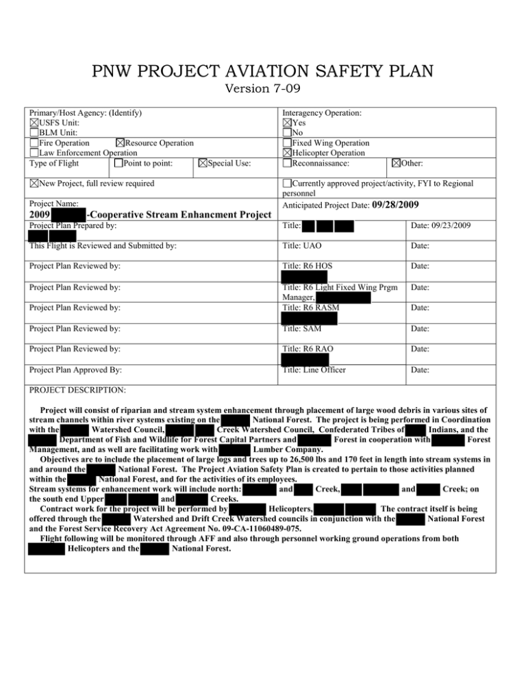
PNW PROJECT AVIATION SAFETY PLAN Version 7-09 Primary/Host Agency: (Identify) USFS Unit: BLM Unit: Fire Operation Resource Operation Law Enforcement Operation Type of Flight Point to point: Special Use: New Project, full review required Project Name: 2009 -Cooperative Stream Enhancment Project Interagency Operation: Yes No Fixed Wing Operation Helicopter Operation Reconnaissance: Other: Currently approved project/activity, FYI to Regional personnel Anticipated Project Date: 09/28/2009 Project Plan Prepared by: Title: Date: 09/23/2009 This Flight is Reviewed and Submitted by: Title: UAO Date: Project Plan Reviewed by: Title: R6 HOS Date: Project Plan Reviewed by: Date: Project Plan Reviewed by: Title: R6 Light Fixed Wing Prgm Manager, Title: R6 RASM Project Plan Reviewed by: Title: SAM Date: Project Plan Reviewed by: Title: R6 RAO Date: Project Plan Approved By: Title: Line Officer Date: Date: PROJECT DESCRIPTION: Project will consist of riparian and stream system enhancement through placement of large wood debris in various sites of stream channels within river systems existing on the National Forest. The project is being performed in Coordination with the Watershed Council, Creek Watershed Council, Confederated Tribes of Indians, and the Department of Fish and Wildlife for Forest Capital Partners and Forest in cooperation with Forest Management, and as well are facilitating work with Lumber Company. Objectives are to include the placement of large logs and trees up to 26,500 lbs and 170 feet in length into stream systems in and around the National Forest. The Project Aviation Safety Plan is created to pertain to those activities planned within the National Forest, and for the activities of its employees. Stream systems for enhancement work will include north: and Creek, and Creek; on the south end Upper and Creeks. Contract work for the project will be performed by Helicopters, The contract itself is being offered through the Watershed and Drift Creek Watershed councils in conjunction with the National Forest and the Forest Service Recovery Act Agreement No. 09-CA-11060489-075. Flight following will be monitored through AFF and also through personnel working ground operations from both Helicopters and the National Forest. ADMINISTRATIVE INFORMATION Project Supervisor: (South Forest), (North Forest) (Central Coast Phone: Cell Sat: Alternate Supervisor: Phone: Cell: Sat: Ranger District) Fixed Wing Manager: Phone: Cell: Sat: Fixed Wing Manager-Special Use: Phone: Cell: Sat: Fire Heli Manager: Phone: Cell: Sat: Project Heli Manager: Phone: Cell: Sat: Unit Aviation Officer: Phone: Cell: Sat: Charge Code: AMD Billee Code: n/a OAS-23 CWN# ARA# n/a ABS Aircraft Availability (Per Day): Aircraft hourly rate: $8,500.00 Fixed Wing Standby rate: n/a x hours= RON: “Minimum” number of hours per day: Heli-Service Truck Rate: x persons = n/a n/a x miles = Seeder: Helitorch: Batch Truck: Extended Pilot: Extended Driver: Other: Total Per Day: Number of days x cost per day = $ Projected Total Cost = Mobilization:$42,000; Total project cost: Vendor(s): Vendor Phone(s): Vendor Cell(s): Helicopters Aircraft Information: Make and Model: Color: N #: White with Red Stripe N N Pilot Name(s): TBA Pilot Phone #(s) TBA Pilot Cell # TBA Aircraft carded: Yes No Pilot carded: Yes No REMARKS: An Interagency qualified Helicopter Manager (HMGB) will be present on site to coordinate aviation operations with the contractor and ground personnel, to facilitate safe air operations, and to ensure the requirements of this plan are followed. The expectation will be to also inspect to insure equipment and personnel are carded for aircraft used, aircraft personnel using expected Personal Protective Equipment, and Duty limitations and equipment maintenance protocals are being followed as reflected withing the Federal CWN contract standards. RESOURCE TRACKING INFORMATION Aircraft Home Base Location(s): Aurora Aircraft destination: Ferry Flight Following and Tracking FAA VFR with 60 minute check in: Ferry Start Time: 9/27/2009 Scheduling Dispatch Phone: Resource Order # n/a Initiate and terminate By Phone: FAA IFR: Stop(s): Flight # n/a Radio: Stop(s): Ferry Ending Time: 9/27/2009 Contact: Aircraft Desk Notes: Destination Dispatch Phone: Contact: Dispatch Notes: Dispatchers @ National Forest Dispatch Center Project Flight Following Local Agency 15 minute: AFF equipped aircraft: Search and Rescue Procedures: (Follow the Northwest Crash, Search and Rescue Guide) REMARKS: LANDING SITE(S) INFORMATION Project Start Location: Upper service (09/28/2009) Lat / Long: Destination Location: Little River Service (09/30/2009) Lat / Long: N Destination Location: and Crk Service (10/03/2009) Lat / Long: Ending Location: Crk Service (10/07/2009) Lat / Long: Destination Location: Crk Service (10/10/2009) Lat / Long: Ending Location: Lat / Long: Helibase or Helispots land ownership: BLM: NPS: FS: NF Private: State: Other: Runway Length (if applic): Elevation: 500' Surface: Field Runway Length (if applic): Elevation: 50' Surface: River Basin Runway Length (if applic): Elevation: 1000" Surface: Ridge Runway Length (if applic): Elevation: 10' Surface: Gravel Runway Length (if applic): Elevation: 220' Surface: Meadow Runway Length (if applic): Elevation: Surface: Location by landmark: Various on and around Forest Contact(s): Phone #(s): Helibase or Helispot “approval-to-use” from landowner/manager: Yes No Fuel Truck Location(s): At service landing sites. REMARKS: Five individual mobiliaztion days are planned for the project. Dispatch) ( HELICOPTER CRASH RESCUE / MEDIVAC PLAN General Instructions: For suspect or confirmed accident will notify Dispatch Center who will then follow procedures as described in the Pacific Nrothwest REgion Aircraft Crash and Rescue Guide located in Dispatch office. The Regional Aviation Officer will determine if an Investigation Team is warranted. Specific Information and Instructions (Utilize cell phone if possible. Do not use names over the radio.) 1. Nature of the injury(s)/illness. Assist, render first aid, secure site, obtain written statements, keep bystanders out. 2. Is medical help needed? If available, supply vital signs! 3. What transportation is needed? Is patient(s) ambulatory? 4. Location of victim. 5. Route to be taken (use land marks as guide). 6. Equipment needed. 7. 8. Name of contact on site. Notify appropriate agency line officer. Call Dispatch - - or Forest Radio Comm Network. EMT(S) on project: Call 911 Available Medivac helicopters. FAA # US Coast Guard HMGB: Litter/rappel/extraction capable Yes REMARKS: Newport, Oregon Phone: 541-265-5381 FAA # "Reach 8" Corvallis, Oregon HMGB: Litter/rappel/extraction capable No, Medivac Only REMARKS: - Nearest burn center Oregon Burn Center Latitude: 45-32-35.4240N Location Newport, Oregon Longitude: 124-03-34.4210W NM Location Portland Longitude: :122-40-12.3460W VOR NM: Life Flight: "Reach 8" Type aircraft: Augusta 109 Location: Corvallis, Oregon Phone Number: 541-257-2600 Site conditions Latitude: Longitude: Nearest medical facility: Samaritain Pacific Comm Hospital Latitude :44-37-46.4210N VOR Vortac 117.1 VOR: Wind speed: Terrain factors: Contact Freq ONP Traffic 122.8 DEG Contact Freq: PDX Approach Control 118.1, PDX 118.7 DEG: Contact Freq: ODF White Net: 151.3100 Rx Tx Contact Freq Rx: Tx : NM: DEG: Elevation (msl): Temperature (F, C) Helispot(s) size/description : Proximity of helispot to injury site: Flight hazards : Other aircraft in area (call signs and frequencies): Ground contact will likely be Project Helicopter Manager: Visibility/sunrise/sunset limitations: REMARKS: PASSENGER INFORMATION Passengers Name: Name: Name: Name: Name: Name: Name: Name: Weight: Weight: Weight: Weight: Weight: Weight: Weight: Weight: Dept Pt: Dept Pt: Dept Pt: Dept Pt: Dept Pt: Dept Pt: Dept Pt: Dept Pt: Destination Pt: Destination Pt: Destination Pt: Destination Pt: Destination Pt: Destination Pt: Destination Pt: Destination Pt: Cargo Description: Description: Description: Description: Description: Description: REMARKS: weight: weight: weight: weight: weight: weight: Hazardous Mat Hazardous Mat Hazardous Mat Hazardous Mat Hazardous Mat Hazardous Mat Yes: Yes: Yes: Yes: Yes: Yes: No: No: No: No: No: No: Destination: Destination: Destination: Destination: Destination: Destination: PPE REQUIREMENTS Type of flight Fixed wing, point to point Fixed wing, mission flight, 500’ above Fixed wing, mission flight, 500” and below (DOI) All Helicopter operations Special PPE Requirements, if any: Personal Protective Equipment Requirements Appropriate field attire based on the season, hearing protection recommended Field attire mandatory, (long natural fiber pants and shirt) PPE recommended Full PPE required Full PPE required REMARKS: PPE will reflect standard as described with the Federal CWN contract requirement. FREQUENCY INFORMATION Unit Radio Frequencies NO. NARROW /WIDE FREQ. LABEL Narrow Narrow TONE TX TONE GEOG. AREA East NF East NF REMARKS North Narrow Narrow Narrow Narrow Narrow RX Channel #1 Channel #2 Channel #3 Channel #4 Field Comm. Field Comm. Field Comm. Field Comm. Tac Freq. Tac Freq. Tac Freq. Tac Freq. RISK MANAGEMENT Risk Management: Job Risk Analysis Planning Reminder List (check appropriate boxes) Is there an alternative method that would accomplish the mission more safely? Is everything approved with clear instructions? Are communications and flight following established? Can terrain, altitude, temperature or weather that could have an adverse effect be mitigated? Will the mission be conducted at low levels? (Below 500’ AGL) Can the same objective be achieved by flying above 500’ AGL? Are all aerial hazards identified and known to all participants? Have mitigating measures been taken to avoid conflicts with military or civilian aircraft Have adequate landing areas been identified and or improved to minimum standards Are all agency personnel qualified for the mission? Is the pilot carded and experienced for the mission to be conducted? Are pilot flight and duty times compromised? Is there enough agency personnel to accomplish the mission safely? Will adequate briefings be conducted prior to flight? Are all involved aware that the pilot has the final authority, but if any passenger feels uncomfortable, that they can decline the flight without fear of reprisal? Is the aircraft capable of performing the mission with a margin of safety Is the aircraft properly carded? Do all personnel have the required PPE Yes Yes Yes Yes Yes Yes Yes Yes Yes Yes Yes Yes Yes Yes Yes No No No No No No No No No No No No No No No NA NA NA NA NA NA NA NA NA NA NA NA NA NA NA Yes Yes Yes No No No NA NA NA OPERATIONAL RISK MANAGEMENT follows a five-step cyclic process that must be integrated into the decision making process at all levels. The five steps are as follows (see IHOG 3-2, for Risk Management Applied): 1. 2. 3. 4. 5. Identify Hazards Assess Hazards Implement Controls (mitigations) Make Risk Decision Supervise In keeping with the steps above, a thorough review of the completed System Safety Risk Assessments applicable to the planned mission(s) must be conducted and all hazards mitigated in like or appropriate manner. The hazards and mitigations listed in the Aviation Program Risk Assessments are thorough but incomplete. Each project will likely have additional hazards that must be identified, assessed, and mitigated. Then the risks must be weighed against the expected benefit of performing the operation. Risk Management Instructions: To conduct a complete Risk Analysis for your project: 1. Review and utilize the applicable System Safety data available at http://www.fs.fed.us/fire/av_safety/Systems_Safety/av_risk_mgt/index.html ; 2. Implement the mitigations as listed in the System Safety Assessments; 3. Conduct your individual analysis of the project following the five steps above and utilizing the Risk Assessment Matrix provided in this document, AND, 4. Complete and follow the reminder lists below. System Safety risk assessments have developed predetermined values, but, as mentioned above, each project will present its own specific hazards that you must identify, mitigate, and manage. OPERATIONAL RISK MANAGEMENT WORKSHEET LIKELIHOOD Frequent Probable Occasional Remote Improbable Negligible Medium Medium Low Low Low Marginal Serious Serious Medium Medium Medium SEVERITY Critical High High Serious Medium Medium Catastrophic High High High Serious Medium -Step 1: Identify and describe the hazards present for this project. -Step 2: Assess the Likelihood of an occurrence of each hazard and determine the potential Severity of the outcome by referring to the definitions at the System Safety Matrix site. Click on this link: http://www.fs.fed.us/fire/av_safety/Systems_Safety/av_risk_mgt/matrix.pdf and then click the link to the Risk Assessment Matrix. Once you have identified the likelihood and severity, determine the Risk Level using the matrix above. -Step 3: Identify the mitigation controls to follow that will reduce the Likelihood of a hazard occurrence. **Remember, the severity will likely remain the same as first determined. The mitigations generally only affect the likelihood of an occurrence. Once you have established the mitigations and changed the likelihood, determine the post-mitigation Risk Level. –Step 4: Make decision to perform or not to perform mission/project based upon overall risk level compared to the judged benefit. Decision to conduct operation should be made at appropriate management level. In the case of Serious or High risk operations, the unit Line Officer shall make decision. PRE-MITIGATION: Identify and describe each hazard: Likelihood Severity Risk Level Probable Catastrophic High Remote Catastrophic Serious 4. Inclimate weather, poor visibility. Fequent Catastrophic High 5. Aerial Hazards powerlines, trees, cables, towers, urban interface. Frequent Catastrophic High 6. Aerial Hazards external load operations in mountainous terrain. Frequent Catastrophic High Occasional Critical Serious 1. Ground personnel can be subject to rotor-wash in monitoring log placement activities around structure sites for large wood debris placement activities. 2. No communications link with helicopter or crew could lead to being caught in a highly vulnerable area if helicopter were to arrive unexpectedly. 3. Dropped loads, personnel too close to drop site, flights over ground hazards. 7. Acceptance of risk as normal, multi-tasking, mission focused attitudes. NOTE: Add additional rows if necessary. Probable Critical High POST-MITIGATION: Mitigations to control Risk for each Hazard: 1. At all site locations maintain awareness of personnel where helilcopter will be working to monitor flight path and personal safety zone away from structures being worked. See "attachment 1" for further guidance. 2. Make sure all personnel have a radio and can closely monitor the activities of the helicopter and remain in communications with others to maintain awareness. 3. Brief pilot and crews on protocals to be in place to guard against conseqeunce of dropped loads. Ensure service landing and worksite locations provide contengency planning for unexpected load release. Ensure flight paths convey ability to guard against damage to property or personnel in unexpected event of load release. 4. Ensure pilots are trained and carded for mission as described within the Federal CWN Contract standards, thorough briefings will take place, performance planning in place for weather conditions present with dual pilots used in operation of aircraft, communications with field personnel to monitor source and structure site weather conditions. 5. Conduct thorough briefings. Use preplanning for service site locations, flight routes to stream structure sites and tree source sites, flight paths around residential dwellings, assessment of aviation hazard map known and briefed daily; positive communications link between ground personnel, aircraft,cooperators, and aviation management personnel; close roads and deny acess to interested public veiwers. 6. Post updated hazard map, communicate with field personnel to relay site information, always perform high level recon before transition to lower altitude, utilize helicopter coordination for all relevant information to be conveyed to pilots. 7. Emphasize how competing interests can affect the outcome of events. Convey attitudes that reflect professionalism to maintain control of the job without comprimising safety. Our number one priority is for everyone to come home at night. Risk Level Likelihood Severity Critical Serious Remote Catastrophic Serious Remote Catastrophic Serious Frequent Catastrophic High Frequent Catastrophic High Frequent Catastrophic High Improbable Critical Serious Occasional Total Risk Assessment Value (The highest risk level identified from the appropriate related System Safety/Operational Risk Management Assessments and the above determined risks shall be applied as the overall total risk value): Low Medium Serious High Project Justification Statement: Step 4: Make Risk Decision – weigh the risk against the benefit of performing the operation. From the determined overall risk, a determination must be made to conduct the operation as planned, apply further controls that may reduce the overall risk further, or not to perform the operation. Line Officer Initials: _ _ REMARKS: Follow Safety Criteria in "Attachment 1" Risk Management: Job Hazard Analysis Pre-Operational Reminder List (check appropriate boxes) Issue MTR’s and MOA’s Private aircraft Airport traffic Weather Terrain Low level obstacles Mitigating Measure Check routes in advance. Practice risk management. See and avoid. Stay in radio contact, sterile cockpit Use weather advisory. Maintain VFR minimums. Maintain separation. Do not place the aircraft in performance related situations. Complete a high level recon, no unnecessary low level flight operations. Unimproved landings Doors off heli operations Pilot not familiar with area Noise, rotor wash Internal and external loads Unplanned aircraft events Hazardous materials Non aviation personnel Communications Overload conditions/CG issues Winter/cold weather operations Prop/rotor hazards Multiple aircraft operations Aircraft Refueling Recon LZ. Download on first load. Use secondary restraining harness and protected blade raptor type knife. Remove loose items from cabin. Supply hazard maps. Complete high level recon prior to low level operations. Wear ear and eye protection. Have trained personnel assigned to the mission. Follow agency policies. All personnel equipped with PPE, survival gear and trained in crash procedures. Trained personnel will identify, manifest and insure that the pilot is aware. Maintain control, provide through briefings. Maintain communications at all times, establish backup options and acquire alternate frequencies. Take a handheld FM radio on each flight. Call in prior to landing. If radio contact is lost, climb, check tones, etc. If unable to re-establish contact, return to best suitable landing area and check in via landline. Complete accurate load calculations and or weight and balance. Utilize appropriate clothing for conditions, acquire and maintain a survival kit. Pilot shall provide a safety briefing; approach and departures shall be away form hazards. Provide adequate aerial supervision. Establish and maintain separation, utilize common frequencies. Refueling is the responsibility of the vendor/pilot. Agency personnel shall not be on board. Aircraft shall be shutdown, unless rapid refueling is approved and requested by agency personnel. REMARKS: Will follow language as described in compliance with federal contract requirements for project aviation. AIRSPACE MANAGEMENT MTR Segment Activity IR: Hot Cold IR: Hot Cold IR: Hot Cold VR: Hot Cold VR: Hot Cold VR: Hot Cold VR: Hot Cold Hot Cold Hot Cold Hot Cold Time Time Zone Start Stop Start Stop Start Stop Start Stop Start Stop Start Stop Start Stop UTC PST UTC PST UTC PST UTC PST UTC PST UTC PST UTC PST Start Stop Start Stop UTC PST UTC PST MOA information Aerial Refueling Routes Start UTC PST Stop Hot Cold Start UTC PST Stop MTR/MOA de-confliction procedures: Resource aviation operations will yield to military operations. If an MTR/MOA becomes active, the land management operation will cease during the time the MTR/MOA is active. NOTAM (D) to be developed for the project: yes no (Dispatch will contact Dispatch has checked military operations prior to operations Yes No REMARKS: Will call to monitor military flight route training activities daily. PROJECT MANAGER PRE-OPERATIONAL CHECKLIST Approved and signed project plan Qualified Manager Maps of areas/sites MTR’s MOA’s PPE Fuel Planning Radio Frequencies / Tones Handheld Radios Carded pilot Qualified Crewmembers Notify Dispatch Brief Pilot Load Calc or Weight and Balance Fuel Truck Locations Hobbs Start/End Satellite Phones Carded Aircraft Hazards Identified Weather Brief Passengers Weights of passengers and equipment Permission to land/utilize areas Day/Survival Packs Puke Bags MAP OF PROJECT SITE: WEATHER FORECAST: Will be provided daily during pre-flight and safety briefings. POST-BRIEFING PARTICIPANT SIGNATURES: Aircraft Manager: Signature Date: Pilot: Signature: Date: Other Participants: Signature: Date: Attachment 1 Helicopter Design Criteria General FS personnel should have experience doing stream restoration with helicopter placement of logs or be with an experienced person at all times. Provide the aviation safety officer, the helicopter company, and field crews with GPS coordinates and maps for all wood source areas, stream treatment sites, and the number of trees planned for each site. Provide the helicopter pilots and field crews with site design maps for each stream treatment site. Forest service will maintain radio contact at all times during project. Keep all unauthorized personnel away from the helicopter operations. No smoking within 200 feet of helicopter or 250 feet of refueling procedure or fueling truck. No Forest Service Employee will be transported at any time in any helicopter, except if medical emergencies permit. Forest Air Operations Officer will provide attachment of emergency plan in case of accident, search and resuce plan, and spill cleanup plan. All plans will be filed at District, Forest Dispatch and other appropriate personnel. Stream Treatment Site Selection Criteria FS personnel are intimately familiar with the stream. They should have multiple visits to the sites so they are familiar with all the locations for wood placement and know what is around each meander bend. Select sites that can easily be seen by the helicopter pilots. When the canopy is too dense for the pilots to see the creek, fall trees to make the site clearly visible for the pilots. Select sites that have easy access to safety zones outside the downdraft of the helicopter. If sites do not have easy access, then either drop the site, or create easy access to safety zones or allow the pilot to place trees based on GPS coordinates only. Identify hazards at each site when selecting placement sites. Potential hazards to be identified include: • Snags – both conifer and deciduous • Large Maple trees – from past experience these trees are the ones that most often break off during instream helicopter operations. • • Confined valleys that will tend to focus the downdraft (safety zones will either be farther away or these sites should be pilot placement only) Existing debris in stream or cobble/boulder substrates that will increase the amount of time needed to get back and forth to the sites from the safety area. Stream treatment procedures Wear protective goggles, hard hat with chin strap, and high visibility vest. Designate flight paths and safety zones for field crews to prevent FS personnel from getting in the downdraft from the helicopter and to prevent the helicopter flying over the personnel with a load. Stay clear from underneath the helicopter at all times and any material suspended above and within its arc, including standing snag trees and unstable trees. Keep pilots and personnel associated with pilots aware of who is in the creek and their location at all times. FS personnel show the helicopter personnel where the stream site is located, the number of pieces planned for the site, and provide site design maps to the ground and helicopter personnel. Safety zones should be located consistently either upstream or downstream of the treatment site typically in the direction the work is moving. This will facilitate safe movement in the creek by avoiding recently placed logs and unstable canopies. FS personnel clear to one designated safety zone before the helicopter arrives and remain in the safety zone until the helicopter downdraft has ended. FS personnel can only inspect stream treatment sites when the helicopter is not present to avoid being in the helicopter downdraft. Look for and avoid loose limbs in the canopy or other unstable objects when entering an area where the helicopter was working. *Note: If felling operations are initiated, participants will follow all Regional and Forest protocols that regulate the use of chainsaw equipment. Adequate monitoring measures will be in place including foresight given to contingency planning concerns.
